Lake Erie. June 10 & 11, 2014
|
|
|
- Clarence Cook
- 5 years ago
- Views:
Transcription


1 Discovery Meeting: Lake Erie FEMA REGION II June 10 & 11, 2014 Lake Erie Contributing Watersheds eds
2 Introductions and Who s Here Project Team FEMA Region II RAMPP Local Stakeholders Invited Local Community Officials Non-Governmental Agencies Private Sector People/Organizations discussed during WebExs and on Data Worksheets 2
3 Agenda Introductions and Who s Here Purpose of this Meeting Risk MAP Program Overview Discovery Process Lake Erie Coastal Study Mitigation Planning and Grants Risk Communication NFIP and Community Rating System Next Steps Group Breakout Discussionsi 3
4 Purpose of This Meeting Explain the Discovery process Share your concerns about flood risk Share any additional flood risk data you may have Discuss the Lake Erie Coastal Flood Study Discuss how FEMA flood risk products can facilitate mitigation actions within your community 4


5 Shifting from MapMod to Risk MAP Risk MAP = Risk Mapping, Assessment, and Planning 5


6 What is Risk MAP (Risk Mapping, Assessment and Planning)? Through collaboration with State, Local and Tribal entities, Risk MAP aims to deliver quality data that increases public awareness and leads to action that reduces risk to life and property. You can use Risk MAP tools and data to: Improve and implement your Hazard Mitigation Plans Influence decisions about development, ordinances, and flood mitigation projects Communicate with citizens about flood risk 6


7 Discovery Process FEMA and communities discover and assess flood risk data Discovery Data Collection Period Stakeholder coordination and data analysis Discovery Meeting Initial Discovery Map Post-Meeting Review Final Discovery Map and Discovery Report 7
8 Discovery Products and Results Discovery Report Including summary of data, analysis, meetings, and action items or decisions Discovery Map Visual representation of meeting outcomes and feedback from stakeholders Project Study Areas National Metrics 8


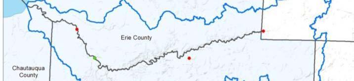
9 Study Area Lake Erie Watersheds 3 watersheds 6 counties 81 Communities Coastal Storm Flooding update 9


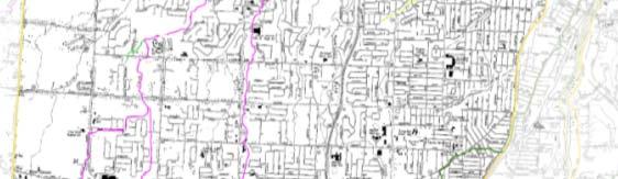

10 Discovery Map: Cataloging Mapping Needs 10


11 Discovery Map: Cataloging Mapping Needs 11
12 Data Collection and Collaboration Discovery is the process of data mining, collection, and analysis with the goal of investigating g a flood risk or mitigation project or risk discussions within a watershed. The following data was researched and reviewed before the meeting: CRS, NFIP status MNUSS flood hazard mapping needs High Water Marks Dams and/or levees Mid-term Levee Inventory (MLI) Topo/Elevation Data Gages NHD streamline Various GIS data for the discovery products Structure Info (bridges, culverts) Average Annualized Loss data Repetitive Loss Data LOMCs Effective Data (FIS, DFIRM, FIRM) List of Communities & Contact Info Hazard Mitigation Plan (online) Hazard Mitigation Assistance Program grants received Individual or Public Assistance information Disaster history or history of disaster declarations 12
13 Sample of Data Collection Progress Data Types Deliverable/Product Source Average Annualized Loss Data Discovery Map Geodatabase Census 2010 and Hazus Coordinated Needs Management Strategy Discovery Map Geodatabase FEMA Declared Disasters Community Fact Sheets FEMA s Disaster Declarations Summary Dams and/or Levees Discovery Map Geodatabase USACE NYSDEC Demographics, Industry Community Fact Sheet Census Bureau, Hazard Mitigation Plans Effective Floodplains: Modernized SFHAs Discovery Map Geodatabase Coastal Gage Data Discovery Map Geodatabase USGS, NOAA CO-OPS Insurance Policies Community Fact Sheet CIS FEMA's Mapping Information Platform Letter of Map Change (LOMCs) Community Fact Sheet FEMA s Mapping Information Platform (known clusters on Discovery Map Geodatabase) Repetitive Loss Community Fact Sheet CIS Stream Gages Discovery Map Geodatabase USGS Insurance Policies Community Fact Sheet CIS BureauNet 13


14 Sample of Data Collection Progress Table 10: Dams in the Buffalo-Eighteenmile Watershed County Class A Class B Class C Class D Total ERIE GENESEE WYOMING Total
15 Sample of Data Collection Progress CATTARAUGUS COUNTY COMMUNITY FIS Effective Date Notes ASHFORD, TOWN OF 5/25/1984 CATTARAUGUS, VILLAGE OF 4/20/1984 CHAUTAUQUA No Of No Of Rep No Of BCX DELEVAN, VILLAGE OF 1/20/1984 COUNTY Variances Losses Claims COMMUNITY EAST OTTO, TOWN OF 4/20/1984 Partial CHAUTAUQUA, TOWN OF FARMERSVILLE, TOWN OF 7/23/1982 countywide. DUNKIRK, CITY OF FREEDOM, TOWN OF 8/19/1991 DUNKIRK, TOWN OF GOWANDA, VILLAGE OF 9/26/2008 Effective MACHIAS, TOWN OF 8/20/1982 FREDONIA, VILLAGE OF Community MANSFIELD, TOWN OF 5/25/1984 HANOVER, TOWN OF Flood Insurance NEW ALBION, TOWN OF 12/3/1982 PORTLAND, TOWN OF Studies' dates OTTO, TOWN OF 4/20/1984 SHERIDAN, TOWN OF range from 1982 PERRYSBURG, TOWN OF 4/20/1984 SILVER CREEK, VILLAGE OF PERRYSBURG, VILLAGE OF None* PERSIA, TOWN OF 4/20/1984 Percent of 2010 Estimated County County Population in the Square Miles in Total County Population in Chautauqua-Conneaut Chautauqua- Population Chautauqua- Watershed (Based on % Conneaut (2010 data) Conneaut in watershed * Total Watershed Watershed Population) CATTARAUGUS 80, % CHAUTAUQUA 134, % 49, TOTAL 215,222 23% 49, YORKSHIRE, TOWN OF 5/25/
16 Sample of Data Collection Progress COUNTY COMMUNITY Number of Policies by Zone Total V-Zone A-Zone Policies Total Coverage NFIP Total Premium Total Claims Total Paid Since 1978 Since 1978 GENESEE DARIEN, TOWN OF $296,900 $2,683 0 $0 WYOMING ARCADE, TOWN OF $714,400 $3,893 5 $7,377 WYOMING BENNINGTON, TOWN OF $513,600 $1,936 0 $0 WYOMING JAVA, TOWN OF $399,000 $2,051 1 $8,228 WYOMING SHELDON, TOWN OF $719,000 $3,455 2 $16,362 COUNTY COMMUNITY CAC Date CAV Date Ord Enf Eng Oth Biennia al Program Problem ms Violation ns Remedia al Actions ERIE ERIE ALDEN, TOWN OF AURORA, TOWN OF 05/11/ /15/2012 NONE NONE SERIOUS 05/04/ /18/2008 NONE MINOR NONE 02/24/ /22/1992 NONE NONE SERIOUS ONE NONE NONE A N N N N N N Y N N Y N ERIE BLASDELL, VILLAGE OF N 16


17 Sample of Data Collection Progress 17
18 Data We Need from You Areas of Concern Areas of recent or planned development Areas of high growth or other significant land changes Areas of historical flooding Other flood risks (high erosion areas, drainage issues ) Mitigation projects Your ideas about Risk MAP products and mitigation projects that may help your community Your ideas about other ways to increase your community s resilience from flooding To explain some of the actions that your community may take to reduce risk, we ll review mitigation grants and planning and participation in the NFIP program 18
19 Data Worksheet Feedback We need online surveys completed by August 29, / /L k Digital comments can be submitted to: lakeeriediscovery@rampp-team.com Written comments can be sent to the following: Attention: Rachael Herman 1066 Long Pond Road Rochester, NY
20 New Detailed Coastal Analysis in the Great Lakes Current FIRMs may be dated due to the age of data & methodologies many date to 1970s Changes in NFIP policies and methodologies have since occurred, creating need for an update Coastal analysis will include: Historical water level changes Detailed assessment and modeling of wave conditions Erosion analysis Detailed modeling of wave runup Coastal hazard mapping based on detailed modeling 20


21 Available Coastal Data For the Coastal Study, the following data is currently available for use: LiDAR NOAA Bathymetric Data USACE Oblique Aerials USACE Shoreline Classification Data communities can submit for use: Coastal Structure data More detailed topographic data Detailed bathymetric data Beach sediment size 21


22 Topographic Data 22
23 Storm Surge Analysis and Stillwater Elevations Stillwater elevations determined from results of surge modeling Storms run with water level that existed during event Extreme value analysis used to determine the 1% coastal stillwater elevations Several scenarios of differing water levels and wave conditions tested for most conservative results Name Scenario 1 Scenario 2 Scenario 3 Scenario 4 Scenario 5 Methodology Maximum water level and associated wave height extracted from the iso-probability curve Maximum wave height and associated water level extracted from the iso-probability curve Combination of intermediate values extracted from the iso-probability curve 1-percent-annual-chance exceedence value of water level, and expected wave height from the conditional probability distribution 1-percent-annual-chance exceedence value of wave height and expected water level from the conditional probability distribution 23
24 Coastal Analysis Process TERRAIN PROCESSING STORM SURGE ANALYSIS STARTING WAVE CONDITION ANALYSIS TRANSECT LAYOUT & FIELD RECONNAISSANCE STORM-INDUCED EROSION OVERLAND WAVE HEIGHT & RUNUP ANALYSIS FLOOD HAZARD ZONE MAPPING 24
25 Erosion in the Great Lakes USACE CSHORE model Applies real physics Near-shore wave processes Cross-shore sediment transport Requires sediment grain size Available data or estimated 25


26 Runup Modeling in the Great Lakes USACE CSHORE model Limit of Wave Runup Storm Still Water Level Barrier Slope Breaker Depth Source: FEMA, 2003 Figure D Wave Runup Sketch 26


27 Wave Runup Mapping How runup is mapped Terrain shows different slope at the shore 27


28 Changing BFEs Base Flood Elevation on FIRM now includes 3 components: 1. Storm surge stillwater elevation (SWEL) includes wave setup 2. Wave height above storm surge (stillwater) elevation 3. Wave runup above storm surge elevation (where present) 28
29 Mapping Base Flood Elevation (BFE): The height in feet above a certain datum that flood waters have a 1 percent annual chance of reaching or exceeding in any given year Zone VE: Defined by wave heights of 3 ft. or greater Study in process headed by FEMA HQ regarding feasibility Zone AE: Defined by wave heights ranging from 0-3 ft. Limit of Moderate Wave Action (LiMWA): Defined by the area subject to wave action with waves greater than 1.5 ft. in height 29
30 Mapping (continued) 30
31 Wave Runup Mapping 31
32 Limit of Moderate Wave Action (LiMWA) At present not a FEMA regulatory requirement Residential Building Code in NYS does not require different standards Building Code of NYS does require different standards in Coastal A zones for structures other than 1-2 family residential. No Federal Insurance requirements e e tied to LiMWA CRS benefit for communities requiring VE Zone construction standards in areas defined by LiMWA or areas subject to waves greater then 1.5 ft. Potential of additional 600+ points 32


33 How does this apply to my community? NFIP Compliance Local impact of the coastal study 33


34 National Flood Insurance Program Allows property owners to purchase federally backed flood insurance State and local governments agree to adopt and enforce floodplain management ordinances Over 20,300 communities participate p in the NFIP nationwide 1,498 communities in NYS participate i in the NFIP 34
35 Standard NFIP Building Requirements The lowest enclosed area, including basement must tbe at or above the Base Flood Elevation plus two feet (residential) Non-residential buildings may be flood proofed in lieu of elevation (freeboard applies) NO development in the regulatory floodway that would raise flood elevations 35
36 Standard NFIP Building Requirements A Zone Building Requirements Where no Base Flood Elevation: Lowest floor at least 3 above highest adjacent grade If have a BFE then use it Developments over 5 acres or over 50 lots must provide a BFE VE Zone Buildings Requirements Lowest horizontal member must be above BFE Structure must have open foundation, not built on fill Below BFE must be free of obstructions Breakaway walls are permissible 36
37 Recommended Higher Standards Restrictions on hazardous material storage Regulated high risk land uses (e.g. manufactured homes/critical infrastructure) Conservation/open space area Cumulative Substantial Damage/Substantial Improvement Lower threshold for Substantial Damage Subdivision design triggering flood study Prohibitions SFHA development Manufactured homes Fill Community Identified Flood Areas 37
38 Community Rating System (CRS) Flood insurance premium rates discounted to reward community actions that reduce flood losses, facilitate accurate insurance ratings, and encourage a comprehensive approach to floodplain management Class rating system from 1 to 10 Each Class improvement (500 point increments) results in additional 5% discount, up to 45% in SFHAs for Class 1 communities Uniform minimum credits give you points for activities on the state level (state laws) and make achieving a Class 9 relatively easy 18 creditable activities, organized under four categories: Public Information Mapping and Regulations Flood Damage Reduction Flood Preparation 38
39 Coastal Erosion Hazard Area (CEHA) Projects to prevent shore erosion Empowers DEC to identify and map coastal erosion hazard areas and to adopt regulations to control o certain activities t and development in those areas Currently being updated 86 communities in New York State 42 certified and have own law 3 communities in Lake Erie watersheds 44 managed by DEC 9 communities in Lake Erie watersheds Certified communities Contact local building/zoning g department Managed Apply for a permit Genesee Scott Sheeley ( ) Erie and Wyoming David Denk ( ) Alleghany, Cattaraugus and Chautauqua Website Charles Cranston ( ) html 39

40 Hazard Mitigation Planning Risk MAP and Mitigation Planning Coordinated and Local hazard mitigation plans must be participative Planning updated every five (5) years. Process Use new Risk MAP information to Identify update local HMP. hazards that Keep it can affect the jurisdiction Flood Hazard Profile Current Risk Assessment Mitigation Mitigation Strategy Planning Cycle Refer to the Plan & Adopt the plan and implement the mitigation strategy Assess the risks from these hazards Develop strategy to mitigate the risks 40
41 Possible Mitigation Activities Mitigation should be part of overall hazard mitigation plan Cumulative substantial improvement clause. List of publicly owned buildings that have flood risk. Acquisition of flood prone structures. County GIS system. Updated weather tracking equipment. Stream bank stabilization projects Identified sanitary sewer mains vulnerable to erosion from flood Stream bank or shoreline stabilization projects Adopted a wellhead protection ordinance. Vulnerability assessment of water and wastewater infrastructure. Elevate, move and acquire flood damaged structures. Identify vulnerable critical facilities. Implement mitigation measures for repetitive loss properties. Require elevation of new structures and substantially improved structures. Natural stream restoration 41
42 Mitigation Grant Programs and Funding Sources Federal Hazard Mitigation Grant Program (HMGP) Pre-Disaster Mitigation Grant Program (PDM) Flood Mitigation Assistance (FMA) Repetitive Flood Claims (RFC) Severs Repetitive Flood Claims (SRL) US Army Corps. of Engineers Natural Resource Conservation Service (NRCS) State NYSDEC NYS Office of Community Renewal NYS Office of Emergency Management Local Watershed Conservancy Districts Local taxes Storm water utilities 42
43 Risk Communication Federal/State/Local goals: To reduce risk to life and property, ensure safer, sustainable communities To effectively communicate risk and increase public awareness, leading citizens to make informed decisions regarding their risk Key factors contributing to successful achievement of these goals are: Community engagement and exchange of flood risk information Effective collaboration through partnerships Strategic communications plan development Local understanding and implementation of mitigation action and strategies t 43
44 Next Steps Communities will provide additional data RAMPP will: Finalize Discovery Map and Discovery Report and distribute to communities and other stakeholders Update FEMA systems (Coordinated Needs Management Strategy, National Digital Elevation/Orthophotography Programs, etc.) 44


45 Schedule Today In person Meetings Data Survey Due August 29, 2014 Final Deliverables December
46 Breakout Sessions We want to hear from you! What are areas of recent or planned development or high h growth or other significant land changes in your community? What other flood risks are there in your community? What other mitigation plans and projects are there in your community? What are your community s concerns? How can we (both FEMA and you) communicate risk within your community and increase resilience from floods? 46
47 Resources Risk Assessment, Mapping and Planning Partners: Draft Discovery report, PowerPoint presentation, and maps will be posted here FEMA: Floodsmart, the official site of the National Flood Insurance Program (NFIP): NFIP Reform: National Committee on Levee Safety: 47
48 Contact Information FEMA: Alan Springett: gov RAMPP: Robyn Boyd: NYSDEC: Jennifer Horton: Please provide data survey, questions or comments to: 48
49 Questions? 49
Discovery Meeting: Lake Ontario. FEMA REGION II November 12-14, 2013 and November 19-21, 2013 Lake Ontario Contributing Watersheds
 Discovery Meeting: Lake Ontario FEMA REGION II November 12-14, 2013 and November 19-21, 2013 Lake Ontario Contributing Watersheds Introductions and Who s Here Project Team FEMA Region II Dewberry New York
Erie County Flood Risk Review Meeting. January 18, 2018
 Erie County Flood Risk Review Meeting January 18, 2018 Agenda The value of updated flood maps for your community Review updated flood-risk data and important next steps in the Risk MAP process Increasing
Discovery Meeting: Middle Potomac- Catoctin Watershed. FEMA REGION III September 26, 2012 Rockville, MD and Fairfax, VA
 Discovery Meeting: Middle Potomac- Catoctin Watershed FEMA REGION III September 26, 2012 Rockville, MD and Fairfax, VA Agenda Introductions Purpose of This Meeting Discovery Process Community Rating System
Bucks County, PA Flood Risk Review Meeting. November 2014
 Bucks County, PA Flood Risk Review Meeting November 2014 Agenda for Today Risk MAP Program overview Overview of non-regulatory Flood Risk Products and datasets Discuss mitigation action Technical overview
Cumberland County, NJ. Risk MAP Project Status Update April 22, 2013
 Cumberland County, NJ Risk MAP Project Status Update April 22, 2013 Agenda Project Team Milestones Risk MAP Overview Study Scope overview Regulatory products Non-regulatory products Proposed Schedule Risk
Chemung HUC-8 Watershed Project. February 1, 2011
 Chemung HUC-8 Watershed Project Kickoff Bi Fl t NY Big Flats, NY February 1, 2011 Introductions FEMA Region II Alan Springett, Senior Engineer, FEMA Risk Analysis Risk Assessment Lead Robert Schaefer,
Location: Tampa, Florida March 6, 2013
 Discovery Meeting: West Florida Coastal Study Location: Tampa, Florida March 6, 2013 Agenda Introductions Why we are here Outline Risk MAP products and datasets Discovery Overview: Project scoping and
OTTAWA COUNTY AND SANDUSKY COUNTY COMMUNITY CONSULTATION OFFICERS (CCO) MEETING December 7, 2017
 MEETING December 7, 2017") OTTAWA COUNTY AND SANDUSKY COUNTY COMMUNITY CONSULTATION OFFICERS (CCO) MEETING December 7, 2017 TODAY S AGENDA The Value of Updated Flood Maps for Your Community Reviewing the Updated Flood Risk Data
OTTAWA COUNTY AND SANDUSKY COUNTY COMMUNITY CONSULTATION OFFICERS (CCO) MEETING December 7, 2017 TODAY S AGENDA The Value of Updated Flood Maps for Your Community Reviewing the Updated Flood Risk Data
Flood Risk in the Schuylkill Watershed. Planning for Resilient Communities
 Flood Risk in the Schuylkill Watershed Planning for Resilient Communities Welcome to Our Poster Session! We are here to talk about: Flood Risk in the Schuylkill River Watershed Taking Action to Reduce
Floodplain Management 101. Mississippi Emergency Management Agency Floodplain Management Bureau
 Floodplain Management 101 Mississippi Emergency Management Agency Floodplain Management Bureau Stafford Act The Stafford Disaster Relief and Emergency Assistance Act (Stafford Act) (Public Law 100-707)
Community Coordination Meeting. York County, Maine. Risk MAP Study
 Community Coordination Meeting York County, Maine Risk MAP Study January 9, 2014 Agenda Welcome and Introductions Project Timeline Flood Hazard Analysis Recap (Digital Conversion, Riverine and Coastal)
Michael Taylor, PE, CFM Project Manager, AECOM August 25, 2015
 Promoting FEMA s Flood Risk Products in the Lower Levisa Watershed Michael Taylor, PE, CFM Project Manager, AECOM August 25, 2015 Agenda Study Background Flood Risk Product Overview AOMI and Mitigation
WAYNE COUNTY COMMUNITY CONSULTATION OFFICERS (CCO) MEETING. February 27, 2019
 MEETING. February 27, 2019") WAYNE COUNTY COMMUNITY CONSULTATION OFFICERS (CCO) MEETING February 27, 2019 TODAY S AGENDA Review the Updated Flood Risk Data for Your County Next Steps in the Map Adoption Process Understanding Flood
WAYNE COUNTY COMMUNITY CONSULTATION OFFICERS (CCO) MEETING February 27, 2019 TODAY S AGENDA Review the Updated Flood Risk Data for Your County Next Steps in the Map Adoption Process Understanding Flood
FLOOD STUDY Atlantic County, NJ. FEMA REGION II July 12, :00
 FLOOD STUDY Atlantic County, NJ FEMA REGION II July 12, 2011 14:00 Agenda Introductions FEMA Strategic Plan & Risk Mapping, Assessment, and Planning (Risk MAP) Goals Risk MAP Program Overview Meeting Objectives
Updates to Maine Coastal Flood Insurance Rate Maps (FIRM s): What a Local Official Should Know. Presented by: Steve Johnson, P.E.
: What a Local Official Should Know. Presented by: Steve Johnson, P.E.") Updates to Maine Coastal Flood Insurance Rate Maps (FIRM s): What a Local Official Should Know Presented by: Steve Johnson, P.E. Town Engineer October 4, 2018 Introduction Federal Emergency Management
Updates to Maine Coastal Flood Insurance Rate Maps (FIRM s): What a Local Official Should Know Presented by: Steve Johnson, P.E. Town Engineer October 4, 2018 Introduction Federal Emergency Management
Community Coordination Meeting Sagadahoc County, Maine
 Community Coordination Meeting Sagadahoc County, Maine Risk MAP Study April 2, 2014 Agenda Welcome and Introductions Project Timeline Flood Hazard Analysis Recap Flood Risk Products Action: Hazard Mitigation
Middlesex County Timeline
 Community Coordination Meeting for Middlesex County, Connecticut Risk MAP Study November 9, 2011 Agenda Welcome and Introductions Project Timeline Coastal Flood Hazard Analysis Recap Public Review and
Cameron County, TX. Consultation Coordination Officer (CCO) Meeting. Please sign in (sheet at front of the room) Meeting will begin at 9:00
 Meeting. Please sign in (sheet at front of the room) Meeting will begin at 9:00") Cameron County, TX Consultation Coordination Officer (CCO) Meeting Please sign in (sheet at front of the room) Meeting will begin at 9:00 July 29, 2015 Lisa Jennings FEMA Region 6 Roles & Responsibilities
Cameron County, TX Consultation Coordination Officer (CCO) Meeting Please sign in (sheet at front of the room) Meeting will begin at 9:00 July 29, 2015 Lisa Jennings FEMA Region 6 Roles & Responsibilities
Door County Floodplain Program Informational Meeting
 Door County Floodplain Program Informational Meeting Door County Land Use Services Department Wisconsin Department of Natural Resources January 15, 2018 Floodplain = Land affected by flood event with a
ADVISORY BASE FLOOD ELEVATIONS (ABFEs)
") The Department of Homeland Security s Federal Emergency Management Agency is committed to helping communities that were impacted by Hurricanes Katrina and Rita rebuild safer and stronger. Following catastrophic
The Department of Homeland Security s Federal Emergency Management Agency is committed to helping communities that were impacted by Hurricanes Katrina and Rita rebuild safer and stronger. Following catastrophic
JAXGIS FEMA Flood Hazard Mapping -- Frequently Asked Questions
 Flood Hazard Zone Designations Summary Zones starting with the letter 'A' (for instance, Zone A, Zone AE, Zone AH, Zone AO) denote a Special Flood Hazard Area, which can also be thought of as the 100-year
Flood Map Revisions. Town of Nags Head Public Information and Input Session. December 14, 2016, 6 pm
 Flood Map Revisions Town of Nags Head Public Information and Input Session December 14, 2016, 6 pm Flood Map Revisions New preliminary flood maps released for Dare County June 30, 2016 www.nagsheadnc.gov/floodmaps
Kentucky Risk MAP It s not Map Mod II
 Kentucky Risk MAP It s not Map Mod II Risk Mapping Assessment and Planning Carey Johnson Kentucky Division of Water carey.johnson@ky.gov What is Risk MAP? Risk Mapping, Assessment, and Planning (Risk MAP)
Facts & Info regarding the NFIP in Mathews County VA And the Mathews County Floodplain Management Ordinance
 Facts & Info regarding the NFIP in Mathews County VA And the Mathews County Floodplain Management Ordinance As of 05-31-2014: Current NFIP policies in Mathews County = 1687 NFIP Claims= 1127, for a total
Findings/Debrief Meeting September 9, CDOT R4 Headquarters Big Thompson Conference Room W 10 th St. Greeley, CO 80634
 Findings/Debrief Meeting September 9, 2016 CDOT R4 Headquarters Big Thompson Conference Room 10601 W 10 th St. Greeley, CO 80634 Discovery Review & Outcome May 25 Discovery Meeting Summary Summarize Data
Modernization, FEMA is Recognizing the connection between damage reduction and
 EXECUTIVE SUMMARY Every year, devastating floods impact the Nation by taking lives and damaging homes, businesses, public infrastructure, and other property. This damage could be reduced significantly
Maryland Model Floodplain Management Ordinance (May, 2014) MODEL NOTES
 MODEL NOTES") Maryland Model Floodplain Management Ordinance (May, 2014) MODEL NOTES The model floodplain management ordinance that most Maryland communities have used as the basis for their regulations since the early
Maryland Model Floodplain Management Ordinance (May, 2014) MODEL NOTES The model floodplain management ordinance that most Maryland communities have used as the basis for their regulations since the early
N.C. Floodplain Mapping Program
 N.C. Floodplain Mapping Program Current Status and Update April 23, 2018 NCFMP Program Objectives Purpose: Develop, Maintain, and Disseminate current, accurate, digital flood hazard data for all of NC,
Best Practices. for Incorporating Building Science Guidance into Community Risk MAP Implementation November 2012
 Best Practices for Incorporating Building Science Guidance into Community Risk MAP Implementation November 2012 Federal Emergency Management Agency Department of Homeland Security 500 C Street, SW Washington,
Federal Emergency Management Agency
 Page 1 of 3 COMMUNITY AND MAP PANEL INFORMATION COMMUNITY CITY OF MARGATE CITY, ATLANTIC COUNTY, NEW JERSEY LEGAL PROPERTY DESCRIPTION A parcel of land, as described in Deed recorded in Book 4826, page
Delaware Bay / River Coastal Flood Risk Study. FEMA REGION II and III September 19, 2012
 Delaware Bay / River Coastal Flood Risk Study FEMA REGION II and III September 19, 2012 Agenda Risk MAP Program Overview Risk MAP Non-Regulatory Products & Datasets Region II New Jersey Coastal Flood Study
Using GISWeb to Determine Your Property s Flood Zone
 Using GISWeb to Determine Your Property s Flood Zone 1. In a new browser window, go to http://www.co.santacruz.ca.us/departments/geographicinformationsystemsgis.aspx 2. Click on GISWeb - GIS Mapping Application
Discovery Report. Cache River Watershed, Alexander, Johnson, Pulaski, and Union Counties, Illinois
 Discovery Report Cache River Watershed, 07140108 Alexander, Johnson, Pulaski, and Union Counties, Illinois 12/21/2012 i Project Area Community List Community Name Alexander County Village of Tamms Johnson
Community Rating System. National Flood Insurance Program
 National Flood Insurance Program Community Rating System A Local Official s Guide to Saving Lives Preventing Property Damage Reducing the Cost of Flood Insurance FEMA B-573 / May 2015 How the Community
NFIP Program Basics. KAMM Regional Training
 NFIP Program Basics KAMM Regional Training Floodplain 101 Homeowners insurance does not cover flood damage Approximately 25,000 flood insurance policies in KY According to BW12 analysis, approximately
Pre-Development Floodplain Application
 Pre-Development Floodplain Application The Department of Planning, at the recommendation of FEMA, is now requiring completion of a Pre- Development Floodplain Application for all properties in the regulated
FEMA s Flood Map Modernization Preparing for FY09 and Beyond: Integrated Flood Data Update, Risk Assessment, and Mitigation Planning
 FEMA s Flood Map Modernization Preparing for FY09 and Beyond: Integrated Flood Data Update, Risk Assessment, and Mitigation Planning DRAFT CONCEPT PAPER June 1, 2007 Integrated Flood Data Update, Risk
Non Regulatory Risk MAP Products Flood Depth and Probability Grids
 Non Regulatory Risk MAP Products Flood Depth and Probability Grids Virginia Floodplain Management Association 2015 Floodplain Management Workshop October 29th, 2015 Nabil Ghalayini, P.E., PMP, D.WRE, CFM
CRISP COUNTY, GEORGIA AND INCORPORATED AREAS
 CRISP COUNTY, GEORGIA AND INCORPORATED AREAS Community Name Community Number ARABI, CITY OF 130514 CORDELE, CITY OF 130214 CRISP COUNTY (UNINCORPORATED AREAS) 130504 Crisp County EFFECTIVE: SEPTEMBER 25,
Hazard Mitigation Grants. Technical Assistance Session Middlesex County, NJ December 7, 2011
 Hazard Mitigation Grants Technical Assistance Session Middlesex County, NJ December 7, 2011 Outline Purpose of Hazard Mitigation Hazard Mitigation Projects Hazard Mitigation Assistance Grant Programs Using
Article 23-6 FLOODPLAIN DISTRICT
 AMENDING THE CODE OF THE CITY OF PITTSFIELD CHAPTER 23, ZONING ORDINANCE SECTION I That the Code of the City of Pittsfield, Chapter 23, Article 23-6 Floodplain District, shall be replaced with the following:
ASFPM Partnerships for Statewide Mitigation Actions. Alicia Williams GIS and HMP Section Manager, Amec Foster Wheeler June 2016
 ASFPM Partnerships for Statewide Mitigation Actions Alicia Williams GIS and HMP Section Manager, Amec Foster Wheeler June 2016 Summary The Concept Leveraging Existing Data and Partnerships to reduce risk
Physical Map Revisions as a Result of Updated Coastal Flood Hazards
 Physical Map Revisions as a Result of Updated Coastal Flood Hazards Agenda Coastal Flood Hazard Analysis Recap Public Review and Appeal Period Effect on Existing Letters of Map Change Insurance Questions
Pinellas County Flood Map Information Service & Real Estate Disclosure Program Training January 26, 2017 COMMON FLOODPLAIN ACRONYMS
 FEMA ASFPM BFE CAV Pinellas County Flood Map Information Service & Real Estate Disclosure Program Training COMMON FLOODPLAIN ACRONYMS Federal Emergency Management Agency Association of State Floodplain
California Building Code and the NFIP. John Ingargiola, Senior Engineer FEMA Building Science Branch
 California Building Code and the NFIP John Ingargiola, Senior Engineer FEMA Building Science Branch CA Major Disaster Declarations and Federal Assistance $21 $21 $76 $78 7 declarations, 2004-2016, total
Kevin Wagner Maryland Department of the Environment
 Kevin Wagner Maryland Department of the Environment Topics Overview of the National Flood Insurance Program (NFIP) Mapping Regulations Insurance Mitigation Community Rating System (CRS) Questions Know
Why do we care about floodplains?
 NFIP 101 Outline What is the NFIP? What are its goals? What is a flood? A floodplain? Maps, FIRMs, and FISs NFIP Requirements Local Flood Ordinances & Permitting Tips, Tricks, & Tools Mitigation & Other
The New Maryland Model Floodplain Management Ordinance
 Department of the Environment The New Maryland Model Floodplain Management Ordinance MAFSM Conference October 21, 2010 Kevin G. Wagner Agenda Brief history/background What s driving new ordinances Introduction
FREQUENTLY ASKED QUESTION ABOUT FLOODPLAINS Michigan Department of Environmental Quality
 FREQUENTLY ASKED QUESTION ABOUT FLOODPLAINS Michigan Department of Environmental Quality WHAT IS A FLOOD? The National Flood Insurance Program defines a flood as a general and temporary condition of partial
Dealing With Unnumbered A Zones in Maine Floodplain Management
 Dealing With Unnumbered A Zones in Maine Floodplain Management The following is a list of acceptable methods that the State Floodplain Management Coordinator and the Federal Emergency Management Agency
BUTTS COUNTY, GEORGIA AND INCORPORATED AREAS
 BUTTS COUNTY, GEORGIA AND INCORPORATED AREAS Butts County Community Name Community Number BUTTS COUNTY (UNICORPORATED AREAS) 130518 FLOVILLA, CITY OF 130283 JACKSON, CITY OF 130222 JENKINSBURG, TOWN OF
JOINT STUDY ON FLOOD ELEVATIONS AND BUILDING HEIGHT REQUIREMENTS PURSUANT TO 2015 N.C. SESS. LAW 286. Presented by:
 JOINT STUDY ON FLOOD ELEVATIONS AND BUILDING HEIGHT REQUIREMENTS PURSUANT TO 2015 N.C. SESS. LAW 286 Presented by: Dan H. Tingen Chairman of the North Carolina Building Code Council Rick McIntyre North
NFIP Mapping Issues. Wendy Lathrop, PLS, CFM. Cadastral Consulting, LLC
 NFIP Mapping Issues Cadastral Consulting, LLC NFIP Basic Objectives: Reduce the exposure to flood damages through the use of minimum standards for the placement and design of structures located in flood
Discovery Report Coastal Flood Study Westchester County New York Report Number 01 1/31/2014
 Discovery Report Coastal Flood Study Westchester County New York Report Number 01 1/31/2014 Federal Emergency Management Agency Department of Homeland Security 26 Federal Plaza New York, NY Project Area
SECTION 9: MAPS AND DATA
 SECTION 9: MAPS AND DATA Contents 9.1. NFIP Maps and Data... 9-2 9.1.1. Adopting and enforcing NFIP floodplain maps and data... 9-2 9.1.2. Adopting and enforcing more restrictive data... 9-2 9.1.3. Annexations...
National Flood Insurance Program and Biggert-Waters 2012
 National Flood Insurance Program and Biggert-Waters 2012 National Flood Insurance Program NFIP was created by Congress in 1968 Coverage underwritten by the Federal Government, administered by FEMA NFIP
Changes Coming to the National Flood Insurance Program What to Expect. Impact of changes to the NFIP under Section 205 of the Biggert-Waters Act
 Changes Coming to the National Flood Insurance Program What to Expect Impact of changes to the NFIP under Section 205 of the Biggert-Waters Act Flood Risk Flood risks and the costs of flooding Weather
Floodplain Development Permit Application
 Floodplain Development Permit Application **All construction will also require a building permit** This is an application packet for a Floodplain Development Permit. Certain sections are to be completed
Southwest Florida Discovery Kick-Off Meeting. February 4, 2014
 Southwest Florida Discovery Kick-Off Meeting February 4, 2014 Agenda Introductions Outline Risk MAP products and datasets Project scoping and schedule Data gathered Next steps Gather stakeholder input/feedback
DES MOINES CITY OF TWO RIVERS. Flooding Risk & Impact to Development
 DES MOINES CITY OF TWO RIVERS Flooding Risk & Impact to Development River System Des Moines Flood Protection Des Moines Flood Protection cont. Infrastructure Over 24 miles of levees 21stormwater pump stations
Table 1: Federal, State and Local Government Rules applicable to LOMRs/CLOMRS submittal
 MnDNR LOMC Guide This document has been prepared by the Minnesota Department of Natural Resources floodplain staff and is intended to provide assistance with LOMR/CLOMR submittals. This information is
Martin County, Florida Consultation Coordination Officer (CCO) Meeting. March 22, 2018 Stuart, Florida
 Meeting. March 22, 2018 Stuart, Florida") Martin County, Florida Consultation Coordination Officer (CCO) Meeting March 22, 2018 Stuart, Florida Agenda Introductions Coastal Flood Risk Study Review Data Collected Storm Surge Modeling Overland Wave
Martin County, Florida Consultation Coordination Officer (CCO) Meeting March 22, 2018 Stuart, Florida Agenda Introductions Coastal Flood Risk Study Review Data Collected Storm Surge Modeling Overland Wave
Introduction to the National Flood Insurance Program: A Guide for Coastal Property Owners MAINE BEACHES CONFERENCE 2017
 Introduction to the National Flood Insurance Program: A Guide for Coastal Property Owners MAINE BEACHES CONFERENCE 2017 SUE BAKER, CFM STATE NFIP COORDINATOR MAINE DEPT OF AGRICULTURE, CONSERVATION & FORESTRY
Preliminary Work Map Release
 Coastal Mapping in New Jersey Preliminary Work Map Release Monmouth County, New Jersey June 14, 2013 Agenda Introduction and Purpose of Briefing Hurricane Sandy Advisory Base Flood Elevations Transitioning
Chapter 7 Appendix B: National Flood Insurance Program Summary for Kaua'i County, 2015 Update
 Chapter 7 Appendix B: National Flood Insurance Program Summary for Kaua'i County, 2015 Update Topic Considerations Description INSURANCE SUMMARY STAFF RESOURCES How many NFIP policies are in Kaua i County?
Repetitive Loss Area Revisit # 6 Walter Road Area Jefferson Parish
 Repetitive Loss Area Revisit # 6 Walter Road Area Jefferson Parish www.floodhelp.uno.edu Supported by FEMA Acknowledgement The compilation if this report was managed by Erin Patton, CFM, a UNO-CHART Research
a) Ensure public safety through reducing the threats to life and personal injury.
 Ensure public safety through reducing the threats to life and personal injury.") SECTION VII: FLOODPLAIN DISTRICT 7-1 Statement Of Purpose The purposes of the Floodplain District are to: a) Ensure public safety through reducing the threats to life and personal injury. b) Eliminate
SECTION VII: FLOODPLAIN DISTRICT 7-1 Statement Of Purpose The purposes of the Floodplain District are to: a) Ensure public safety through reducing the threats to life and personal injury. b) Eliminate
Role of Disaster Insurance in Improving Resilience: An Expert Meeting The Resilient America Roundtable
 Role of Disaster Insurance in Improving Resilience: An Expert Meeting The Resilient America Roundtable National Academy of Science Washington, DC July 9, 2015 Roseville Demographics Primary population
AMENDMENTS TO CHAPTER 50: FLOODPLAIN DEVELOPMENT
 AMENDMENTS TO CHAPTER 50: FLOODPLAIN DEVELOPMENT PART I: 2018 FLOOD MAP IMPLEMENTATION PART II: STRATEGIES TO IMPROVE THE CITY S COMMUNITY RATING SYSTEM SCORE NATIONAL FLOOD INSURANCE PROGRAM (NFIP) CREATED
10/5/2015. What Makes a Sound Floodplain Management Program? What are the Flood Problems in your Community?
 The Community Rating System (CRS) and Hazard Mitigation Planning Preparing Your Community Through Common Program Goals September 3, 2015 What Makes a Sound Floodplain Management Program? Know your community
National Flood Insurance Program, Biggert-Waters 2012, and Homeowners Flood Insurance Affordability Act 2014
 National Flood Insurance Program, Biggert-Waters 2012, and Homeowners Flood Insurance Affordability Act 2014 Janice Mitchell, Insurance Specialist Floodplain Management and Insurance Branch FEMA Region
Use of FEMA Non regulatory Flood Risk Products in Planning
 Use of FEMA Non regulatory Flood Risk Products in Planning Georgia Association of Floodplain Managers Annual Conference March 24, 2016 What are the Non regulatory Flood Risk products? Go beyond the basic
North Carolina Department of Public Safety Emergency Management Risk Management
 North Carolina Department of Public Safety Emergency Management Risk Management Roy Cooper, Governor Erik A. Hooks, Secretary Michael A. Sprayberry, Director INSTRUCTIONS FOR COMPLETING THE NORTH CAROLINA
Requirements for Mapping Levees Complying with Section of the NFIP Regulations
 FACT SHEET Requirements for Mapping Levees Complying with Section 65.10 of the NFIP Regulations As part of a mapping project, it is the levee owner s or community s responsibility to provide data and documentation
Coastal Flood Insurance Studies in Virginia and Climate Change
 Coastal Flood Insurance Studies in Virginia and Climate Change VFMA Floodplain Management Workshop October 22, 2015 Jeff Gangai Why is a Coastal Restudy Needed? New Guidelines need to be implemented Atlantic
Flood Hazard Risk Mapping:
 Mitigation Division Flood Hazard Risk Mapping: Past, Present and Future Oklahoma Floodplain Management Association Ron Wanhanen, PE FEMA Region 6 Risk Analysis Branch Overview The Past The Present Risk
STATE OF MARYLAND FLOODPLAIN MANAGEMENT PLAN FIVE-YEAR WORK PLAN DRAFT SEPTEMBER, 2004
 STATE OF MARYLAND FLOODPLAIN MANAGEMENT PLAN FIVE-YEAR WORK PLAN DRAFT SEPTEMBER, 2004 Prepared by: Maryland Department of the Environment Wetlands and Waterways Program Flood Mitigation Division D R A
Accounting for Long-Term Erosion and Sea Level Rise in New England: A TMAC Recommendation
 Accounting for Long-Term Erosion and Sea Level Rise in New England: A TMAC Recommendation Elena Drei-Horgan, PhD, CFM Jeremy Mull, PE Brian Caufield, PE May 2017 Establishment of TMAC, Definition, Members
Action Items for Flood Risk Management on Wildcat Creek Interagency success with floodplain management plans and flood forecast inundation maps
 Presentation to USACE 2012 Flood Risk Management and Silver Jackets Joint Workshop, Harrisburg, Pennsylvania Action Items for Flood Risk Management on Wildcat Creek Interagency success with floodplain
Georgia Flood M.A.P. Program Risk MAP Plenary Session GAFM 2011
 Georgia Flood M.A.P. Program Risk MAP Plenary Session GAFM 2011 Collis Brown, Georgia DNR March 24, 2011 GA Flood Map Modernization Responsible for end-to-end production Developed aggressive outreach program
MEIGS COUNTY UNINCORPORATED AREAS
 VOLUME 1 MEIGS COUNTY, OHIO AND INCORPORATED AREAS COMMUNITY NAME COMMUNITY NUMBER MEIGS COUNTY UNINCORPORATED AREAS 390387 MIDDLEPORT, VILLAGE OF 390388 POMEROY, VILLAGE OF 390389 RACINE, VILLAGE OF 390390
New Jersey Department of Environmental Protection. Five-Year Floodplain Management Work Plan
 New Jersey Department of Environmental Protection Five-Year Floodplain Management Work Plan September 30, 2004 I. State Authority New Jersey Department of Environmental Protection Five-Year Floodplain
Floodplain Management 101: UNIT II. Maps & Flood Insurance Studies
 Floodplain Management 101: UNIT II Maps & Flood Insurance Studies Who is ASFPM? ASFPM stands for the Association of State Floodplain Managers A national organization of floodplain management professionals
Federal Emergency Management Agency
 Page 1 of 4 Issue Date: April 26, 2013 DETERMINATION DOCUMENT COMMUNITY AND REVISION INFORMATION PROJECT DESCRIPTION BASIS OF REQUEST City of Coppell Dallas County Texas FILL HYDRAULIC ANALYSIS NEW TOPOGRAPHIC
Pricing storm surge risks in Florida: Implications for determining flood insurance premiums and evaluating mitigation measures
 Pricing storm surge risks in Florida: Implications for determining flood insurance premiums and evaluating mitigation measures Marilyn Montgomery Postdoctoral Fellow, Wharton Risk Center, University of
This survey is expected to take approximately 20 minutes and must be completed in one session.
 State Flood Assessment Survey 1 Introduction Thank you for your willingness to participate in this online survey as part of the State Flood Assessment effort. This first step toward developing comprehensive
COLLIER COUNTY FLOODPLAIN MANAGEMENT
 COLLIER COUNTY FLOODPLAIN MANAGEMENT FREQUENTLY ASKED QUESTIONS The following information is based on common questions from the public. If you have a specific question or need further information, please
Sandy + BW-12: Changing the Equation for Building Safer, More Resilient Communities
 Sandy + BW-12: Changing the Equation for Building Safer, More Resilient Communities Grant Smith Jerry Sparks Jean Huang Ken Logsdon Stephanie Routh Session Agenda Moderators: Grant Smith & Jerry Sparks
Welcome to a Silver Jackets Webinar
 Welcome to a Silver Jackets Webinar The CRS and Repetitive Loss Area Analysis (RLAA) For audio, Dial: 877 336-1839 Access code: 5884527 Security code: 4567 Visual 10.1 David A. Stroud, CFM Emergency &
This survey is expected to take approximately 20 minutes and must be completed in one session.
 Introduction Thank you for your willingness to participate in this online survey as part of the State Flood Assessment effort. This first step toward developing comprehensive flood planning for Texas does
What Was Updated in 2004 in Hennepin Countywide Maps?
 What Was Updated in 2004 in Hennepin Countywide Maps? Combined the city and township maps into one countywide index Done by USACE Mainly digital capture of old floodplain boundaries; some spots with shifts
Upper Joachim Creek Public Survey on Potential Flood Risk Reduction
 Upper Joachim Creek Public Survey on Potential Flood Risk Reduction This survey is intended to help the interagency planning committee to receive public feedback on specific flood risk reduction techniques,
Appendix B. A Comparison of the Minimum NFIP Requirements and the CRS
 A Comparison of the Minimum s and the CRS The Community Rating System provides credits for exceeding the minimum requirements of the National Flood Insurance Program (NFIP). Many local officials are not
Flood Analysis Memo. 629 Orangewood Dr. Dunedin, FL BFE = 21 ft
 Flood Analysis Memo Property Address 629 Orangewood Dr. In Partnership with: ** This property is NOT within a high-risk flood zone ** 629 Orangewood Dr. BFE = 21 ft This property is located in the FEMA
Risk Assessment Training Cape May County, NJ. FEMA REGION II December 13, :00 pm
 Risk Assessment Training Cape May County, NJ FEMA REGION II December 13, 2011 1:00 pm Agenda Welcome and Introductions Objectives NJ Disaster Recovery Efforts Risk MAP Non-Regulatory Products & Risk Assessment
Georgia Silver Jackets Team
 Georgia Silver Jackets Team 9 th Annual GAFM Technical Conference Jeff Morris GA SJ Collaborator Savannah District, USACE US Army Corps of Engineers SMART GOVERNMENT Integrate and synchronize flood risk
Town of Montrose Annex
 Town of Montrose Annex Community Profile The Town of Montrose is located in the Southwest quadrant of the County, east of the Town of Primrose, south of the Town of Verona, and west of the Town of Oregon.
Skagit County Flood Insurance Study Update. Ryan Ike, CFM FEMA Region 10
 Skagit County Flood Insurance Study Update Ryan Ike, CFM FEMA Region 10 Skagit County Flood Insurance Study Process Overview Process, Schedule, & Deliverables Base Flood Elevations, Modeling, & Levees
Nassau County, Florida Consultation Coordination Officer (CCO) Meeting. February 24, 2016 Fernandina Beach, Florida
 Meeting. February 24, 2016 Fernandina Beach, Florida") Nassau County, Florida Consultation Coordination Officer (CCO) Meeting February 24, 2016 Fernandina Beach, Florida Agenda Introductions Coastal Study Update Study Process and Timeline Flood Insurance Implications
Nassau County, Florida Consultation Coordination Officer (CCO) Meeting February 24, 2016 Fernandina Beach, Florida Agenda Introductions Coastal Study Update Study Process and Timeline Flood Insurance Implications
Crediting Adaptation Strategies through the National Flood Insurance Program s Community Rating System Coordinator s Manual
 Crediting Adaptation Strategies through the National Flood Insurance Program s Community Rating System Coordinator s Manual W. Thomas Hawkins, Adjunct Faculty, University of Florida, Levin College of Law