Findings/Debrief Meeting September 9, CDOT R4 Headquarters Big Thompson Conference Room W 10 th St. Greeley, CO 80634
|
|
|
- Cecil Pearson
- 5 years ago
- Views:
Transcription


1 Findings/Debrief Meeting September 9, 2016 CDOT R4 Headquarters Big Thompson Conference Room W 10 th St. Greeley, CO 80634
 and Potential Uses Action Items/Mitigation Ideas by Community Next Steps: Community-Partner")
2 Discovery Review & Outcome May 25 Discovery Meeting Summary Summarize Data in Report Overview non-regulatory products (NRPs) and Potential Uses Action Items/Mitigation Ideas by Community Next Steps: Community-Partner Involvement
3 The Goal: helping communities identify risk and become more resilient Discovery Prep Report & Meeting Post Discovery Data Collection: February-May Partner Coordination: March-May Community Contact: April-May Draft Report to Partners: May 4 Partner Coordination Call: May 5 Draft Report to Communities: May 18 Discovery Meeting: May 25 Compile & discuss action items: June- July Finalize Discovery Report: August Share products & debrief meeting: September 9
4 Promote mitigation action and resilience Prioritize a list of mitigation projects Increase hazard awareness and plan out mitigation actions established through community conversations Incorporate partner and community feedback and produce final Discovery Report Connect communities with partners and funding opportunities
5 Sign-In General Info Sign-Out Sign In Table May 25 th, 12:30-2:30 pm: 29 entities represented AECOM CWCB Intro Layout Questions Presentation AECOM CWCB CRS NFIP CRS & NFIP CWCB FEMA Templates Messaging Strategies Training Grants Mit. Planning Community Outreach Hazard Mitigation & Grants CERC SHMO FEMA AECOM Discovery Meeting Layout Depth Grids Risk Analysis Velocity Grids Building Science Risk Combos Flood Draft Studies Coordination Non-Reg Products Flood CWCB FEMA AECOM CWCB FEMA AECOM Programs Ongoing Efforts USACE USACE Ongoing Efforts Ongoing Efforts Watershed Coalitions CDOT EWP Mit. Opp. Ongoing Efforts Fire Dams Other Hazards Forest Service Dam Safety Erosion Debris Erosion & Debris CGS Resilient Watershed

6 area of mitigation interest changes since last firm flood depth and analysis grids flood risk assessment flood risk database flood risk map
7

8 Flood Risk Map Flood Risk Report Flood Risk Database Basic spatial layers Risk assessment tables (HAZUS level 1 analysis)
 4.")

9 5. Produce output (maps, tables, and reports, etc.) 4. Analyze social and economic impacts 3. Consider what is at risk 2. Identify hazard 1. Assess the physical landscape
10
11 Detailed explanation of products and Risk Assessment Summary of data by community Loss information Areas of Mitigation Interest (AOMI) Actions to Reduce Flood Risk

12 Community Loss Summary

13 Can be used to add to community AOMIs Database contains information to help base mitigation actions on Flood Risk Analysis
14

15 contains information on deliverable format
16
17

18
19 Hazard Type Mitigation Action Action By Potential Funding or Support Identify dam risk in area Dam -See if additional risk analysis is needed Emergency Management -See if non-reg products would be beneficial Coordinator -Talk about higher standards in dam risk CWCB areas Work with state to identify potential erosion Erosion risk zones based on new state guidance. Incorporate higher flood standards based on CWCB new risk zones. Identify claims hot spots and implement mitigation strategies such as buy outs and DOLA, FEMA drainage improvement projects. Debris Work with ongoing CHAMP efforts to consider areas for detailed study based on debris susceptibility mapping. Implement Emergency Manager CWCB mitigation measures as needed. Erosion Work with ongoing CHAMP efforts to consider areas for detailed study based on fluvial erosion zone mapping. Consider implementing more conservative Emergency Manager CWCB development standards per guidance developed for CWCB. Work with ongoing CHAMP efforts to review and adopt new flood risk analyses. Obtain a more detailed building inventory to run Hazus on rather than running it based on census tract, which can improve risk information for citizens. Use non-regulatory products, including depth grids, velocity grids, and a Percent 30-year Chance grid, for outreach assistance. Floodplain administrator, building manager, and CWCB Floodplain administrator and CWCB CWCB, DOLA CWCB, FEMA
20 Hazard Type Mitigation Action Action By Potential Funding or Support Wildfire risk is high and suppression is Fire difficult, urban loss risk is high; CAFA, CSFS Forest Restoration, Emergency Management coordination with the Colorado State Forest LSR, SFA-WUI, and DNR WRR Coordinator Service to identify what mitigation actions grants identified can be completed. Use updated draft floodplains to plan for future flood elevations and draft ways to meet mitigation actions of elevating flood prone structures and start formulating updated post-flood watershed master plan. Work with CHAMP team to identify new flood risks for multiple bridge designs identified in HMP. Use CHAMP updated study information to identify stream restoration areas and low water crossings identified in CACs and CAVs. Debris Flow Use collected data to identify debris related mitigation actions. Watershed Coordinators CWCB Would like to use information of changes in BFEs between effective and new mapping to inform stakeholders of change in risk based on inundation depth. Would like to evaluate CSLF for mapped areas to assess areas added to or removed from the floodplain. Would like to use depth and velocity grids for Zone A mapped stretches to better define the floodway area and restrict development. Boulder County Floodplain Administrator to discuss their creation with CWCB. Boulder County Floodplain Administrator to discuss their creation with CWCB.
21 Fire Hazard Type Mitigation Action Action By Potential Funding or Support Wildfire and prairie fire risk is high and suppression is difficult; Urban loss risk is Emergency Management high. Investigate mitigation actions Coordinator available through coordination with CSFS Colorado State Forest Service. Work with CHAMP team for velocity and depth grid creation based on new floodplains as identified in HMP. CWCB, FEMA Use CHAMP updated study information to identify stream restoration areas and drainage implementations identified in HMP. Use NHD layer and past flooding problem areas to identify if other streams not studied in CHAMP or CNMS should be studied. Join CRS after mitigation actions from HMP are completed and use projects to increase credit rating. Debris Flow Use identified data to identify debris- related mitigation actions. Watershed Coordinators CWCB
22 Fire Hazard Type Mitigation Action Action By Potential Funding or Support Prairie fire risk and rate of spread is high, investigate mitigation actions available through coordination with Colorado State Forest Service. Work with CHAMP team to identify new flood risks for bridge design and road construction and channel clearing identified in HMP. Emergency Management Coordinator CSFS NRCS, USACE /Outreach Work with CERC to come up with an outreach plan for talking with citizens about updated floodplains. Consider joining CRS. Use mitigation actions to gain credit for joining CRS. Want to study Box Elder Creek in Weld County. Look at model backed Zone A segments for restudy. Look into NFIP- and CFM-related training resources that FEMA can provide. Consider attending a Community Planning Workshop. CWCB, FEMA FEMA Consider acquisition of flood-prone lands and developing a post-hazard debris management plan. and Community Relations NRCS Consider developing an outreach plan, crafting answers to common questions beforehand, and designating a spokesperson or county representative. and Community Relations
23 Hazard Type Mitigation Action Action By Potential Funding or Support All Identify efforts and data sets that can be used to update plans identified in HMP Emergency Management Coordinator DOLA, FEMA, CWCB
24 Fire Fire Hazard Type Mitigation Action Action By Potential Funding or Support Wildfire risk is high and suppression is difficult; urban loss risk is high. Investigate Emergency Management mitigation actions available through Coordinator coordination with Colorado State Forest CSFS Service. Investigate ways to protect drinking water sources following a burn, or analyze flood potential from fire. Work with the CHAMP team to use new flooding to identify flood prone areas in downtown and mitigation measures identified in the HMP. After mitigation actions are completed, join CRS and use projects to obtain points. Work with the CHAMP team to identify new flood risks for multiple bridge designs and channel widening identified in HMP. Use updated hydrology data to identify storm water management measures as identified from HMP. Analyze flood risk to buildings using the new hydrology being developed for Estes. Use revised BFEs from CHAMP modeling in structural damage analysis to improve community planning for resilience. Using detailed structure information to perform Hazus modeling with the new hydrology. Leverage CERC&CWCB in outreach efforts following new hydrology and mapping. Emergency Management Coordinator CSFS Grant Via Silver Jackets Program USACE Estes Park already identified grant
25 Fire Hazard Type Mitigation Action Action By Potential Funding or Support Prairie fire risk and rate of spread is high, investigate mitigation actions available through coordination with the Colorado State Forest Service. Emergency Management Coordinator CSFS Debris Flow Use identified data to identify debris related mitigation actions. Watershed Coordinators CWCB Through coordination with CHAMP team use updated flooding to help implement updated flood ordinance and drainage updates identified in HMP. Join CRS after mitigation actions from HMP are completed; prepare storm ready, floodplain ordinance updates. Work with the CHAMP team to identify new flood risks for bridge designs identified in HMP.
26 Hazard Type Mitigation Action Action By Potential Funding or Support Work with CHAMP team to identify new floodplain extent to help strengthen NFIP participation and administration identified in HMP. Consider joining CRS.
27 Hazard Type Mitigation Action Action By Potential Funding or Support Debris Flow Use data to identify debris related mitigation actions. Watershed Coordinators CWCB Work with the CHAMP team to identify if there are new flood risks for bridge improvements on Railroad Ave identified in HMP. Coordinate with the CHAMP team to identify new flood risks for the Hwy 287 and Lincoln Ave bridge and other bridge projects. Consider evaluating structures at risk in Buckhorn Creek within the Loveland Fire Rescue Authority (LFRA) district. Look at the Building Code Effectiveness Grading Schedule (BCEGS) and consider Building Department how to improve the City s CRS rating. All Hazards Consider evaluating Areas of Mitigation Interest (AOMI) as a good framework for identifying land use issues. Debris Include debris flow susceptibility mapping in HMP update. Emergency Manager All Hazards Would like more structure-specific information for the Big Thompson Canyon; to have an inventory rather than a census block, to use to increase community resilience. Emergency Manager
28 Hazard Type Mitigation Action Action By Potential Funding or Support Join the NFIP and use updated flooding information to identify potential hazard areas.
29 Fire Hazard Type Mitigation Action Action By Potential Funding or Support Prairie fire risk and rate of spread is high, investigate mitigation actions available through coordination with Colorado State Forest Service. Emergency Management Coordinator CSFS Debris Flow Use data to identify debris related mitigation actions. Use floodplain data updated through CHAMP to help with assistance and outreach and locate improvement areas to minimize flood damages identified in CACs and CAVs. Coordinate with CHAMP team to use updated floodplain data to help the acquisition of identified mobile home parks and storm water improvements, as well as maintain NFIP status. After these actions are completed, account for their implementation to obtain credit and join CRS. Watershed Coordinators CWCB Reach out to FEMA and/or CWCB for assistance, if needed, and consider joining the CRS.
30 Potential Mitigation actions in Section 6 Tables Connecting with Partners (Section 3.2) Look at grants follow links in Section CHAMP
31 CWCB Project Contacts: Thuy Patton Stephanie DiBetitto AECOM Project Contacts: Rigel Rucker Geoffrey Uhlemann
Michael Taylor, PE, CFM Project Manager, AECOM August 25, 2015
 Promoting FEMA s Flood Risk Products in the Lower Levisa Watershed Michael Taylor, PE, CFM Project Manager, AECOM August 25, 2015 Agenda Study Background Flood Risk Product Overview AOMI and Mitigation
ASFPM Partnerships for Statewide Mitigation Actions. Alicia Williams GIS and HMP Section Manager, Amec Foster Wheeler June 2016
 ASFPM Partnerships for Statewide Mitigation Actions Alicia Williams GIS and HMP Section Manager, Amec Foster Wheeler June 2016 Summary The Concept Leveraging Existing Data and Partnerships to reduce risk
Non Regulatory Risk MAP Products Flood Depth and Probability Grids
 Non Regulatory Risk MAP Products Flood Depth and Probability Grids Virginia Floodplain Management Association 2015 Floodplain Management Workshop October 29th, 2015 Nabil Ghalayini, P.E., PMP, D.WRE, CFM
New Tools for Mitigation & Outreach. Louie Greenwell Stantec
 New Tools for Mitigation & Outreach Louie Greenwell Stantec Our Discussion Today Background What is Risk MAP? FEMA Products Overview of RiskMAP Data Sets Changes Since Last FIRM Depth and Analysis Grids
Flood Risk Products. New Techniques for Identifying and Communicating Flood Risk
 Flood Risk Products New Techniques for Identifying and Communicating Flood Risk Mark Zito, GISP, CFM GIS Specialist Amol Daxikar, GISP, CFM Project Manager March 28, 2012 1% Flood with 3 Feet Sea Level
Flood Risk Review (FRR) Meeting. Cumberland County, Pennsylvania Carlisle, Pennsylvania December 5, 2016
 Meeting. Cumberland County, Pennsylvania Carlisle, Pennsylvania December 5, 2016") Flood Risk Review (FRR) Meeting Cumberland County, Pennsylvania Carlisle, Pennsylvania December 5, 2016 Why are we here today? The Flood Insurance Study (FIS) report and Flood Insurance Rate Maps (FIRMs)
Flood Risk Review (FRR) Meeting Cumberland County, Pennsylvania Carlisle, Pennsylvania December 5, 2016 Why are we here today? The Flood Insurance Study (FIS) report and Flood Insurance Rate Maps (FIRMs)
Best Practices. for Incorporating Building Science Guidance into Community Risk MAP Implementation November 2012
 Best Practices for Incorporating Building Science Guidance into Community Risk MAP Implementation November 2012 Federal Emergency Management Agency Department of Homeland Security 500 C Street, SW Washington,
Kentucky Risk MAP It s not Map Mod II
 Kentucky Risk MAP It s not Map Mod II Risk Mapping Assessment and Planning Carey Johnson Kentucky Division of Water carey.johnson@ky.gov What is Risk MAP? Risk Mapping, Assessment, and Planning (Risk MAP)
Action Items for Flood Risk Management on Wildcat Creek Interagency success with floodplain management plans and flood forecast inundation maps
 Presentation to USACE 2012 Flood Risk Management and Silver Jackets Joint Workshop, Harrisburg, Pennsylvania Action Items for Flood Risk Management on Wildcat Creek Interagency success with floodplain
Flood Risk Assessment in the
 Georgia Flood M.A.P. Program Flood Risk Assessment in the Upper Chattahoochee h h River Basin GAFM Annual Conference March 28, 2012 Agenda Map Mod to Risk MAP (Georgia Flood M.A.P.) transition Flood Risk
Flood Risk Review and Resilience Meeting: Allegheny County
 Flood Risk Review and Resilience Meeting: Allegheny County Allegheny County Conservation District Building December 5-6, 2012 Introductions Risk MAP Project Team Local partners and officials State partners
Cameron County, TX. Consultation Coordination Officer (CCO) Meeting. Please sign in (sheet at front of the room) Meeting will begin at 9:00
 Meeting. Please sign in (sheet at front of the room) Meeting will begin at 9:00") Cameron County, TX Consultation Coordination Officer (CCO) Meeting Please sign in (sheet at front of the room) Meeting will begin at 9:00 July 29, 2015 Lisa Jennings FEMA Region 6 Roles & Responsibilities
Cameron County, TX Consultation Coordination Officer (CCO) Meeting Please sign in (sheet at front of the room) Meeting will begin at 9:00 July 29, 2015 Lisa Jennings FEMA Region 6 Roles & Responsibilities
Flood Hazard Risk Mapping:
 Mitigation Division Flood Hazard Risk Mapping: Past, Present and Future Oklahoma Floodplain Management Association Ron Wanhanen, PE FEMA Region 6 Risk Analysis Branch Overview The Past The Present Risk
Use of FEMA Non regulatory Flood Risk Products in Planning
 Use of FEMA Non regulatory Flood Risk Products in Planning Georgia Association of Floodplain Managers Annual Conference March 24, 2016 What are the Non regulatory Flood Risk products? Go beyond the basic
Floodplain Remapping
 Floodplain Remapping Floodplain Remapping Why remap the regulatory floodplain? More accurate maps means more effective floodplain management and safer communities. Who is remapping the regulatory floodplain?
Role of Disaster Insurance in Improving Resilience: An Expert Meeting The Resilient America Roundtable
 Role of Disaster Insurance in Improving Resilience: An Expert Meeting The Resilient America Roundtable National Academy of Science Washington, DC July 9, 2015 Roseville Demographics Primary population
Discovery Meeting: Middle Potomac- Catoctin Watershed. FEMA REGION III September 26, 2012 Rockville, MD and Fairfax, VA
 Discovery Meeting: Middle Potomac- Catoctin Watershed FEMA REGION III September 26, 2012 Rockville, MD and Fairfax, VA Agenda Introductions Purpose of This Meeting Discovery Process Community Rating System
Bucks County, PA Flood Risk Review Meeting. November 2014
 Bucks County, PA Flood Risk Review Meeting November 2014 Agenda for Today Risk MAP Program overview Overview of non-regulatory Flood Risk Products and datasets Discuss mitigation action Technical overview
Flood Plain Management Services (FPMS) Program
 Program") Flood Plain Management Services (FPMS) Program 2016 Winter Stakeholder Partnering Forum March 2016 Mario Beddingfield, P.E., CFM Hydraulic Engineer/FPMS Program Manager H&H/Water Control Branch U.S. Army
Flood Plain Management Services (FPMS) Program 2016 Winter Stakeholder Partnering Forum March 2016 Mario Beddingfield, P.E., CFM Hydraulic Engineer/FPMS Program Manager H&H/Water Control Branch U.S. Army
Increasing Risk Communication for Property Owners with Risk NJAFM Conference Atlantic City, NJ
 RISK COMMUNICATION Increasing Risk Communication for Property Owners with Risk MAP Products Garrett Skinner CFM Garrett Skinner, CFM 2014 NJAFM Conference Atlantic City, NJ Overview Background Flood Risk
Community Rating System. National Flood Insurance Program
 National Flood Insurance Program Community Rating System A Local Official s Guide to Saving Lives Preventing Property Damage Reducing the Cost of Flood Insurance FEMA B-573 / May 2015 How the Community
January 11, 2018 Boulder, CO Fourmile Creek & Gold Run
 Public Review of Draft Boulder County Floodplain Maps January 11, 2018 Boulder, CO Fourmile Creek & Gold Run HOUSEKEEPING Sign-in sheet Newsletters & Flyers Snacks, restrooms, etc. Tonight s Agenda 1.
Georgia Flood M.A.P. Program
 Georgia Flood M.A.P. Program Georgia Flood M.A.P. Program The Upper Chattahoochee River Basin Risk MAP Project Transitioning State Program to align with FEMA s Risk MAP Program Increase focus on risk assessment
FEMA FLOOD MAPS Public Works Department Stormwater Management Division March 6, 2018
 FEMA FLOOD MAPS Public Works Department Stormwater Management Division March 6, 2018 Presentation Overview FEMA National Flood Insurance Program (NFIP) FEMA Community Rating System (CRS) Flood Insurance
Are Risk MAP Products Really on Our Mind?
 Are Risk MAP Products Really on Our Mind? ASFPM 2015 Atlanta, GA Presented By: Jason Wilson, PE, CFM William Fain, EIT, CFM Amec Foster Wheeler Presentation Overview 1. What is Risk MAP/What are Risk Map
Now You re Cooking! Recipes for Resilience. Jerri Daniels, Dewberry Diane Howe, FEMA Region 6
 Now You re Cooking! Recipes for Resilience Jerri Daniels, Dewberry jdaniels@dewberry.com Diane Howe, FEMA Region 6 diane.howe@fema.dhs.gov I ve lived here all my life 2 Who loves to cook? 3 Ingredients
Discovery Report. Cache River Watershed, Alexander, Johnson, Pulaski, and Union Counties, Illinois
 Discovery Report Cache River Watershed, 07140108 Alexander, Johnson, Pulaski, and Union Counties, Illinois 12/21/2012 i Project Area Community List Community Name Alexander County Village of Tamms Johnson
National Capitol Region HAZUS User Group Call
 Listen to the recording here to follow along with the presentation: http://www.freeconferencecalling.com/recordings/recording.aspx?fileid=l AF3494_04252013070630062_1154707&bridge=697620&email=&account
Delaware Bay / River Coastal Flood Risk Study. FEMA REGION II and III September 19, 2012
 Delaware Bay / River Coastal Flood Risk Study FEMA REGION II and III September 19, 2012 Agenda Risk MAP Program Overview Risk MAP Non-Regulatory Products & Datasets Region II New Jersey Coastal Flood Study
Vision to Action: Creating and Using a Flood Risk Assessment for Identifying Mitigation Options
 Vision to Action: Creating and Using a Flood Risk Assessment for Identifying Mitigation Options Lisa Graff, CFM, GISP Clayton Ballerine, CFM Brad McVay, CFM, GISP University of Illinois Prairie Research
in coordination with Peoria County, Planning and Zoning Department
 Prepared by Amec Foster Wheeler Environment & Infrastructure Hazard Mitigation and Emergency Management Program in coordination with Peoria County, Planning and Zoning Department The purpose of hazard
Truckloads (at 25 tons/truck) of building debris 90
 of building debris 90") Marlborough Marlborough is a rural community in Hartford County covering a land area of 23.3 square miles and with an estimated population of 6,410. Elevation ranges from about 160 to 800 feet. The Town
Marlborough Marlborough is a rural community in Hartford County covering a land area of 23.3 square miles and with an estimated population of 6,410. Elevation ranges from about 160 to 800 feet. The Town
CITY OF VESTAVIA HILLS
 CITY OF VESTAVIA HILLS FLOODPLAIN MANAGEMENT PLAN KICK-OFF MEETING MARCH 10, 2015 FLOODPLAIN MANAGEMENT PLANNING COMMITTEE Representative of the following categories Preventive Maintenance (e.g., codes)
New Jersey Department of Environmental Protection. Five-Year Floodplain Management Work Plan
 New Jersey Department of Environmental Protection Five-Year Floodplain Management Work Plan September 30, 2004 I. State Authority New Jersey Department of Environmental Protection Five-Year Floodplain
Flood Smart Communities
 Flood Smart Communities Stevie Adams, Freshwater Specialist, The Nature Conservancy Funding provided by NOAA Coastal Storms Program through Ohio Sea Grant To conserve the lands and waters on which all
Erie County Flood Risk Review Meeting. January 18, 2018
 Erie County Flood Risk Review Meeting January 18, 2018 Agenda The value of updated flood maps for your community Review updated flood-risk data and important next steps in the Risk MAP process Increasing
Georgia Flood M.A.P. Program Risk MAP Plenary Session GAFM 2011
 Georgia Flood M.A.P. Program Risk MAP Plenary Session GAFM 2011 Collis Brown, Georgia DNR March 24, 2011 GA Flood Map Modernization Responsible for end-to-end production Developed aggressive outreach program
David A. Stroud, CFM AMEC Earth & Environmental Raleigh, NC
 David A. Stroud, CFM AMEC Earth & Environmental Raleigh, NC Objectives Risk MAP background North Carolina s Risk MAP role Role of communication in Risk MAP Effective risk communication two examples Multi-hazard
CRISP COUNTY, GEORGIA AND INCORPORATED AREAS
 CRISP COUNTY, GEORGIA AND INCORPORATED AREAS Community Name Community Number ARABI, CITY OF 130514 CORDELE, CITY OF 130214 CRISP COUNTY (UNINCORPORATED AREAS) 130504 Crisp County EFFECTIVE: SEPTEMBER 25,
ASFPM REGION 7 DIRECTOR ANNUAL REPORT. Annual Conference-Atlanta, Georgia
 ASFPM REGION 7 DIRECTOR ANNUAL REPORT Annual Conference-Atlanta, Georgia Shanna Michael ASFPM REGION 7 DIRECTOR ANNUAL REPORT Annual Conference-Atlanta, Georgia Region 7 encompasses Iowa, Kansas, Missouri,
Dade County Natural Hazard Mitigation Plan
 Introduction to Mitigation Definition of Mitigation Mitigation is defined by FEMA as "...sustained action that reduces or eliminates longterm risk to people and property from natural hazards and their
SILVER JACKETS INTERAGENCY PROJECT POST-WILDFIRE GUIDE. Rachael Orellana, PE. Jeremy Lancaster, CEG
 SILVER JACKETS INTERAGENCY PROJECT 237 237 237 217 217 217 200 200 200 80 119 27 252 174.59 POST-WILDFIRE GUIDE 255 255 255 0 0 0 163 163 163 131 132 122 Rachael Orellana, PE 239 65 53 Flood Risk Program
Cumberland County, NJ. Risk MAP Project Status Update April 22, 2013
 Cumberland County, NJ Risk MAP Project Status Update April 22, 2013 Agenda Project Team Milestones Risk MAP Overview Study Scope overview Regulatory products Non-regulatory products Proposed Schedule Risk
Location: Tampa, Florida March 6, 2013
 Discovery Meeting: West Florida Coastal Study Location: Tampa, Florida March 6, 2013 Agenda Introductions Why we are here Outline Risk MAP products and datasets Discovery Overview: Project scoping and
Overview of Presentation
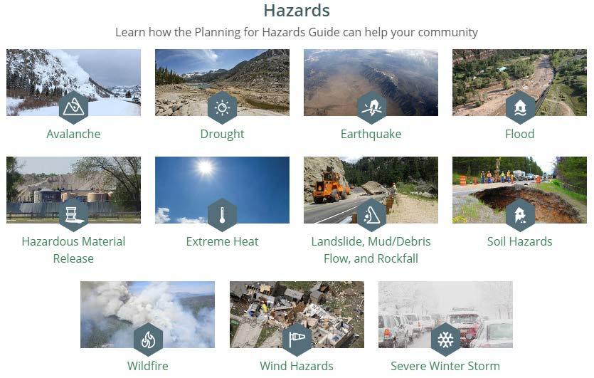
 Rocky Mountain Land Use Institute March 10, 2016 Overview of Presentation Why planning for hazards is important to Colorado Approaches to planning for hazards Overview of the planning for hazards guide
Planning Commission April 19, 2017 Erin Cooper, Floodplain Specialist Varda Blum, Floodplain Program Manger
 Public Hearing for Z-17-0001: Zoning Map Amendments to the Floodplain Overlay District & DC-17-0001: Land Use Code text amendments to the Floodplain regulations Planning Commission April 19, 2017 Erin
Using GISWeb to Determine Your Property s Flood Zone
 Using GISWeb to Determine Your Property s Flood Zone 1. In a new browser window, go to http://www.co.santacruz.ca.us/departments/geographicinformationsystemsgis.aspx 2. Click on GISWeb - GIS Mapping Application
Using Non-Regulatory RiskMAP Products in Floodplain Management. Ferrin Affleck, PE, CFM, Water Resources Engineer Project Manager Atkins
 Using Non-Regulatory RiskMAP Products in Floodplain Management Ferrin Affleck, PE, CFM, Water Resources Engineer Project Manager Atkins 1 Goal of this Presentation Inform Peak interest Stimulate creativity
Floodplain Management Plan State of Utah
 Utah Department of Public Safety Division of Emergency Services Floodplain Management Plan State of Utah September 2004 Prepared by: Judy Watanabe Utah Division of Emergency Services State NFIP Coordinator
10/5/2015. What Makes a Sound Floodplain Management Program? What are the Flood Problems in your Community?
 The Community Rating System (CRS) and Hazard Mitigation Planning Preparing Your Community Through Common Program Goals September 3, 2015 What Makes a Sound Floodplain Management Program? Know your community
Flood Risk in the Schuylkill Watershed. Planning for Resilient Communities
 Flood Risk in the Schuylkill Watershed Planning for Resilient Communities Welcome to Our Poster Session! We are here to talk about: Flood Risk in the Schuylkill River Watershed Taking Action to Reduce
Silver Jackets - Flood Risk Management Program
 COOPERATING TECHNICAL PARTNER INFORMATION EXCHANGE Silver Jackets - Flood Risk Management Program August 31, 2017 Association of State Floodplain Managers AUDIO AND WEB SETTINGS Your Participation Open
SILVER JACKETS: TEAMING TO MITIGATE AND MANAGE STATE FLOOD HAZARD PRIORITIES
 SILVER JACKETS: TEAMING TO MITIGATE AND MANAGE STATE FLOOD 255 255 255 237 237 237 0 0 0 217 217 217 163 163 163 200 200 200 131 132 122 239 65 53 80 119 27 HAZARD PRIORITIES 110 135 120 252 174.59 112
Floodplain Management Plan
 Floodplain Management Plan CITY OF FORT WORTH TFMA 2016 Spring Conference March 10, 2016 Agenda 1. Fort Worth Higher Standards (NFIP & CRS) 2. Floodplain Management Plan Overview and Results 3. Project
Thurston County, WA Flood Hazard Mitigation Plan Annual Progress Report CRS Activity 510
 Thurston County, WA Flood Hazard Mitigation Plan Annual Progress Report CRS Activity 510 Reporting Period: ctober 1, 2014 to September 30, 2015 Background: Thurston County developed a flood hazard mitigation
Planning Process---Requirement 201.6(b): An open public involvement process is essential to the development of an effective plan.
: An open public involvement process is essential to the development of an effective plan.") Section 3 Capability Identification Requirements Planning Process---Requirement 201.6(b): An open public involvement process is essential to the development of an effective plan. Documentation of the Planning
Section 3 Capability Identification Requirements Planning Process---Requirement 201.6(b): An open public involvement process is essential to the development of an effective plan. Documentation of the Planning
Modernization, FEMA is Recognizing the connection between damage reduction and
 EXECUTIVE SUMMARY Every year, devastating floods impact the Nation by taking lives and damaging homes, businesses, public infrastructure, and other property. This damage could be reduced significantly
Federal Emergency Management Agency
 Page 1 of 4 Issue Date: August 1, 2012 Effective Date: December 13, 2012 Case No.: 12-06-0595P LOMR-APP Washington, D.C. 20472 LETTER OF MAP REVISION DETERMINATION DOCUMENT COMMUNITY AND REVISION INFORMATION
BUTTS COUNTY, GEORGIA AND INCORPORATED AREAS
 BUTTS COUNTY, GEORGIA AND INCORPORATED AREAS Butts County Community Name Community Number BUTTS COUNTY (UNICORPORATED AREAS) 130518 FLOVILLA, CITY OF 130283 JACKSON, CITY OF 130222 JENKINSBURG, TOWN OF
Taylor County, Florida Community Coordination and Outreach (CCO) Meeting
 Meeting") Taylor County, Florida Community Coordination and Outreach (CCO) Meeting Suwannee River Water Management District April 26, 2017 11:00AM to 12:00PM Taylor County Administration Building, 201 E. Green Street,
Taylor County, Florida Community Coordination and Outreach (CCO) Meeting Suwannee River Water Management District April 26, 2017 11:00AM to 12:00PM Taylor County Administration Building, 201 E. Green Street,
Chapter 5 Floodplain Management
 Chapter 5 Floodplain Management Contents 1.0 Introduction... 1 2.0 Floodplain Management and Regulation... 1 2.1 City Code... 1 2.2 Floodplain Management... 1 2.3 Level of Flood Protection... 2 2.3.1 Standard
State of South Carolina Five-Year Floodplain Management Work Plan
 Purpose The purpose of the Community Assistance Program State Support Services Element (CAP-SSSE) is to provide, through a State grant mechanism, a means to ensure that communities participating in the
G318 Local Mitigation Planning Workshop. Module 2: Risk Assessment. Visual 2.0
 G318 Local Mitigation Planning Workshop Module 2: Risk Assessment Visual 2.0 Unit 1 Risk Assessment Visual 2.1 Risk Assessment Process that collects information and assigns values to risks to: Identify
Coordinating CRS Success on a County Scale. Presented at the 41st Annual ASFPM Conference Managing Flood Risk in the Heartland
 Coordinating CRS Success on a County Scale Presented at the 41st Annual ASFPM Conference Managing Flood Risk in the Heartland May 3, 2017 Today's Speaker Cynthia Bianco, CFM, AICP/PP Community Resiliency
Section 19: Basin-Wide Mitigation Action Plans
 Section 19: Basin-Wide Mitigation Action Plans Contents Introduction...19-1 Texas Colorado River Floodplain Coalition Mitigation Actions...19-2 Mitigation Actions...19-9 Introduction This Mitigation Plan,
Federal Emergency Management Agency
 Page 1 of 4 Issue Date: September 7, 2012 Effective Date: January 22, 2013 DETERMINATION DOCUMENT COMMUNITY COMMUNITY AND REVISION INFORMATION City of Lubbock Lubbock County Texas PROJECT DESCRIPTION CHANNELIZATION
Flood Hazards and Flood Risk, the Impact of a Changing Climate
 Flood Hazards and Flood Risk, the Impact of a Changing Climate Sally A. McConkey, P.E. CFM, D. WRE. Illinois State Water Survey June 14, 2017 Topics ISWS Coordinated Hazard Assessment and Mapping Program
Water Resources Engineering Division Public Works City of Colorado Springs
 Water Resources Engineering Division Public Works City of Colorado Springs Richard Mulledy, P.E. Division Manager City of Colorado Springs/Pueblo County IGA City of Colorado Springs/Pueblo County IGA $460
ANNEX B: TOWN OF BLUE RIVER
 ANNEX B: TOWN OF BLUE RIVER B.1 Community Profile Figure B.1 shows a map of the Town of Blue River and its location within Summit County. Figure B.1. Map of Blue River Summit County (Blue River) Annex
This survey is expected to take approximately 20 minutes and must be completed in one session.
 State Flood Assessment Survey 1 Introduction Thank you for your willingness to participate in this online survey as part of the State Flood Assessment effort. This first step toward developing comprehensive
FEMA s Flood Map Modernization Preparing for FY09 and Beyond: Integrated Flood Data Update, Risk Assessment, and Mitigation Planning
 FEMA s Flood Map Modernization Preparing for FY09 and Beyond: Integrated Flood Data Update, Risk Assessment, and Mitigation Planning DRAFT CONCEPT PAPER June 1, 2007 Integrated Flood Data Update, Risk
CITY OF PLANTATION ENGINEERING DEPARTMENT INTEROFFICE MEMORANDUM NO
 CITY OF PLANTATION ENGINEERING DEPARTMENT INTEROFFICE MEMORANDUM NO. 2013-003 DATE: October 22, 2012 TO: Mayor and Members of City Council FROM: Brett W. Butler, PE, CFM City Engineer SUBJECT: CRS Program
Lake Erie. June 10 & 11, 2014
 Discovery Meeting: Lake Erie FEMA REGION II June 10 & 11, 2014 Lake Erie Contributing Watersheds eds Introductions and Who s Here Project Team FEMA Region II RAMPP Local Stakeholders Invited Local Community
MUNICIPAL LAND USE STRATEGIES for Improving Flood Resilience
 MUNICIPAL LAND USE STRATEGIES for Improving Flood Resilience Strategy for a Flood Resistant Southern Tier Central Region (LWRP project) This presentation was prepared by Southern Tier Central Regional
FLOODPLAIN MANAGEMENT PLAN 2015 ANNUAL PROGRESS REPORT
 FLOODPLAIN MANAGEMENT PLAN 2015 ANNUAL PROGRESS REPORT Hinds County (Unincorporated) NFIP Community Number 280070 The 2015 Floodplain Management Plan Annual Progress Report on the progress made in implementing
FREQUENTLY ASKED QUESTION ABOUT FLOODPLAINS Michigan Department of Environmental Quality
 FREQUENTLY ASKED QUESTION ABOUT FLOODPLAINS Michigan Department of Environmental Quality WHAT IS A FLOOD? The National Flood Insurance Program defines a flood as a general and temporary condition of partial
Delaware River Basin Commission s Role in Flood Loss Reduction Efforts
 Delaware River Basin Commission s Role in Flood Loss Reduction Efforts There is a strong need to reduce flood vulnerability and damages in the Delaware River Basin. This paper presents the ongoing role
Georgia Flood M.A.P. Program
 ASFPM 2013 Conference Remembering the Past - Insuring the Future June 9-14, 2013 Georgia Flood M.A.P. Program Tom Shillock, CFM Georgia Floodplain Management Unit Coordinator George Thompson IV, CFM GIS
HAZARD MITIGATION PLAN POINT OF CONTACT MUNICIPAL PROFILE
 HAZARD MITIGATION PLAN POINT OF CONTACT louise@windgap-pa.gov jeffreyyob@gmail.com MUNICIPAL PROFILE MUNICIPAL PARTICIPATION Compliance with the National Flood Insurance Program (NFIP) Identify source
Chemung HUC-8 Watershed Project. February 1, 2011
 Chemung HUC-8 Watershed Project Kickoff Bi Fl t NY Big Flats, NY February 1, 2011 Introductions FEMA Region II Alan Springett, Senior Engineer, FEMA Risk Analysis Risk Assessment Lead Robert Schaefer,
Planning Process---Requirement 201.6(b): An open public involvement process is essential to the development of an effective plan.
: An open public involvement process is essential to the development of an effective plan.") Section 3 Capability Identification Requirements Planning Process---Requirement 201.6(b): An open public involvement process is essential to the development of an effective plan. Documentation of the Planning
Section 3 Capability Identification Requirements Planning Process---Requirement 201.6(b): An open public involvement process is essential to the development of an effective plan. Documentation of the Planning
Repetitive Loss Area Revisit # 6 Walter Road Area Jefferson Parish
 Repetitive Loss Area Revisit # 6 Walter Road Area Jefferson Parish www.floodhelp.uno.edu Supported by FEMA Acknowledgement The compilation if this report was managed by Erin Patton, CFM, a UNO-CHART Research
Federal Emergency Management Agency
 Page 1 of 5 Issue Date: October 28, 2009 Follows Conditional Case No.: 08-08-0612R DETERMINATION DOCUMENT COMMUNITY AND REVISION INFORMATION PROJECT DESCRIPTION BASIS OF REQUEST COMMUNITY Lincoln County
Oklahoma High Water Marks. CTP Community of Practice April 20, 2017
 Oklahoma High Water Marks CTP Community of Practice April 20, 2017 The Rains Came into Region 6 in May 2015 2 Disaster DR-4222 30 Day Rainfall 3 NOAA Rainfall Amounts / Rainfall Frequency 4 The Rains in
State of Vermont FLOODPLAIN MANAGEMENT WORK PLAN
 State of Vermont FLOODPLAIN MANAGEMENT WORK PLAN Prepared by: Vermont Agency of Natural Resources Department of Environmental Conservation Water Quality Division July 2004 TABLE OF CONTENTS INTRODUCTION...
GAFM Showcase: Multiple Agencies Combating Georgia s Flood Risk Together: Proven Results Gained by Strong Partnerships
 National Flood Insurance Program Participation GAFM Showcase: Multiple Agencies Combating Georgia s Flood Risk Together: Proven Results Gained by Strong Partnerships Moderator: Jill Bazinet, PE, CFM GAFM
USACE Silver Jackets, the Missouri State Risk Management Team and State Hazard Mitigation
 MfSMA Conference, State Risk Management Team Meeting Things You Want To Know USACE Silver Jackets, the Missouri State Risk Management Team and State Hazard Mitigation Brian Rast, PE, CFM, PMP Silver Jackets
YAVAPAI COUNTY FLOOD CONTROL DISTRICT STAKEHOLDER WORKSHOP. March 30 th & 31 st, 2015
 YAVAPAI COUNTY FLOOD CONTROL DISTRICT STAKEHOLDER WORKSHOP March 30 th & 31 st, 2015 1 Floods Happen In Yavapai County September 1983 Northwest Prescott Area: - Willow Creek - Bottleneck Wash - Granite
Discovery Meeting: Lake Ontario. FEMA REGION II November 12-14, 2013 and November 19-21, 2013 Lake Ontario Contributing Watersheds
 Discovery Meeting: Lake Ontario FEMA REGION II November 12-14, 2013 and November 19-21, 2013 Lake Ontario Contributing Watersheds Introductions and Who s Here Project Team FEMA Region II Dewberry New York
SECTION 6: MITIGATION STRATEGIES
 SECTION 6: MITIGATION STRATEGIES This section presents mitigation actions for Somerset County to reduce potential exposure and losses identified as concerns in the Risk Assessment portion of this plan.
National Flood Insurance Program. Jennifer Gilbert, CFM, ANFI New Hampshire NFIP State Coordinator
 National Flood Insurance Program Jennifer Gilbert, CFM, ANFI New Hampshire NFIP State Coordinator What is the National Flood Insurance Program? Created by Congress in 1968 Participating Communities voluntarily
RichSmith_slate-FEMA_320x240.wmv.
 Nebraska DNR s role in the making of FEMA s Digital Flood Insurance Rate Maps Becky Groshens (grow-hands) & Shelley Schindler Important Terms: FIRM: Flood Insurance Rate Map FIS: Flood Insurance Study
Wyoming s Five-Year Floodplain Management Work Plan
 Wyoming s Five-Year Floodplain Management Work Plan Purpose: The purpose of this work plan is for the benefit of the Wyoming communities so that the risk and damages are minimized and environmental values
ECONOMIC EVALUATION OF FLOODPLAIN MANAGEMENT AND FLOOD MITIGATION
 ECONOMIC EVALUATION OF FLOODPLAIN MANAGEMENT AND FLOOD MITIGATION CITY OF BIRMINGHAM, ALABAMA EDWIN REVELL, CFM FLOOD PLAIN ADMINISTRATOR DENISE PRUITT, CFM PROJECT PLANNER PRESENTATION OUTLINE 1. BACKGROUND/LOCATION
Outreach Georgia Flood M.A.P. Program. GAFM Technical Conference Flood Risk Outreach and Policy Session
 Outreach Georgia Flood M.A.P. Program GAFM Technical Conference Flood Risk Outreach and Policy Session 7 th Annual Technical Conference, Lanier Islands March 29, 2012 Risk Communication Key Learnings People
Passaic River Basin Flood Advisory Commission Report/Status of Recommendations. October 2014 Update
 Passaic River Basin Flood Advisory Commission Report/Status of Recommendations October 2014 Update Passaic River Basin Flood Advisory Commission April 2010: By Executive Order, Governor Christie created
T-318. Hazard Mitigation Section TDEM Recovery, Mitigation, and Standards
 T-318 Local Hazard Mitigation Plan Requirements Hazard Mitigation Section TDEM Recovery, Mitigation, and Standards Raymond Mejia, Lead Hazard Mitigation Planner Samantha Aburto, Hazard Mitigation Planner
Meeting the Nation s Levee Challenges
 ASDSO USACE/FEMA Levee Discussion Meeting the Nation s Levee Challenges November 2015 Presenters: Richard Varuso, USACE Michael Bishop, FEMA 1 This Session s Objective KNOWLEDGE - Provide you with insight
Justification for Floodplain Regulatory Standards in Illinois
 Justification for Floodplain Regulatory Standards in Illinois Office of Water Resources Issue Paper April, 2015 Proactive Illinois floodplain and floodway regulatory standards have prevented billions of