Little Wabash River HUC Watershed FEMA Risk MAP Discovery Meeting August 18, 2016
|
|
|
- Lynn Annis Wright
- 5 years ago
- Views:
Transcription


1 Little Wabash River HUC Watershed FEMA Risk MAP Discovery Meeting August 18, 2016 Sally McConkey P.E., CFM Glenn Heistand P.E., CFM Greg Byard P.E., CFM Zoe Zaloudek GISP, CFM Brad McVay GISP, CFM Ryan Meekma GISP,CFM Mary Richardson CFM

2 Risk MAP (Mapping, Assessment Planning) Through collaboration with State, Local, and Tribal entities, Risk MAP will deliver quality data that increases public awareness and leads to action that reduces risk to life and property 2 2
3 FEMA Risk MAP On a watershed basis: Identify flood hazards Raise flood awareness Encourage mitigation actions to increase resilience Discovery Meeting Goals: Provide information about floodplain management, mitigation resources, and flood hazards Gather information on flood study and mapping needs 3
 Digital Flood Insurance Rate Map - DFIRM (Coles, Cumberland, White County)")
4 Flood Maps: Paper vs Digital Paper Flood Insurance Rate Map - FIRM (Clay, Edwards, Effingham, Fayette, Jasper, Richland, Shelby, and Wayne County) Digital Flood Insurance Rate Map - DFIRM (Coles, Cumberland, White County) 4
 Zone AE")

5 Basic Map Terms: Zone A & Zone AE Zone A is an approximate flood hazard zone, showing the area that has a 1% annual chance of flooding (a.k.a. 100 year flood, Base Flood) Zone AE (or numbered Zone A) is a floodplain where BFEs have been established. Engineering study performed to determine how high the water will rise during the 1% annual chance (100 year ) flood. 5
6 Risk MAP mapping floodplain mitigation management 6 6

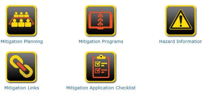
7 FEMA s Toolbox Publications Education Mitigation Action Tracker Hazard Mitigation Plans National Flood Insurance Program Discovery Products Changes Since Last FIRM Community Rating System 7
8 The National Flood Insurance Program (NFIP) 8 A voluntary program based on a mutual agreement between the Federal government and the local community: In exchange for adopting and enforcing a floodplain management ordinance, Federally-backed flood insurance is made available to property owners throughout the community. 8
9 Little Wabash River Watershed NFIP Participation (8/17/2016- Community Status Book Report for Illinois) County Community NFIP Current Effective Map Date Village of Clay City City of Flora yes yes 01/18/ /05/1985* Coles County City of Mattoon yes yes 07/18/ /18/2011 Cumberland County Village of Montrose City of Neoga yes yes yes 02/04/2011 NSFHA 02/04/2011* Edwards County yes 02/07/1984* (Effingham County) City of Altamont Village of Dietrich City of Effingham Village of Montrose Village of Teutopolis yes yes yes yes yes 09/04/1985* - 07/18/1985* NSFHA 08/19/1985* 9
10 Little Wabash River Watershed NFIP Participation continued (8/17/2016- Community Status Book Report for Illinois) County Community Gallatin County Village of New Haven NFIP yes yes Current Effective Map Date 12/02/2011 NSFHA Jasper County yes 01/17/1985 Moultrie County yes 07/18/2011 Richland County City of Olney yes yes 11/01/ /04/1985* (Wayne County) City of Fairfield yes yes 04/17/1985* 06/27/1975 White County City of Carmi Village of Crossville yes yes yes 02/16/ /16/ /16/2012 No elevations determined- all zone A, C and X NSFHA- no Special Flood Hazard Area- all Zone C 10
11 Non NFIP Counties & Communities County Community County Community Clay Clay Clay Clay Edwards Effingham Effingham Effingham Effingham Effingham Fayette Fayette Jasper Marion Clay County Village of Iola Village of Louisville Village of Sailor Springs City of Albion Effingham County Village of Edgewood Town of Mason Village of Shumway Village of Watson Fayette County Village of Farina Village of Wheeler Marion County Richland Richland Richland Shelby Shelby Wayne Wayne Wayne Wayne Wayne White Village of Calhoun Village of Noble Village of Parkersburg Shelby County Town of Sigel Wayne County Village of Cisne Village of Jeffersonville Village of Golden Gate Village of Mount Erie Village of Burnt Prairie 11

12 FEMA training: 12

13 ASFPM 13
14 NFIP State Coordinator Paul Osman Illinois Department of Natural Resources, Office of Water Resources Springfield, IL 14
15 Community Rating System (CRS) FEMA National Flood Insurance Program Administered by ISO (Insurance Services Office) Recognition for Going Above and Beyond Minimum NFIP Standards with Reduce Flood Insurance Premiums Voluntary Program with Community Activities for Point Accumulation Based on a 10 Class System. 500 Points & 5% Discount / Class Local Floodplain Management Program More Organized. Free Technical Assistance for Certain Activities Better Educated Public Reduced Flood Damage and Faster Recovery 15
16 Premium Discounts Class Points SFHA Non-SFHA 1 4,500 45% 10% 2 4,000 40% 10% 3 3,500 35% 10% 4 3,000 30% 10% 5 2,500 25% 10% 6 2,000 20% 10% 7 1,500 15% 5% 8 1,000 10% 5% % 5%
17 CRS Activities Public Information- raise public awareness of hazard risk to county through local television and \or radio station, Facebook page etc. Mapping & Regulatory- create new and\or revised plans and maps Flood Damage Reduction- purchase road closure devices; improve drainage ditches and stormwater management; install pumping stations; elevate low-lying roads; institute buy-out plans for repetitive loss properties; flood proof waste water systems; Warning & Response- NOAA weather radios; reverse 911 system 17
18 How To Join ISO/CRS Must be NFIP Compliant Specialist will help w/ application Document Activities you choose
19 CRS Contact Information Lou Ann Patellaro
20 FEMA s Toolbox Publications Education Mitigation Action Tracker Hazard Mitigation Plans National Flood Insurance Program Discovery Products Changes Since Last FIRM Community Rating System 20
21 Hazard Mitigation Plan Status County with a Plan Date of Plan Approval Planning Grant Plan authors Coles January 15, 2010 yes Cumberland June 15, 2015 Jasper May 22, 2012 (Plan expires May 22, 2017) U of I Extension\Jasper Co. Co-op\Lawrence Co. Industrial Development Group Richland Working on a plan January 31, 2013 (Plan expires January 31, 2018) Polis and EIU Edwards July 13, 2009 yes Edwards County EMA Director\Greater Wabash Regional Planning Commission\SIU\Polis Center Gallatin Update in progress Moultrie Plan under review White January 15, 2010 (Carmi buyouts) yes Never had a plan Clay Effingham Fayette Hamilton No Plan No Plan No Plan No Plan Shelby No Plan yes Marion No Plan Wayne No Plan yes 21

22 Mitigation Success FEMA Awards $707,507 Grant to City of Carmi: Hazard mitigation funds will be used to acquire 22 more flood prone structures and seven vacant lots in floodplain. Builds on past mitigation efforts removing more than 36 homes from floodplain. The Hazard Mitigation Grant Program enables communities to implement critical mitigation measures to reduce the risk of loss of life and property, said FEMA Region V Administrator Andrew Velasquez III. The acquisition and demolition of these homes permanently removes the structures from the floodplain and greatly reduces the financial impact on individuals and the community when future flooding occurs in this area. 22 Stories FEMA Awards $1,398,396 Grant to Gallatin County Hazard mitigation funds will be used to acquire and demolish 19 flood prone structures and elevate an additional 7 structures CHICAGO -- The U.S. Department of Homeland Security s Federal Emergency Management Agency (FEMA) has released $1,398,396 in Hazard Mitigation Grant Program (HMGP) funds to Gallatin County, Ill., for the acquisition and demolition of 19 residential structures in the Ohio River floodplain. 7 additional structures will be raised so that the lowest floor of these residential structures will be above the Base Flood Elevation. HMGP provides grants to state and local governments to implement long-term hazard mitigation measures. Through HMGP, FEMA will pay 75 percent of the $1,864,528 eligible project cost. The remaining 25 percent of the funds, $466,132 will be provided by the Illinois Department of Natural Resources.
23 News Release FEMA Awards $676,740 Grant to Saline County Hazard mitigation funds will be used to acquire and demolish 9 flood prone structures CHICAGO -- The U.S. Department of Homeland Security s Federal Emergency Management Agency (FEMA) has released $676,740 in Hazard Mitigation Grant Program (HMGP) funds to Saline County, Ill., for the acquisition and demolition of 8 residential structures and 1 commercial structure in the Ohio River floodplain. HMGP provides grants to state and local governments to implement long-term hazard mitigation measures. Through HMGP, FEMA will pay 75 percent of the $902,320 eligible project cost. The remaining 25 percent of the funds, $225,580 will be provided by Saline County. Marion Unit 2 Awarded Grant For Safe Room (WSILTV) WSIL-TV Carterville (IL), January 29, 2014 MARION The Marion school district has been awarded $1.2 million to build a safe room at Lincoln Elementary. The money comes through FEMA s Hazard Mitigation Grant Program and will cover 75 percent of the project s $1.67 million total cost. The safe room will be used by students and staff, as well as nearby residents, during severe weather. This grant will help the Marion School District ensure the safety of hundreds of students when severe weather threatens, said Jonathon Monken, director of the Illinois Emergency Management Agency. We re very pleased with the approval of this grant and look forward to working with the school district as they move forward on this project. Marion Unit 2 will be responsible for $417,728 for the safe room project. 23
 to determine funding status for available grants and grant cycles. Ron Davis Ron.Davis@Illinois.")
24 Mitigation Plan getting started 1. Contact IEMA s State Hazard Mitigation Office (SHMO) to determine funding status for available grants and grant cycles. Ron Davis Ron.Davis@Illinois.gov IEMA Main Office (217) Pick up IEMA s Grant Application How to Guide 3. Visit IEMA and FEMA web sites 24
 342 5108")
25 Mitigation Plan - Getting help Illinois Emergency Management Agency Considerations for hiring a consultant List of planning consultants Regional Planning Commission University of Illinois Extension Carrie McKillip University of Illinois Extension (309) mckillip@illinois.edu 25

26 Mitigation Ideas Drought Flood Erosion Earthquake Tornado Hail Lightning Extreme Temperature Severe Winter weather 26

27 Mitigation Action Tracker (MAT) The Mitigation Action Tracker (MAT) is a Web-based tool used to capture, store, organize and track mitigation actions. Community officials are encouraged to utilize this tool as a resource for organizing and tracking potential mitigation actions in their community. Mitigation actions will be entered as part of our follow up work after Risk MAP Discovery meetings. 27


28 Building Community Resilience To increase a community s ability to reduce flood risk through mitigation efforts resulting in less loss of life and property so the community can recover quicker. Missionviejodispatch.com 28

29 29
30 FEMA Resources
31 FEMA s Toolbox Education Mitigation Action Tracker Hazard Mitigation Plans National Flood Insurance Program Discovery Products Changes Since Last FIRM Community Rating System 31

32 Little Wabash River Watershed Discovery: littlewabashdiscovery.aspx 32

33 Interactive Discovery Map 33

34 Automated Engineering Approximations of flood hazards Approximate methods used to map floodplain for 1% flood event Based on current high resolution LiDAR Compare to current Zone A areas on FIRMs What might change: increase /decrease Download comparison maps from ISWS web site Station to view now Second draft 34

35 Break out Session Discovery Maps 35
36 Discovery Map Symbology 36
37 Break out Session Discovery Maps 37

38 Discovery Map Comments: Embankments Name? Owner? Purpose? 38
39 Discovery Map Comments: Dam Safety Reports Dam Name Paradise Lake Dam Altamont Reservoir Dam Central Illinois Public Service Company Dam Little Wabsh River Dam Lake Sara Dam Old Altamont Reservoir Dam Newton Power Station Lake Dam Olney Lake Dam a.k.a. M.D. Borah Lake Dam East Fork Lake Dam Vernor Lake Dam Lake Mattoon Dam Old Fairfield Reservoir Dam Pont-Ca Lake Dam Absher Lake Dam County Coles Effingham Effingham Effingham Effingham Effingham Jasper Richland Richland Richland Shelby Wayne White White 39
40 Gather information on flood study and mapping needs streams where the effective study/ mapping does not reflect existing conditions streams where the new approximate floodplains do not reflect existing conditions areas of growth where more detailed flood study data is needed available technical data to support hydrologic and hydraulic studies restrictive bridges, culverts or other structures overtopped roads dams areas of stream erosion levees and levee like structures and failures locations of critical facilities areas of mitigation interest 40
41 Next Steps Discovery Map Update Discovery Report (which will include new hydrology and hydraulic study needs) Discovery Map and Report posted on the web site FEMA Region will evaluate information for prioritization of future projects 41
42 Complete exit survey. 42
43 Break out session: Gather information on flood study and mapping needs streams where the effective study/ mapping does not reflect existing conditions streams where the new approximate floodplains do not reflect existing conditions areas of growth where more detailed flood study data is needed available technical data to support hydrologic and hydraulic studies restrictive bridges, culverts or other structures overtopped roads dams areas of stream erosion levees and levee like structures and failures locations of critical facilities areas of mitigation interest 43
Bucks County, PA Flood Risk Review Meeting. November 2014
 Bucks County, PA Flood Risk Review Meeting November 2014 Agenda for Today Risk MAP Program overview Overview of non-regulatory Flood Risk Products and datasets Discuss mitigation action Technical overview
Discovery Report. Cache River Watershed, Alexander, Johnson, Pulaski, and Union Counties, Illinois
 Discovery Report Cache River Watershed, 07140108 Alexander, Johnson, Pulaski, and Union Counties, Illinois 12/21/2012 i Project Area Community List Community Name Alexander County Village of Tamms Johnson
Vision to Action: Creating and Using a Flood Risk Assessment for Identifying Mitigation Options
 Vision to Action: Creating and Using a Flood Risk Assessment for Identifying Mitigation Options Lisa Graff, CFM, GISP Clayton Ballerine, CFM Brad McVay, CFM, GISP University of Illinois Prairie Research
Flood Hazards and Flood Risk, the Impact of a Changing Climate
 Flood Hazards and Flood Risk, the Impact of a Changing Climate Sally A. McConkey, P.E. CFM, D. WRE. Illinois State Water Survey June 14, 2017 Topics ISWS Coordinated Hazard Assessment and Mapping Program
in coordination with Peoria County, Planning and Zoning Department
 Prepared by Amec Foster Wheeler Environment & Infrastructure Hazard Mitigation and Emergency Management Program in coordination with Peoria County, Planning and Zoning Department The purpose of hazard
CITY OF PLANTATION ENGINEERING DEPARTMENT INTEROFFICE MEMORANDUM NO
 CITY OF PLANTATION ENGINEERING DEPARTMENT INTEROFFICE MEMORANDUM NO. 2013-003 DATE: October 22, 2012 TO: Mayor and Members of City Council FROM: Brett W. Butler, PE, CFM City Engineer SUBJECT: CRS Program
Chemung HUC-8 Watershed Project. February 1, 2011
 Chemung HUC-8 Watershed Project Kickoff Bi Fl t NY Big Flats, NY February 1, 2011 Introductions FEMA Region II Alan Springett, Senior Engineer, FEMA Risk Analysis Risk Assessment Lead Robert Schaefer,
NFIP Program Basics. KAMM Regional Training
 NFIP Program Basics KAMM Regional Training Floodplain 101 Homeowners insurance does not cover flood damage Approximately 25,000 flood insurance policies in KY According to BW12 analysis, approximately
National Flood Insurance Program (NFIP) Community Rating System (CRS) Together North Jersey Resilient Task Force Meeting
 Community Rating System (CRS) Together North Jersey Resilient Task Force Meeting") National Flood Insurance Program (NFIP) Community Rating System (CRS) Together North Jersey Resilient Task Force Meeting April 3, 2017 Marianne Luhrs, AICP FEMA R2 CRS Coordinator Visual Intro-1 CRS Program
National Flood Insurance Program (NFIP) Community Rating System (CRS) Together North Jersey Resilient Task Force Meeting April 3, 2017 Marianne Luhrs, AICP FEMA R2 CRS Coordinator Visual Intro-1 CRS Program
IN THIS ISSUE SPRING FLOODS. Black River, Pocahontas, Arkansas
 IN THIS ISSUE April and May brought a series of severe storm events to Arkansas, causing extensive damage throughout the state. ANRC spoke with many of you, gathering information on damages, providing
Michael Taylor, PE, CFM Project Manager, AECOM August 25, 2015
 Promoting FEMA s Flood Risk Products in the Lower Levisa Watershed Michael Taylor, PE, CFM Project Manager, AECOM August 25, 2015 Agenda Study Background Flood Risk Product Overview AOMI and Mitigation
ASFPM Partnerships for Statewide Mitigation Actions. Alicia Williams GIS and HMP Section Manager, Amec Foster Wheeler June 2016
 ASFPM Partnerships for Statewide Mitigation Actions Alicia Williams GIS and HMP Section Manager, Amec Foster Wheeler June 2016 Summary The Concept Leveraging Existing Data and Partnerships to reduce risk
BACKGROUND ANNUAL PROGRESS REPORT DEVELOPMENT ADOPTION OF THE H-GAC HAZARD MITIGATION PLAN/UPDATES MISSION STATEMENT
 BACKGROUND CITY OF CONROE FLOODPLAIN MANAGEMENT ANNUAL PROGRESS Activity 510 of the National Flood Insurance Program s (NFIP) Community Rating System (CRS) requires the development of a Floodplain Management
Comprehensive Flood Mitigation for 12,000 Properties
 Comprehensive Flood Mitigation for 12,000 Properties Lori Rafferty, PE, CFM, Louisville MSD & Louie Greenwell, GISP, CFM, T&M Associates Association of State Floodplain Managers 2014 State Conference June
Erie County Flood Risk Review Meeting. January 18, 2018
 Erie County Flood Risk Review Meeting January 18, 2018 Agenda The value of updated flood maps for your community Review updated flood-risk data and important next steps in the Risk MAP process Increasing
Natural Hazards Mitigation Plan. Executive Summary
 Natural Hazards Mitigation Plan Executive Summary 1. Introduction Kane County Illinois, is subject to natural hazards that threaten life and health and have caused extensive property damage. Floods struck
COMMUNITY SUMMARY LINN COUNTY MULTI-JURISDICTIONAL HAZARD MITIGATION PLAN CITY OF LISBON
 COMMUNITY SUMMARY LINN COUNTY MULTI-JURISDICTIONAL HAZARD MITIGATION PLAN CITY OF LISBON This document provides a summary of the hazard mitigation planning information for the City of Lisbon that will
Flood Risk Review (FRR) Meeting. Cumberland County, Pennsylvania Carlisle, Pennsylvania December 5, 2016
 Meeting. Cumberland County, Pennsylvania Carlisle, Pennsylvania December 5, 2016") Flood Risk Review (FRR) Meeting Cumberland County, Pennsylvania Carlisle, Pennsylvania December 5, 2016 Why are we here today? The Flood Insurance Study (FIS) report and Flood Insurance Rate Maps (FIRMs)
Flood Risk Review (FRR) Meeting Cumberland County, Pennsylvania Carlisle, Pennsylvania December 5, 2016 Why are we here today? The Flood Insurance Study (FIS) report and Flood Insurance Rate Maps (FIRMs)
Village of Blue Mounds Annex
 Village of Blue Mounds Annex Community Profile The Village of Blue Mounds is located in the southwest quadrant of the County, north of the town of Perry, west of the town of Springdale, and south of the
Community Rating System. National Flood Insurance Program
 National Flood Insurance Program Community Rating System A Local Official s Guide to Saving Lives Preventing Property Damage Reducing the Cost of Flood Insurance FEMA B-573 / May 2015 How the Community
10/5/2015. What Makes a Sound Floodplain Management Program? What are the Flood Problems in your Community?
 The Community Rating System (CRS) and Hazard Mitigation Planning Preparing Your Community Through Common Program Goals September 3, 2015 What Makes a Sound Floodplain Management Program? Know your community
Discovery Meeting: Middle Potomac- Catoctin Watershed. FEMA REGION III September 26, 2012 Rockville, MD and Fairfax, VA
 Discovery Meeting: Middle Potomac- Catoctin Watershed FEMA REGION III September 26, 2012 Rockville, MD and Fairfax, VA Agenda Introductions Purpose of This Meeting Discovery Process Community Rating System
Flood Plain Management Services (FPMS) Program
 Program") Flood Plain Management Services (FPMS) Program 2016 Winter Stakeholder Partnering Forum March 2016 Mario Beddingfield, P.E., CFM Hydraulic Engineer/FPMS Program Manager H&H/Water Control Branch U.S. Army
Flood Plain Management Services (FPMS) Program 2016 Winter Stakeholder Partnering Forum March 2016 Mario Beddingfield, P.E., CFM Hydraulic Engineer/FPMS Program Manager H&H/Water Control Branch U.S. Army
Action Items for Flood Risk Management on Wildcat Creek Interagency success with floodplain management plans and flood forecast inundation maps
 Presentation to USACE 2012 Flood Risk Management and Silver Jackets Joint Workshop, Harrisburg, Pennsylvania Action Items for Flood Risk Management on Wildcat Creek Interagency success with floodplain
A Flood Mitigation Plan for the Non-Tidal N.J. Section of the Delaware River Basin. Warren County Planning Workshop (2 nd Meeting) March 7, 2007
 March 7, 2007") A Flood Mitigation Plan for the Non-Tidal N.J. Section of the Delaware River Basin Warren County Planning Workshop (2 nd Meeting) March 7, 2007 Study Area Participation: Hunterdon: 16 Eligible Municipalities
A Flood Mitigation Plan for the Non-Tidal N.J. Section of the Delaware River Basin Warren County Planning Workshop (2 nd Meeting) March 7, 2007 Study Area Participation: Hunterdon: 16 Eligible Municipalities
USACE Levee Safety Meeting FEMA Overview
 USACE Levee Safety Meeting FEMA Overview Christine Gaynes, CFM FEMA Region V Roger Denick, PE, CFM FEMA Region V Service Center Agenda FEMA Region V Overview FEMA Levee Program Levee Guidance Transformation
Updates to Maine Coastal Flood Insurance Rate Maps (FIRM s): What a Local Official Should Know. Presented by: Steve Johnson, P.E.
: What a Local Official Should Know. Presented by: Steve Johnson, P.E.") Updates to Maine Coastal Flood Insurance Rate Maps (FIRM s): What a Local Official Should Know Presented by: Steve Johnson, P.E. Town Engineer October 4, 2018 Introduction Federal Emergency Management
Updates to Maine Coastal Flood Insurance Rate Maps (FIRM s): What a Local Official Should Know Presented by: Steve Johnson, P.E. Town Engineer October 4, 2018 Introduction Federal Emergency Management
Repetitive Loss Area Revisit # 6 Walter Road Area Jefferson Parish
 Repetitive Loss Area Revisit # 6 Walter Road Area Jefferson Parish www.floodhelp.uno.edu Supported by FEMA Acknowledgement The compilation if this report was managed by Erin Patton, CFM, a UNO-CHART Research
Role of Disaster Insurance in Improving Resilience: An Expert Meeting The Resilient America Roundtable
 Role of Disaster Insurance in Improving Resilience: An Expert Meeting The Resilient America Roundtable National Academy of Science Washington, DC July 9, 2015 Roseville Demographics Primary population
Non Regulatory Risk MAP Products Flood Depth and Probability Grids
 Non Regulatory Risk MAP Products Flood Depth and Probability Grids Virginia Floodplain Management Association 2015 Floodplain Management Workshop October 29th, 2015 Nabil Ghalayini, P.E., PMP, D.WRE, CFM
How Does Flood Insurance Work?
 How Does Flood Insurance Work? The National Flood Insurance Program (NFIP) Makes Available: flood insurance disaster assistance grants and loans In Exchange For: Local adoption of a floodplain ordinance
ROI for Joining CRS. Floodplain Management Association Conference. Sacramento, CA. September 2016
 ROI for Joining CRS Floodplain Management Association Conference Sacramento, CA September 2016 Agenda Joining CRS Challenges ROI Tips Wrap Up 1 FMA Conference What is CRS? Community Rating System Voluntary
COMMUNITY RATING SYSTEM (CRS) October 28, 2013
 October 28, 2013") COMMUNITY RATING SYSTEM (CRS) October 28, 2013 SUE K. HOPFENSPERGER, CFM ISO/CRS SPECIALIST ASSOCIATION OF STATE FLOODPLAIN MANAGER CERTIFIED FLOODPLAIN MANAGER Location: Fernandina Beach, FL INSURANCE
COMMUNITY RATING SYSTEM (CRS) October 28, 2013 SUE K. HOPFENSPERGER, CFM ISO/CRS SPECIALIST ASSOCIATION OF STATE FLOODPLAIN MANAGER CERTIFIED FLOODPLAIN MANAGER Location: Fernandina Beach, FL INSURANCE
Flood Vulnerability Assessment for Critical Facilities. Molly Woloszyn Lisa Graff, GISP, CFM
 Flood Vulnerability Assessment for Critical Facilities Molly Woloszyn Lisa Graff, GISP, CFM 2011 University of Illinois Board of Trustees. All rights reserved. For permission information, contact the Illinois
New Tools for Mitigation & Outreach. Louie Greenwell Stantec
 New Tools for Mitigation & Outreach Louie Greenwell Stantec Our Discussion Today Background What is Risk MAP? FEMA Products Overview of RiskMAP Data Sets Changes Since Last FIRM Depth and Analysis Grids
MUNICIPAL LAND USE STRATEGIES for Improving Flood Resilience
 MUNICIPAL LAND USE STRATEGIES for Improving Flood Resilience Strategy for a Flood Resistant Southern Tier Central Region (LWRP project) This presentation was prepared by Southern Tier Central Regional
CRS State Profile: Ohio
 CRS State Profile: Ohio This is a profile for communities in your state that are participating in the Community Rating System (CRS). This profile is intended to provide information to the State NFIP Coordinator
Durham County Preliminary Flood Hazard Data Public Meeting. July 28, 2016
 Durham County Preliminary Flood Hazard Data Public Meeting July 28, 2016 Why Are We Here New flood hazard data has been released as Preliminary for Durham County Statutory Due Process for review/comments
Floodplain Management Plan
 Floodplain Management Plan CITY OF FORT WORTH TFMA 2016 Spring Conference March 10, 2016 Agenda 1. Fort Worth Higher Standards (NFIP & CRS) 2. Floodplain Management Plan Overview and Results 3. Project
Floodplain Management Assessment
 CHEHALIS RIVER BASIN Floodplain Management Assessment Master Report Final April, 2015 TABLE OF CONTENTS Executive Summary... 1 Introduction... 2 The Floodplain... 4 Floodplain Development... 4 Floodplain
Disaster Insurance: Are States and Insurance Companies Prepared?
 Disaster Insurance: Are States and Insurance Companies Prepared? National Conference of State Legislatures 2015 Legislative Summit Roy Wright Deputy Associate Administrator for Insurance and Mitigation
The National Flood Insurance Program Community Rating System: An Introduction and Discussion of the RDO Role. October 2, :00-3:15 pm ET
 The National Flood Insurance Program Community Rating System: An Introduction and Discussion of the RDO Role October 2, 2014 2:00-3:15 pm ET Our Mission The National Association of Development Organizations
FLOODPLAIN MANAGEMENT PLAN 2015 ANNUAL PROGRESS REPORT
 FLOODPLAIN MANAGEMENT PLAN 2015 ANNUAL PROGRESS REPORT Hinds County (Unincorporated) NFIP Community Number 280070 The 2015 Floodplain Management Plan Annual Progress Report on the progress made in implementing
FREQUENTLY ASKED QUESTION ABOUT FLOODPLAINS Michigan Department of Environmental Quality
 FREQUENTLY ASKED QUESTION ABOUT FLOODPLAINS Michigan Department of Environmental Quality WHAT IS A FLOOD? The National Flood Insurance Program defines a flood as a general and temporary condition of partial
ASFPM REGION 6 DIRECTOR ANNUAL REPORT. Annual Conference-Atlanta, Georgia
 ASFPM REGION 6 DIRECTOR ANNUAL REPORT Annual Conference-Atlanta, Georgia Jessica Baker, Regional Director 5/31/2015 ASFPM REGION 6 DIRECTOR ANNUAL REPORT Annual Conference-Atlanta, Georgia Region 6 Report
Flood Risk Products. New Techniques for Identifying and Communicating Flood Risk
 Flood Risk Products New Techniques for Identifying and Communicating Flood Risk Mark Zito, GISP, CFM GIS Specialist Amol Daxikar, GISP, CFM Project Manager March 28, 2012 1% Flood with 3 Feet Sea Level
Skagit County Flood Insurance Study Update. Ryan Ike, CFM FEMA Region 10
 Skagit County Flood Insurance Study Update Ryan Ike, CFM FEMA Region 10 Skagit County Flood Insurance Study Process Overview Process, Schedule, & Deliverables Base Flood Elevations, Modeling, & Levees
Findings/Debrief Meeting September 9, CDOT R4 Headquarters Big Thompson Conference Room W 10 th St. Greeley, CO 80634
 Findings/Debrief Meeting September 9, 2016 CDOT R4 Headquarters Big Thompson Conference Room 10601 W 10 th St. Greeley, CO 80634 Discovery Review & Outcome May 25 Discovery Meeting Summary Summarize Data
Community Incentives for Nature-Based Flood Solutions
 Community Incentives for Nature-Based Flood Solutions A GUIDE TO FEMA S COMMUNITY RATING SYSTEM FOR CONSERVATION PRACTITIONERS The Federal Emergency Management Agency (FEMA) uses a Community Rating System
Cumberland County, NJ. Risk MAP Project Status Update April 22, 2013
 Cumberland County, NJ Risk MAP Project Status Update April 22, 2013 Agenda Project Team Milestones Risk MAP Overview Study Scope overview Regulatory products Non-regulatory products Proposed Schedule Risk
G E M A. Georgia Emergency Management Agency. Hazard Mitigation Division - Planning. Dee Langley Planning Program Manager.
 G E M A Georgia Emergency Management Agency Office of Homeland Security Georgia Emergency Management Agency Hazard Mitigation Division - Planning Dee Langley Planning Program Manager Kelly Keefe Hazard
National Flood Insurance Program s Community Rating System:
 National Flood Insurance Program s Community Rating System: An Introduction and Discussion of the RDO Role: 1/2 Presentation - 1/2 Discussion Bill Lesser, Federal Insurance and Mitigation Administration,
Floodplain Management 101. Mississippi Emergency Management Agency Floodplain Management Bureau
 Floodplain Management 101 Mississippi Emergency Management Agency Floodplain Management Bureau Stafford Act The Stafford Disaster Relief and Emergency Assistance Act (Stafford Act) (Public Law 100-707)
Federal Emergency Management Agency
 Page 1 of 4 Issue Date: April 26, 2013 DETERMINATION DOCUMENT COMMUNITY AND REVISION INFORMATION PROJECT DESCRIPTION BASIS OF REQUEST City of Coppell Dallas County Texas FILL HYDRAULIC ANALYSIS NEW TOPOGRAPHIC
This survey is expected to take approximately 20 minutes and must be completed in one session.
 State Flood Assessment Survey 1 Introduction Thank you for your willingness to participate in this online survey as part of the State Flood Assessment effort. This first step toward developing comprehensive
This survey is expected to take approximately 20 minutes and must be completed in one session.
 Introduction Thank you for your willingness to participate in this online survey as part of the State Flood Assessment effort. This first step toward developing comprehensive flood planning for Texas does
In 1993, spring came in like a lion, but refused
 36 UNIVERSITIES COUNCIL ON WATER RESOURCES ISSUE 130, PAGES 36-40, MARCH 2005 FEMA and Mitigation: Ten Years After the 1993 Midwest Flood Norbert Director of Federal Insurance and Mitigation Division Federal
History of Floodplain Management in Ascension Parish
 History of Floodplain Management in Ascension Parish presented by: Kara Moree Floodplain Coordinator February 6, 2012 Floodplain 101 Floodplain 101 Base or 1% Flood: A flood having a 1% chance of being
COMMUNITY SUMMARY LINN COUNTY MULTI-JURISDICTIONAL HAZARD MITIGATION PLAN CITY OF CENTRAL CITY
 COMMUNITY SUMMARY LINN COUNTY MULTI-JURISDICTIONAL HAZARD MITIGATION PLAN CITY OF CENTRAL CITY This document provides a summary of the hazard mitigation planning information for the City of Central City
Preliminary DFIRM Community Coordination (PDCC) Meeting Gilchrist & Levy Counties, FL. April 30, 2015
 Meeting Gilchrist & Levy Counties, FL. April 30, 2015") Preliminary DFIRM Community Coordination (PDCC) Meeting Gilchrist & Levy Counties, FL April 30, 2015 Agenda 1. Introductions 2. Study Process and Timeline 3. Overview of Preliminary Products 4. Overview
Preliminary DFIRM Community Coordination (PDCC) Meeting Gilchrist & Levy Counties, FL April 30, 2015 Agenda 1. Introductions 2. Study Process and Timeline 3. Overview of Preliminary Products 4. Overview
Town of Montrose Annex
 Town of Montrose Annex Community Profile The Town of Montrose is located in the Southwest quadrant of the County, east of the Town of Primrose, south of the Town of Verona, and west of the Town of Oregon.
July 31, 2017 NFIP Flood Map Open House Flood Maps 101 Flood Mapping acronyms History of the NFIP Flood Mapping Updates Flood Insurance Fairhope,
 July 31, 2017 NFIP Flood Map Open House Flood Maps 101 Flood Mapping acronyms History of the NFIP Flood Mapping Updates Flood Insurance Fairhope, Alabama Flood Maps Fairhope Permitting Jurisdiction Coastal
Kentucky Risk MAP It s not Map Mod II
 Kentucky Risk MAP It s not Map Mod II Risk Mapping Assessment and Planning Carey Johnson Kentucky Division of Water carey.johnson@ky.gov What is Risk MAP? Risk Mapping, Assessment, and Planning (Risk MAP)
Cameron County, TX. Consultation Coordination Officer (CCO) Meeting. Please sign in (sheet at front of the room) Meeting will begin at 9:00
 Meeting. Please sign in (sheet at front of the room) Meeting will begin at 9:00") Cameron County, TX Consultation Coordination Officer (CCO) Meeting Please sign in (sheet at front of the room) Meeting will begin at 9:00 July 29, 2015 Lisa Jennings FEMA Region 6 Roles & Responsibilities
Cameron County, TX Consultation Coordination Officer (CCO) Meeting Please sign in (sheet at front of the room) Meeting will begin at 9:00 July 29, 2015 Lisa Jennings FEMA Region 6 Roles & Responsibilities
Winter Storm Jonas Hazard Mitigation Grant Program
 Winter Storm Jonas Hazard Mitigation Grant Program Avalon, Ocean City, Sea Isle City and Stone Harbor March 25, 2017 Sea Isle City April 1, 2017 Ocean City Today's Agenda Nor Easter Jonas Hazard Mitigation
APPENDIX D PLANNING PROCESS DOCUMENTATION
 APPENDIX D PLANNING PROCESS DOCUMENTATION This appendix includes the following: 1. Meeting Agendas 2. Meeting Minutes 3. Meeting Sign-In Sheets 4. Public Survey Summary Results 1) Introductions AGENDA
Why do we care about floodplains?
 NFIP 101 Outline What is the NFIP? What are its goals? What is a flood? A floodplain? Maps, FIRMs, and FISs NFIP Requirements Local Flood Ordinances & Permitting Tips, Tricks, & Tools Mitigation & Other
Dade County Natural Hazard Mitigation Plan
 Introduction to Mitigation Definition of Mitigation Mitigation is defined by FEMA as "...sustained action that reduces or eliminates longterm risk to people and property from natural hazards and their
Kevin Wagner Maryland Department of the Environment
 Kevin Wagner Maryland Department of the Environment Topics Overview of the National Flood Insurance Program (NFIP) Mapping Regulations Insurance Mitigation Community Rating System (CRS) Questions Know
Changes Coming to the National Flood Insurance Program What to Expect. Impact of changes to the NFIP under Section 205 of the Biggert-Waters Act
 Changes Coming to the National Flood Insurance Program What to Expect Impact of changes to the NFIP under Section 205 of the Biggert-Waters Act Flood Risk Flood risks and the costs of flooding Weather
Are Risk MAP Products Really on Our Mind?
 Are Risk MAP Products Really on Our Mind? ASFPM 2015 Atlanta, GA Presented By: Jason Wilson, PE, CFM William Fain, EIT, CFM Amec Foster Wheeler Presentation Overview 1. What is Risk MAP/What are Risk Map
GAFM Showcase: Multiple Agencies Combating Georgia s Flood Risk Together: Proven Results Gained by Strong Partnerships
 National Flood Insurance Program Participation GAFM Showcase: Multiple Agencies Combating Georgia s Flood Risk Together: Proven Results Gained by Strong Partnerships Moderator: Jill Bazinet, PE, CFM GAFM
Chapter 7 Appendix B: National Flood Insurance Program Summary for Kaua'i County, 2015 Update
 Chapter 7 Appendix B: National Flood Insurance Program Summary for Kaua'i County, 2015 Update Topic Considerations Description INSURANCE SUMMARY STAFF RESOURCES How many NFIP policies are in Kaua i County?
All Hazard All Discipline Minutes
 All Hazard All Discipline Minutes October 27, 2016 11:30 am Gallatin County Coordination Center Agenda Present Patrick Lonergan, Kerri Strasheim; Mary Martin; Sean O Callaghan, Graver Johnson, Don Wilson,
Federal Emergency Management Agency
 Page 1 of 6 Issue Date: May 13 2016 Case No.: Follows Conditional Case No.: 14-05-0595R DETERMINATION DOCUMENT COMMUNITY AND REVISION INFORMATION PROECT DESCRIPTION BASIS OF REQUEST COMMUNITY Village of
Sources of FEMA Funding
 ASFPM Nonstructural/Floodproofing Workshops Sources of FEMA Funding ASFPM Nonstructural/Floodproofing Committee Gene Barr, CFM Principal Project Manager Nonstructural Specialist Sources of FEMA Funding
DES MOINES CITY OF TWO RIVERS. Flooding Risk & Impact to Development
 DES MOINES CITY OF TWO RIVERS Flooding Risk & Impact to Development River System Des Moines Flood Protection Des Moines Flood Protection cont. Infrastructure Over 24 miles of levees 21stormwater pump stations
OTTAWA COUNTY AND SANDUSKY COUNTY COMMUNITY CONSULTATION OFFICERS (CCO) MEETING December 7, 2017
 MEETING December 7, 2017") OTTAWA COUNTY AND SANDUSKY COUNTY COMMUNITY CONSULTATION OFFICERS (CCO) MEETING December 7, 2017 TODAY S AGENDA The Value of Updated Flood Maps for Your Community Reviewing the Updated Flood Risk Data
OTTAWA COUNTY AND SANDUSKY COUNTY COMMUNITY CONSULTATION OFFICERS (CCO) MEETING December 7, 2017 TODAY S AGENDA The Value of Updated Flood Maps for Your Community Reviewing the Updated Flood Risk Data
Community Resilience & NFIP s Community Rating system
 Community Resilience & NFIP s Community Rating system Ajita Atreya Wharton Risk Management and Decision Processes Center University of Pennsylvania National Association of Counties (NACo) Session on Risk
Discovery Meeting: Lake Ontario. FEMA REGION II November 12-14, 2013 and November 19-21, 2013 Lake Ontario Contributing Watersheds
 Discovery Meeting: Lake Ontario FEMA REGION II November 12-14, 2013 and November 19-21, 2013 Lake Ontario Contributing Watersheds Introductions and Who s Here Project Team FEMA Region II Dewberry New York
Hazard Mitigation Grants. Technical Assistance Session Middlesex County, NJ December 7, 2011
 Hazard Mitigation Grants Technical Assistance Session Middlesex County, NJ December 7, 2011 Outline Purpose of Hazard Mitigation Hazard Mitigation Projects Hazard Mitigation Assistance Grant Programs Using
Federal Emergency Management Agency
 Page 1 of 5 Issue Date: July 27, 2012 Effective Date: December 10, 2012 Case No.: 11-06-4512P Follows Conditional Case No.: 06-06-B789R LOMR-APP Federal Emergency Management Agency Washington, D.C. 20472
Strategies for Increasing Flood Resiliency
 Strategies for Increasing Flood Resiliency Flood Hazard Mitigation Steve Ferryman, CFM Mitigation Branch Chief Ohio Emergency Management Agency Ohio EMA Mitigation Branch The mission of the Mitigation
CRS State Profile: Wyoming
 CRS State Profile: Wyoming This is a profile for communities in your state that are participating in the Community Rating System (CRS). This profile is intended to provide information to the State NFIP
Attachment B. King County Flood Control Zone District Work Program
 Attachment B King County Flood Control Zone District Work Program The King County Flood Control Zone District work program is comprised of two major categories: Programmatic Work Program o Flood Preparedness,
LOCAL MITIGATION PLAN REVIEW CROSSWALK
 INSTRUCTIONS FOR USING THE PLAN REVIEW CROSSWALK FOR REVIEW OF LOCAL MITIGATION PLANS Attached is a Plan Review Crosswalk based on the Local Multi-Hazard Mitigation Planning Guidance, published by FEMA
Lake Erie. June 10 & 11, 2014
 Discovery Meeting: Lake Erie FEMA REGION II June 10 & 11, 2014 Lake Erie Contributing Watersheds eds Introductions and Who s Here Project Team FEMA Region II RAMPP Local Stakeholders Invited Local Community
FEMA FLOOD MAPS Public Works Department Stormwater Management Division March 6, 2018
 FEMA FLOOD MAPS Public Works Department Stormwater Management Division March 6, 2018 Presentation Overview FEMA National Flood Insurance Program (NFIP) FEMA Community Rating System (CRS) Flood Insurance
State of Vermont FLOODPLAIN MANAGEMENT WORK PLAN
 State of Vermont FLOODPLAIN MANAGEMENT WORK PLAN Prepared by: Vermont Agency of Natural Resources Department of Environmental Conservation Water Quality Division July 2004 TABLE OF CONTENTS INTRODUCTION...
Presented by: Connie Perkins, PE, CFM April 20, 2016
 Presented by: Connie Perkins, PE, CFM April 20, 2016 City of Sacramento s Flood History Need for a Comprehensive Flood Management Plan (CFMP) Overview of Sacramento s CFMP 2016 Next Steps Sacramento
Natural Hazards Mitigation Plan Kankakee County, Illinois Executive Summary
 1. Introduction Natural Hazards Mitigation Plan Kankakee County, Illinois Executive Summary Kankakee County is subject to natural hazards that threaten life, safety, health, and welfare and cause extensive
Modernization, FEMA is Recognizing the connection between damage reduction and
 EXECUTIVE SUMMARY Every year, devastating floods impact the Nation by taking lives and damaging homes, businesses, public infrastructure, and other property. This damage could be reduced significantly
STATE OF MARYLAND FLOODPLAIN MANAGEMENT PLAN FIVE-YEAR WORK PLAN DRAFT SEPTEMBER, 2004
 STATE OF MARYLAND FLOODPLAIN MANAGEMENT PLAN FIVE-YEAR WORK PLAN DRAFT SEPTEMBER, 2004 Prepared by: Maryland Department of the Environment Wetlands and Waterways Program Flood Mitigation Division D R A
5/25/2017. So why don t more communities participate in the Community Rating System (CRS)? Agenda. What is CRS? Community Rating System
? Agenda. What is CRS? Community Rating System") Floodplain Management Activities Flood Insurance Rates So why don t more communities participate in the Community Rating System (CRS)? Texas Floodplain Management Association 29 th Annual Spring Conference
Floodplain Management Activities Flood Insurance Rates So why don t more communities participate in the Community Rating System (CRS)? Texas Floodplain Management Association 29 th Annual Spring Conference
TIPS FOR PREPARING TO JOIN SYSTEM THE COMMUNITY RATING. Kristin Owen, AICP, CFM. VFMA Fall Workshops
 TIPS FOR PREPARING TO JOIN THE COMMUNITY RATING SYSTEM Kristin Owen, AICP, CFM 1 The Community Rating System (CRS) Voluntary program for communities participating in the NFIP Recognizes activities beyond
TESTIMONY. Association of State Floodplain Managers, Inc.
 ASSOCIATION OF STATE FLOODPLAIN MANAGERS, INC. 2809 Fish Hatchery Road, Suite 204, Madison, Wisconsin 53713 www.floods.org Phone: 608-274-0123 Fax: 608-274-0696 Email: asfpm@floods.org TESTIMONY Association
Floodplain Management Plan State of Utah
 Utah Department of Public Safety Division of Emergency Services Floodplain Management Plan State of Utah September 2004 Prepared by: Judy Watanabe Utah Division of Emergency Services State NFIP Coordinator
Community Coordination Meeting. York County, Maine. Risk MAP Study
 Community Coordination Meeting York County, Maine Risk MAP Study January 9, 2014 Agenda Welcome and Introductions Project Timeline Flood Hazard Analysis Recap (Digital Conversion, Riverine and Coastal)
210 W Canal Dr Palm Harbor, FL 34684
 Flood Analysis Memo Property Address In Partnership with: ** This property is within a high risk flood zone ** BFE = 6 ft This property is located in the FEMA designated high-risk zone, Zone AE - an area