Request for Removal of Lands from Floodplain & City Floodplain Map Amendment Madison Metropolitan Sewerage District Pump Station 18, Monona, WI
|
|
|
- Suzanna York
- 5 years ago
- Views:
Transcription

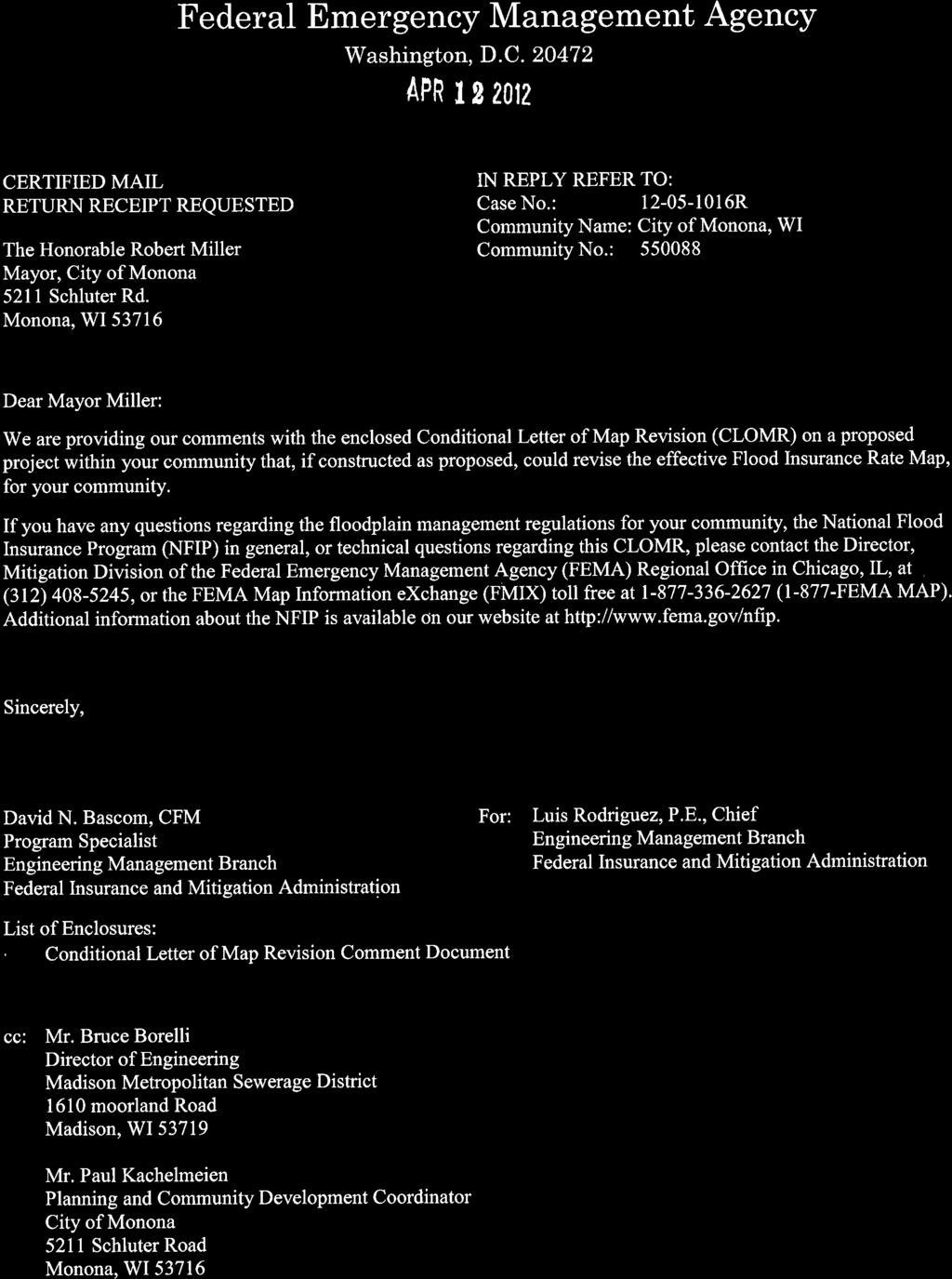
1 999 Fourier Drive, Suite 201 Madison, Wisconsin (608) phone (608) FAX September 6, 2016 Ms. Sonja Reichertz Planning & Community Development Coordinator Plan Commission & Common Council City of Monona 5211 Schluter Road VIA Monona, WI Re: Request for Removal of Lands from Floodplain & City Floodplain Map Amendment Madison Metropolitan Sewerage District Pump Station 18, Monona, WI Dear Sonja, Plan Commission & Common Council: As you are aware, Madison Metropolitan Sewerage District (MMSD) constructed Pumping Station No. 18 (PS 18) on the south side of East Broadway adjacent to the UW Yahara Clinic and Whitehorse properties. Construction of the pumping station was completed in spring of Prior to construction of the pumping station, portions of the parcel were located in the floodplain of an unnamed tributary to Lake Waubesa. In order to remove these portions of the parcel from the floodplain, fill was placed on the MMSD PS 18 parcel. MMSD s consultant (AECOM) completed hydraulic analysis of the fill to determine its effect on the base flood elevation and floodplain. This analysis indicated that the fill did not change the base flood elevation. However, the analysis indicated that the floodway would be change from what is currently shown on FEMA s Flood Insurance Rate Map (FIRM) 55025C0437G for the City of Monona. As shown in the attached Figure E-1 provided by AECOM, the floodway on the MMSD property, the two Whitehorse properties on the east side of the tributary, and the WDNR property to the south of the MMSD property have changed as result of the placed fill. Placement of the fill and its effects on the floodway were approved by the Federal Emergency Management Agency (FEMA) and Wisconsin Department of Natural Resources. FEMA issued a Conditional Letter of Map Revision (CLOMR) on April 12, 2015 to approve the proposed placement of the fill, and a Letter of Map Revision (LOMR) on August 15, 2016 based on an as-built survey of the placed fill. The LOMR revised FEMA s Flood Insurance Rate Map (FIRM) 55025C0437G for the City of Monona. FEMA s FIRMS are the City s official Floodplain Maps. City Official Floodplain Map Amendment Process: Due to the request for removal of lands from the floodplain, and change to the floodway, the City s floodplain zoning district boundaries, as shown on the City s Official Floodplain Maps (FEMA FIRM 55025C0437G), need to be amended as required by FEMA, the WDNR, and Sections (e)(2) and (e)(5) of the City of Monona Code of Ordinances. vision to reality Reedsburg (608) Madison (608) Milwaukee Metro (262) Prairie du Chien (608)
2 September 6, 2016 Page 2 of 2 The following requirements from Sections , (d), and procedures for amendments from Section of the city s ordinances are as follows: 1. Submittal of an aerial photograph or plan showing the general floodplain district limits, stream channel, legal description of property, fill limits and elevations. (Figures E-1 & E-2 provided by AECOM, MMSD s Engineer) 2. Information required by WDNR to evaluate the effects of the proposed fill upon flood height and flood flows, BFE and to determine floodway boundaries. (Information contained in Letter of Map Revision Request dated March 2016 and provided by AECOM, MMSD s Engineer). 3. WDNR and FEMA approval of changes to the floodway and removal of lands from the floodplain. (WDNR approval letter issued June 15, 2016 and FEMA LOMR issued August 10, 2016) 4. Verification that the fill has been placed at least two feet above the BFE and the fill is contiguous to land outside the floodplain. (Certified As-Built conditions Figure E-1 stamped 5/25/16 by Carla Fischer, PE of AECOM, MMSD s Engineer). 5. Referral of the amendment request to the Plan Commission for a public hearing (Class II Notification = two publications required) and a recommendation to the Common Council. Schedule: As coordinated with Sonja, the amendment schedule is proposed as follows: 1. City Submits Public Notice & Amendment Resolution Text to WDNR: Sep WDNR Reviews Public Notice & Amendment Resolution Text: Sep. 12 to Submit Public Hearing Notice to Newspaper: Sep Two Publications in Monona Herald Independent: Sep. 22 & City Planning Commission Meeting & Public Hearing: Oct City Council Meeting 1 st Reading: Oct City Council Meeting 2 nd Reading: Nov. 7 The documents referenced above are attached for your use. As discussed, with Sonja, I will be available to attend the plan commission meeting and city council meetings to answer any questions regarding our review, and the FEMA and City Floodplain Map Amendment processes. If you have any questions, please contact me at our Madison office. Sincerely, VIERBICHER ASSOCIATES, INC. Darrin R. Pope, PE DRP/drp Enclosures


3 845 Match Effective Floodplain and LOMR Floodplain E. Broadway Match Effective Floodway and LOMR Floodway Legend LOMR LOMR Floodway LOMR Flood Fringe Boundary Dane Co. Effective Mapping Effective Floodway Effective Floodplain Zone AE Match Effective Floodway and LOMR Floodway Survey Contours 5' Contour 1' Contour Supporting Layers Match Effective Floodplain and LOMR Floodplain FIS Cross Sections White Horse Cross Sections Area Removed from Effective Floodplain Match Effective Floodway and LOMR Floodway Match Effective Floodplain and LOMR Floodplain Vertical Datum NAVD Ij In Match Effective Floodway and LOMR Floodway Feet To Lake Waubesa Feb Figure E-1 MMSD Pump Station #18 LOMR Application Topographic Work Map Dane County, WI
4 Figure E-2 0 Legend LOMR Zone X LOMR Floodway LOMR Flood Fringe Whitehorse CLOMR Flood Fringe Feet
5 Prepared for: Prepared by: MMSD AECOM Madison, Wisconsin Middleton, Wisconsin March 2016 Letter of Map Revision Request Madison Metropolitan Sewerage District Pumping Station 18 Monona, WI; Dane County, WI FEMA Case No R

6 Prepared for: Prepared by: MMSD AECOM Madison, Wisconsin Middleton, Wisconsin March 2016 Letter of Map Revision Request Madison Metropolitan Sewerage District Pumping Station 18 Monona, WI; Dane County, WI FEMA Case No R Prepared by: Carla Fischer, PE Prepared By Theran Jacobson, P.E. Reviewed By
7 AECOM LOMR Request MMSD Pumping Station 18 Madison, Wisconsin 1-1 Contents 1.0 Introduction Project Location Summary of Completed Work MT-2 Forms Effective Model Effective Conditions Hydrologic Model Hydraulic Model Duplicate Effective Hydraulic Model Duplicate Effective Hydraulic Model Results Corrected Effective Hydraulic Model Corrected Effective Hydraulic Model Results Post-Project (As-Built) Conditions Hydrologic Changes Hydraulic Changes Cross Section Modifications Post-Project Hydraulic Model Updates Floodway Boundaries Post-Project Hydraulic Results Digital Data List of Appendices Appendix A Project Maps Appendix B Project Plans Appendix C MT-2 Forms Appendix D Hydraulic Results Appendix E Post-Project Floodplain Maps Appendix F Digital Data Appendix G FEMA CLOMR Approval Letter \\usmsn1fs001\prod\data\projects\ \400-technical\lomr\narrative\ lomr_rpt.docx March 2016
8 AECOM LOMR Request MMSD Pumping Station 18 Madison, Wisconsin Introduction Madison Metropolitan Sewerage District (MMSD) is preparing this Letter of Map Revision (LOMR) request to complete the CLOMR (case number R) approved by FEMA on April 12, FEMA s approval letter is included in Appendix G. The project, located in the City of Monona, Wisconsin, involved grading and filling along an unnamed tributary to Lake Waubesa. The grading and filling was required to prepare an area outside of the floodplain for the construction of new sanitary sewer Pumping Station 18. Construction of Pumping Station 18 was started in the fall of 2013 and completed in the spring of 2015, with as-built survey completed in August Appendix references A through F throughout this report indicate LOMR replacement information based upon as-built conditions. Appendix G is a new appendix. 1.1 Project Location See attached Figure 1 Project Location Map in Appendix A, which is unchanged from what was submitted for the CLOMR. 1.2 Summary of Completed Work This project consisted of construction of a pumping station to improve sanitary sewer conveyance to the MMSD s Nine Springs Waste Water Treatment Plant (WWTP). Fill was placed in the property owned by MMSD, west of the unnamed tributary to Lake Waubesa, to prepare an area outside of the floodplain for the construction of new sanitary sewer Pumping Station 18. See attached Figure 2 LOMR Application HEC-RAS Cross Sections in Appendix A showing locations of cross sections used in the HEC-RAS model. The plan sheet located Appendix B shows the postproject conditions. 1.3 MT-2 Forms The MT-2 Forms included with this report include the following: Overview & Concurrence form Riverine Hydrology & Hydraulics form These forms are located in Appendix C. \\usmsn1fs001\prod\data\projects\ \400-technical\lomr\narrative\ lomr_rpt.docx March 2016
9 AECOM LOMR Request MMSD Pumping Station 18 Madison, Wisconsin Effective Model See CLOMR. No changes for LOMR. \\usmsn1fs001\prod\data\projects\ \400-technical\lomr\narrative\ lomr_rpt.docx March 2016
10 AECOM LOMR Request MMSD Pumping Station 18 Madison, Wisconsin Effective Conditions 3.1 Hydrologic Model See CLOMR. No changes for LOMR. 3.2 Hydraulic Model See CLOMR. No changes for LOMR Duplicate Effective Hydraulic Model See CLOMR. No changes for LOMR Duplicate Effective Hydraulic Model Results See CLOMR. No changes for LOMR Corrected Effective Hydraulic Model See CLOMR. No changes for LOMR Corrected Effective Hydraulic Model Results See CLOMR. No changes for LOMR. \\usmsn1fs001\prod\data\projects\ \400-technical\lomr\narrative\ lomr_rpt.docx March 2016
11 AECOM LOMR Request MMSD Pumping Station 18 Madison, Wisconsin Post-Project (As-Built) Conditions 4.1 Hydrologic Changes See CLOMR. No changes for LOMR. 4.2 Hydraulic Changes The Corrected Effective hydraulic data, which represent Pre-Project conditions, was used as the baseline for the Post-Project (As-Built) hydraulic data. The LOMR for the Whitehorse property, Case No P effective March 15, 2013, was reviewed to determine if changes had been made since the Whitehorse CLOMR was submitted. It was determined that no changes to the cross sections had been made from the Whitehorse CLOMR submittal; however, the reach lengths in the Whitehorse LOMR model had been adjusted at Sta and to better reflect actual conditions. The MMSD Pumping Station 18 CLOMR submittal had identified downstream reach lengths in the Whitehorse CLOMR model as incorrect and had adjusted cross section downstream reach lengths to reflect survey locations. Therefore, no reach lengths were changed from what had been submitted in the MMSD Pumping Station CLOMR Cross Section Modifications Cross Sections throughout the project corridor were modified from the Corrected Effective (Pre- Project) conditions as outlined below. Cross sections 15+32, 13+96, 12+00, and were modified to reflect the as-built survey of the fill on the MMSD site, which impacted the west side of the channel Post-Project Hydraulic Model Updates The updates to the geometry include the work performed for the MMSD Pumping Station 18 project reflected in the the project site s post-construction topographic survey from August 31, Changes to the geometry included side slope grading to facilitate construction of sanitary sewer interceptor, force main, and driveway for access to the pumping station. The Post-Project geometry file includes the project area and all reaches upstream and downstream affected by the proposed improvements, as required by FEMA and the WDNR. Figure 2 in Appendix A shows the cross section locations. The tie-in location at the upstream end of the reach is at cross section and the Post-Project WSEL is equal to (less than 0.01-ft change) the Pre-Project floodplain elevation at the tie-in location. The tie-in location at the south end of the reach is at cross section 8+12 and the Post-Project WSEL is equal to the Pre-Project floodplain elevation at the tie-in location. LOMR modeling results show a slightly greater decrease in the Post-Project floodplain elevations than the CLOMR results. 4.3 Floodway Boundaries The floodway boundaries for the Corrected Effective geometry file were based upon the ineffective flow limits or the floodplain limits. The Post-Project floodway boundaries were updated in the project corridor to reflect the grading and filling performed. Figure E-1 in Appendix E displays the Post-project floodway and floodfringe overlaid on the project site s post-construction topographic survey from August 31, The Post-Project floodway boundaries overlaid on the Flood Insurance Rate Map (FIRM) are also included in Appendix E. \\usmsn1fs001\prod\data\projects\ \400-technical\lomr\narrative\ lomr_rpt.docx March 2016
12 AECOM LOMR Request MMSD Pumping Station 18 Madison, Wisconsin Post-Project Hydraulic Results The comparison between the Post-Project Model and Corrected Effective Model resulted in slight changes to the 100-year floodplain elevations at several cross sections. These changes include: Cross Section 16+90: The water surface elevation (WSEL) decreased feet. Cross Section 15+32: The water surface elevation (WSEL) increased feet. Cross Section 13+96: The water surface elevation (WSEL) decreased feet. Cross Section 12+00: The water surface elevation (WSEL) increased feet. Cross Section 11+50: The water surface elevation (WSEL) decreased feet. See Table D-3 in Appendix D. \\usmsn1fs001\prod\data\projects\ \400-technical\lomr\narrative\ lomr_rpt.docx March 2016
13 AECOM LOMR Request MMSD Pumping Station 18 Madison, Wisconsin Digital Data Appendix F includes reference to digital data, which is included as a.zip file. The following data is included: The HEC-RAS version model, which includes plans for Duplicate Effective, Corrected Effective, and Post-Project conditions. GIS shapefiles, including the Post-Project floodway and floodfringe for the 1% recurrence interval and the flooding extents of the Post-Project 0.2% recurrence interval. Post-project survey CAD file, which includes updated survey data on the west side of the channel where grading was modified from existing conditions. \\usmsn1fs001\prod\data\projects\ \400-technical\lomr\narrative\ lomr_rpt.docx March 2016
14 AECOM LOMR Request MMSD Pumping Station 18 Madison, Wisconsin 5-2 Appendix A Project Maps - Figure 1 Project Location Map - Figure 2 HEC-RAS Cross Sections \\usmsn1fs001\prod\data\projects\ \400-technical\lomr\narrative\ lomr_rpt.docx March 2016
15 Floodplain Study Area Feet Oct Figure 1 Project Location Map MMSD Pump Station #18 Project Dane County, WI
16 Legend LOMR Cross sections E. Broadway 1 HW FIS Index - 10' Intermediate - 2' Parcels Rd OrthoRectified Contours (2010) l v e rt ox C u 1' Contour Y 51 B ' Contour n ghto Stou Survey Contours Pumping Station USH 12/18/151 / Stoughton Road Interchange STH 12/18 n j I I To Lake Waubesa Feet 14.3 Feb Figure 2 LOMR Cross Application HEC-RAS Sections MMSD Pump Station #18 Project HEC-RAS Cross Sections MMSD Pumping Station Dane County, WI 18 Project Dane County, WI
17 AECOM LOMR Request MMSD Pumping Station 18 Madison, Wisconsin 5-3 Appendix B Project Plan - Post-Project Site Plan \\usmsn1fs001\prod\data\projects\ \400-technical\lomr\narrative\ lomr_rpt.docx March 2016
18
19 AECOM LOMR Request MMSD Pumping Station 18 Madison, Wisconsin 5-4 Appendix C MT-2 Forms - Overview & Concurrence Form - Riverine Hydrology & Hydraulics Form \\usmsn1fs001\prod\data\projects\ \400-technical\lomr\narrative\ lomr_rpt.docx March 2016
20 DEPARTMENT OF HOMELAND SECURITY FEDERAL EMERGENCY MANAGEMENT AGENCY OVERVIEW AND CONCURRENCE FORM OMB NO Expires May 31, 2017 PAPERWORK BURDEN DISCLOSURE NOTICE Public reporting burden for this form is estimated to average 1 hours per response. The burden estimate includes the time for reviewing instructions, searching existing data sources, gathering and maintaining the needed data, and completing, reviewing, and submitting the form. You are not required to respond to this collection of information unless it displays a valid OMB control number. Send comments regarding the accuracy of the burden estimate and any suggestions for reducing this burden to: Information Collections Management, Department of Homeland Security, Federal Emergency Management Agency, 500 C Street, SW, Washington, DC, Paperwork Reduction Project ( ). Submission of the form is required to obtain or retain benefits under the National Flood Insurance Program. Please do not send your completed survey to the above address. PRIVACY ACT STATEMENT AUTHORITY: The National Flood Insurance Act of 1968, Public Law , as amended by the Flood Disaster Protection Act of 1973, Public Law PRINCIPAL PURPOSE(S): This information is being collected for the purpose of determining an applicant's eligibility to request changes to National Flood Insurance Program (NFIP) Flood Insurance Rate Maps (FIRM). ROUTINE USE(S): The information on this form may be disclosed as generally permitted under 5 U.S.C 552a(b) of the Privacy Act of 1974, as amended. This includes using this information as necessary and authorized by the routine uses published in DHS/ FEMA/NFIP/LOMA-1 National Flood Insurance Program (NFIP); Letter of Map Amendment (LOMA) February 15, 2006, 71 FR DISCLOSURE: The disclosure of information on this form is voluntary; however, failure to provide the information requested may delay or prevent FEMA from processing a determination regarding a requested change to a (NFIP) Flood Insurance Rate Maps (FIRM). This request is for a: (check one) A. REQUESTED RESPONSE FROM DHS-FEMA CLOMR: A letter from DHS-FEMA commenting on whether a proposed project, if built as proposed, would justify a map revision, or proposed hydrology changes (See 44 CFR Ch. 1, Parts 60, 65 & 72). LOMR: A letter from DHS-FEMA officially revising the current NFIP map to show the changes to floodplains, regulatory floodway, or flood elevations. (See 44 CFR Ch. 1, Parts 60, 65 & 72). B. OVERVIEW 1. The NFIP map panel(s) affected for all impacted communities is (are): Community No. Community Name State Map No. Panel No. Effective Date Ex: City of Katy TX 48473C 0005D 02/08/ Harris County TX 48201C 0220G 09/28/ City of Monona Dane County WI 55025C 0437G 01/02/ a Flooding Source: Unnamed Tributary to Lake Waubesa Riverine Coastal Shallow Flooding (e.g., Zones AO and AH) Alluvial fan Lakes Other (Attach Description) 3. Project Name/Identifier: MMSD Pump Station FEMA Zone designations affected: AE, X (Choices A, AH, AO, A1-A30, A99, AE, AR, V, V1-V30, VE, B, C, D, X) 5. Basis for Request and Type of Revision: MMSD Pump Station 18 As-Built Physical Change Improved Mehtodology/Data Regulatory Floodway Revision Base Map Changes Coastal Analysis Hydraulic Analysis Hydrologic Analysis Corrections Weir-Dam Changes Levee Certification Alluvial Fan Analysis Natural Changes New Topographic Data Other (attach Description) Channelization Dam Levee/Floodwall Fill Bridge/Culvert Other (Attach Description) FEMA Form (9/14) Page 1 of 2
21
22 DEPARTMENT OF HOMELAND SECURITY FEDERAL EMERGENCY MANAGEMENT AGENCY RIVERINE HYDROLOGY & HYDRAULICS FORM OMB NO Expires May 31, 2017 PAPERWORK BURDEN DISCLOSURE NOTICE Public reporting burden for this form is estimated to average 3.5 hours per response. The burden estimate includes the time for reviewing instructions, searching existing data sources, gathering and maintaining the needed data, and completing, reviewing, and submitting the form. You are not required to respond to this collection of information unless a valid OMB control number appears in the upper right corner of this form. Send comments regarding the accuracy of the burden estimate and any suggestions for reducing this burden to: Information Collections Management, Department of Homeland Security, Federal Emergency Management Agency, 500 C Street, SW, Washington, DC, 20472, Paperwork Reduction Project ( ). Submission of the form is required to obtain or retain benefits under the National Flood Insurance Program. Please do not send your completed survey to the above address. PRIVACY ACT STATEMENT AUTHORITY: The National Flood Insurance Act of 1968, Public Law , as amended by the Flood Disaster Protection Act of 1973, Public Law PRINCIPAL PURPOSE(S): This information is being collected for the purpose of determining an applicant's eligibility to request changes to National Flood Insurance Program (NFIP) Flood Insurance Rate Maps (FIRM). ROUTINE USE(S): The information on this form may be disclosed as generally permitted under 5 U.S.C 552a(b) of the Privacy Act of 1974, as amended. This includes using this information as necessary and authorized by the routine uses published in DHS/FEMA/ NFIP/LOMA-1 National Flood Insurance Program (NFIP); Letter of Map Amendment (LOMA) February 15, 2006, 71 FR DISCLOSURE: The disclosure of information on this form is voluntary; however, failure to provide the information requested may delay or prevent FEMA from processing a determination regarding a requested change to a (NFIP) Flood Insurance Rate Maps (FIRM). Flooding Source: Unnamed Tributary to Lake Waubesa Note: Fill out one form for each flooding source studied. 1. Reason for New Hydrologic Analysis (check all that apply) A. HYDROLOGY Not revised (skip to section 2) No existing analysis Improved data Alternative methodology Proposed Conditions (CLOMR) Changed physical condition of watershed 2. Comparison of Representative 1%-Annual-Chance Discharges Location Drainage Area (Sq. Mi.) FIS (cfs) Revised (cfs) 3. Methodology for New Hydrologic Analysis (check all that apply) Statistical Analysis of Gage Records Precipitation/runoff Model Regional Regression Equations Other (please attach description) (TR-20, HEC-1, HEC-HMS, etc.) Please enclose all relevant models in digital format, maps, computations (including computation of parameters), and documentation to support the new analysis. The document, "Numerical Models Accepted by FEMA for NFIP Usage" lists the models accepted by FEMA. This document can be found at: 4. Review/Approval of Analysis. If your community requires a regional, state, or federal agency to review the hydrologic analysis, please attach evidence of approval/review. 5. Impacts of Sediment Transport on Hydrology Was sediment transport considered? Yes No If Yes, fill out Section F (Sediment Transport) of Form 3. If No, attach your explanation for why sediment transport was not considered. FEMA Form A (9/14) Page 1 of 3
23 DEPARTMENT OF HOMELAND SECURITY FEDERAL EMERGENCY MANAGEMENT AGENCY RIVERINE HYDROLOGY & HYDRAULICS FORM OMB NO Expires May 31, 2017 B. HYDRAULICS 1. Reach to be Revised Water-Surface Elevations (ft.) Description Cross Section Effective Proposed/Revised Downstream Limit Mouth of drainage ditch Upstream Limit DS of E. Broadway struct. 2. Hydraulic Method Used Hydraulic Analysis HEC-2, HEC-RAS, Other (Attach description) 3. Pre-Submittal Review of Hydraulic Models FEMA has developed two review programs, CHECK-2 and CHECK-RAS to aid in the review of HEC-2 and HEC-RAS hydraulic models, respectively. These review programs verify that the hydraulic estimates and assumptions in the model data are in accordance with NFIP requirements, and that the data are comparable with the assumptions and limitations of HEC-2/HEC-RAS. CHECK-2 and CHECK-RAS identify areas of potential error or concern. These tools do not replace engineering judgement. CHECK-2 and CHECK-RAS can be downloaded from We recommend that you review your HEC-2 and HEC-RAS models with CHECK-2 and CHECK-RAS. If you disagree with a message, please attach an explanation of why the message is not valid in this case. Review of your submittal and resolution of valid modeling discrepancies will result in reduced review time. HEC-2/HEC-RAS models reviewed with CHECK-2/CHECK-RAS? Yes No 4. Models Submitted HEC-RAS Duplicate Effective Model* Natural File Name MMSD_FloodStudy.prj Floodway File Name Effective, *.p06 Corrective Effective Model* Natural File Name MMSD_FloodStudy.prj Floodway File Name Corr. Eff., *.p04 Existing or Pre-Project Conditions Model Natural File Name MMSD_FloodStudy.prj Floodway File Name Pre-Proj., *.p05 Revised or Post-Project Conditions Model Natural File Name MMSD_FloodStudy.prj Floodway File Name Post-Proj., *.p01 Other - (attach description) Natural File Name Floodway File Name *Not required for revisions to approximate 1%-annual-chance floodplains (Zone A) - for details, refer to the corresponding section of the instructions. The document "Numerical Models Accepted by FEMA for NFIP Usage" list the models accepted by FEMA. This document can be found at: C. MAPPING REQUIREMENTS A certified topographic map must be submitted showing the following information (where applicable): the boundaries of the effective, existing, and proposed conditions 1%-annual-chance floodplain (for approximate Zone A revisions) or the boundaries of the 1%-and 0.2%-annual-chance floodplains and regulatory floodway (for detailed Zone AE, AO, and AH revisions); location and alignment of all cross sections with stationing control indicated; stream, road, and other alignments (e.g. dams, levees, etc.); current community easements and boundaries; boundaries of the requester's property; certification of a registered professional engineer registered in the subject State; location and description of reference marks; and the referenced vertical datum (NGVD, NAVD, etc.). Note that the boundaries of the existing or proposed conditions floodplains and regulatory floodway to be shown on the revised FIRM and/or FBFM must tie-in with the effective floodplain and regulatory floodway boundaries. Please attach a copy of the effective FIRM and/or FBFM, annotated to show the boundaries of the revised 1%-and 0.2%-annual-chance floodplains and regulatory floodway that tie-in with the boundaries of the effective 1%-and 0.2%-annual-chance floodplain and regulatory floodway at the upstream and downstream limits of the area on revision. D. COMMON REGULATORY REQUIREMENTS 1. For LOMR/CLOMR Requests, do Base Flood Elevations (BFEs) Increase? Yes No For LOMR/CLOMR requests, if either of the following is true, please submit evidence of compliance with Section of the NFIP regulations: * The proposed project encroaches upon a regulatory floodway and would result in increases above 0.00 foot compared to preproject conditions. * The proposed project encroaches upon a SFHA with BFEs established and would result in increases above 1.00 foot. 2. Does the request involve the placement of proposed placement of fill? Yes No FEMA Form A (9/14) Page 2 of 3
24 DEPARTMENT OF HOMELAND SECURITY FEDERAL EMERGENCY MANAGEMENT AGENCY RIVERINE HYDROLOGY & HYDRAULICS FORM OMB NO Expires May 31, 2017 If Yes, the community must acknowledge that the area to be removed from the special flood hazard area, to include any structures or proposed structures, meets (will meet) all of the standards of the local floodplain ordinances, and is (will be) reasonably safe from flooding in accordance with NFIP regulation 44 CFR 65.2(c). Please see the MT-2 instructions for more information. 3. For LOMR requests, is the regulatory floodway being revised? Yes No If Yes, attach evidence of regulatory floodway revised notification. As per paragraph 65.7(b)(1) of the NFIP regulations, notification is required for requests involving revisions to the regulatory floodway. (Not required for revisions to approximate 1%-annual-chance floodplains (studied Zone A designation) unless a regulatory floodway is being added. Elements and examples of regulatory floodway revision notification can be found in the MT-2 Form 2 instructions.) 4. For LOMR requests, does this request require property owner notification and acceptance of Yes No BFE increase? If Yes, please attach proof of property owner notification and acceptance (if available). Elements of and examples of property owner notification can be found in the MT-2 form 2 instructions. FEMA Form A (9/14) Page 3 of 3
25 AECOM LOMR Request MMSD Pumping Station 18 Madison, Wisconsin 5-5 Appendix D Hydraulic Results - Table D-1 Dup.Eff. vs. Corr. Eff. WSE (reference CLOMR) - Table D-2 Corr. Eff. vs. Prop. WSE (reference CLOMR) - Table D-3 Eff. vs. Corr. Eff. vs. Pre-Proj. vs. Post- Proj. WSE \\usmsn1fs001\prod\data\projects\ \400-technical\lomr\narrative\ lomr_rpt.docx March 2016
26 River Station Effective Table D-3 MMSD Pumping Station 18 LOMR Request Corrected Effective 100-yr Water Surface Elev (ft) Post- Project (As-Built) (LOMR) Pre-Project (CLOMR) CLOMR - Corr. Eff. LOMR - Corr. Eff N/A * * in Effective model, renamed during CLOMR to more accurately reflect XS location
27 AECOM LOMR Request MMSD Pumping Station 18 Madison, Wisconsin 5-6 Appendix E Post-Project Floodplain Maps - Figure E-1 Topographic Work Map - Post-Project FIRM \\usmsn1fs001\prod\data\projects\ \400-technical\lomr\narrative\ lomr_rpt.docx March 2016


 LOMR Index - 10' LOMR Floodway LOMR")


28 845 E. Broadway Area Removed from Effective Floodplain Area Removed from Effective Floodplain Area Removed from Effective Floodplain Match Effective Floodway and LOMR Floodway Match Effective Floodway and LOMR Floodway Vertical Datum NAVD Ij In Legend OrthoRectified Contours (2010) LOMR Index - 10' LOMR Floodway LOMR Flood Fringe Boundary Intermediate - 2' Survey Contours LOMR 0.2 PCT Annual Chance Flood Hazard Whitehorse CLOMR Flood Fringe Boundary Dane Co. Effective Mapping Effective Floodway Effective Floodplain Zone AE Effective 0.2 PCT Annual Chance Flood Hazard 5' Contour 1' Contour Supporting Layers FIS Cross Sections White Horse Cross Sections Feet Feb Figure E-1 MMSD Pump Station #18 LOMR Application Topographic Work Map Dane County, WI
29 0 Legend LOMR Zone X LOMR Floodway LOMR Flood Fringe Whitehorse CLOMR Flood Fringe Feet
30 AECOM LOMR Request MMSD Pumping Station 18 Madison, Wisconsin 5-7 Appendix F Digital Data - HEC-RAS - GIS Shapefiles - CAD file of survey \\usmsn1fs001\prod\data\projects\ \400-technical\lomr\narrative\ lomr_rpt.docx March 2016
31 AECOM LOMR Request MMSD Pumping Station 18 Madison, Wisconsin 5-8 Included in attached R_LOMR.zip file \\usmsn1fs001\prod\data\projects\ \400-technical\lomr\narrative\ lomr_rpt.docx March 2016
32 AECOM LOMR Request MMSD Pumping Station 18 Madison, Wisconsin 5-9 Appendix G FEMA CLOMR Approval Letter \\usmsn1fs001\prod\data\projects\ \400-technical\lomr\narrative\ lomr_rpt.docx March 2016
33

34

35

36

37
38

39

40 State of Wisconsin DEPARTMENT OF NATURAL RESOURCES 3911 Fish Hatchery Road Fitchburg WI Scott Walker, Governor Cathy Stepp, Secretary Telephone Toll Free TTY Access via relay June 15, 2016 Ms. Sonja Reichertz City of Monona 5211 Schluter Road Monona, WI Subject: Floodplain Study Review - MMSD Pump Station 18 LOMR Submittal, City of Monona, Unnamed Tributary to Lake Waubesa Dear Ms. Reichertz: As per your request, we have completed our technical review of the floodplain study performed for the Unnamed Tributary to Lake Waubesa in the City of Monona. The study was prepared for construction of MMSD Pump Station #18. The project has received a CLOMR previously and the purpose of this submittal is to include the asbuilt information for the final LOMR submittal. The final study was completed by AECOM and submitted under the professional seal of Carla Fischer, P.E. The study meets the Standards of NR 116, Wisconsin Administrative Code and is hereby approved. Prior to adoption and rezoning of the mapped floodplain, the study must receive a Letter of Map Revision (LOMR) from FEMA. Upon receipt of the final LOMR approval, the study must be adopted into the City of Monona s floodplain zoning ordinance. Please pay particular attention to the Class 2 notice requirements for public hearings. The second publication must at least one week before the hearing. A certified copy of the approved ordinance amendment adopting the study along with evidence of a Class 2 public hearing notice must be sent to the Department for final administrative review and approval. If you have any questions relative to the FEMA requirements, the FEMA Region 5 contact for Wisconsin is John Devine. John can be reached at (312) or by at john.devine@fema.dhs.gov. This approval only relates to the Standards of NR 116 and does not relieve the applicant of other necessary Federal, State or Local requirements. If you have any questions relative to this review and approval, please feel free to contact me. Sincerely, Robert R. Davis, P.E. Water Management Engineer Southern District Robert.Davis@Wisconsin.gov cc: Carla Fischer, P.E. - AECOM (via )

41

42
43

44


45


46


47


48
INSTRUCTIONS FOR COMPLETING THE APPLICATION FORMS FOR CONDITIONAL LETTERS OF MAP REVISION AND LETTERS OF MAP REVISION
 INSTRUCTIONS FOR COMPLETING THE APPLICATION FORMS FOR CONDITIONAL LETTERS OF MAP REVISION AND LETTERS OF MAP REVISION GENERAL In 1968, the U.S. Congress passed the National Flood Insurance Act, which created
Table 1: Federal, State and Local Government Rules applicable to LOMRs/CLOMRS submittal
 MnDNR LOMC Guide This document has been prepared by the Minnesota Department of Natural Resources floodplain staff and is intended to provide assistance with LOMR/CLOMR submittals. This information is
Appendix D - Floodplain Documents
 City of Aspen Urban Runoff Management Plan Appendix D - Floodplain Documents 1. Floodplain Development Permit 2. Elevation Certificate and Instructions 3. Floodproofing Certificate for Non-Residential
INSTRUCTIONS FOR COMPLETING THE APPLICATION FORMS FOR CONDITIONAL LETTERS OF MAP REVISION AND LETTERS OF MAP REVISION
 INSTRUCTIONS FOR COMPLETING THE APPLICATION FORMS FOR CONDITIONAL LETTERS OF MAP REVISION AND LETTERS OF MAP REVISION GENERAL In 1968, the U.S. Congress passed the National Flood Insurance Act, which created
JAXGIS FEMA Flood Hazard Mapping -- Frequently Asked Questions
 Flood Hazard Zone Designations Summary Zones starting with the letter 'A' (for instance, Zone A, Zone AE, Zone AH, Zone AO) denote a Special Flood Hazard Area, which can also be thought of as the 100-year
CRISP COUNTY, GEORGIA AND INCORPORATED AREAS
 CRISP COUNTY, GEORGIA AND INCORPORATED AREAS Community Name Community Number ARABI, CITY OF 130514 CORDELE, CITY OF 130214 CRISP COUNTY (UNINCORPORATED AREAS) 130504 Crisp County EFFECTIVE: SEPTEMBER 25,
NFIP Mapping Issues. Wendy Lathrop, PLS, CFM. Cadastral Consulting, LLC
 NFIP Mapping Issues Cadastral Consulting, LLC NFIP Basic Objectives: Reduce the exposure to flood damages through the use of minimum standards for the placement and design of structures located in flood
Federal Emergency Management Agency
 Page 1 of 6 Issue Date: May 13 2016 Case No.: Follows Conditional Case No.: 14-05-0595R DETERMINATION DOCUMENT COMMUNITY AND REVISION INFORMATION PROECT DESCRIPTION BASIS OF REQUEST COMMUNITY Village of
BUTTS COUNTY, GEORGIA AND INCORPORATED AREAS
 BUTTS COUNTY, GEORGIA AND INCORPORATED AREAS Butts County Community Name Community Number BUTTS COUNTY (UNICORPORATED AREAS) 130518 FLOVILLA, CITY OF 130283 JACKSON, CITY OF 130222 JENKINSBURG, TOWN OF
Federal Emergency Management Agency
 Page 1 of 4 Issue Date: October 2, 2017 Effective Date: October 2, 2017 Case No.: 17-09-2731P LOMR-APP Federal Emergency Management Agency Washington, D.C. 20472 LETTER OF MAP REVISION DETERMINATION DOCUMENT
Federal Emergency Management Agency
 Page 1 of 5 Issue Date: October 28, 2009 Follows Conditional Case No.: 08-08-0612R DETERMINATION DOCUMENT COMMUNITY AND REVISION INFORMATION PROJECT DESCRIPTION BASIS OF REQUEST COMMUNITY Lincoln County
Requirements for Construction on Properties in the Special Flood Hazard Area (SFHA)
") Requirements for Construction on Properties in the Special Flood Hazard Area (SFHA) Rev 010915 The website for the IDNR to request the EFARA (Electronic Floodplain Analysis/Regulatory Assessment is found
Requirements for Construction on Properties in the Special Flood Hazard Area (SFHA) Rev 010915 The website for the IDNR to request the EFARA (Electronic Floodplain Analysis/Regulatory Assessment is found
SECTION 9: MAPS AND DATA
 SECTION 9: MAPS AND DATA Contents 9.1. NFIP Maps and Data... 9-2 9.1.1. Adopting and enforcing NFIP floodplain maps and data... 9-2 9.1.2. Adopting and enforcing more restrictive data... 9-2 9.1.3. Annexations...
Federal Emergency Management Agency
 Page 1 of 6 Issue Date: September 27, 2010 Effective Date: February 14, 2011 Follows Conditional Case No.: 08-08-0873R DETERMINATION DOCUMENT COMMUNITY AND REVISION INFORMATION PROJECT DESCRIPTION BASIS
Federal Emergency Management Agency
 Page 1 of 5 Issue Date: June 21, 2013 Follows Conditional Case No.: 04-06-A148R DETERMINATION DOCUMENT COMMUNITY COMMUNITY AND REVISION INFORMATION City of Irving Dallas County Texas FILL PROJECT DESCRIPTION
Federal Emergency Management Agency
 Page 1 of 4 Issue Date: September 7, 2012 Effective Date: January 22, 2013 DETERMINATION DOCUMENT COMMUNITY COMMUNITY AND REVISION INFORMATION City of Lubbock Lubbock County Texas PROJECT DESCRIPTION CHANNELIZATION
Federal Emergency Management Agency
 Page 1 of 4 Issue Date: April 26, 2013 DETERMINATION DOCUMENT COMMUNITY AND REVISION INFORMATION PROJECT DESCRIPTION BASIS OF REQUEST City of Coppell Dallas County Texas FILL HYDRAULIC ANALYSIS NEW TOPOGRAPHIC
Federal Emergency Management Agency
 Page 1 of 6 Issue Date: October 24, 2012 Effective Date: March 7, 2013 Case No.: LOMR-APP DETERMINATION DOCUMENT COMMUNITY AND REVISION INFORMATION PROJECT DESCRIPTION BASIS OF REQUEST City of Lubbock
Federal Emergency Management Agency
 Page 1 of 4 Issue Date: August 1, 2012 Effective Date: December 13, 2012 Case No.: 12-06-0595P LOMR-APP Washington, D.C. 20472 LETTER OF MAP REVISION DETERMINATION DOCUMENT COMMUNITY AND REVISION INFORMATION
Federal Emergency Management Agency
 Page 1 of 5 Issue Date: July 27, 2012 Effective Date: December 10, 2012 Case No.: 11-06-4512P Follows Conditional Case No.: 06-06-B789R LOMR-APP Federal Emergency Management Agency Washington, D.C. 20472
Enough about me! Topics Covered
 About Me Worked in land surveying since 1997 Employed by the City of Orlando since 2006 City of Orlando City Surveyor since February 2015 Certified Floodplain Manager since 2015 Florida Licensed Surveyor,
Federal Emergency Management Agency
 Page 1 of 5 Issue Date: October 16, 2014 Effective Date: March 2, 2015 Case No.: 14-09-2279P LOMR-APP Federal Emergency Management Agency Washington, D.C. 20472 LETTER OF MAP REVISION DETERMINATION DOCUMENT
Chapter 5 Floodplain Management
 Chapter 5 Floodplain Management Contents 1.0 Introduction... 1 2.0 Floodplain Management and Regulation... 1 2.1 City Code... 1 2.2 Floodplain Management... 1 2.3 Level of Flood Protection... 2 2.3.1 Standard
Floodplain Management 101: UNIT II. Maps & Flood Insurance Studies
 Floodplain Management 101: UNIT II Maps & Flood Insurance Studies Who is ASFPM? ASFPM stands for the Association of State Floodplain Managers A national organization of floodplain management professionals
DECATUR COUNTY, GEORGIA AND INCORPORATED AREAS
 DECATUR COUNTY, GEORGIA AND INCORPORATED AREAS Community Name Community Number ATTAPULGUS, CITY OF 130541 BAINBRIDGE, CITY OF 130204 BRINSON, TOWN OF 130670 CLIMAX, CITY OF 130542 DECATUR COUNTY (UNINCORPORATED
Federal Emergency Management Agency
 Federal Emergency Management Agency Washington, D. C. 24 72 December 29, 214 CERTIFIED MAIL RETURN RECEIPT REQUESTED The Honorable Gary Wescott Mayor, City of Stevens Point 1515 Strongs A venue Stevens
Door County Floodplain Program Informational Meeting
 Door County Floodplain Program Informational Meeting Door County Land Use Services Department Wisconsin Department of Natural Resources January 15, 2018 Floodplain = Land affected by flood event with a
Federal Emergency Management Agency
 Page 1 of 5 Issue Date: April 2, 2015 DETERMINATION DOCUMENT COMMUNITY AND REVISION INFORMATION PROJECT DESCRIPTION BASIS OF REQUEST Ventura County California NO PROJECT UPDATE COMMUNITY (Unincorporated
LOCAL OFFICIALS MEETING Lake Wausau Physical Map Revision MARATHON COUNTY, WISCONSIN FEBRUARY 9, 2017
 LOCAL OFFICIALS MEETING Lake Wausau Physical Map Revision MARATHON COUNTY, WISCONSIN FEBRUARY 9, 2017 Welcome & Introduction Michelle Staff Floodplain Management Policy Coordinator, WDNR Michelle.Staff@Wisconsin.gov
July 31, 2017 NFIP Flood Map Open House Flood Maps 101 Flood Mapping acronyms History of the NFIP Flood Mapping Updates Flood Insurance Fairhope,
 July 31, 2017 NFIP Flood Map Open House Flood Maps 101 Flood Mapping acronyms History of the NFIP Flood Mapping Updates Flood Insurance Fairhope, Alabama Flood Maps Fairhope Permitting Jurisdiction Coastal
Revisions to National Flood Insurance Program Maps
 MT-1 Revisions to National Flood Insurance Program Maps Application Forms and Instructions for Conditional and Final Letters of Map Amendment and Letters of Map Revision Based on Fill FEMA Form 81-87 Series
VOLUME 1 OF 1 CARROLL COUNTY, IOWA AND INCORPORATED AREAS
 VOLUME 1 OF 1 CARROLL COUNTY, IOWA AND INCORPORATED AREAS COMMUNITY NAME NUMBER ARCADIA, CITY OF 190694 BREDA, CITY OF* 190926 CARROLL, CITY OF 190041 CARROLL COUNTY UNINCORPORATED AREAS 190039 COON RAPIDS,
Federal Emergency Management Agency
 Page 1 of 4 Issue Date: November 16 2016 Effective Date: March 31 2017 Case No: 16-06-2056P LOMR-APP Follows Conditional Case No: 10-06-3320R Federal Emergency Management Agency Washington DC 20472 LETTER
Skagit County Flood Insurance Study Update. Ryan Ike, CFM FEMA Region 10
 Skagit County Flood Insurance Study Update Ryan Ike, CFM FEMA Region 10 Skagit County Flood Insurance Study Process Overview Process, Schedule, & Deliverables Base Flood Elevations, Modeling, & Levees
Preliminary DFIRM Community Coordination (PDCC) Meeting Gilchrist & Levy Counties, FL. April 30, 2015
 Meeting Gilchrist & Levy Counties, FL. April 30, 2015") Preliminary DFIRM Community Coordination (PDCC) Meeting Gilchrist & Levy Counties, FL April 30, 2015 Agenda 1. Introductions 2. Study Process and Timeline 3. Overview of Preliminary Products 4. Overview
Preliminary DFIRM Community Coordination (PDCC) Meeting Gilchrist & Levy Counties, FL April 30, 2015 Agenda 1. Introductions 2. Study Process and Timeline 3. Overview of Preliminary Products 4. Overview
Federal Emergency Management Agency
 Page 1 of 4 Issue Date: April 29, 2011 DETERMINATION DOCUMENT COMMUNITY COMMUNITY AND REVISION INFORMATION City of Simi Valley Ventura County California PROJECT DESCRIPTION NO PROJECT BASIS OF REQUEST
Bucks County, PA Flood Risk Review Meeting. November 2014
 Bucks County, PA Flood Risk Review Meeting November 2014 Agenda for Today Risk MAP Program overview Overview of non-regulatory Flood Risk Products and datasets Discuss mitigation action Technical overview
DES MOINES COUNTY, IOWA AND INCORPORATED AREAS
 VOLUME 1 OF 1 DES MOINES COUNTY, IOWA AND INCORPORATED AREAS COMMUNITY NAME CID CITY OF BURLINGTON 190114 CITY OF DANVILLE 190115 DES MOINES COUNTY (UNINCORPORATED AREAS) 190113 CITY OF MEDIAPOLIS 190615
King County, WA DFIRM Update and Seclusion Process. Webinar June 14, 2016
 King County, WA DFIRM Update and Seclusion Process Webinar June 14, 2016 Agenda King County DFIRM Study History What is/has been done Process for moving forward Seclusion Seclusion mapping process Seclusion
THE $64,000 FLOOD INSURANCE BILL
 THE $64,000 FLOOD INSURANCE BILL GEORGIA ASSOCIATION OF FLOODPLAIN MANAGERS 9 TH ANNUAL TECHNICAL CONFERENCE Patrick Gervais, PE, CFM A CASE STUDY IN FLOOD INSURANCE This is a true story that happened
Updates to Maine Coastal Flood Insurance Rate Maps (FIRM s): What a Local Official Should Know. Presented by: Steve Johnson, P.E.
: What a Local Official Should Know. Presented by: Steve Johnson, P.E.") Updates to Maine Coastal Flood Insurance Rate Maps (FIRM s): What a Local Official Should Know Presented by: Steve Johnson, P.E. Town Engineer October 4, 2018 Introduction Federal Emergency Management
Updates to Maine Coastal Flood Insurance Rate Maps (FIRM s): What a Local Official Should Know Presented by: Steve Johnson, P.E. Town Engineer October 4, 2018 Introduction Federal Emergency Management
Technical Memorandum 3.4 E Avenue NW Watershed Drainage Study. Appendix E Floodplain Impacts and Implications Memo
 Technical Memorandum 3.4 E Avenue NW Watershed Drainage Study Appendix E Floodplain Impacts and Implications Memo September 8, 2017 City of Cedar Rapids E Avenue Watershed Drainage Study Memo Date: Tuesday,
Durham County Preliminary Flood Hazard Data Public Meeting. July 28, 2016
 Durham County Preliminary Flood Hazard Data Public Meeting July 28, 2016 Why Are We Here New flood hazard data has been released as Preliminary for Durham County Statutory Due Process for review/comments
WASHINGTON COUNTY, KENTUCKY AND INCORPORATED AREAS
 WASHINGTON COUNTY, KENTUCKY AND INCORPORATED AREAS COMMUNITY NAME COMMUNITY NUMBER *MACKVILLE, CITY OF 210475 SPRINGFIELD, CITY OF 210220 WASHINGTON COUNTY (UNINCORPORATED AREAS) 210365 *WILLISBURG, CITY
Federal Emergency Management Agency
 Page 1 of 5 Issue Date: October 19, 2012 Effective Date: March 4, 2013 Case No.: 12-06-3459P LOMR-APP Washington, D.C. 20472 LETTER OF MAP REVISION DETERMINATION DOCUMENT COMMUNITY AND REVISION INFORMATION
FREQUENTLY ASKED QUESTION ABOUT FLOODPLAINS Michigan Department of Environmental Quality
 FREQUENTLY ASKED QUESTION ABOUT FLOODPLAINS Michigan Department of Environmental Quality WHAT IS A FLOOD? The National Flood Insurance Program defines a flood as a general and temporary condition of partial
Article 23-6 FLOODPLAIN DISTRICT
 AMENDING THE CODE OF THE CITY OF PITTSFIELD CHAPTER 23, ZONING ORDINANCE SECTION I That the Code of the City of Pittsfield, Chapter 23, Article 23-6 Floodplain District, shall be replaced with the following:
National Flood Insurance Program (NFIP) for Real Estate Professionals
 for Real Estate Professionals") National Flood Insurance Program (NFIP) for Real Estate Professionals 1 Joshua Oyer, CFM Outreach Specialist NFIP State Coordinator s Office at the Texas Water Development Board 2 Outline Introduction
National Flood Insurance Program (NFIP) for Real Estate Professionals 1 Joshua Oyer, CFM Outreach Specialist NFIP State Coordinator s Office at the Texas Water Development Board 2 Outline Introduction
Federal Emergency Management Agency
 Federal Emergency Management Agency Washington, D.C. 20472 August 16, 2016 CERTIFIED MAIL IN REPLY REFER TO: RETURN RECEIPT REQUESTED Case No.: 16-07-1180P Community Name: City of Overland Park, KS The
Using GISWeb to Determine Your Property s Flood Zone
 Using GISWeb to Determine Your Property s Flood Zone 1. In a new browser window, go to http://www.co.santacruz.ca.us/departments/geographicinformationsystemsgis.aspx 2. Click on GISWeb - GIS Mapping Application
PUTNAM COUNTY, GEORGIA
 PUTNAM COUNTY, GEORGIA AND INCORPORATED AREAS Community Name Community Number Eatonton, City of 130218 Putnam County 130540 (Unincorporated Areas) Putnam County Effective: September 26, 2008 FLOOD INSURANCE
Table of Revisions for Appendix J,
 Table of Revisions for Appendix J, Format and Specifications for Flood Insurance Study Reports The following Summary of Changes details revisions of Appendix J subsequent to the initial publication of
Federal Emergency Management Agency
 Page 1 of 4 Issue ate: May 18, 2012 Follows Conditional Case No.: 08-06-1597R ETERMINATION OCUMENT COMMUNITY AN REVISION INFORMATION PROJECT ESCRIPTION BASIS OF REQUEST COMMUNITY Harris County Texas (Unincorporated
MT-1 Basics: A Comprehensive Overview of LOMAs and Discussion of Common Application Setbacks
 MT-1 Basics: A Comprehensive Overview of LOMAs and Discussion of Common Application Setbacks Introduction: Terminology MT-1s vs. MT-2s LOMAs vs. LOMRs What is a LOMC? Letters of Map Change (LOMCs) MT-1s
Herkimer County, New York Flood Hazard Mapping Status Report for Property Owners
 Herkimer County, New York Flood Hazard Mapping Status Report for Property Owners Herkimer County, New York Flood Hazard Mapping Status Report for Property Owners FLOOD INSURANCE Who Should Purchase Flood
THE FEDERAL EMERGENCY MANAGEMENT AGENCY. Letters of Map Change Kristen Martinenza, P.E., CFM FEMA Region IV
 THE FEDERAL EMERGENCY MANAGEMENT AGENCY Letters of Map Change Presented by: Kristen Martinenza, P.E., CFM FEMA Region IV 1 NATIONAL FLOOD INSURANCE ACT OF 1968 At the start of the program, there was not
North Carolina Department of Public Safety Emergency Management Risk Management
 North Carolina Department of Public Safety Emergency Management Risk Management Roy Cooper, Governor Erik A. Hooks, Secretary Michael A. Sprayberry, Director INSTRUCTIONS FOR COMPLETING THE NORTH CAROLINA
Federal Emergency Management Agency
 Page 1 of 4 Issue Date: February 14, 2013 Effective Date: June 28, 2013 DETERMINATION DOCUMENT COMMUNITY AND REVISION INFORMATION City of Sunny Isles Beach Miami-Dade County Florida PROJECT DESCRIPTION
l ederal Emergency Management Agency
 past.it ~[.~hn 014 854 482 l ederal Emergency Management Agency August 16, 2011 CERTIFIED MAIL RETURN RECEIPT REQUESTED The Honorable Frank Mann Chairman, Lee County Board of Commissioners Post Office
Federal Emergency Management Agency
 Page 1 of 4 Issue Date: April 11, 2013 Case No.: DETERMINATION DOCUMENT COMMUNITY AND REVISION INFORMATION PROJECT DESCRIPTION BASIS OF REQUEST Town Of Stratford Fairfield County Connecticut NO PROJECT
MEIGS COUNTY UNINCORPORATED AREAS
 VOLUME 1 MEIGS COUNTY, OHIO AND INCORPORATED AREAS COMMUNITY NAME COMMUNITY NUMBER MEIGS COUNTY UNINCORPORATED AREAS 390387 MIDDLEPORT, VILLAGE OF 390388 POMEROY, VILLAGE OF 390389 RACINE, VILLAGE OF 390390
JONES COUNTY GEORGIA AND INCORPORATED AREAS. Effective: May 4, 2009 FLOOD INSURANCE STUDY NUMBER 13169CV000A
 JONES COUNTY, GEORGIA AND INCORPORATED AREAS JONES COUNTY COMMUNITY NAME COMMUNITY NUMBER GRAY, CITY OF 130237 JONES COUNTY 130434 (UNINCORPORATED AREAS) Effective: May 4, 2009 FLOOD INSURANCE STUDY NUMBER
PARK COUNTY, WYOMING AND INCORPORATED AREAS
 PARK COUNTY, WYOMING AND INCORPORATED AREAS Community Name Community Number CODY, CITY OF 560038 MEETEETSE, TOWN OF 560039 PARK COUNTY UNINCORPORATED AREAS 560085 POWELL, CITY OF 560040 June 18, 2010 Federal
SENECA COUNTY, OHIO AND INCORPORATED AREAS
 SENECA COUNTY, OHIO AND INCORPORATED AREAS COMMUNITY NAME COMMUNITY NUMBER ATTICA, VILLAGE OF* 390991 BETTSVILLE, VILLAGE OF 390500 BLOOMFIELD, VILLAGE OF* 390989 NEW RIEGEL, VILLAGE OF* 390990 REPUBLIC,
JENKINS COUNTY, GEORGIA
 JENKINS COUNTY, GEORGIA AND INCORPORATED AREAS Community Name Community Number Jenkins County JENKINS COUNTY 130118 (UNINCORPORATED AREAS) MILLEN, CITY OF 130119 Revised: August 5, 2010 FLOOD INSURANCE
NFIP Overview Elevation Certificate Flood Insurance Rate Maps. By: Maureen O Shea, AICP, CFM State NFIP Coordinator
 NFIP Overview Elevation Certificate Flood Insurance Rate Maps By: Maureen O Shea, AICP, CFM State NFIP Coordinator Example of a flood failure Example of a flood failure Purposes of the NFIP Identify &
HOLMES COUNTY, FLORIDA AND INCORPORATED AREAS
 HOLMES COUNTY, FLORIDA AND INCORPORATED AREAS Community Name Community Number BONIFAY, CITY OF 120116 ESTO, TOWN OF 120630 HOLMES COUNTY (UNINCORPORATED AREAS) 120420 NOMA, TOWN OF 120631 PONCE DE LEON,
FLOODPLAIN FAQ s. Last Update: June 2017
 FLOODPLAIN FAQ s Last Update: June 2017 What does FEMA stand for? Federal Emergency Management Agency - the operation of FEMA is to lead America to prepare for, prevent, respond to, and recover from disasters.
Taylor County, Florida Community Coordination and Outreach (CCO) Meeting
 Meeting") Taylor County, Florida Community Coordination and Outreach (CCO) Meeting Suwannee River Water Management District April 26, 2017 11:00AM to 12:00PM Taylor County Administration Building, 201 E. Green Street,
Taylor County, Florida Community Coordination and Outreach (CCO) Meeting Suwannee River Water Management District April 26, 2017 11:00AM to 12:00PM Taylor County Administration Building, 201 E. Green Street,
LONG COUNTY, GEORGIA AND INCORPORATED AREAS. Long County. Effective: September 26, 2008 FLOOD INSURANCE STUDY NUMBER 13183CV000A
 LONG COUNTY, GEORGIA AND INCORPORATED AREAS Long County Community Name Community Number LONG COUNTY 130127 (UNINCORPORATED AREAS) LUDOWICI, CITY OF 130128 Effective: September 26, 2008 FLOOD INSURANCE
VOLUME 1 OF 1 GONZALES COUNTY, TEXAS AND INCORPORATED AREAS GONZALES COUNTY, UNINCORPORATED AREAS
 VOLUME 1 OF 1 GONZALES COUNTY, TEXAS AND INCORPORATED AREAS COMMUNITY NAME GONZALES COUNTY, UNINCORPORATED AREAS COMMUNITY NUMBER 480253 GONZALES, CITY OF 480254 NIXON, CITY OF 481114 SMILEY, CITY OF*
Federal Emergency Management Agency
 Page 1 of Issue Date: October 2 201 Effective Date: March 10 2017 Case No.: 1-08-0839P LOMR-APP Federal Emergency Management Agency Washington D.C. 2072 LETTER OF MAP REVISION DETERMINATION DOCUMENT COMMUNITY
Nassau County, Florida Consultation Coordination Officer (CCO) Meeting. February 24, 2016 Fernandina Beach, Florida
 Meeting. February 24, 2016 Fernandina Beach, Florida") Nassau County, Florida Consultation Coordination Officer (CCO) Meeting February 24, 2016 Fernandina Beach, Florida Agenda Introductions Coastal Study Update Study Process and Timeline Flood Insurance Implications
Nassau County, Florida Consultation Coordination Officer (CCO) Meeting February 24, 2016 Fernandina Beach, Florida Agenda Introductions Coastal Study Update Study Process and Timeline Flood Insurance Implications
Pinellas County Flood Map Information Service & Real Estate Disclosure Program Training January 26, 2017 COMMON FLOODPLAIN ACRONYMS
 FEMA ASFPM BFE CAV Pinellas County Flood Map Information Service & Real Estate Disclosure Program Training COMMON FLOODPLAIN ACRONYMS Federal Emergency Management Agency Association of State Floodplain
MONROE COUNTY, GEORGIA
 MONROE COUNTY, GEORGIA AND INCORPORATED AREAS Monroe County Community Name Community Number *CULLODEN, CITY OF 130543 FORSYTH, CITY OF 130359 MONROE COUNTY 130138 (UNINCORPORATED AREAS) *No Flood Hazard
Kentucky Division of Water Permitting Floodplain Overview and Considerations
 Kentucky Division of Water Permitting Floodplain Overview and Considerations Presentation to: 2014 KAMM Conference Lake Barkley State Resort Park by Solitha Dharman Department for Environmental Protection
MOKAN CRS Users Group Activity 310, Elevation Certificates Packet
 http://mokan.stormsmart.org/ MOKAN CRS Users Group Activity 310, Elevation Certificates Packet This packet includes the following documents to be used as applicable to your community: EC checklist EC correction
What Was Updated in 2004 in Hennepin Countywide Maps?
 What Was Updated in 2004 in Hennepin Countywide Maps? Combined the city and township maps into one countywide index Done by USACE Mainly digital capture of old floodplain boundaries; some spots with shifts
REVISED: MARCH 7, 2019 VOLUME 1 OF 3 MISSOULA COUNTY, MONTANA AND INCORPORATED AREAS COMMUNITY NUMBER COMMUNITY NAME
 VOLUME 1 OF 3 MISSOULA COUNTY, MONTANA AND INCORPORATED AREAS COMMUNITY NAME MISSOULA COUNTY, UNINCORPORATED AREAS COMMUNITY NUMBER 300048 MISSOULA, CITY OF 300049 REVISED: MARCH 7, 2019 FLOOD INSURANCE
RichSmith_slate-FEMA_320x240.wmv.
 Nebraska DNR s role in the making of FEMA s Digital Flood Insurance Rate Maps Becky Groshens (grow-hands) & Shelley Schindler Important Terms: FIRM: Flood Insurance Rate Map FIS: Flood Insurance Study
a) Ensure public safety through reducing the threats to life and personal injury.
 Ensure public safety through reducing the threats to life and personal injury.") SECTION VII: FLOODPLAIN DISTRICT 7-1 Statement Of Purpose The purposes of the Floodplain District are to: a) Ensure public safety through reducing the threats to life and personal injury. b) Eliminate
SECTION VII: FLOODPLAIN DISTRICT 7-1 Statement Of Purpose The purposes of the Floodplain District are to: a) Ensure public safety through reducing the threats to life and personal injury. b) Eliminate
Floodplain Management 101. Mississippi Emergency Management Agency Floodplain Management Bureau
 Floodplain Management 101 Mississippi Emergency Management Agency Floodplain Management Bureau Stafford Act The Stafford Disaster Relief and Emergency Assistance Act (Stafford Act) (Public Law 100-707)
Floodplain Development Permit Application
 Floodplain Development Permit Application **All construction will also require a building permit** This is an application packet for a Floodplain Development Permit. Certain sections are to be completed
Cameron County, TX. Consultation Coordination Officer (CCO) Meeting. Please sign in (sheet at front of the room) Meeting will begin at 9:00
 Meeting. Please sign in (sheet at front of the room) Meeting will begin at 9:00") Cameron County, TX Consultation Coordination Officer (CCO) Meeting Please sign in (sheet at front of the room) Meeting will begin at 9:00 July 29, 2015 Lisa Jennings FEMA Region 6 Roles & Responsibilities
Cameron County, TX Consultation Coordination Officer (CCO) Meeting Please sign in (sheet at front of the room) Meeting will begin at 9:00 July 29, 2015 Lisa Jennings FEMA Region 6 Roles & Responsibilities
Non Regulatory Risk MAP Products Flood Depth and Probability Grids
 Non Regulatory Risk MAP Products Flood Depth and Probability Grids Virginia Floodplain Management Association 2015 Floodplain Management Workshop October 29th, 2015 Nabil Ghalayini, P.E., PMP, D.WRE, CFM
Pre-Development Floodplain Application
 Pre-Development Floodplain Application The Department of Planning, at the recommendation of FEMA, is now requiring completion of a Pre- Development Floodplain Application for all properties in the regulated
Floodplain Development Permit Application
 Floodplain Development Permit Application City of Jonesboro, AR This is an application packet for a Floodplain Development Permit. Certain sections are to be completed by the Applicant, and certain sections
17.13 FLOOD DAMAGE PREVENTION ORDINANCE. Article I. Statutory Authorization, Findings of Fact, Purpose, and Methods
 17.13 FLOOD DAMAGE PREVENTION ORDINANCE Article I Statutory Authorization, Findings of Fact, Purpose, and Methods 17.1301 Statutory Authorization. The Legislature of the State of South Dakota has in (statutes)
Understanding and Using NFIP Data
 Understanding and Using NFIP Data The understanding of those who provide information and of those who have to act responsibly in using that information is often very much misunderstood. Old Proverb Overview
Community Coordination Meeting. York County, Maine. Risk MAP Study
 Community Coordination Meeting York County, Maine Risk MAP Study January 9, 2014 Agenda Welcome and Introductions Project Timeline Flood Hazard Analysis Recap (Digital Conversion, Riverine and Coastal)
Using Non-Regulatory RiskMAP Products in Floodplain Management. Ferrin Affleck, PE, CFM, Water Resources Engineer Project Manager Atkins
 Using Non-Regulatory RiskMAP Products in Floodplain Management Ferrin Affleck, PE, CFM, Water Resources Engineer Project Manager Atkins 1 Goal of this Presentation Inform Peak interest Stimulate creativity
DELTA COUNTY FLOOD DAMAGE PREVENTION REGULATIONS CERTIFIED BY THE. Delta County Planning Commission September 26, 2013 ADOPTED BY THE
 DELTA COUNTY FLOOD DAMAGE PREVENTION REGULATIONS CERTIFIED BY THE Delta County Planning Commission September 26, 2013 ADOPTED BY THE Board of Delta County Commissioners December 9, 2013 REVISED BY THE
CONWAY COUNTY, ARKANSAS AND INCORPORATED AREAS
 E VOLUME 1 OF 1 CONWAY COUNTY, ARKANSAS AND INCORPORATED AREAS COMMUNITY NAME CONWAY COUNTY, UNINCORPORATED AREAS COMMUNITY NUMBER 050426 MENIFEE, TOWN OF 050266 MORRILTON, CITY OF 050044 OPPELO, CITY
History of Floodplain Management in Ascension Parish
 History of Floodplain Management in Ascension Parish presented by: Kara Moree Floodplain Coordinator February 6, 2012 Floodplain 101 Floodplain 101 Base or 1% Flood: A flood having a 1% chance of being
LUMPKIN COUNTY, GEORGIA
 LUMPKIN COUNTY, GEORGIA AND INCORPORATED AREAS Lumpkin County COMMUNITY NAME COMMUNITY NUMBER DAHLONEGA, CITY OF 130129 LUMPKIN COUNTY 130354 (UNINCORPORATED AREAS) SEPTEMBER 26, 2008 FLOOD INSURANCE STUDY
Dealing With Unnumbered A Zones in Maine Floodplain Management
 Dealing With Unnumbered A Zones in Maine Floodplain Management The following is a list of acceptable methods that the State Floodplain Management Coordinator and the Federal Emergency Management Agency
Federal Emergency Management Agency
 age 1 of 4 Issue Date: April 16, 2013 Effective Date: August 30, 2013 DETERMINATION DOCUMENT COMMUNITY AND REVISION INFORMATION ROJECT DESCRITION BASIS OF REQUEST City of Naples Collier County Florida
If you have any questions or concerns please give us a call at , or Walter Jenkins at (ext 300).
.") FLORIDA ZONE SERVICES Flood Insurance and Zone Consulting 461 SE 3 rd Terrace Pompano Beach, FL 33060 Phone 954-290-7420 bspencer@florida-floodzone.com March 6, 2014 Dear Pebblebrook II Homeowner: We informing
FLORIDA ZONE SERVICES Flood Insurance and Zone Consulting 461 SE 3 rd Terrace Pompano Beach, FL 33060 Phone 954-290-7420 bspencer@florida-floodzone.com March 6, 2014 Dear Pebblebrook II Homeowner: We informing
FLOOD DAMAGE PREVENTION REGULATION ARTICLE I STATUTORY AUTHORIZATION, FINDINGS OF FACT, PURPOSE AND OBJECTIVES
 CHAPTER 12 FLOOD DAMAGE PREVENTION REGULATION ARTICLE I STATUTORY AUTHORIZATION, FINDINGS OF FACT, PURPOSE AND OBJECTIVES SECTION A. STATUTORY AUTHORIZATION The Legislature of the State of Colorado has,
SUPERHERO!!! Elevation Certificate. You are about to go from SURVEYOR 2/18/2019
 Karol L. Grove Licensed Professional Surveyor Certified Floodplain Manager Elevation Certificate No longer the Animal it used to be When are they needed??? You are about to go from SURVEYOR to SUPERHERO!!!