What can be done to minimise future economic and social harm caused by flooding and improve resilience. Flood Warning and Informing
|
|
|
- Brian Harvey
- 5 years ago
- Views:
Transcription
1 What can be done to minimise future economic and social harm caused by flooding and improve resilience Flood Warning and Informing Marc Becker SEPA Flood Risk Manager (Hydrology) 16 th September 2016 The Insurance Institute of Perth and Dundee Aviva, Perth


 Act 2009:")


2 SEPA s Role Operate network of gauging stations for: Rainfall River flow Groundwater Loch and tide levels Advice about flooding and land use planning Flood warning Civil contingency Cat 1 responder Flood Risk Management (Scotland) Act 2009: Co-ordinating / strategic role in FRM Data, maps and models Flood risk management strategies Flood warning authority Flood advice to the land use planning system 2
3 Flood Risk Management Strategies Every 6 years Improved understanding of flooding Agreed objectives Targeted and prioritised actions


4 Flood Risk in Scotland Properties at flood risk* 108, ,000 Residential properties at flood risk 79, ,000 Non-residential properties at flood risk 29,000 42,000 Annual Average Damages 252m TBC 56% 23% 21% * All properties at 0.5% Annual Exceedance Probability
 Over 200,000 hectares of agricultural")
5 Wider impacts 33% of residential properties at risk have High or Very High social flood vulnerability 2,000km road network impacted 500km railway Over 300 community facilities Over 2,000 utility assets (individual sites not assessed) Over 200,000 hectares of agricultural land


6 Delivery Plan Potentially Vulnerable Areas Covering 90% of flooding impacts across Scotland 14 Local Plan Districts Each LPD requires: - FRM Strategy - Local FRM Plan


7 Actions Flood Protection Schemes 134 Flood Protection Studies 113 Mapping and Modelling Improvements 109 Surface Water Management Plans
 159")
8 Actions Flood Warning Scheme Potentially Vulnerable Areas* 254 % Number of new planned flood warning schemes 14 - Potentially Vulnerable Areas with flood warning % Potentially Vulnerable Areas with new flood warning 38 13% Potentially Vulnerable Areas with flood warning (2021) %


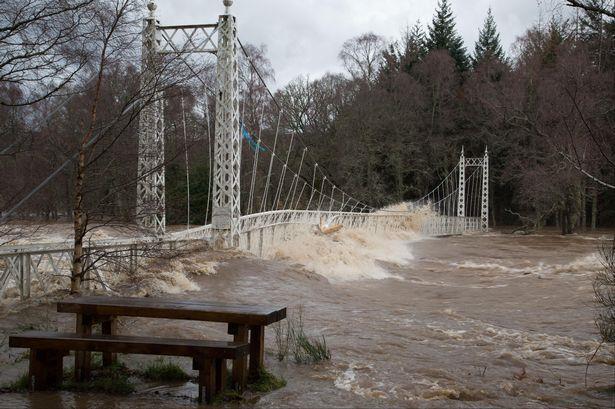
9 Storm Desmond 5 Dec 2015 Crown copyright


10


11

12 Climate Change Extreme precipitation events over most of the midlatitude land masses ( ) will very likely become more intense and more frequent by the end of this century. Global mean sea level rise for relative to will likely be in the ranges of 0.26 to ( ) 0.82 m.

13 * Seasonal Changes in Flow Wetter Winters Drier Summers Less Snow Lower Spring Flows
14 The SEPA Flood Warning Service


15 Flood Warning how? Real time data Post event data collection Skilled and trained staff Met Office forecasts SEPA flood forecasts Public and partner dissemination

16 SEPA Flood warning service: key customers Strategic Partners Police, Fire & Rescue, Local Authorities Critical National Infrastructure Energy, Water, Transport and Telecoms + Individual property owner/occupiers Householders, Businesses Media Broadcast, Online +


17 Scottish Flood Forecasting Service


18 National flood vigilance Daily Flood Guidance Statement Promoting flood vigilance 5 day forecast Actively disseminated daily to Cat 1 and 2 responders only Risk-based approach (based on impact matrix and likelihood)
 of the possibility of flooding and encourage them to be alert, stay vigilant and make early preparation for")
19 Regional Flood Alerts Raise early awareness of potential flooding where the impact of impending weather may cause river, coastal or surface water flooding. Flood Alert stage to warn the public (inc businesses) of the possibility of flooding and encourage them to be alert, stay vigilant and make early preparation for flooding.

20 Flood warning Advise people that flooding is expected Only available where we have designated schemes Flood type specific river or coastal Flood Warning to advise people that action needs to be taken to protect themselves and their property from the effects of flooding.
21 Significant risk to life means that death or serious injury is a likely risk for people in the area, rather than just a possible risk, as is always present with flooding. Potential for significant disruption to essential services.
22 Winter 2015/16 5 th December - Severe Warnings issued for Hawick & Newcastleton 30 th December Severe Warnings issued for the Tweed in Peebles & Whitesands, Dumfries 7 th January 2016 Severe Warnings issued for Inverurie & Kintore

23 Floodline Floodline ( / ) UK service provided by the Environment Agency in England and Wales and by SEPA in Scotland. Common flood warning codes Messages delivered direct to registered customers phones and via SEPA website, a recorded messaging system and call centre agents Flood warning Flood Guidance Statement Flood Warning Flood Advice Flood Warning Dissemination Responders Floodline customers Public

24 Strategic Liaison / Coordination Represented at Scottish Government Resilience Room (SGoRR) SGoRR Ministerial Meetings UK CoBRA Local and Regional Resilience Partnerships Local Emergency Responders Media (TV, Radio, Print, On-line, Social Media)
25 Further information Floodline Live flood alerts & warnings Flooding publications advice & guidance
Fort William (Potentially Vulnerable Area 01/25) Local authority Main catchment The Highland Council Appin coastal Background This Potentially Vulnera
 Local authority Main catchment The Highland Council Appin coastal Background This Potentially Vulnera") Fort William (Potentially Vulnerable Area 01/25) Local authority The Highland Council Main catchment Appin coastal Summary of flooding impacts 100 residential properties 80 non-residential properties 520,000
Fort William (Potentially Vulnerable Area 01/25) Local authority The Highland Council Main catchment Appin coastal Summary of flooding impacts 100 residential properties 80 non-residential properties 520,000
Inverurie and Kintore (Potentially Vulnerable Area 06/13) Local Plan District Local authority Main catchment North East Aberdeenshire Council River Do
 Local Plan District Local authority Main catchment North East Aberdeenshire Council River Do") Inverurie and Kintore (Potentially Vulnerable Area 06/13) Local Plan District North East Local authority Aberdeenshire Council Main catchment River Don Summary of flooding impacts 230 residential properties
Inverurie and Kintore (Potentially Vulnerable Area 06/13) Local Plan District North East Local authority Aberdeenshire Council Main catchment River Don Summary of flooding impacts 230 residential properties
Stirling (Raploch and Riverside) (Potentially Vulnerable Area 09/07) Local Plan District Local authority Main catchment Forth Stirling Council Stirlin
 (Potentially Vulnerable Area 09/07) Local Plan District Local authority Main catchment Forth Stirling Council Stirlin") Stirling (Raploch and Riverside) (Potentially Vulnerable Area 09/07) Local Plan District Forth Local authority Stirling Council Main catchment Stirling coastal Summary of flooding impacts At risk of flooding
Stirling (Raploch and Riverside) (Potentially Vulnerable Area 09/07) Local Plan District Forth Local authority Stirling Council Main catchment Stirling coastal Summary of flooding impacts At risk of flooding
Glasgow City centre (Potentially Vulnerable Area 11/16) Local Plan District Local authority Main catchment Clyde and Loch Lomond Glasgow City Council
 Local Plan District Local authority Main catchment Clyde and Loch Lomond Glasgow City Council") Glasgow City centre (Potentially Vulnerable Area 11/16) Local Plan District Clyde and Loch Lomond Local authority Glasgow City Council Main catchment River Clyde Summary of flooding impacts At risk of
Glasgow City centre (Potentially Vulnerable Area 11/16) Local Plan District Clyde and Loch Lomond Local authority Glasgow City Council Main catchment River Clyde Summary of flooding impacts At risk of
Arbroath (Potentially Vulnerable Area 07/07) Local Plan District Local authority Main catchment Tay Estuary and Montrose Basin Angus Council Brothock
 Local Plan District Local authority Main catchment Tay Estuary and Montrose Basin Angus Council Brothock") Arbroath (Potentially Vulnerable Area 07/07) Local Plan District Tay Estuary and Montrose Basin Local authority Angus Council Main catchment Brothock Water Summary of flooding impacts 250 residential properties
Arbroath (Potentially Vulnerable Area 07/07) Local Plan District Tay Estuary and Montrose Basin Local authority Angus Council Main catchment Brothock Water Summary of flooding impacts 250 residential properties
Oban (Potentially Vulnerable Area 01/31) Local authority Main catchment Argyll and Bute Council Knapdale coastal Background This Potentially Vulnerabl
 Local authority Main catchment Argyll and Bute Council Knapdale coastal Background This Potentially Vulnerabl") Oban (Potentially Vulnerable Area 01/31) Local authority Argyll and Bute Council Main catchment Knapdale coastal Summary of flooding impacts 320 residential properties 310 non-residential properties 1.8
Oban (Potentially Vulnerable Area 01/31) Local authority Argyll and Bute Council Main catchment Knapdale coastal Summary of flooding impacts 320 residential properties 310 non-residential properties 1.8
Kelso (Potentially Vulnerable Area 13/09) Local Plan District Local authority Main catchment Tweed Scottish Borders Council River Tweed Background Thi
 Local Plan District Local authority Main catchment Tweed Scottish Borders Council River Tweed Background Thi") Kelso (Potentially Vulnerable Area 13/09) Local Plan District Tweed Local authority Scottish Borders Council Main catchment River Tweed Summary of flooding impacts At risk of flooding 90 residential properties
Kelso (Potentially Vulnerable Area 13/09) Local Plan District Tweed Local authority Scottish Borders Council Main catchment River Tweed Summary of flooding impacts At risk of flooding 90 residential properties
Solway Local Plan District 1 Flood risk management in Scotland 1.1 What is a Flood Risk Management Strategy? Flood Risk Management Strategies have bee
 Flood Risk Management Strategy Solway Local Plan District Section 1: Flood Risk Management in Scotland 1.1 What is a Flood Risk Management Strategy?... 1 1.2 How to read this Strategy... 1 1.3 Managing
Kirkwall (Potentially Vulnerable Area 03/05) Local Plan District Local authority Main catchment Orkney Orkney Islands Council Orkney coastal Backgroun
 Local Plan District Local authority Main catchment Orkney Orkney Islands Council Orkney coastal Backgroun") Kirkwall (Potentially Vulnerable Area 03/05) Local Plan District Orkney Local authority Orkney Islands Council Main catchment Orkney coastal Summary of flooding impacts 490 residential properties 460 non-residential
Kirkwall (Potentially Vulnerable Area 03/05) Local Plan District Orkney Local authority Orkney Islands Council Main catchment Orkney coastal Summary of flooding impacts 490 residential properties 460 non-residential
Dunblane and Bridge of Allan (Potentially Vulnerable Area 09/03) Local Plan District Local authority Main catchment Forth Stirling Council Allan Water
 Local Plan District Local authority Main catchment Forth Stirling Council Allan Water") Dunblane and Bridge of Allan (Potentially Vulnerable Area 09/03) Local Plan District Forth Local authority Stirling Council Main catchment Allan Water Summary of flooding impacts At risk of flooding 370
Dunblane and Bridge of Allan (Potentially Vulnerable Area 09/03) Local Plan District Forth Local authority Stirling Council Main catchment Allan Water Summary of flooding impacts At risk of flooding 370
Caol and Inverlochy (Potentially Vulnerable Area 01/24) Local Plan District Highland and Argyll Local authority The Highland Council Main catchment Fo
 Local Plan District Highland and Argyll Local authority The Highland Council Main catchment Fo") Caol and Inverlochy (Potentially Vulnerable Area 01/24) Local authority The Highland Council Main catchment Fort William coastal Summary of flooding impacts 170 residential properties 40 non-residential
Caol and Inverlochy (Potentially Vulnerable Area 01/24) Local authority The Highland Council Main catchment Fort William coastal Summary of flooding impacts 170 residential properties 40 non-residential
Alyth (Potentially Vulnerable Area 08/04) Local Plan District Local authority Main catchment Tay Perth and Kinross Council Alyth Burn (River Tay) Back
 Local Plan District Local authority Main catchment Tay Perth and Kinross Council Alyth Burn (River Tay) Back") Alyth (Potentially Vulnerable Area 08/04) Local Plan District Tay Local authority Perth and Kinross Council Main catchment Alyth Burn (River Tay) Summary of flooding impacts 50 residential properties 20
Alyth (Potentially Vulnerable Area 08/04) Local Plan District Tay Local authority Perth and Kinross Council Main catchment Alyth Burn (River Tay) Summary of flooding impacts 50 residential properties 20
Nairn Central (Potentially Vulnerable Area 01/18) Local authority Main catchment The Highland Council Moray coastal Background This Potentially Vulner
 Local authority Main catchment The Highland Council Moray coastal Background This Potentially Vulner") Nairn Central (Potentially Vulnerable Area 01/18) Local authority The Highland Council Main catchment Moray coastal Summary of flooding impacts At risk of flooding 350 residential 30 non-residential 340,000
Nairn Central (Potentially Vulnerable Area 01/18) Local authority The Highland Council Main catchment Moray coastal Summary of flooding impacts At risk of flooding 350 residential 30 non-residential 340,000
Ness, Isle of Lewis (Potentially Vulnerable Area 02/01) Local Plan District Outer Hebrides Local authority Comhairle nan Eilean Siar Main catchment Le
 Local Plan District Outer Hebrides Local authority Comhairle nan Eilean Siar Main catchment Le") Ness, Isle of Lewis (Potentially Vulnerable Area 02/01) Local Plan District Local authority Comhairle nan Eilean Siar Main catchment Lewis and Harris coastal Summary of flooding impacts At risk of flooding
Ness, Isle of Lewis (Potentially Vulnerable Area 02/01) Local Plan District Local authority Comhairle nan Eilean Siar Main catchment Lewis and Harris coastal Summary of flooding impacts At risk of flooding
Clyde south - Port Glasgow to Inchinnan (Potentially Vulnerable Area 11/09) Local Plan District Clyde and Loch Lomond Local authority Inverclyde Counc
 Local Plan District Clyde and Loch Lomond Local authority Inverclyde Counc") Clyde south - Port Glasgow to Inchinnan (Potentially Vulnerable Area 11/09) Local Plan District Clyde and Loch Lomond Local authority Inverclyde Council, Renfrewshire Council Main catchment Firth of Clyde
Clyde south - Port Glasgow to Inchinnan (Potentially Vulnerable Area 11/09) Local Plan District Clyde and Loch Lomond Local authority Inverclyde Council, Renfrewshire Council Main catchment Firth of Clyde
Newton Stewart (Potentially Vulnerable Area 14/12) Local Plan District Local authority Main catchment Dumfries and Galloway Solway River Cree Council
 Local Plan District Local authority Main catchment Dumfries and Galloway Solway River Cree Council") Newton Stewart (Potentially Vulnerable Area 14/12) Local Plan District Solway Local authority Dumfries and Galloway Council Main catchment River Cree Summary of flooding impacts 210 residential properties
Newton Stewart (Potentially Vulnerable Area 14/12) Local Plan District Solway Local authority Dumfries and Galloway Council Main catchment River Cree Summary of flooding impacts 210 residential properties
Ellon (Potentially Vulnerable Area 06/12) Local Plan District North East Local authority Aberdeenshire Council Main catchment River Ythan, Buchan coas
 Local Plan District North East Local authority Aberdeenshire Council Main catchment River Ythan, Buchan coas") Ellon (Potentially Vulnerable Area 06/12) Local Plan District North East Local authority Aberdeenshire Council Main catchment River Ythan, Buchan coastal Summary of flooding impacts 110 residential 40
Ellon (Potentially Vulnerable Area 06/12) Local Plan District North East Local authority Aberdeenshire Council Main catchment River Ythan, Buchan coastal Summary of flooding impacts 110 residential 40
Coupar Angus (Potentially Vulnerable Area 08/07) Local Plan District Local authority Main catchment Tay Perth and Kinross Council Coupar Burn (River T
 Local Plan District Local authority Main catchment Tay Perth and Kinross Council Coupar Burn (River T") Coupar Angus (Potentially Vulnerable Area 08/07) Local Plan District Tay Local authority Perth and Kinross Council Main catchment Coupar Burn (River Tay) Summary of flooding impacts Summary of flooding
Coupar Angus (Potentially Vulnerable Area 08/07) Local Plan District Tay Local authority Perth and Kinross Council Main catchment Coupar Burn (River Tay) Summary of flooding impacts Summary of flooding
Climate risk management plan. Towards a resilient business
 Type your organisation name here Climate risk management plan Towards a resilient business 1 2 3 4 5 1 2 3 4 5 1 2 3 4 5 Click the numbers to select your cover images 1 2 3 4 5 Document control sheet Document
Flood Risk Management Strategy Orkney Local Plan District This section is the most relevant for individuals, communities and businesses seeking to und
 Flood Risk Management Strategy Orkney Local Plan District This section is the most relevant for individuals, communities and businesses seeking to understand their local flood risk and its management.
Turriff (Potentially Vulnerable Area 06/07) Local Plan District Local authority Main catchment North East Aberdeenshire Council River Deveron Backgrou
 Local Plan District Local authority Main catchment North East Aberdeenshire Council River Deveron Backgrou") Turriff (Potentially Vulnerable Area 06/07) Local Plan District North East Local authority Aberdeenshire Council Main catchment River Deveron Summary of flooding impacts At risk of flooding
Turriff (Potentially Vulnerable Area 06/07) Local Plan District North East Local authority Aberdeenshire Council Main catchment River Deveron Summary of flooding impacts At risk of flooding
Stirling (Cornton and Causewayhead) (Potentially Vulnerable Area 09/05) Local Plan District Forth Local authority Clackmannanshire Council, Stirling C
 (Potentially Vulnerable Area 09/05) Local Plan District Forth Local authority Clackmannanshire Council, Stirling C") Stirling (Cornton and Causewayhead) (Potentially Vulnerable Area 09/05) Local Plan District Forth Local authority Clackmannanshire Council, Stirling Council Main catchment River Forth Summary of flooding
Stirling (Cornton and Causewayhead) (Potentially Vulnerable Area 09/05) Local Plan District Forth Local authority Clackmannanshire Council, Stirling Council Main catchment River Forth Summary of flooding
Castle Douglas (Potentially Vulnerable Area 14/11) Local Plan District Local authority Main catchment Dumfries and Galloway Solway River Dee (Solway)
 Local Plan District Local authority Main catchment Dumfries and Galloway Solway River Dee (Solway)") Castle Douglas (Potentially Vulnerable Area 14/11) Local Plan District Solway Local authority Dumfries and Galloway Council Main catchment River Dee (Solway) Summary of flooding impacts 180 residential
Castle Douglas (Potentially Vulnerable Area 14/11) Local Plan District Solway Local authority Dumfries and Galloway Council Main catchment River Dee (Solway) Summary of flooding impacts 180 residential
Ross of Mull (Potentially Vulnerable Area 01/30) Local authority Main catchment Argyll and Bute Council Island of Mull coastal Background This Potenti
 Local authority Main catchment Argyll and Bute Council Island of Mull coastal Background This Potenti") Ross of Mull (Potentially Vulnerable Area 01/30) Local authority Argyll and Bute Council Main catchment Island of Mull coastal Summary of flooding impacts At risk of flooding
Ross of Mull (Potentially Vulnerable Area 01/30) Local authority Argyll and Bute Council Main catchment Island of Mull coastal Summary of flooding impacts At risk of flooding
Forres (Potentially Vulnerable Area 05/06) Local Planning District Local authority Main catchment Findhorn, Nairn and Speyside The Moray Council Moray
 Local Planning District Local authority Main catchment Findhorn, Nairn and Speyside The Moray Council Moray") Forres (Potentially Vulnerable Area 05/06) Findhorn, Nairn and Speyside Local authority The Moray Council Main catchment Moray coastal Summary of flooding impacts Summary of flooding impacts At risk of
Forres (Potentially Vulnerable Area 05/06) Findhorn, Nairn and Speyside Local authority The Moray Council Main catchment Moray coastal Summary of flooding impacts Summary of flooding impacts At risk of
Luncarty, Stanley, Bankfoot, Dunkeld and Birnam (Potentially Vulnerable Area 08/08) Local Plan District Local authority Main catchment Tay Perth and K
 Local Plan District Local authority Main catchment Tay Perth and K") Luncarty, Stanley, Bankfoot, Dunkeld and Birnam (Potentially Vulnerable Area 08/08) Local Plan District Tay Local authority Perth and Kinross Council Main catchment River Tay Summary of flooding impacts
Luncarty, Stanley, Bankfoot, Dunkeld and Birnam (Potentially Vulnerable Area 08/08) Local Plan District Tay Local authority Perth and Kinross Council Main catchment River Tay Summary of flooding impacts
Flood Risk Management Strategy. Shetland
 Flood Risk Management Strategy Shetland Publication date: 14 December 2015 Terms and conditions Ownership: All intellectual property rights for Flood Risk Management Strategies are owned by SEPA or its
River Findhorn (Potentially Vulnerable Area 05/07) Local Planning District Local authority Main catchment Findhorn, Nairn and The Highland Council, Ri
 Local Planning District Local authority Main catchment Findhorn, Nairn and The Highland Council, Ri") River Findhorn (Potentially Vulnerable Area 05/07) Findhorn, Nairn and Speyside Local authority The Moray Council, The Highland Council Main catchment River Findhorn Summary of flooding impacts 100 residential
River Findhorn (Potentially Vulnerable Area 05/07) Findhorn, Nairn and Speyside Local authority The Moray Council, The Highland Council Main catchment River Findhorn Summary of flooding impacts 100 residential
Elgin (Potentially Vulnerable Area 05/05) Local Planning District Local authority Main catchment Findhorn, Nairn and Speyside The Moray Council River
 Local Planning District Local authority Main catchment Findhorn, Nairn and Speyside The Moray Council River") Elgin (Potentially Vulnerable Area 05/05) Findhorn, Nairn and Speyside Local authority The Moray Council Main catchment River Lossie Summary of flooding impacts Summary of flooding impacts At risk of flooding
Elgin (Potentially Vulnerable Area 05/05) Findhorn, Nairn and Speyside Local authority The Moray Council Main catchment River Lossie Summary of flooding impacts Summary of flooding impacts At risk of flooding
Conon Bridge and Muir of Ord (Potentially Vulnerable Area 01/16) Local authority Main catchment The Highland Council River Conon Background This Poten
 Local authority Main catchment The Highland Council River Conon Background This Poten") Conon Bridge and Muir of Ord (Potentially Vulnerable Area 01/16) Local authority The Highland Council Main catchment River Conon Summary of flooding impacts Summary of flooding impacts At risk of flooding
Conon Bridge and Muir of Ord (Potentially Vulnerable Area 01/16) Local authority The Highland Council Main catchment River Conon Summary of flooding impacts Summary of flooding impacts At risk of flooding
Aberfeldy and Pitlochry (Potentially Vulnerable Area 08/03) Local Plan District Local authority Main catchment Tay Perth and Kinross Council River Tay
 Local Plan District Local authority Main catchment Tay Perth and Kinross Council River Tay") Aberfeldy and Pitlochry (Potentially Vulnerable Area 08/03) Local Plan District Tay Local authority Perth and Kinross Council Main catchment River Tay Summary of flooding impacts 240 residential properties
Aberfeldy and Pitlochry (Potentially Vulnerable Area 08/03) Local Plan District Tay Local authority Perth and Kinross Council Main catchment River Tay Summary of flooding impacts 240 residential properties
Nairn East and Auldearn (Potentially Vulnerable Area 05/08) Local Planning District Local authority Main catchment Findhorn, Nairn and Speyside The Hi
 Local Planning District Local authority Main catchment Findhorn, Nairn and Speyside The Hi") Nairn East and Auldearn (Potentially Vulnerable Area 05/08) Findhorn, Nairn and Speyside Local authority The Highland Council Main catchment River Nairn Summary of flooding impacts Summary of flooding
Nairn East and Auldearn (Potentially Vulnerable Area 05/08) Findhorn, Nairn and Speyside Local authority The Highland Council Main catchment River Nairn Summary of flooding impacts Summary of flooding
Creetown (Potentially Vulnerable Area 14/17) Local Plan District Local authority Main catchment Dumfries and Galloway Solway Moneypool Burn Council Ba
 Local Plan District Local authority Main catchment Dumfries and Galloway Solway Moneypool Burn Council Ba") Creetown (Potentially Vulnerable Area 14/17) Local Plan District Solway Local authority Dumfries and Galloway Council Main catchment Moneypool Burn Summary of flooding impacts 90 residential properties
Creetown (Potentially Vulnerable Area 14/17) Local Plan District Solway Local authority Dumfries and Galloway Council Main catchment Moneypool Burn Summary of flooding impacts 90 residential properties
Dornoch (Potentially Vulnerable Area 01/07) Local Plan District Highland and Argyll Local authority The Highland Council Main catchment Dornoch coasta
 Local Plan District Highland and Argyll Local authority The Highland Council Main catchment Dornoch coasta") Dornoch (Potentially Vulnerable Area 01/07) Local authority The Highland Council Main catchment Dornoch coastal Summary of flooding impacts
Dornoch (Potentially Vulnerable Area 01/07) Local authority The Highland Council Main catchment Dornoch coastal Summary of flooding impacts
Hillfoots Villages (Potentially Vulnerable Area 09/04) Local Plan District Forth Local authority Clackmannanshire Council, Stirling Council Main catch
 Local Plan District Forth Local authority Clackmannanshire Council, Stirling Council Main catch") Hillfoots Villages (Potentially Vulnerable Area 09/04) Local Plan District Forth Local authority Clackmannanshire Council, Stirling Council Main catchment River Devon Summary of flooding impacts Summary
Hillfoots Villages (Potentially Vulnerable Area 09/04) Local Plan District Forth Local authority Clackmannanshire Council, Stirling Council Main catchment River Devon Summary of flooding impacts Summary
SEPA Update (How can Kemnay become a PVA?)
") SEPA Update (How can Kemnay become a PVA?) Kemnay Flood Action Group 21 st September 2017 Steve McFarland, Flood Risk Planning Manager (North) SEPA Duties DO Flood risk management planning Flood forecasting
SEPA Update (How can Kemnay become a PVA?) Kemnay Flood Action Group 21 st September 2017 Steve McFarland, Flood Risk Planning Manager (North) SEPA Duties DO Flood risk management planning Flood forecasting
Working with natural processes to help manage flood risk natural flood management Dr. Heather Forbes. Scottish Environment Protection Agency
 Working with natural processes to help manage flood risk natural flood management Dr. Heather Forbes Senior Policy Officer Programme Scottish Environment Protection Agency Scotland s flood risk 56% 21%
Eddleston, Peebles, Innerleithen, Selkirk, Stow and Galashiels (Potentially Vulnerable Area 13/04) Local Plan District Local authority Main catchment
 Local Plan District Local authority Main catchment") Eddleston, Peebles, Innerleithen, Selkirk, Stow and Galashiels (Potentially Vulnerable Area 13/04) Local Plan District Tweed Local authority Scottish Borders Council Main catchment River Tweed Summary
Eddleston, Peebles, Innerleithen, Selkirk, Stow and Galashiels (Potentially Vulnerable Area 13/04) Local Plan District Tweed Local authority Scottish Borders Council Main catchment River Tweed Summary
Flood Risk Management Planning in Scotland: Arrangements for February 2012
 Flood Risk Management Planning in Scotland: Arrangements for 2012 2016 February 2012 Flood Risk Management (Scotland) Act 2009 1 Contents Forewords 1. Introduction to this document... 5 2. Sustainable
2.1 Summary of flooding in the Forth Local Plan District The covers an area of 1,609km 2 with a population of approximately 130,000. It contains five
 Flood Risk Management Strategy This section is the most relevant for individuals, communities and businesses seeking to understand their local flood risk and its management. There is an overview of the
Clyde catchment - Motherwell to Lesmahagow (Potentially Vulnerable Area 11/17/2) Local Plan District Clyde and Loch Lomond Local authority North Lanar
 Local Plan District Clyde and Loch Lomond Local authority North Lanar") Clyde catchment - Motherwell to Lesmahagow (Potentially Vulnerable Area 11/17/2) Local Plan District Clyde and Loch Lomond Local authority North Lanarkshire Council, South Lanarkshire Council Main catchment
Clyde catchment - Motherwell to Lesmahagow (Potentially Vulnerable Area 11/17/2) Local Plan District Clyde and Loch Lomond Local authority North Lanarkshire Council, South Lanarkshire Council Main catchment
Flood Risk Management in Ireland. The National CFRAM Programme & overview of the Capital Works Programme. Click to add text
 Flood Risk Management in Ireland The National CFRAM Programme & overview of the Capital Works Programme Click to add text Dr. John Martin Office of Public Works Engineers Ireland's Local Government Seminar
Engineers Ireland Annual Conference
 Engineers Ireland Annual Conference MANAGING FLOOD RISK AND BUILDING SUSTAINABLE COMMUNITIES Mark Adamson Office of Public Works 15 th May, 2015 FLOOD RISK IN IRELAND RECENT FLOODS November 2009: >1,600
2018 PREPARING FOR A CHANGING CLIMATE AND MANAGING THE RISING FLOOD RISK
 Ireland Water 2018 PREPARING FOR A CHANGING CLIMATE AND MANAGING THE RISING FLOOD RISK Mark Adamson Office of Public Works 25 th April, 2018 FLOOD RISK IN IRELAND NATIONAL RISK ASSESSMENT, OEP 2012 & 2017
World Meteorological Organization Role of WMO and National Meteorological and Hydrological Services in Disaster Risk Reduction
 World Meteorological Organization Role of WMO and National Meteorological and Hydrological Services in Disaster Risk Reduction By Maryam Golnaraghi, Ph.D. Chief of Disaster Risk Reduction Programme Extreme
Indicators and trends
 Indicators and trends Monitoring climate change adaptation Indicator name Version BT8 Railway network at risk of flooding 31/03/16 Indicator type: Risk/opportunity Impact Action X SCCAP Theme SCCAP Objective
PREPARE FOR FLOODING.
 PREPARE FOR FLOODING. A GUIDE FOR RESIDENTS AND BUSINESSES FOR ADVANCE FLOOD WARNINGS Your property could be at risk of flooding. But help is available. The frequency of floods has risen dramatically in
Isle of Arran (Potentially Vulnerable Area 12/08) Local Plan District Local authority Main catchment Brodick to Kilmory Ayrshire North Ayrshire Counci
 Local Plan District Local authority Main catchment Brodick to Kilmory Ayrshire North Ayrshire Counci") Isle of Arran (Potentially Vulnerable Area 12/08) Local Plan District Ayrshire Local authority North Ayrshire Council Main catchment Brodick to Kilmory Arran coastal Summary of flooding impacts At risk
Isle of Arran (Potentially Vulnerable Area 12/08) Local Plan District Ayrshire Local authority North Ayrshire Council Main catchment Brodick to Kilmory Arran coastal Summary of flooding impacts At risk
Understanding the risks, empowering communities, building resilience: the national flood and coastal erosion risk management strategy for England
 14669 NFS Cor Slip / Sig: 1 / Plate A Understanding the risks, empowering communities, building resilience: the national flood and coastal erosion risk management strategy for England Session: 2010-2012
Flood Risk Management (Scotland) Act 2009: DRAFT Local Flood Risk Management Plan Ayrshire Local Plan District
 Act 2009: DRAFT Local Flood Risk Management Plan Ayrshire Local Plan District") Appendix 1 Flood Risk Management (Scotland) Act 2009: DRAFT Local Flood Risk Management Plan Ayrshire Local Plan District Published by: North Ayrshire Council No 12 Local FRM Plan March 2016 Delivering
Appendix 1 Flood Risk Management (Scotland) Act 2009: DRAFT Local Flood Risk Management Plan Ayrshire Local Plan District Published by: North Ayrshire Council No 12 Local FRM Plan March 2016 Delivering
DRAFT Revised Guide to the National CDEM Plan 2015 July 2015
 2. Hazards and risks Summary The National CDEM Plan 2015 identifies core functions for national management of the consequences of emergencies. It may also address the management of consequences of other
Flood and Coastal Risk Management - A Risk Based. David Rooke Head of Flood & Coastal Risk Management 20 March 2009
 Flood and Coastal Risk Management - A Risk Based Approach David Rooke Head of Flood & Coastal Risk Management 20 March 2009 Risk Significant risks to the delivery of Defra s outcomes in this area Consequence
MEETING OF THE SOUTHERN AFRICA REGION FLASH FLOOD GUIDANCE SYSTEM (SARFFGS) Country Presentation for Malawi 28TH OCTOBER, 2015.
 Country Presentation for Malawi 28TH OCTOBER, 2015.") MEETING OF THE SOUTHERN AFRICA REGION FLASH FLOOD GUIDANCE SYSTEM (SARFFGS) Country Presentation for Malawi 28TH OCTOBER, 2015. Outline Introduction 2 DRM Institutional Structure Disasters and development
MEETING OF THE SOUTHERN AFRICA REGION FLASH FLOOD GUIDANCE SYSTEM (SARFFGS) Country Presentation for Malawi 28TH OCTOBER, 2015. Outline Introduction 2 DRM Institutional Structure Disasters and development
FLOOD RISK MANAGEMENT IN IRELAND
 National Flood Management Conference 2018 FLOOD RISK MANAGEMENT IN IRELAND Mark Adamson Office of Public Works 15 th March, 2018 FLOOD RISK IN IRELAND NATIONAL RISK ASSESSMENT, OEP 2012 Flooding: Joint
2.1 Summary of flooding in the Forth Estuary Local Plan District The covers an area of 3,256km 2 with a population of approximately 1.4 million. It co
 Flood Risk Management Strategy This section is the most relevant for individuals, communities and businesses seeking to understand their local flood risk and its management. There is an overview of the
Indicators and trends
 Indicators and trends Monitoring climate change adaptation Indicator name Version BB6 Cultural Heritage in Flood Risk Areas 31/03/16 Indicator type: Risk/opportunity Impact Action X SCCAP Theme SCCAP Objective
PLANNING FOR SAFE AND SUSTAINABLE COMMUNITIES
 Flood Risk Management Protecting and Planning for our Communities PLANNING FOR SAFE AND SUSTAINABLE COMMUNITIES Mark Adamson Office of Public Works 12 th February, 2014 A WET START TO THE YEAR! STORM CHRISTINE
ABI RESPONSE TO PITT INTERIM REPORT: OVERVIEW
 ABI RESPONSE TO PITT INTERIM REPORT: OVERVIEW The ABI broadly supports the recommendations and interim conclusions contained in the Pitt interim report on flood policy issues, although we believe that
Flood Response - Tenants Guide
 Flood Response - Tenants Guide Forethought Climate change, combined with other factors such as urbanisation, is increasing the likelihood and severity of flooding events in the UK. By the 2050s, an extra
Social vulnerability and climate change in Flood Risk Management in Scotland
 Social vulnerability and climate change in Flood Risk Management in Scotland Leigh Fraser leigh.fraser@sepa.org.uk Senior Policy Officer, Flood Risk Management Planning and Policy Scottish Environment
Implementation of Water Framework and Flood Directive in Finland. Markku Maunula Finnish Environment Institute
 Implementation of Water Framework and Flood Directive in Finland Markku Maunula Finnish Environment Institute Finland is rich in freshwater About 11 % of surface is covered by water The number of lakes
2. Hazards and risks. 2 HAZARDS AND RISKS p1
 2. Hazards and risks Summary The National CDEM Plan 2015 identifies core functions for national management of the consequences of emergencies. It may also address the management of consequences of other
Strategic flood risk management
 Report by the Comptroller and Auditor General Department for Environment, Food & Rural Affairs and Environment Agency Strategic flood risk management HC 780 SESSION 2014-15 5 NOVEMBER 2014 4 Key facts
Consider the risks to your own business as well as to your operations
 Hayley Bowman Flood and Coastal Risk Management Mapping, Modelling and Data 07919 544 551 Hayley.bowman@environment-agency.gov.uk DataInfo@environment-agency.gov.uk EA covers England only. Wales covered
Homecheck Flood. Click here. Overall Flood Risk. Insurability. Flood Defences. Individual Flood Risks.
 Homecheck Flood Overall Flood Risk PASSED The property is considered to be at minimal or no risk of flooding. However, you should ask the seller if the property has flooded in the past. The home buyer
Background to the PFRA European Overview - UC9810.5b
 Background to the PFRA European Overview - UC9810.5b The individual Member State Reports reflect the situation as reported by the Member States to the European Commission in 2012 The situation in the MSs
Canada s exposure to flood risk. Who is affected, where are they located, and what is at stake
 Canada s exposure to flood risk Who is affected, where are they located, and what is at stake Why a flood model for Canada? Catastrophic losses Insurance industry Federal government Average industry CAT
Planning and Flood Risk
 Planning and Flood Risk Patricia Calleary BE MEngSc MSc CEng MIEI After the Beast from the East Patricia Calleary Flood Risk and Planning Flooding in Ireland» Floods are a natural and inevitable part of
IRISH FLOOD PREVENTION PROGRAMME Example of integrating climate change adaptation into projects
 IRISH FLOOD PREVENTION PROGRAMME Example of integrating climate change adaptation into projects JASPERS Networking Platform Event Climate Change Adaptation: Vulnerability and Risk Assessment and the Resilience
The AIR Inland Flood Model for Great Britian
 The AIR Inland Flood Model for Great Britian The year 212 was the UK s second wettest since recordkeeping began only 6.6 mm shy of the record set in 2. In 27, the UK experienced its wettest summer, which
Responsibilities and Risk Management
 Responsibilities and Risk Management in a changing climate Legal Responsibility to Adapt Stormwater Management to Climate Change September 24, 2014 Understanding Low Impact Development Laura Zizzo Organizations
FLOODING INFORMATION SHEET YOUR QUESTIONS ANSWERED
 The information in this document has been written in partnership by the Association of British Insurers and the Environment Agency 1. Flood risk and insurance Q1. How can I find out the flood risk affecting
Workshop Climate Change Adaptation (CCA)
") Workshop Climate Change Adaptation (CCA) March 24th 27th, 2014 Manila, Philippines Tuesday, March 25th, 2014 09.00h 09.30h: Exchange of Experiences and Key Learning Points Resty Lou Talamayan (PRC) Session
Workshop Climate Change Adaptation (CCA) March 24th 27th, 2014 Manila, Philippines Tuesday, March 25th, 2014 09.00h 09.30h: Exchange of Experiences and Key Learning Points Resty Lou Talamayan (PRC) Session
NOT PROTECTIVELY MARKED A PROTOCOL FOR MEDIA RELATIONS IN THE EVENT OF AN OFFSHORE INCIDENT
 A PROTOCOL FOR MEDIA RELATIONS IN THE EVENT OF AN OFFSHORE INCIDENT 1. Introduction 1.1. The Emergency Preparedness Offshore Liaison (EPOL) Group has developed the Protocol for Media Relations in the Event
Managing the Risk and Impact of Regional Flooding
 Managing the Risk and Impact of Regional Flooding Ben Lukey FCRM Manager Strategy & Investment Environment Agency Wednesday 8 June 2016 Environment Agency - Who are we? Our role in Flood Risk Management
Indicators and trends
 Indicators and trends Monitoring climate change adaptation Indicator name Version BT16 Rail network benefitting from fluvial flood protection 14/03/16 Indicator type: Risk/opportunity Impact Action X SCCAP
LOW. Overall Flood risk. Flood considerations. Specimen Address, Specimen Town. Rivers and the Sea Low page 4. Historic Flood.
 Specimen Address, Specimen Town Overall Flood risk LOW Crown copyright and database rights 2018. Ordnance Survey licence 100035207 Groundsure Floodview complies with relevant Law Society practice notes
Natural Hazards Risks in Kentucky. KAMM Regional Training
 Natural Hazards Risks in Kentucky KAMM Regional Training Floodplain 101 Kentucky has approximately 92,000 linear miles of streams and rivers Approximately 31,000 linear miles have mapped flood hazards
Flood Risk Assessment Insuring An Emerging CAT
 Flood Risk Assessment Insuring An Emerging CAT Vijay Manghnani Analytics and Exposure Officer Chartis Insurance Antitrust Notice The Casualty Actuarial Society is committed to adhering strictly to the
Introduction. Purpose
 Table of Contents Introduction... 1 Purpose... 1 Related Projects and Programs 3 Vision... 3 Legislation and Policy Framework... 3 Target Audience... 4 Guiding Principles... 5 Governance... 6 Roles and
eastsussex.gov.uk East Sussex Local Flood Risk Management Strategy
 eastsussex.gov.uk East Sussex Local Flood Risk Management Strategy 2013 2016 Foreword I am sure that you will agree that flooding has been at the forefront of all our minds over the past year. The country
LFB role in flood response
 LFB role in flood response 27 th April 2016 Andy Roe Deputy Assistant Commissioner London Fire Brigade the basics UK s 2 nd largest fire and rescue service (5 th largest in the world) Just over 5,300 wholetime
World Flooding Jan - Aug 2002
 Bonn, 14 May 2003 Risk Management Best Practice Professor David Crichton University College London Middlesex University, London University of Dundee, Scotland Fellow of the Chartered Insurance Institute
Bates, P. D. (2016). Flooding: what is normal? Science in Parliament, 73(1),
. Flooding: what is normal? Science in Parliament, 73(1),") Bates, P. D. (2016). Flooding: what is normal? Science in Parliament, 73(1), 25-26. Peer reviewed version License (if available): Unspecified Link to publication record in Explore Bristol Research PDF-document
Bates, P. D. (2016). Flooding: what is normal? Science in Parliament, 73(1), 25-26. Peer reviewed version License (if available): Unspecified Link to publication record in Explore Bristol Research PDF-document
The approach to managing natural hazards in this Plan is to: set out a clear regional framework for natural hazard management
 10 Natural Hazards 10.1 Scope and Background This chapter establishes an overall framework for natural hazard management under the Resource Management Act 1991 (RMA). It also sets out the division of responsibilities
Flood Risk Management Plan A National Pilot from the River Kokemäenjoki
 Flood Risk Management Plan A National Pilot from the River Kokemäenjoki 26-27th January 2010, Maastricht Olli-Matti Verta & Juha-Pekka Triipponen Southwest Finland Centre for Economic Development, Transport
COMMUNITY SUMMARY LINN COUNTY MULTI-JURISDICTIONAL HAZARD MITIGATION PLAN CITY OF LISBON
 COMMUNITY SUMMARY LINN COUNTY MULTI-JURISDICTIONAL HAZARD MITIGATION PLAN CITY OF LISBON This document provides a summary of the hazard mitigation planning information for the City of Lisbon that will
FURTHER ACTION CLICK TO VIEW ONLINE VIEWER. Individual Flood Risks
 Homecheck Flood FURTHER ACTION Overall Flood Risk CLICK TO VIEW ONLINE VIEWER The property is at a significant risk of River, Surface Water and Other flooding. Further assessment is recommended to understand
DRAFT STRATEGIC ENVIRONMENTAL ASSESSMENT SCREENING REPORT. Climate Change Sectoral Adaptation Plan for Flood Risk Management ( )
") Office of Public Works DRAFT STRATEGIC ENVIRONMENTAL ASSESSMENT SCREENING REPORT Climate Change Sectoral Adaptation Plan for Flood Risk Management (2014-2019) Determination of the need for strategic environmental
Office of Public Works DRAFT STRATEGIC ENVIRONMENTAL ASSESSMENT SCREENING REPORT Climate Change Sectoral Adaptation Plan for Flood Risk Management (2014-2019) Determination of the need for strategic environmental
Resilience to Flooding of Grid and Primary Substations
 PRODUCED BY THE OPERATIONS DIRECTORATE OF ENERGY NETWORKS ASSOCIATION Engineering Technical Report 138 Resilience to Flooding of Grid and Primary Substations www.energynetworks.org PUBLISHING AND COPYRIGHT
Preliminary Flood Risk Assessment (PFRA) Final guidance
 Final guidance") 07/12/2010 Preliminary Flood Risk Assessment (PFRA) Final guidance Report GEHO1210BTGH-E-E i 07/12/2010 We are The Environment Agency. It's our job to look after your environment and make it a better place
07/12/2010 Preliminary Flood Risk Assessment (PFRA) Final guidance Report GEHO1210BTGH-E-E i 07/12/2010 We are The Environment Agency. It's our job to look after your environment and make it a better place
Flood Risk Assessment. Approved by RECOMMENDATIONS. Professional Opinion
 Flood Report Flood Risk Assessment Professional Opinion RECOMMENDATIONS 1. A prudent purchaser may wish to consider further assessment of the property to identify appropriate flood protection measures.
Garfield County NHMP:
 Garfield County NHMP: Introduction and Summary Hazard Identification and Risk Assessment DRAFT AUG2010 Risk assessments provide information about the geographic areas where the hazards may occur, the value
Flood Risk and Land Use Vulnerability Guidance
 Flood Risk and Land Use Vulnerability Guidance UPS-BP-GU2a v.2 UNCONTROLLED DOCUMENT WHEN PRINTED Pag SCOTTISH ENVIRONMENT PROTECTION AGENCY Identifier: LUPS-GU24 Land Use Planning System SEPA Guidance
Flood Risk Valuation Flood Model Evaluation and Risk Pricing Evaluation
 Flood Risk Valuation Flood Model Evaluation and Risk Pricing Evaluation February 26, 2019 Joseph Becker Natural Hazards/Geosciences Group 203.229.8832 joseph.f.becker@guycarp.com GUY CARPENTER Macro forces
Review of preliminary flood risk assessments (Flood Risk Regulations 2009): guidance for lead local flood authorities in England
: guidance for lead local flood authorities in England") Review of preliminary flood risk assessments (Flood Risk Regulations 2009): guidance for lead local flood authorities in England 25 January 2017 We are the Environment Agency. We protect and improve the
Review of preliminary flood risk assessments (Flood Risk Regulations 2009): guidance for lead local flood authorities in England 25 January 2017 We are the Environment Agency. We protect and improve the
Implementation processes for the Flood Risk Management (Scotland) Act 2009
 Act 2009") Implementation processes for the Flood Risk Management (Scotland) Act 2009 Final Report 30/05/2012 Page 0 Published by The James Hutton Institute on behalf of CREW Scotland s Centre of Expertise for Waters
Implementation processes for the Flood Risk Management (Scotland) Act 2009 Final Report 30/05/2012 Page 0 Published by The James Hutton Institute on behalf of CREW Scotland s Centre of Expertise for Waters
Government Decree on Flood Risk Management 659/2010
 Ministry of Agriculture and Forestry, Finland NB: Unofficial translation; legally binding texts are those in Finnish and Swedish. Government Decree on Flood Risk Management 659/2010 Section 1 Preliminary
Adaptation Practices and Lessons Learned
 Adaptation Practices and Lessons Learned Increased Flooding Risk Due To Sea Level Rise in Hampton Roads: A Forum to Address Concerns, Best Practices and Plans for Adaptation Nov. 16, 2012 Virginia Modeling,
QUESTIONS & ANSWERS Wildfire and Flooding Frequently Asked Questions for First Nations Communities
 QUESTIONS & ANSWERS Wildfire and Flooding Frequently Asked Questions for First Nations Communities Updated: September 24, 2018 Flooding Information 1. Who should I contact about an emergency such as a