Consider the risks to your own business as well as to your operations
|
|
|
- Marilynn Boyd
- 6 years ago
- Views:
Transcription
1 Hayley Bowman Flood and Coastal Risk Management Mapping, Modelling and Data EA covers England only. Wales covered by Natural Resources Wales. Scotland by SEPA. 15,000 employees 600 branches Consider the risks to your own business as well as to your operations 1
2 Variety of different flood sources EA river / sea Lead Local Flood Authority EA has some Surface Water information as it has a Strategic Overview role in England 2

3 So who are the Environment Agency? We are a government agency in England. We work to create better places for people and wildlife, and support sustainable development. We have a central role in delivering the environmental priorities of central government through our functions and roles. Our 3 main business areas are: flood and coastal risk management; water, land and biodiversity; and regulated business. We ensure that we consider the impacts of CC through our work to manage flood risk and coastal erosion, safeguard water resources and protect the water and wetland environment We take this challenge seriously and have responded to it for a number of years. For example we; have factored CC into our plans, strategies and capital investments in flood for over a decade, provide advice to local planning authorities on future flooding to support their local plans and development decisions, work to balance the water needs of people, businesses, farmers and the environment both now and in the future The Thames Estuary 2100 project (TE2100) pioneered a flexible approach to planning and climate risks in developing a flood risk management plan to the end of the century. 3

4 We have been modelling, mapping and managing flood risk for many years We respond to flooding We work with other agency s and organisations to raise awareness and help them plan to manage risk better We comment on development proposals We provide data to a host of organisations and to the public 4

5 We model and map flood risk in a strategic way Planning where we need more data, for example where there is high development pressure or in urban areas We invest approximately 17 million per year in modelling and mapping and an additional 15 million in gathering and processing data to support flood and coastal risk management. This data, modelling and mapping underpins all the decisions we make in Flood and Coastal Risk Management, including significant investment decisions. We have systems in place to manage our data controlling how we store it, data standards, maturity etc and operate a custodianship model to help us achieve this 5
6 Variety of different flood sources EA river / sea Lead Local Flood Authority EA has some Surface Water information as it has a Strategic Overview role in England 6

7 Property conveyancing 800,000 reports to solicitors The public taking action to protect themselves and their property App developers such as Halcrows flood alert I phone app Developers determining where to build and where not to Consultants creating their own mapping Insurers Emergency services National Infrastructure, travel and utility networks looking to engage more with these sectors and provide data to help inform and build resilience 7

8 We are engaging with may different organisations to raise their awareness of our data and get them to include it in their decision making These are just a few Our vision is that our data is used by everyone in their decisions and that the public s awareness of flood risk is raised by all the organisations they deal with using our data and understanding flood risk and what can be done to manage it 8

9 We are not allowed to offer a bespoke service to customers This is for a number of reasons including concerns about state aid and competition law We can offer our data, produced over many years by staff with years of local knowledge and experience, and provide this for a specific location, if the concern is to understand the risk of flooding in areas where specific properties or buildings are located. We can offer advice on how to use our data We are open and transparent about the strengths and limitations of our data 9

10 You can find your local EA office here: Ask for customer engagement teams Request a product 4 for a specific postcode. Cost is 50 per report. 10

11 You can find your local EA office here: Ask for customer engagement teams Request an Insurance Related Request report for a specific postcode. Cost is 50 per report. 11

12 We model and map the risk to land, not to property There are a number of reasons for this, the main one being that we do not have a dataset of doorstep or threshold levels for properties across the country We do not believe anyone else has this either To be a truely property specific risk assessment these levels are needed We can produce water levels with a target accuracy of +/- 250mm But we dont have doorstep levels 12
13 13

14 This is the last time the Thames flooded in 1928 We gather a variety of info during a flood Often involving the public afterwards to QA our records We aim to get all new historic info included in our flood records within 3 months of the flood ending Constantly updating our information We hold extensive records of historic floods which we make available either individually, or showing the combined worst case as part of the Historic Flood Map. Historic Flood Map biggest ever extent = 11,437 records Historic Flood Event Outlines individual polygons. - 22,000 records ,000 + properties flooded, smaller geographic areas, Hull, Tewkesbury smaller number but larger number of communities affected 2013/14 around

15 We ve been publishing flood maps since 2000 and it s our main way of communicating risk to the public. Our main product is called Risk of Flooding from Rivers and the Sea, which is a national assessment of flood risk across England. The same assessment is also available for Wales and can be licensed from NRW. Since Dec 14 it is Open Data free of charge and accessed through the DataShare (GeoStore) website. It shows the probability of flooding from rivers and the sea, considering the location, type and condition of defences and maps these on a 50m x 50m grid in four probability bandings: High: each year, there is a chance of flooding of greater than 1 in 30 (3.3%). Medium: each year, there is a chance of flooding of between 1 in 30 (3.3%) and 1 in 100 (1%). Low: each year, there is a chance of flooding of between 1 in 100 (1%) and 1 in 1000 (0.1%). Very Low: each year, there is a chance of flooding of less than 1 in 1000 (0.1%). Properties where the likelihood of flooding is greater than or equal to 1 in 75 (1.3%) in each year are also identified This shows the GIS version of the dataset which is on.gov.uk website and the map the public use to understand the risk where they live. There are two other versions which are in database form which link OS address data and royal mail data to the likelihood data to give a risk category of every property in the floodplain, and every postcode unit based on the likelihood of the cell the property is within. We also calculate reliability information based on how good the data is going into the model, and how well the model performs, and have a record for every cell in the final data which shows at which spatial scale the data is most reliable at; National-County, County-Town, Town-Street, Parcels of Land, Property. Most is currently County to Town but we are making several improvements in 2015 to improve this (Data due for release early in 2016). Indicates where results are most / least reliable & should be used on it s own / combined with other data to verify it. We use it to better plan and prepare to protect more people and property for flood and coastal erosion risk by informing how Flood Defence Grant in Aid is allocated every year. 15

16 Flood Map for Planning shows the areas of land that would be expected to flood from rivers and the sea It shows 2 different flood likelihoods ignoring the impact of flood defences shows the undefended floodplain, or worst case scenario. It is used primarily for land use planning and for raising awareness. It also shows the areas of land that would be protected by defences (1:100 SoP Fluvial / 1:200 SoP Tidal). Its produced from detailed local models produced by our local teams and infilled with a national model. Where a historic event is bigger than the predicted (modelled) extent then we can include this too. Can help you understand the worst case risk in an area and for understanding areas that would be at risk if defences were to fail / be overtopped 16

17 More detailed local data is available in the higher risk areas from scheme design models or detailed modelling for understanding risk better. Where available the data is fed into the national products, but is also available on their own: Water levels at different flood magnitudes Extents of flooding at different flood magnitudes Scenario modelling climate change, blockage, with and without defences, maintenance. Not open data and not on DataShare available through contacting Data Info or direct to local offices. Nationally around 1600 models available 17

18 We are on track to reduce flood and coastal erosion risk to 300,000 households between 2015 and 2021 New flood defence data feeds into our risk modeling Our local staff survey the defences in their area at a frequency determined by the defence type, for example surveying a grass embankment more often than a concrete wall to ensure that the local landowner has not lowered the crest level The dataset we have available contains details such as standard of protection, condition grade, and crest levels of over 175,000 defences Defence details are usually used to feed into modeling of flood risk, and its important that models are updated as soon as possible to reflect the changes in condition or new defences 18

19 To help customers understand where we plan to work we have a dataset of where our local teams plan to construct new defences. This covers a 5 year period and is effectively updated annually by our local teams It shows spatially where we plan to invest 100k or more to change or sustain the current standard of protection offered to an area It does not directly indicate the likelihood of flooding to individual properties. It also includes the equivalent schemes for all Local Authority and Internal Drainage Boards and details the number of households and areas of land contributing to DEFRA s Outcome Measures are also attributed i.e. could benefit from major work on flood defences. Currently have the TE2100 plan looking at the future of the Thames Barrier and defences to London over the next 100 years, and Lower Thames Scheme Datchet to Teddington which will provide defences to the non tidal Thames, especially around the communities hit hard this Winter, Staines, Egham, Windsor and Datchet. 19

20 We survey the ground to use the levels to feed into our modelling using our 2 LIDAR planes Explain LIDAR We also use planes and satellite imagery to capture flood extents 20
.")
21 In December 2013 we published surface water maps for the first time Risk shown in four probability bandings: High (1 in 30 probability or greater) Medium (between 1 in 30 and 1 in 100 probability) Low (less than 1 in 100 probability). Very Low The national scale model uses a detailed model of the ground to see where rain water flows and ponds, taking account of a range of storm durations, infiltration into the ground, hydraulics, and, in broad terms, subsurface drainage. Lead Local Flood Authorities (LLFAs), who are responsible for surface water flooding, have provided compatible detailed surface water mapping where this is available and where it is more representative, and this replaces the national scale mapping in these locations. A suitability rating has been assigned based on the applicability of the model, the input data quality and, where available, an LLFA review of the maps against recorded or known flood risk. Understanding all sources of flood risk is key and this new data with its LLFA input is an important dataset to aid that understanding CLICK this is the direction map we also have velocity and depth. 21

22 CLICK this is the direction map we also have velocity and depth. 22

23 These warnings are communicated to those living in at risk areas by phone, text or e mail and also through the internet and the media. Warning status is updated every 15mins and available as an XML feed 23

24 We make our national datasets available through a web download service called DataShare. Quarterly updates are available for lots of our datasets On this data is pre-cut to users operational areas and we have over 2000 active users. Accessing flood data through the site speeds up the time it takes to obtain the data, it can be incorporated into systems as soon as possible. Users are notified when new data is available to download We have almost 5000 registered users downloading from 28 different datasets 24
25 Recent commitment to publish as much of our data as possible as Open Data Coastal: GIS dataset and supporting information providing design / extreme sea level and typical surge information around the coastline of England and Wales under present day conditions 25
26 Flood Alert Area is generally a large expanse of floodplain (up to and including the extreme flood outline which defines the Flood Warning Service Limit), within a catchment, subcatchment or group of catchments, that is/are at risk from low impact flooding (from main rivers, ordinary watercourses and the sea). Flood Warning Areas Locations within the Flood Warning Service Limit (FWSL) that represent a single or aggregation of Flood Warning Sub Areas (FWSAs) or Flood Warning Flood Risk Areas (FWFRAs) containing a discrete community at risk of flooding. Flood Risk Areas have been defined by Lead Local Flood Authorities, based on combining risk to people, critical services and commercial and public assets, and detailed flood modelling. These areas cover surface water flooding only. RoFRS: Previously known as NaFRA Spatial Flood Likelihood Category Grid. This national assessment of flood risk for England shows the chance of flooding from rivers and/or the sea, based on cells of 50m. Each cell is allocated one of four flood risk categories, taking into account flood defences and their condition. 26
27 HFM: The maximum extent of all recorded individual historic flood event outlines from rivers, the sea and groundwater springs in England & Wales Recorded Flood Outlines contains the individual records of historic flooding. These records show flooding to the land and do not necessarily indicate that properties were flooded internally. Absence of a flood event does not mean that the area has never flooded, only that we do not currently have records of flooding in this area. 27
28 We charge for commercial re-use of our information Each dataset has a national charge Discounts are available where the data is used on less than 100 terminals Example shows Flood Map for Planning (ref Slide 6). 14,000 (plus 3 rd party) pa for England dataset full corporate use. 1,925 for England dataset single terminal use. 28
. 14,000 (plus 3 rd party) pa for England dataset full corporate use.")
29 We charge for commercial re-use of our information Each dataset has a national charge Discounts are available where the data is used on less than 100 terminals Example shows Flood Map for Planning (ref Slide 6). 14,000 (plus 3 rd party) pa for England dataset full corporate use. 1,925 for England dataset single terminal use. 29

30 Most 1/4ly updated best to review the flood risk information for specific locations at least once a year. Community input We build the defences and update to include them Public facing web, media, weather reports In -expensive Local expert input Unique local input and expertise. We gather the historic data. We survey and build the defences. We provide the flood warning service. 30
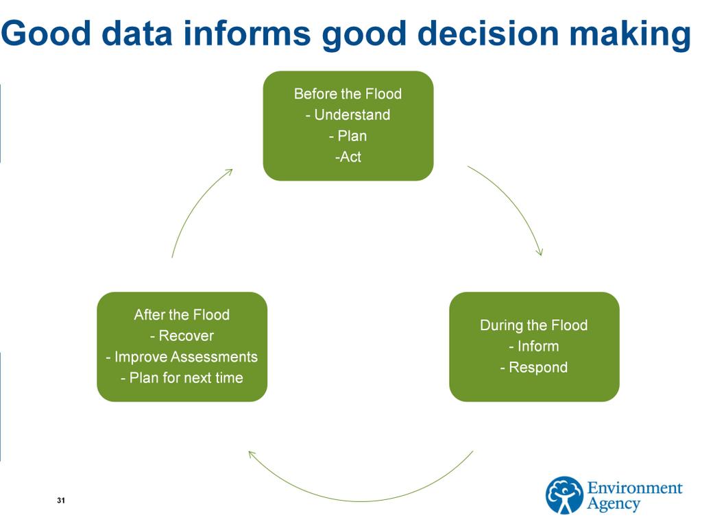
31 31

32 We have samples available of all of our data We would be happy to meet to discuss further 32
Risk of Flooding from Rivers and Sea
 Risk of Flooding from Rivers and Sea Product Description April 2015 RISK OF FLOODING FROM RIVERS AND SEA PRODUCT DESCRIPTION An assessment of flood risk for England produced using local data and expertise.
FLOODING INFORMATION SHEET YOUR QUESTIONS ANSWERED
 The information in this document has been written in partnership by the Association of British Insurers and the Environment Agency 1. Flood risk and insurance Q1. How can I find out the flood risk affecting
Mapping flood risk its role in improving flood resilience in England
 Mapping flood risk its role in improving flood resilience in England Catherine Wright Director of Digital and Skills Flood and Coastal Risk Management Environment Agency 6 October 2017 The Environment
Guildford Borough Level 1 Strategic Flood Risk Assessment Summary Report. January 2016
 Guildford Borough Level 1 Strategic Flood Risk Assessment Summary Report January 2016 What is this document? This document provides a summary of Guildford Borough Strategic Flood Risk Assessment (SFRA,
Risk of Flooding from Rivers and Sea Properties in Areas at Risk (AfA378)
") Risk of Flooding from Rivers and Sea Properties in Areas at Risk (AfA378) Description: Previously known as NaFRA Property Flood Likelihood Category Database. This dataset is a product of a national assessment
Risk of Flooding from Rivers and Sea Properties in Areas at Risk (AfA378) Description: Previously known as NaFRA Property Flood Likelihood Category Database. This dataset is a product of a national assessment
Engineers Ireland Annual Conference
 Engineers Ireland Annual Conference MANAGING FLOOD RISK AND BUILDING SUSTAINABLE COMMUNITIES Mark Adamson Office of Public Works 15 th May, 2015 FLOOD RISK IN IRELAND RECENT FLOODS November 2009: >1,600
Flood Risk Management in Ireland. The National CFRAM Programme & overview of the Capital Works Programme. Click to add text
 Flood Risk Management in Ireland The National CFRAM Programme & overview of the Capital Works Programme Click to add text Dr. John Martin Office of Public Works Engineers Ireland's Local Government Seminar
Managing the Risk and Impact of Regional Flooding
 Managing the Risk and Impact of Regional Flooding Ben Lukey FCRM Manager Strategy & Investment Environment Agency Wednesday 8 June 2016 Environment Agency - Who are we? Our role in Flood Risk Management
Good Practice Guide. GPG 101 Document Owner: Steve Cook. Page 1 of 7.
 Good Practice Guide Producing flood risk hydraulic models and flood consequence assessments for development planning purposes Date Published: September 2015 GPG 101 Document Owner: Steve Cook Page 1 of
National Flood Risk Assessment Key facts. Environment Agency 1 NaFRA 2005 Key Facts
 National Flood Risk Assessment 2005 Key facts 1 NaFRA 2005 Key Facts We are The. It's our job to look after your environment and make it a better place - for you, and for future generations. Your environment
Flood Risk Assessment. Approved by RECOMMENDATIONS. Professional Opinion
 Flood Report Flood Risk Assessment Professional Opinion RECOMMENDATIONS 1. A prudent purchaser may wish to consider further assessment of the property to identify appropriate flood protection measures.
Solway Local Plan District 1 Flood risk management in Scotland 1.1 What is a Flood Risk Management Strategy? Flood Risk Management Strategies have bee
 Flood Risk Management Strategy Solway Local Plan District Section 1: Flood Risk Management in Scotland 1.1 What is a Flood Risk Management Strategy?... 1 1.2 How to read this Strategy... 1 1.3 Managing
Background to the PFRA European Overview - UC9810.5b
 Background to the PFRA European Overview - UC9810.5b The individual Member State Reports reflect the situation as reported by the Member States to the European Commission in 2012 The situation in the MSs
Combined Sources Product
 Combined Sources Product EA Data Advisory Group Selena Peters: FCRM Mapping, Modelling and Data 18 June 2015 selena.peters@environment-agency.gov.uk Assessing flood risk New Product What? Combined Sources
Planning and Flood Risk
 Planning and Flood Risk Patricia Calleary BE MEngSc MSc CEng MIEI After the Beast from the East Patricia Calleary Flood Risk and Planning Flooding in Ireland» Floods are a natural and inevitable part of
CYNGOR SIR POWYS COUNTY COUNCIL. CABINET EXECUTIVE 18 th September Flood Risk Management Plan (FRMP)
") CYNGOR SIR POWYS COUNTY COUNCIL. CABINET EXECUTIVE 18 th September 2018 REPORT AUTHOR: SUBJECT: County Councillor Phyl Davies Portfolio Holder for Highways, Recycling and Assets Flood Risk Management Plan
CYNGOR SIR POWYS COUNTY COUNCIL. CABINET EXECUTIVE 18 th September 2018 REPORT AUTHOR: SUBJECT: County Councillor Phyl Davies Portfolio Holder for Highways, Recycling and Assets Flood Risk Management Plan
Resilience to Flooding of Grid and Primary Substations
 PRODUCED BY THE OPERATIONS DIRECTORATE OF ENERGY NETWORKS ASSOCIATION Engineering Technical Report 138 Resilience to Flooding of Grid and Primary Substations www.energynetworks.org PUBLISHING AND COPYRIGHT
Homecheck Professional. Flood Risk Assessment PASSED. Overall Flood Risk: LOW RISK IDENTIFIED. Insurability: YES. Flood Report. Professional Opinion
 Homecheck Professional Flood Report Flood Risk Assessment PASSED Professional Opinion The overall flood risk rating for the property is assessed to be 'Low'. No further action is considered necessary however
Flood Risk Management Planning in Scotland: Arrangements for February 2012
 Flood Risk Management Planning in Scotland: Arrangements for 2012 2016 February 2012 Flood Risk Management (Scotland) Act 2009 1 Contents Forewords 1. Introduction to this document... 5 2. Sustainable
Product 4 (Detailed Flood Risk) for Our Ref: OX_0748_01. Mill Lane, Somerford Keynes
 for Our Ref: OX_0748_01. Mill Lane, Somerford Keynes") Product 4 (Detailed Flood Risk) for Our Ref: OX_0748_01 Mill Lane, Somerford Keynes Product 4 is designed for developers where Flood Risk Standing Advice FRA (Flood Risk Assessment) Guidance Note 3 Applies.
Product 4 (Detailed Flood Risk) for Our Ref: OX_0748_01 Mill Lane, Somerford Keynes Product 4 is designed for developers where Flood Risk Standing Advice FRA (Flood Risk Assessment) Guidance Note 3 Applies.
Flood Risk Management: Modelling blockage and breach scenarios February 2015
 Flood Risk Management: Modelling blockage and breach scenarios February 2015 OGN100 Document Owner: Mark Pugh Page 1 of 6 Version History: Document Date Summary of Changes Version Published 1.0 DEC-2014
Protocol for the maintenance of flood and coastal risk management assets (England only) Version 4, 27/01/2014 UNCLASSIFIED
 Version 4, 27/01/2014 UNCLASSIFIED") Protocol for the maintenance of flood and coastal risk management assets (England only) Version 4, 27/01/2014 UNCLASSIFIED We are the Environment Agency. We protect and improve the environment and make
Protocol for the maintenance of flood and coastal risk management assets (England only) Version 4, 27/01/2014 UNCLASSIFIED We are the Environment Agency. We protect and improve the environment and make
London Borough of Sutton Local Flood Risk Management Strategy Action Draft for Consultation
 London Borough of Sutton Local Flood Risk Strategy Action Draft for Consultation This Action Plan supports the London Borough of Sutton Local Flood Risk Strategy (v1.0) July 2014. The reader should refer
Role of the Flood & Water Management Committee & LCC as Lead Local Flood Authority
 Role of the Flood & Water Management Committee & LCC as Lead Local Flood Authority Page 1 Agenda Item 5 Page 2 21F of Local Government Act 2000 - Overview and scrutiny committees: flood risk management
Strategic flood risk management
 Report by the Comptroller and Auditor General Department for Environment, Food & Rural Affairs and Environment Agency Strategic flood risk management HC 780 SESSION 2014-15 5 NOVEMBER 2014 4 Key facts
Saturday, 14 April 2012
 Residential Property at Site Located at Grid Reference: 371914E 293168N Order Reference: 24011234_1 Your Reference: REDALLRISKSTEST_HCF Saturday, 14 April 2012 Requested by Landmark(Test Account) 6-7 Abbey
Assessing future flood risk across the UK
 Climate Change Risk Assessment: 2017 Assessing future flood risk across the UK (England, Wales, Scotland and Northern Ireland) Presentation to the FoRUM Workshop Paul Sayers and Matt Horritt 17 March 2015
Caol and Inverlochy (Potentially Vulnerable Area 01/24) Local Plan District Highland and Argyll Local authority The Highland Council Main catchment Fo
 Local Plan District Highland and Argyll Local authority The Highland Council Main catchment Fo") Caol and Inverlochy (Potentially Vulnerable Area 01/24) Local authority The Highland Council Main catchment Fort William coastal Summary of flooding impacts 170 residential properties 40 non-residential
Caol and Inverlochy (Potentially Vulnerable Area 01/24) Local authority The Highland Council Main catchment Fort William coastal Summary of flooding impacts 170 residential properties 40 non-residential
Preliminary Flood Risk Assessment (PFRA) Final guidance
 Final guidance") 07/12/2010 Preliminary Flood Risk Assessment (PFRA) Final guidance Report GEHO1210BTGH-E-E i 07/12/2010 We are The Environment Agency. It's our job to look after your environment and make it a better place
07/12/2010 Preliminary Flood Risk Assessment (PFRA) Final guidance Report GEHO1210BTGH-E-E i 07/12/2010 We are The Environment Agency. It's our job to look after your environment and make it a better place
Review of preliminary flood risk assessments (Flood Risk Regulations 2009): guidance for lead local flood authorities in England
: guidance for lead local flood authorities in England") Review of preliminary flood risk assessments (Flood Risk Regulations 2009): guidance for lead local flood authorities in England 25 January 2017 We are the Environment Agency. We protect and improve the
Review of preliminary flood risk assessments (Flood Risk Regulations 2009): guidance for lead local flood authorities in England 25 January 2017 We are the Environment Agency. We protect and improve the
Flood Report Flood Risk Assessment
 Flood Report Flood Risk Assessment This report is issued for the property described as: PASSED Professional Opinion The Strand, Saundersfoot The overall flood risk rating for the property has been assessed
Kirkwall (Potentially Vulnerable Area 03/05) Local Plan District Local authority Main catchment Orkney Orkney Islands Council Orkney coastal Backgroun
 Local Plan District Local authority Main catchment Orkney Orkney Islands Council Orkney coastal Backgroun") Kirkwall (Potentially Vulnerable Area 03/05) Local Plan District Orkney Local authority Orkney Islands Council Main catchment Orkney coastal Summary of flooding impacts 490 residential properties 460 non-residential
Kirkwall (Potentially Vulnerable Area 03/05) Local Plan District Orkney Local authority Orkney Islands Council Main catchment Orkney coastal Summary of flooding impacts 490 residential properties 460 non-residential
Broad-Scale Assessment of Urban Flood Risk Mark G. E. Adamson 1
 Broad-Scale Assessment of Urban Flood Risk Mark G. E. Adamson 1 1 Office of Public Works, Trim, Co. Meath, Ireland Abstract The Directive on the assessment and management of flood risks (2007/60/EC The
Glasgow City centre (Potentially Vulnerable Area 11/16) Local Plan District Local authority Main catchment Clyde and Loch Lomond Glasgow City Council
 Local Plan District Local authority Main catchment Clyde and Loch Lomond Glasgow City Council") Glasgow City centre (Potentially Vulnerable Area 11/16) Local Plan District Clyde and Loch Lomond Local authority Glasgow City Council Main catchment River Clyde Summary of flooding impacts At risk of
Glasgow City centre (Potentially Vulnerable Area 11/16) Local Plan District Clyde and Loch Lomond Local authority Glasgow City Council Main catchment River Clyde Summary of flooding impacts At risk of
RIVER LUGG INTERNAL DRAINAGE BOARD. Statement on Water Level and Flood Risk Management
 RIVER LUGG INTERNAL DRAINAGE BOARD Statement on Water Level and Flood Risk Management 1. Introduction Purpose 1.1. This policy statement has been prepared by the River Lugg Internal Drainage Board (the
PROPERTY CODES COMPLIANCE BOARD COMPLIANCE NOTES CN02I: REGULATED FLOOD SEARCHES
 PROPERTY CODES COMPLIANCE BOARD COMPLIANCE NOTES CN02I: REGULATED FLOOD SEARCHES The Code s requirements 1. The 7 principles of the Search Code apply to regulated flood searches just as they apply to regulated
Flood and Coastal Risk Management - A Risk Based. David Rooke Head of Flood & Coastal Risk Management 20 March 2009
 Flood and Coastal Risk Management - A Risk Based Approach David Rooke Head of Flood & Coastal Risk Management 20 March 2009 Risk Significant risks to the delivery of Defra s outcomes in this area Consequence
Homecheck Professional. Flood Risk Assessment. Overall Flood Risk at the Site: Insurability: PASSED LOW RISK IDENTIFIED YES.
 Homecheck Professional Flood Report Flood Risk Assessment This report is issued for the property described as: PASSED Sample site Professional Opinion The overall flood risk rating for the property is
Flood Investigation Report
 Flood Investigation Report Bar Hill 1.1 Background As the Lead Local Flood Authority (LLFA) for Cambridgeshire, it is Cambridgeshire County Council s duty to investigate flood incidents as detailed within
CHAPTER 10 FLOOD RISK
 CHAPTER 10 FLOOD RISK 10.1 Introduction and Key Issues 10.1.1 This chapter describes the likely effects that the construction and operation of the Upgrade will have on flood risk. The potential effects
HRPP 358. Adapting flood risk management for an uncertain future: Flood management planning on the thames estuary. D. Ramsbottom & T.
 HRPP 358 Adapting flood risk management for an uncertain future: Flood management planning on the thames estuary D. Ramsbottom & T. Reeder Reproduced from a paper presented at: The 43rd Defra Flood and
Local Flood Risk Management Strategy
 of London Local Flood Risk Management Strategy 2014-2020 September 2014 of London Local Flood Risk Management Strategy 2014-2020 Sept 2014 1 Contents 1 Introduction... 4 2 Flood Risk Management Strategy
Environment Agency pre-application advice incorporating Local Flood Risk Standing Advice from East Lindsey District Council
 Environment Agency pre-application advice incorporating Local Flood Risk Standing Advice from East Lindsey District Council Version 1 UNCLASSIFIED We are the Environment Agency. We protect and improve
Indicators and trends
 Indicators and trends Monitoring climate change adaptation Indicator name Version BT16 Rail network benefitting from fluvial flood protection 14/03/16 Indicator type: Risk/opportunity Impact Action X SCCAP
Frequently Asked Questions
 Frequently Asked Questions The West of Wales Shoreline Management Plan (SMP) provides a high level strategy for managing flood and erosion risk for the coastline and is a non statutory policy document
Development and Flood Risk - the Environment Agency s approach to PPS25. scrutinised before planning decisions are made
 Development and Flood Risk - the Environment Agency s approach to PPS25 Steve Cook Flood Risk Policy Advisor Stephen.cook@environment-agency.gov.uk Our role in PPS25 h Providing advice and information
Flood Risk Management Strategy. Shetland
 Flood Risk Management Strategy Shetland Publication date: 14 December 2015 Terms and conditions Ownership: All intellectual property rights for Flood Risk Management Strategies are owned by SEPA or its
Flood Risk Management New legislation New Duties!
 Flood Risk Management New legislation New Duties! Andy Cameron Lancashire County Council Senior Engineer Strategic Flood Risk Iwan Lawton Environment Agency Technical Specialist Development & Flood Risk
Lowestoft. Summary 2016 FLOOD RISK MANAGEMENT. Mike Page
 Mike Page Lowestoft FLOOD RISK MANAGEMENT Strategy Summary 2016 Introduction This Strategy Summary Document is a brief overview of the Strategy for managing the risk of flooding to Lowestoft from the sea,
The AIR Coastal Flood Model for Great Britain
 The AIR Coastal Flood Model for Great Britain The North Sea Flood of 1953 inundated more than 100,000 hectares in eastern England. More than 24,000 properties were damaged, and 307 people lost their lives.
Lowestoft Flood Risk Management Project
 Volume 1, Issue 1 Winter 2017 Lowestoft Flood Risk Management Project I N S I D E T H I S I S S U E : Welcome 1 Background to the project 2 What are we considering 2 and how has the project progressed?
FOR TO THE GAELTACHT LOCAL AREA PLAN MARCH 2013
 APPENDIX II TO THE SEA ENVIRONMENTAL REPORT STAGE 2 STRATEGIC FLOOD RISK ASSESSMENT FOR PROPOSED AMENDMENT TO THE GAELTACHT LOCAL AREA PLAN 2008-2014 for: Galway County Council County Buildings Prospect
Understanding the risks, empowering communities, building resilience: the national flood and coastal erosion risk management strategy for England
 14669 NFS Cor Slip / Sig: 1 / Plate A Understanding the risks, empowering communities, building resilience: the national flood and coastal erosion risk management strategy for England Session: 2010-2012
Derry City & Strabane District Council 17th July 2015, 3pm.
 Derry City & Strabane District Council 17th July 2015, 3pm Malcolm Calvert, (Principal Engineer, Mapping & Modelling Unit) Sean O Neill, (Regional Engineer - Western) Flood Hazard & Risk Mapping www.riversagencyni.gov.uk
National Infrastructure Assessment Technical Annex. Technical annex: Flood modelling
 Technical annex: Flood modelling July 2018 1 This annex provides supplementary detail on modelling of flood management for the National Infrastructure Assessment. Assessing cost and benefits of different
The AIR Inland Flood Model for Great Britian
 The AIR Inland Flood Model for Great Britian The year 212 was the UK s second wettest since recordkeeping began only 6.6 mm shy of the record set in 2. In 27, the UK experienced its wettest summer, which
FLOOD SOLUTIONS Residence
 FLOOD SOLUTIONS Residence Report prepared on 22 Knighton Road, Liverpool, L4 9RD Report reference AEL028FLR022381 National grid reference 337815, 394462 Report prepared for Specimen Client Client reference
Climate Change and Flood Risk. Tim Reeder Regional Climate Change Programme Manager
 Climate Cange and Flood Risk Tim Reeder Regional Climate Cange Programme Manager Structure of talk Callenges of flood risk management in London & climate cange issues Te TE 2100 Project - Climate Cange
Local Flood Risk Management Strategy
 Local Flood Risk Management Strategy 2017 2019 Contents Section Pages Executive Summary 3 1.0 Introduction 4 2.0 Aims 5 3.0 Flood Risk in Poole 6 4.0 Drainage 10 5.0 Surface Water Management Plans 12 6.0
Sample Site, Sample Street, Sample Town
 Telephone: 2 7261 191 Email: SitecheckFlood@rpsgroup.com Sample Site, Sample Street, Sample Town Prepared for: L And1 Landmark1 Account Landmark(Test Account) 6-7 Abbey Court, Sowton Ind Estate Exeter
Joint Lincolnshire Flood Risk and Drainage Management Strategy: Draft v.6.0:consultation Draft, : Annexes A-F
 Lincolnshire Flood Risk and Drainage Management Partnership Framework Lincolnshire Joint Flood Risk and Drainage Management Strategy Draft v.6.0 Consultation Draft 23 rd May 2012 Annexes A-F Joint Lincolnshire
Clyde south - Port Glasgow to Inchinnan (Potentially Vulnerable Area 11/09) Local Plan District Clyde and Loch Lomond Local authority Inverclyde Counc
 Local Plan District Clyde and Loch Lomond Local authority Inverclyde Counc") Clyde south - Port Glasgow to Inchinnan (Potentially Vulnerable Area 11/09) Local Plan District Clyde and Loch Lomond Local authority Inverclyde Council, Renfrewshire Council Main catchment Firth of Clyde
Clyde south - Port Glasgow to Inchinnan (Potentially Vulnerable Area 11/09) Local Plan District Clyde and Loch Lomond Local authority Inverclyde Council, Renfrewshire Council Main catchment Firth of Clyde
LOW. Overall Flood risk. Flood considerations. Specimen Address, Specimen Town. Rivers and the Sea Low page 4. Historic Flood.
 Specimen Address, Specimen Town Overall Flood risk LOW Crown copyright and database rights 2018. Ordnance Survey licence 100035207 Groundsure Floodview complies with relevant Law Society practice notes
Background to the PFRA European Overview UC10508
 Background to the PFRA European Overview UC10508 The individual Member State Reports reflect the situation as reported by the Member States to the European Commission in 2014 The situation in the MSs may
Creetown (Potentially Vulnerable Area 14/17) Local Plan District Local authority Main catchment Dumfries and Galloway Solway Moneypool Burn Council Ba
 Local Plan District Local authority Main catchment Dumfries and Galloway Solway Moneypool Burn Council Ba") Creetown (Potentially Vulnerable Area 14/17) Local Plan District Solway Local authority Dumfries and Galloway Council Main catchment Moneypool Burn Summary of flooding impacts 90 residential properties
Creetown (Potentially Vulnerable Area 14/17) Local Plan District Solway Local authority Dumfries and Galloway Council Main catchment Moneypool Burn Summary of flooding impacts 90 residential properties
Evidence for Environmental Audit Committee Enquiry on Sustainable Housing Submission by Association of British Insurers, May 2004
 Evidence for Environmental Audit Committee Enquiry on Sustainable Housing Submission by Association of British Insurers, May 2004 The Government s plans to tackle the country s profound housing shortage
National Assessment of Defence Needs and Costs for flood and coastal erosion management (NADNAC) Summary Report
 Summary Report") National Assessment of Defence Needs and Costs for flood and coastal erosion management (NADNAC) Summary Report Flood Management Division June 2004 Contents Contents, Abbreviations and Glossary...1 1 Introduction...2
National Assessment of Defence Needs and Costs for flood and coastal erosion management (NADNAC) Summary Report Flood Management Division June 2004 Contents Contents, Abbreviations and Glossary...1 1 Introduction...2
LOCAL FLOOD RISK MANAGEMENT STRATEGY FOR HERTFORDSHIRE. STRATEGY (Vision) Part 1 of 4
 Part 1 of 4") LOCAL FLOOD RISK MANAGEMENT STRATEGY FOR HERTFORDSHIRE STRATEGY (Vision) Part 1 of 4 Geoperspectives 2011 Contents Executive Summary... 1 E1. Background... 1 E2. Relevance... 1 E3. Strategy Content...
LOCAL FLOOD RISK MANAGEMENT STRATEGY FOR HERTFORDSHIRE STRATEGY (Vision) Part 1 of 4 Geoperspectives 2011 Contents Executive Summary... 1 E1. Background... 1 E2. Relevance... 1 E3. Strategy Content...
Canada s exposure to flood risk. Who is affected, where are they located, and what is at stake
 Canada s exposure to flood risk Who is affected, where are they located, and what is at stake Why a flood model for Canada? Catastrophic losses Insurance industry Federal government Average industry CAT
Contents Amendment Record
 Contents Amendment Record This report has been issued and amended as follows: Issue Revision Description Date Approved by 1 1 0 1 Draft for CSG review Consultation Draft 30 April 2010 30 July 2010 M Phillips
Nairn Central (Potentially Vulnerable Area 01/18) Local authority Main catchment The Highland Council Moray coastal Background This Potentially Vulner
 Local authority Main catchment The Highland Council Moray coastal Background This Potentially Vulner") Nairn Central (Potentially Vulnerable Area 01/18) Local authority The Highland Council Main catchment Moray coastal Summary of flooding impacts At risk of flooding 350 residential 30 non-residential 340,000
Nairn Central (Potentially Vulnerable Area 01/18) Local authority The Highland Council Main catchment Moray coastal Summary of flooding impacts At risk of flooding 350 residential 30 non-residential 340,000
IRISH FLOOD PREVENTION PROGRAMME Example of integrating climate change adaptation into projects
 IRISH FLOOD PREVENTION PROGRAMME Example of integrating climate change adaptation into projects JASPERS Networking Platform Event Climate Change Adaptation: Vulnerability and Risk Assessment and the Resilience
Oban (Potentially Vulnerable Area 01/31) Local authority Main catchment Argyll and Bute Council Knapdale coastal Background This Potentially Vulnerabl
 Local authority Main catchment Argyll and Bute Council Knapdale coastal Background This Potentially Vulnerabl") Oban (Potentially Vulnerable Area 01/31) Local authority Argyll and Bute Council Main catchment Knapdale coastal Summary of flooding impacts 320 residential properties 310 non-residential properties 1.8
Oban (Potentially Vulnerable Area 01/31) Local authority Argyll and Bute Council Main catchment Knapdale coastal Summary of flooding impacts 320 residential properties 310 non-residential properties 1.8
Ness, Isle of Lewis (Potentially Vulnerable Area 02/01) Local Plan District Outer Hebrides Local authority Comhairle nan Eilean Siar Main catchment Le
 Local Plan District Outer Hebrides Local authority Comhairle nan Eilean Siar Main catchment Le") Ness, Isle of Lewis (Potentially Vulnerable Area 02/01) Local Plan District Local authority Comhairle nan Eilean Siar Main catchment Lewis and Harris coastal Summary of flooding impacts At risk of flooding
Ness, Isle of Lewis (Potentially Vulnerable Area 02/01) Local Plan District Local authority Comhairle nan Eilean Siar Main catchment Lewis and Harris coastal Summary of flooding impacts At risk of flooding
Flood Risk Management in England
 REPORT BY THE COMPTROLLER AND AUDITOR GENERAL HC 1521 SESSION 2010 2012 28 OCTOBER 2011 Department for Environment, Food and Rural Affairs and Environment Agency Flood Risk Management in England Flood
ARUN DISTRICT COUNCIL POLICY STATEMENT ON FLOOD AND COASTAL DEFENCE. 12 January 2004
 ARUN DISTRICT COUNCIL POLICY STATEMENT ON FLOOD AND COASTAL DEFENCE 12 January 2004 1.0 INTRODUCTION This is an update to the existing policy statement which was prepared by Arun District Council to provide
Dornoch (Potentially Vulnerable Area 01/07) Local Plan District Highland and Argyll Local authority The Highland Council Main catchment Dornoch coasta
 Local Plan District Highland and Argyll Local authority The Highland Council Main catchment Dornoch coasta") Dornoch (Potentially Vulnerable Area 01/07) Local authority The Highland Council Main catchment Dornoch coastal Summary of flooding impacts
Dornoch (Potentially Vulnerable Area 01/07) Local authority The Highland Council Main catchment Dornoch coastal Summary of flooding impacts
Provision of Flood Risk Information for sites on Duchess Street, Grimsby and Doughty Road, Grimsby.
 Hassan Choudhry hassan.choudhry@arcadis.com Our ref: CCN/217/66343 & 66345 Date: 2 November 217 Dear Hassan Provision of Flood Risk Information for sites on Duchess Street, Grimsby and Doughty Road, Grimsby.
STANDARDS FOR MODELLING OF FLOODING IN OPEN COASTS AND LARGE ESTUARIES
 STANDARDS FOR MODELLING OF FLOODING IN OPEN COASTS AND LARGE ESTUARIES HAKEEM JOHNSON CH2M, UK ASGHAR AKHONDI-ASL, IAIN ANDREWS Environment Agency, UK Flood & Coast 2017 Conference Outline of presentation
Homecheck Flood. Click here. Overall Flood Risk. Insurability. Flood Defences. Individual Flood Risks.
 Homecheck Flood Overall Flood Risk PASSED The property is considered to be at minimal or no risk of flooding. However, you should ask the seller if the property has flooded in the past. The home buyer
FLOOD RISK MANAGEMENT IN IRELAND
 National Flood Management Conference 2018 FLOOD RISK MANAGEMENT IN IRELAND Mark Adamson Office of Public Works 15 th March, 2018 FLOOD RISK IN IRELAND NATIONAL RISK ASSESSMENT, OEP 2012 Flooding: Joint
Flood Response - Tenants Guide
 Flood Response - Tenants Guide Forethought Climate change, combined with other factors such as urbanisation, is increasing the likelihood and severity of flooding events in the UK. By the 2050s, an extra
Glossary. Annual Average Damages (AAD) Benefit cost ratio (BCR)
 Benefit cost ratio (BCR)") Glossary Term Accretion Actions Annual Average Damages (AAD) Appraisal Appraisal baseline Awareness raising Bathing waters Benefit cost ratio (BCR) Blue infrastructure Accumulation of sediment. Activities
Glossary Term Accretion Actions Annual Average Damages (AAD) Appraisal Appraisal baseline Awareness raising Bathing waters Benefit cost ratio (BCR) Blue infrastructure Accumulation of sediment. Activities
Dunblane and Bridge of Allan (Potentially Vulnerable Area 09/03) Local Plan District Local authority Main catchment Forth Stirling Council Allan Water
 Local Plan District Local authority Main catchment Forth Stirling Council Allan Water") Dunblane and Bridge of Allan (Potentially Vulnerable Area 09/03) Local Plan District Forth Local authority Stirling Council Main catchment Allan Water Summary of flooding impacts At risk of flooding 370
Dunblane and Bridge of Allan (Potentially Vulnerable Area 09/03) Local Plan District Forth Local authority Stirling Council Main catchment Allan Water Summary of flooding impacts At risk of flooding 370
What can be done to minimise future economic and social harm caused by flooding and improve resilience. Flood Warning and Informing
 What can be done to minimise future economic and social harm caused by flooding and improve resilience Flood Warning and Informing Marc Becker SEPA Flood Risk Manager (Hydrology) 16 th September 2016 The
The London to Fishguard Trunk Road (East of Magor to Castleton) Order 201-
 Order 201-") Adran yr Economi a r Seilwaith Department for Economy and Infrastructure The M4 Motorway (Junction 23 (East of Magor) to West of Junction 29 (Castleton) and Connecting Roads) and The M48 Motorway (Junction
Adran yr Economi a r Seilwaith Department for Economy and Infrastructure The M4 Motorway (Junction 23 (East of Magor) to West of Junction 29 (Castleton) and Connecting Roads) and The M48 Motorway (Junction
River Lugg Internal Drainage Board. Policy Statement on Flood Protection and Water Level Management
 River Lugg Internal Drainage Board Policy Statement on Flood Protection and Water Level Management 1 INTRODUCTION Purpose 1.1 This policy statement has been prepared by the River Lugg Internal Drainage
HRPP 313. Developing a performance - based management system for flood and coastal defence assets
 HRPP 313 Developing a performance - based management system for flood and coastal defence assets Paul Sayers, Jonathan Simm, Michael Wallis, Foekje Buijs, Jaap Flikweert & Ben Hamer Reproduced from a paper
Draft River Hull Flood Risk Management Strategy. May River Hull Flood Risk Management Strategy Report
 Draft River Hull Flood Risk Management Strategy May 2010 River Hull Flood Risk Management Strategy Report River Hull Flood Risk Management Strategy Report Draft River Hull Flood Risk Management Strategy
Derwent Catchment Flood Management Plan. Summary Report December managing flood risk
 Derwent Catchment Flood Management Plan Summary Report December 2010 managing flood risk We are the Environment Agency. It s our job to look after your environment and make it a better place for you, and
LOCAL FLOOD RISK STRATEGY EMYR WILLIAMS PEMBROKESHIRE COUNTY COUNCIL
 LOCAL FLOOD RISK STRATEGY EMYR WILLIAMS PEMBROKESHIRE COUNTY COUNCIL Flood Risk Management We can only manage flood risk. It is not possible to prevent all flooding even if we had the money. There will
LINCOLNSHIRE COUNTY COUNCIL A DRAINAGE AUTHORITY and what it will mean for Lincolnshire MARK WELSH & DAVID HICKMAN THE LEGISLATION:
 LINCOLNSHIRE COUNTY COUNCIL A DRAINAGE AUTHORITY and what it will mean for MARK WELSH & DAVID HICKMAN ADA Local Authority Seminar Thursday 17 March 2010 Great Northern Hotel, Peterborough THE LEGISLATION:
Strategic Flood Risk Assessment. SFRA Report
 Strategic Flood Risk Assessment SFRA Report on Strandhill Mini-Plan Variation No.1 of the Sligo County Development Plan 2011-2017 Prepared by Contents 1. The context for the Flood Risk Assessment 1 2.
Isle of Arran (Potentially Vulnerable Area 12/08) Local Plan District Local authority Main catchment Brodick to Kilmory Ayrshire North Ayrshire Counci
 Local Plan District Local authority Main catchment Brodick to Kilmory Ayrshire North Ayrshire Counci") Isle of Arran (Potentially Vulnerable Area 12/08) Local Plan District Ayrshire Local authority North Ayrshire Council Main catchment Brodick to Kilmory Arran coastal Summary of flooding impacts At risk
Isle of Arran (Potentially Vulnerable Area 12/08) Local Plan District Ayrshire Local authority North Ayrshire Council Main catchment Brodick to Kilmory Arran coastal Summary of flooding impacts At risk
THE RIVER STOUR (KENT) INTERNAL DRAINAGE BOARD. Policy Statement on Water Level and Flood Risk Management
 INTERNAL DRAINAGE BOARD. Policy Statement on Water Level and Flood Risk Management") THE RIVER STOUR (KENT) INTERNAL DRAINAGE BOARD Policy Statement on Water Level and Flood Risk Management 1. Introduction Purpose 1.1. This policy statement has been prepared by the River Stour (Kent) Internal
THE RIVER STOUR (KENT) INTERNAL DRAINAGE BOARD Policy Statement on Water Level and Flood Risk Management 1. Introduction Purpose 1.1. This policy statement has been prepared by the River Stour (Kent) Internal
Flood risk. Flood Risks. Undefended flood risk. Low. Insurability. Yes. Development. Flood Defences. Yes. Low. Effect.
 Overall Risk Passed Flood risk The site is not considered to be at a significant risk of flooding. No further action is considered necessary. It would be prudent to consider the measures outlined on page
Indicators and trends
 Indicators and trends Monitoring climate change adaptation Indicator name Version BT8 Railway network at risk of flooding 31/03/16 Indicator type: Risk/opportunity Impact Action X SCCAP Theme SCCAP Objective
Inverurie and Kintore (Potentially Vulnerable Area 06/13) Local Plan District Local authority Main catchment North East Aberdeenshire Council River Do
 Local Plan District Local authority Main catchment North East Aberdeenshire Council River Do") Inverurie and Kintore (Potentially Vulnerable Area 06/13) Local Plan District North East Local authority Aberdeenshire Council Main catchment River Don Summary of flooding impacts 230 residential properties
Inverurie and Kintore (Potentially Vulnerable Area 06/13) Local Plan District North East Local authority Aberdeenshire Council Main catchment River Don Summary of flooding impacts 230 residential properties
investing for the future
 investing for the future Flood and coastal risk management in England A long-term investment strategy We are the Environment Agency. It s our job to look after your environment and make it a better place
Indicators and trends
 Indicators and trends Monitoring climate change adaptation Indicator name Version BT6 Trunk road network benefitting from fluvial flood protection 14/03/16 Indicator type: Risk/opportunity Impact Action