Celbridge. Local Area Plan STRATEGIC FLOOD RISK ASSESSMENT
|
|
|
- Johnathan Adams
- 6 years ago
- Views:
Transcription


1 Celbridge Local Area Plan Dréachtphlean Ceantair Áitiúil Cill Droichid STRATEGIC FLOOD RISK ASSESSMENT Planning Department Kildare County Council September 2017
2

3 Strategic Flood Risk Assessment of the Celbridge Local Area Plan MDW0751Rp0005 September 2017 rpsgroup.com/ireland
4


5 Strategic Flood Risk Assessment of the Celbridge Local Area Plan Document Control Sheet Client: Kildare County Council Project Title: Strategic Flood Risk Assessment of the Celbridge Local Area Plan Document Title: Document No: Strategic Flood Risk Assessment MDW0751Rp0005 Text Pages: 47 Appendices: 2 Rev. Status Date Author(s) Reviewed By Approved By 11 th September F01 Final BT BC BC 2017 Copyright RPS Group Limited. All rights reserved. The report has been prepared for the exclusive use of our client and unless otherwise agreed in writing by RPS Group Limited no other party may use, make use of or rely on the contents of this report. The report has been compiled using the resources agreed with the client and in accordance with the scope of work agreed with the client. No liability is accepted by RPS Group Limited for any use of this report, other than the purpose for which it was prepared. RPS Group Limited accepts no responsibility for any documents or information supplied to RPS Group Limited by others and no legal liability arising from the use by others of opinions or data contained in this report. It is expressly stated that no independent verification of any documents or information supplied by others has been made. RPS Group Limited has used reasonable skill, care and diligence in compiling this report and no warranty is provided as to the report s accuracy. No part of this report may be copied or reproduced, by any means, without the written permission of RPS Group Limited rpsgroup.com/ireland
6
7 SFRA of the Celbridge Local Area Plan TABLE OF CONTENTS 1 INTRODUCTION BACKGROUND REPORT OBJECTIVES DISCLAIMER REPORT STRUCTURE STUDY AREA INTRODUCTION WATERCOURSES THE PLANNING SYSTEM AND FLOOD RISK MANAGEMENT GUIDELINES FOR PLANNING AUTHORITIES INTRODUCTION FLOOD RISK ASSESSMENT Flood Risk Assessment Approach Types of Flooding Flood Risk FLOOD ZONES CLIMATE CHANGE STRATEGIC FLOOD RISK ASSESSMENT SEQUENTIAL APPROACH AND JUSTIFICATION TEST DEVELOPMENT PLAN JUSTIFICATION TEST DEVELOPMENT MANAGEMENT AND FLOOD RISK OVERVIEW SURFACE WATER AND DRAINAGE Drainage Storm Water Management RESIDUAL RISK DEVELOPMENT PROPOSALS IN FLOOD ZONES Overview Assessment of Proposals for Minor Development Assessment of Proposals for Highly Vulnerable Development Assessment of Proposals for Less Vulnerable Development MDW0751Rp0005F01 i
8 SFRA of the Celbridge Local Area Plan Extension of Duration in Flood Risk Areas FLOOD RISK INTRODUCTION HISTORICAL FLOODING CFRAM STUDIES Background Flood Risk Management Plans CFRAM Fluvial Flood Zone Mapping FLOOD DEFENCE WORKS Flood Defence Schemes Proposed Flood Relief Works LIFFEY FLOOD CONTROLS FLUVIAL FLOOD ZONE MAPPING REVIEW OTHER SOURCES OF FLOODING Overview Groundwater Flooding Pluvial Flooding CLIMATE CHANGE SENSITIVE AREAS Draft CFRAM Flood Extents DEVELOPMENT PLAN ZONING INTRODUCTION EXISTING ZONED AREAS Overview Forest Park Town Centre (Mill Centre & Donaghcumper) Primrose Gate Commons Newtown West Simmonstown PROPOSED ZONINGS Overview Oldtown Loughlinstown Simmonstown (Extension) MDW0751Rp0005F01 ii
9 SFRA of the Celbridge Local Area Plan Crodaun Newtown East Abbey Farm ZONING FLOOD RISK SUMMARY AND PROPOSALS FLOOD RISK MANAGEMENT POLICIES AND OBJECTIVES GENERAL DEVELOPMENT PLANS AND STRATEGIES FLOOD RISK MANAGEMENT PLANS FLOOD RISK MANAGEMENT OBJECTIVES SUMMARY OVERVIEW FLOOD ZONES AND FLOOD RISK FLOOD MANAGEMENT POLICIES & OBJECTIVES SFRA REVIEW AND MONITORING Appendix A Fluvial Flood Zone Mapping APPENDICES Appendix B Justification Tests LIST OF FIGURES Figure 2.1 Celbridge LAP Boundary, Watercourses and Flood Risk Information... 4 Figure 3.1 Flood Risk Assessment Source Pathway Receptor Model... 7 Figure 3.2 Sequential Approach Principles in Flood Risk Management Figure 5.1 An overview of the CFRAM flood zones in Celbridge LIST OF TABLES Table 3.1 Flood Event Probabilities... 8 Table 3.2 Matrix of vulnerability versus flood zone to illustrate appropriate development and that required to meet the Justification Test Table 3.3 Classification of vulnerability of different types of development Table 3.4 Justification Test for Development Plans Table 4.1 Justification Test for Development Management Table 5.1 Previously recorded flooding within in Celbridge Table 5.2 Eastern CFRAM Draft FRMP proposed Flood Risk Management measures Table 5.3 Locations with an indication of Pluvial Risk Table 5.4 Areas sensitive to climate change flood risk using Flood Zone B as an indicator Table 6.1 Land Use Zoning and Vulnerabilities MDW0751Rp0005F01 iii
10 SFRA of the Celbridge Local Area Plan Table 6.2 Existing zoned areas vulnerable to potential flooding Table 6.3 Proposed zoned areas vulnerable to potential flooding Table 6.4 Areas at risk of flood within the Celbridge area Table 7.1 Local Area Plan Flood Risk Management policies MDW0751Rp0005F01 iv
11 SFRA of the Celbridge Local Area Plan INTRODUCTION 1.1 BACKGROUND Kildare County Council (KCC) has prepared a Local Area Plan (LAP) for Celbridge for the period The LAP will replace the Celbridge Local Area Plan It is a policy of the Kildare County Development Plan and County Development Plan (Policy PSO3) to extend the LAP boundary to incorporate the demesnes of Castletown, Donaghcumper and St. Wolstan s as these historic landscapes form an integral part of the history of Celbridge, whilst also providing significant opportunities for the town. KCC commissioned RPS Consulting Engineers to carry out a Strategic Flood Risk Assessment (SFRA) to support the preparation of the LAP. The SFRA is prepared in accordance with the requirements of The Planning System and Flood Risk Assessment Guidelines for Planning Authorities (2009) and Circular PL02/2014 (August 2014) referred to hereafter as The Guidelines. Following statutory public consultation periods material alterations were considered for the LAP based on submissions and observations. The impact of these material alterations on flood risk was assessed and recommendations have been included in the final SFRA report. The SFRA therefore informs policy regarding inappropriate development in areas at risk of flooding, and identify areas where site specific flood risk assessments should be undertaken for development. 1.2 REPORT OBJECTIVES The objective of this report is to prepare a SFRA for the Celbridge LAP in accordance with The Guidelines. The SFRA provides an assessment of all types of flood risk within the LAP boundary. This has enabled KCC to make informed strategic land use planning decisions and to formulate flood risk policies. A review of available flood risk information was undertaken to identify any flooding or surface water management issues related to the LAP that may warrant further investigation. The best available data at the time of preparation was acquired from the Office of Public Works (OPW) Eastern Catchment Flood Risk Assessment Management (CFRAM) Studies. The CFRAM Studies generated draft flood zone mapping that have enabled KCC to apply The Guidelines sequential approach, and where necessary the Justification Test, to appraise sites for suitable land zonings and identify how flood risk can be managed as part of the development plan. 1.3 DISCLAIMER The SFRA has been prepared in compliance with the Guidelines. It should be noted that the SFRA remains a living document and is based on the best available data at the time of preparation. It is subject to change based on more up to date and relevant flood risk information becoming available during the lifetime of the Local Area Plan. All information in relation to flood risk is provided for general policy guidance only. All landowners and developers are instructed that Kildare County Council and their consultants can accept no MDW0751Rp0005F01 1
12 SFRA of the Celbridge Local Area Plan responsibility for losses or damages arising due to assessments of the vulnerability to flooding of lands, uses and developments. Furthermore owners, users and developers are advised to take all reasonable measures to assess the vulnerability to flooding of lands in which they have an interest prior to making planning or development decisions. It should be noted that the CFRAM mapping used to define the flood zones for this SFRA are at Draft Final stage and are subject to change following ministerial approval. However the CFRAM mapping is the most comprehensive flood zone mapping available for Celbridge and is considered appropriate for use as a strategic overview of flood risk within the town. Further information on the Eastern CFRAM studies is available at The flood maps are predictive flood maps, as they provide predicted flood extent and other information for a flood event that has an estimated probability of occurrence (the 1% Annual Exceedance Probability (AEP) and 0.1% AEP events refer to section 3.2.3), rather than information on floods that have occurred in the past. Kildare County Council makes no representations, warranties or undertakings about any of the information provided on these draft maps including, without limitation, their accuracy, their completeness or their quality or fitness for any particular purpose. To the fullest extent permitted by applicable law, Kildare County Council nor any of its members, officers, associates, consultants, employees, affiliates, servants, agents or other representatives shall be liable for loss or damage arising out of, or in connection with, the use of, or the inability to use, the information provided on the draft flood maps including, but not limited to, indirect or consequential loss or damages, loss of data, income, profit, or opportunity, loss of, or damage to, property and claims of third parties, even if Kildare County Council has been advised of the possibility of such loss or damages, or such loss or damages were reasonably foreseeable. Kildare County Council reserves the right to change the content and / or presentation of any of the information provided on the draft flood maps at its sole discretion, including these notes and disclaimer. This disclaimer, guidance notes and conditions of use shall be governed by, and construed in accordance with, the laws of the Republic of Ireland. If any provision of these disclaimer, guidance notes and conditions of use shall be unlawful, void or for any reason unenforceable, that provision shall be deemed severable and shall not affect the validity and enforceability of the remaining provisions. 1.4 REPORT STRUCTURE The Celbridge LAP area and its primary watercourses are identified in Section 2. A summary of the Planning System and Flood Risk Management Guidelines and the procedure for undertaking a SFRA is presented in Section 3. Section 4 outlines a broad overview of the requirements of Flood Risk Assessments (FRA) which should accompany planning applications. The available flood risk information used to identify the flood risk zones is discussed in Section 5. Potential zoning areas at risk from flooding are examined and recommendations for Flood Risk Assessments are made in Section 6. MDW0751Rp0005F01 2
13 SFRA of the Celbridge Local Area Plan Section 7 details the flood risk management policies and objectives being brought forward to the LAP and lastly Section 8 provides a summary. MDW0751Rp0005F01 3


,")


14 SFRA of the Celbridge Local Area Plan STUDY AREA 2.1 INTRODUCTION The extents for the Celbridge LAP area are shown in Figure 2.1. Celbridge is located in north County Kildare along the banks of the River Liffey. It is approximately 19km west from Dublin City Centre and situated south of the M4 motorway. Census 2016 recorded a population of 20,288 persons in the town of Celbridge. Figure 2.1 Celbridgee LAP Boundary, Watercourses and Flood Risk Information 2.2 WATERCOURSES The Celbridge catchment encompasses the middle reaches of the River Liffey. The town is situated on the banks of the Liffey and several of its minor tributaries. These include the Crippaun (known locally as the Toni River), Coolfitch, Hazelhatch, Kilwoghan and the Shinkeen. The River Liffey is approximately 120km long from source to sea rising at approximately 750mOD in the Wicklow Mountains. The Liffey is heavily influenced by three hydroelectric c power stations and associated dams and reservoirss at Pollaphuca, Leixlip and Golden Falls. The Leixlip Dam is the furthestt located dam downstream and the town is located just upstream of the reservoir. The total contributing catchment area upstream of the Leixlip reservoir (excluding the catchment upstream of Golden Falls Dam and the Poulaphuca Reservoir) is approximately 502 km 2. MDW0751Rp0005F01 4
15 SFRA of the Celbridge Local Area Plan The Crippaun (Toni River) River is a relatively small watercourse with a catchment of approximately 3km 2. The river originates in the Pickering Forest which is located to the West of Celbridge and flows a westerly route in the direction of the Inner Relief Road, it then meanders in a north easterly direction through Celbridge town, passing under the Main Street and outfalls to the Liffey. It has a history of flooding but flood relief works along the channel were carried out in The Shinkeen and Hazelhatch Streams flow from the south east through the Commons and Simmonstown areas of the town respectively. The Shinkeen has a catchment area of approximately of 15 km 2 while the Hazelhatch catchment area is approximately 5 km 2. These streams have historical flooding problems particularly near the village of Hazelhatch on the south east periphery of the town. MDW0751Rp0005F01 5
16 SFRA of the Celbridge Local Area Plan THE PLANNING SYSTEM AND FLOOD RISK MANAGEMENT GUIDELINES FOR PLANNING AUTHORITIES 3.1 INTRODUCTION In 2009 the Department of Environment, Heritage and Local Government in conjunction with the Office of Public Works published The Planning System and Flood Risk Management: Guidelines for Planning Authorities ( The Guidelines ). The purpose of The Guidelines is to ensure that flood risk is considered by all levels of government when preparing development plans and planning guidelines. They should also be used by developers when addressing flood risk in development proposals. The Guidelines should be implemented in conjunction with the relevant flooding and water quality EU Directives including the Water Framework Directive (River Basin Management Plans (RBMPs)) and the Floods Directive (Catchment Flood Risk Assessment and Management (CFRAM) Studies). The core objectives of the Guidelines are to: Avoid inappropriate development in areas at risk of flooding. Avoid new developments increasing flood risk elsewhere, including that which may arise from surface water run off. Ensure effective management of residual risks for development permitted in floodplains. Avoid unnecessary restriction of national, regional or local economic and social growth. Improve the understanding of flood risk among relevant stakeholders; and Ensure that the requirements of EU and national law in relation to the natural environment and nature conservation are complied with at all stages of flood risk management. The Guidelines recommend that Flood Risk Assessments (FRA) be carried out to identify the risk of flooding to land, property and people. FRAs should be carried out at different scales by government organisations, local authorities and for proposed developments appropriate to the level of information required to implement the core objectives of The Guidelines. The FRA scales are Regional Flood Risk Appraisal (RFRA), Strategic Flood Risk Assessment (SFRA) and Site Specific Flood Risk Assessment (FRA). 3.2 FLOOD RISK ASSESSMENT Flood Risk Assessment Approach The Guidelines recommend that Flood Risk Assessments (FRA) be carried out to identify the risk of flooding to land, property and people. FRAs should use the Source Pathway Receptor (S P R) Model to identify the sources of flooding, the flow paths of the floodwaters and the people and assets impacted by the flooding. Figure 3.1 shows the SPR model that should be adopted in FRAs. MDW0751Rp0005F01 6


17 SFRA of the Celbridge Local Area Plan Figure 3.1 Flood Risk Assessment Source Pathway Receptor Model FRAs should be carried out using the following staged approach; Stage 1 Flood Risk Identification to identify whether there may be any flooding or surface water management issues related to either the area of regional planning guidelines, development plans and LAP s or a proposed development site that may warrant further investigation at the appropriate lower level plan or planning application levels. Stage 2 Initial Flood Risk Assessment to confirm sources of flooding that may affect a plan area or proposed development site, to appraise the adequacy of existing information and to scope the extent of the risk of flooding which may involve preparing indicative flood zone maps. Where hydraulic models exist the potential impact of a development on flooding elsewhere and of the scope of possible mitigation measures can be assessed. In addition, the requirements of the detailed assessment should be scoped. Stage 3 Detailed Flood Risk Assessment to assess flood risk issues in sufficient detail and to provide a quantitative appraisal of potential flood risk to a proposed or existing development or land to be zoned, of its potential impact on flood risk elsewhere and of the effectiveness of any proposed mitigation measures Types of Flooding There are two main sources of flooding: inland and coastal. Inland flooding is caused by prolonged and/or intense rainfall. This results in fluvial, pluvial or ground water flooding acting independently or in combination. Coastal flooding is not a concern for the Celbridge area as the watercourses within Kildare County do not experience any tidal influence from the Irish Sea. Fluvial flooding occurs when a river overtops its banks due to a blockage in the channel or the channel capacity is exceeded. Pluvial flooding occurs when overland flow cannot infiltrate into the ground, when drainage systems exceed their capacity or are blocked and when and when the water cannot discharge due to a high water level in the receiving watercourse. Groundwater flooding occurs when the level of water stored in the ground rises as a result of prolonged rainfall to meet the ground surface and flows out over it. MDW0751Rp0005F01 7
18 SFRA of the Celbridge Local Area Plan Flood Risk Guidelines state flood risk is a combination of the likelihood of flooding and the potential consequences arising. Flood risk is expressed as: Flood risk = Likelihood of flooding x Consequences of flooding The Guidelines define the likelihood of flooding as the percentage probability of a flood of a given magnitude as occurring or being exceeded in any given year. A 1% probability indicates the severity of a flood that is expected to be exceeded on average once in 100 years, i.e. it has a 1 in 100 (1%) chance of occurring in any one year. Table 3.1 shows flood event probabilities used in flood risk management. Table 3.1 Flood Event Probabilities Annual Exceedance Probability (%) Return Period (Years) The consequences of flooding depend on the hazards associated with the flooding (e.g. depth of water, speed of flow, rate of onset, duration, wave action effects, water quality), and the vulnerability of people, property and the environment potentially affected by a flood (e.g. the age profile of the population, the type of development, presence and reliability of mitigation measures etc.). 3.3 FLOOD ZONES The Guidelines recommend identifying flood zones which show the extent of flooding for a range flood event probabilities. The Guidelines identify three levels of flood zones: Flood Zone A where the probability of flooding from rivers and the sea is highest (greater than 1% or 1 in 100 for river flooding or 0.5% or 1 in 200 for coastal flooding). Flood Zone B where the probability of flooding from rivers and the sea is moderate (between 0.1% or 1 in 1000 and 1% or 1 in 100 for river flooding and between 0.1% or 1 in 1000 year and 0.5% or 1 in 200 for coastal flooding). Flood Zone C where the probability of flooding from rivers and the sea is low (less than 0.1% or 1 in 1000 for both river and coastal flooding). Flood Zone C covers all areas of the plan which are not in zones A or B. The flood zones are generated without the inclusion of climate change factors. The flood zones only account for inland and coastal flooding. They should not be used to suggest that any areas are free from flood risk as they do not account for potential flooding from pluvial and groundwater flooding. Similarly flood defences should be ignored in determining flood zones as defended areas are still carry a residual risk of flooding from overtopping, failure of the defences and deterioration due to lack of maintenance. Appendix B shows the Flood Zone Map for the Celbridge LAP. MDW0751Rp0005F01 8
19 SFRA of the Celbridge Local Area Plan CLIMATE CHANGE Climate Change is expected to increase flood risk. It could lead to more frequent flooding and increase the depth and extent of flooding. Due to the uncertainty surrounding the potential effects of climate change a precautionary approach is recommended in the Guidelines: Recognise that significant changes in the flood extent may result from an increase in rainfall or tide events and accordingly adopt a cautious approach to zoning land in these potential transitional areas. Ensure that the levels of structures designed to protect against flooding, such as flood defences, land raising or raised floor levels are sufficient to cope with the effects of climate change over the lifetime of the development they are designed to protect. Ensure that structures to protect against flooding and the development protected are capable of adaptation to the effects of climate change when there is more certainty about the effects and still time for such adaptation to be effective. 3.5 STRATEGIC FLOOD RISK ASSESSMENT The purpose of this report is to carry out a SFRA at town scale for the Celbridge LAP. The Guidelines recommend a series of outputs for a SFRA. These outputs in board terms include: Identify principal rivers, sources of flooding and produce flood zone maps for across the local authority area and in key development areas. An appraisal of the availability and adequacy of the existing information. Assess potential impacts of climate change to demonstrate the sensitivity of an area to increased flows or sea levels. Where mathematical models are not available climate change flood extents can be assessed by using the Flood Zone B outline as a surrogate for Flood Zone A with allowance for the possible impacts of climate change. Identify the location of any flood risk management infrastructure and the areas protected by it and the coverage of flood warning systems. Consider, where additional development in Flood Zone A and B is planned within or adjacent to an existing community at risk, the implications of flood risk on critical infrastructure and services across a wider community based area and how the emergency planning needs of existing and new development will be managed. Identify areas of natural floodplain, which could merit protection to maintain their flood risk management function as well as for reasons of amenity and biodiversity. Assess the current condition of flood defence infrastructure and of likely future policy with regard to its maintenance and upgrade. Assess the probability and consequences of overtopping or failure of flood risk management infrastructure, including an appropriate allowance for climate change. Assess, in broad terms, the potential impact of additional development on flood risk elsewhere and how any loss of floodplain could be compensated for. Assess the risks to the proposed development and its occupants using a range of extreme flood or tidal events. Identify areas where site specific FRA will be required for new development or redevelopment. MDW0751Rp0005F01 9

20 SFRA of the Celbridge Local Area Plan Identify drainage catchments where surface water or pluvial flooding could be exacerbated by new development and develop strategies for its management in areas of significant change. Identify where integrated and area based provision of SUDS and green infrastructure are appropriate in order to avoid reliance on individual site by site solutions; and, Provide guidance on appropriate development management criteria for zones and sites. 3.6 SEQUENTIAL APPROACH AND JUSTIFICATION TEST The Guidelines recommend using a sequential approach to planning to ensure the core objectives (as described in Section 3.1) are implemented. Development should be avoided in areas at risk of flooding, where this is not possible, a land use that is less vulnerable to flooding should be considered. If the proposed land use cannot be avoided or substituted a Justification Test must be applied and appropriate sustainable flood risk management proposals should be incorporated into the development proposal. Figure 3.2 shows the sequential approach principles in flood risk management. Table 3.2 and Table 3.3 outline recommendations from the Guidelines for the types of development that would be appropriate to each flood zone and those that would be required to meet the Justification Test. Figure 3.2 Sequential Approach Principles in Flood Risk Management Table 3.2 Matrix of vulnerability versus flood zone to illustrate appropriate development and that required to meet the Justification Test Highly vulnerable development Less vulnerable development Water compatible development Flood Zone A Flood Zone B Flood Zone C Justification Test Justification Test Appropriate Justification Test Appropriate Appropriate Appropriate Appropriate Appropriate MDW0751Rp0005F01 10
21 SFRA of the Celbridge Local Area Plan The Justification Test is used to assess the appropriateness of developments in flood risk areas. The test is comprised of two processes. The first is the Plan making Justification Test and is used at the plan preparation and adoption stage where it is intended to zone or otherwise designate land which is at moderate or high risk of flooding. The second is the Development Management Justification Test and is used at the planning application stage where it is intended to develop land at moderate or high risk of flooding for uses or development vulnerable to flooding that would generally be inappropriate for that land. Table 3.3 Classification of vulnerability of different types of development Vulnerability Class Highly vulnerable development (including essential infrastructure) Less vulnerable development Land uses and types of development which include*: Garda, ambulance and fire stations and command centres required to be operational during flooding; Hospitals; Emergency access and egress points; Schools; Dwelling houses, student halls of residence and hostels; Residential institutions such as residential care homes, children s homes and social services homes; Caravans and mobile home parks; Dwelling houses designed, constructed or adapted for the elderly or, other people with impaired mobility; and Essential infrastructure, such as primary transport and utilities distribution, including electricity generating power stations and sub stations, water and sewage treatment, and potential significant sources of pollution (SEVESO sites, IPPC sites, etc.) in the event of flooding. Buildings used for: retail, leisure, warehousing, commercial, industrial and non residential institutions; Land and buildings used for holiday or short let caravans and camping, subject to specific warning and evacuation plans; Land and buildings used for agriculture and forestry Waste treatment (except landfill and hazardous waste); Mineral working and processing; and Local transport infrastructure. Water compatible development Flood control infrastructure; Docks, marinas and wharves; Navigation facilities; Ship building, repairing and dismantling, dockside fish processing and refrigeration and compatible activities requiring a waterside location; Water based recreation and tourism (excluding sleeping accommodation); Lifeguard and coastguard stations; Amenity open space, outdoor sports and recreation and essential facilities such as changing rooms; and Essential ancillary sleeping or residential accommodation for staff required by uses in this category (subject to a specific warning and evacuation plan). *Uses not listed here should be considered on their own merit MDW0751Rp0005F01 11
22 SFRA of the Celbridge Local Area Plan DEVELOPMENT PLAN JUSTIFICATION TEST The Development Plan Justification Test (or Plan making Justification Test) should be carried out as part of the SFRA using mapped flood zones. It applies where land zonings have been reviewed with respect to the need for development of areas at a high or moderate risk of flooding for uses which are vulnerable to flooding and which would generally be inappropriate and where avoidance or substitution is not appropriate. Where land use zoning objectives are being retained, they must satisfy all of the following criteria as per Table 3.4. Table 3.4 Justification Test for Development Plans Justification Test for Development Plans 1. The urban settlement is targeted for growth under the National Spatial Strategy, regional planning guidelines, statutory plans as defined above or under the Planning Guidelines or Planning Directives provisions of the Planning and Development Act, 2000, as amended. 2. The zoning or designation of the lands for the particular use or development type is required to achieve the proper planning and sustainable development of the urban settlement and, in particular: i. Is essential to facilitate regeneration and/or expansion of the centre of the urban settlement; ii. iii. iv. Comprises significant previously developed and/or under utilised lands; Is within or adjoining the core3 of an established or designated urban settlement; Will be essential in achieving compact and sustainable urban growth; and v. There are no suitable alternative lands for the particular use or development type, in areas at lower risk of flooding within or adjoining the core of the urban settlement. 3. A flood risk assessment to an appropriate level of detail has been carried out as part of the Strategic Environmental Assessment as part of the development plan preparation process, which demonstrates that flood risk to the development can be adequately managed and the use or development of the lands will not cause unacceptable adverse impacts elsewhere. N.B. The acceptability or otherwise of levels of any residual risk should be made with consideration for the proposed development and the local context and should be described in the relevant flood risk assessment In cases where existing zoned lands are discovered to be within flood zones, the Development Plan Justification Test has been applied, and it is demonstrated that it cannot meet the specified requirements it is recommend that planning authorities reconsider the zoning by implementing the following: Remove the existing zoning for all types of development on the basis of the unacceptable high level of flood risk. Reduce the zoned area and change or add zoning categories to reflect the flood risk; and/or Replace the existing zoning with a zoning or a specific objective for less vulnerable uses. If the criteria of the Justification Test have been met, design of structural or non structural flood risk management measures as prerequisites to development in specific areas, ensuring that flood hazard and risk to other locations will not be increased or, if practicable, will be reduced. The mitigation measures are required prior to development taking place. MDW0751Rp0005F01 12
23 SFRA of the Celbridge Local Area Plan DEVELOPMENT MANAGEMENT AND FLOOD RISK 4.1 OVERVIEW All development proposals regardless of which flood zone they are within should be supported by an appropriately detailed Flood Risk Assessment (FRA). The level of detail within the FRA will depend on the risks identified and the proposed land use. Applications should demonstrate the use of the sequential approach in terms of the site layout and design and, in satisfying the Justification Test (where required), the proposal will demonstrate that appropriate mitigation and management measures are put in place. For any development in flood risk areas that meet the Development Plan Justification Test, a Development Management Justification Test must then be applied. Development must satisfy all of the criteria of the Development Management Justification Test as per Table 4.1 below. This chapter provides a broad overview of the requirements of Flood Risk Assessments which should accompany planning applications. Table 4.1 Justification Test for Development Management Justification Test for Development Management 1. The subject lands have been zoned or otherwise designated for the particular use or form of development in an operative development plan, which has been adopted or varied taking account of these Guidelines. 2. The proposal has been subject to an appropriate flood risk assessment that demonstrates: i. The development proposed will not increase flood risk elsewhere and, if practicable, will reduce overall flood risk; ii. The development proposal includes measures to minimise flood risk to people, property, the economy and the environment as far as reasonably possible; iii. The development proposed includes measures to ensure that residual risks to the area and/or development can be managed to an acceptable level as regards the adequacy of existing flood protection measures or the design, implementation and funding of any future flood risk management measures and provisions for emergency services access; and iv. The development proposed addresses the above in a manner that is also compatible with the achievement of wider planning objectives in relation to development of good urban design and vibrant and active streetscapes. The acceptability or otherwise of levels of residual risk should be made with consideration of the type and foreseen use of the development and the local development context. 4.2 SURFACE WATER AND DRAINAGE All development proposals shall carry out a surface water and drainage assessment and shall be compliant with the Greater Dublin Strategic Drainage Study (GDSDS) (2005) and the Greater Dublin Regional Code of Practice for Drainage Works (2012) to ensure that drainage from the site is managed sustainably. The requirements below provide an overview of drainage requirements for development in County Kildare and by extension Celbridge town. It is noted that the GDSDS and Code of Practice remain the overriding policy documents. MDW0751Rp0005F01 13
24 SFRA of the Celbridge Local Area Plan Drainage 1. Proposed development shall be drained on a completely separate system. All new developments must incorporate Sustainable Drainage Systems (SuDS). In the unlikely event of this not being feasible the Developer must provide alternative means of dealing with pollutants. Rainwater should be infiltrated to the ground and/or discharged via a SuDS system to a surface water drain or watercourse. Other effluent, including wastewater, shall discharge to the foul drainage systems. 2. In general, watercourses are not to be culverted or piped. They should remain open in their natural valley, which should be incorporated into the public open space. Culverting should be confined to road crossings and should be sufficiently large to prevent blockage, allow runoff from a one in a hundred rain event and to allow for man entry for maintenance purposes. Permission must be obtained from the OPW (under a section 50 licence) to construct any culvert or bridge. 3. All proposed structures must be set back from the edge of any watercourse to allow access for channel cleaning/maintenance. A 15 meters wide riparian buffer strip each side of the watercourse is recommended. In dense urban areas the width of the riparian buffer strip is to be agreed with KCC. 4. All new development must allow for climate change as set out in the GDSDS Technical Document, Volume 5, Climate Change i. River flows 20% increase in flows for all return periods up to 100 years ii. Rainfall 10% increase intensity (factor all intensities by 1.1) 5. Surface water outfalls to streams, rivers, etc. should be unobtrusive and not cause erosion of the bed and banks. A suitable non return device should be fitted on the outfall pipeline. KCC must approve all design details. Further guidance on the use of SuDS is given in the GDSDS Technical Documents Vol. 2 New Development and Vol. 3 Environmental Management and in the Design and Best Practice manuals produced by CIRIA in the UK Storm Water Management 1. Development shall comply with the Greater Dublin Strategic Drainage Study, Volume 2, New Development Policy. 2. The maximum permitted surface water outflow from any new development is to be restricted to that of a Greenfield site before any development took place. 3. All new development must allow for climate change as set out in the GDSDS Technical Document, Volume 5, Climate Change. 4. In general, all new developments must incorporate Sustainable Drainage Systems (SuDS). 5. Sustainable Drainage Systems include devices such as: Swales, Permeable Pavements, Filter Drains, Storage Ponds, Constructed Wetlands, Soakaways, etc. SuDS devices such as permeable paving or swales/ ponds etc. may require the approval of KCC. 6. In some exceptional cases it may not be feasible to use the above devices and at the discretion of the KCC, approval may be given to install underground attenuation tanks or enlarged pipes in conjunction with other devices to achieve the required water quality. These should only be considered as a last resort where it can be shown that SuDS measures are not achievable MDW0751Rp0005F01 14
25 SFRA of the Celbridge Local Area Plan Attenuation tanks shall normally be located in green areas; any other location requires the approval from KCC. 8. Where a tank is to be constructed in a trafficked area, a standard minimum depth of cover from road level to top of the roof of the tank should be 1.2m. 9. All enlarged pipes and associated manholes must comply with the GDSDS and the Code pf Practice. 10. In order to isolate and carry out maintenance of the flow control device a penstock valve (or similar approved) shall be installed within the outfall manhole, on the upstream end of the manhole. 11. For gravity systems a Hydrobrake (or similar approved flow control device) shall be installed in the last manhole. 4.3 RESIDUAL RISK As well as assessing the surface water management risk for a site, all development including that in Flood Zone C, should consider residual risk factors such as culvert / bridge blockages and the effects of climate change which may expand the extents of Flood Zones A and B. These residual risk factors should influence the potential mitigation measures for a site which could include setting the finished floor levels. 4.4 DEVELOPMENT PROPOSALS IN FLOOD ZONES Overview It is recommended that any planning applications in flood risk areas are accompanied by a supporting appropriately detailed flood risk assessment. This is to ensure a conservative approach and that consideration is given to new development within Flood Zones where mitigation measures may still be required to ensure an appropriate level of flood protection and/or resilience. The detailed assessment should include at a minimum Stage 1 Identification of Flood Risk. Where flood risk is identified a Stage 2 Initial FRA will be required, and depending on the scale and nature of the risk a Stage 3 Detailed FRA may be required. Detailed FRAs should be carried out in accordance with the Guidelines and should present in sufficient detail the potential flood risk to a proposed development, the potential increase in flood risk elsewhere, any proposed mitigation measures and proposals for sustainable surface water management. The surface water drainage must be compliant with the GDSDS and the Code of Practice. The FRA should also consider the impacts of climate change, residual risk associated with culvert blockages and freeboard in setting the finished floor levels (FFLs) of new development Assessment of Proposals for Minor Development The Justification Test does not apply to applications for minor development to existing buildings in areas of flood risk such as small extensions and most changes of use. However, a flood risk assessment of appropriate detail should accompany such applications to demonstrate that they would not have adverse flood risk impacts. These proposals should follow best practice in the MDW0751Rp0005F01 15
26 SFRA of the Celbridge Local Area Plan management of health and safety for users and residents of the proposal. FRAs should consider placing bedrooms upstairs, sockets above the 1% AEP water level and other individual property protection measures e.g. flood doors, non return valves. They must also ensure that modifications do not block significant flow paths or cause flood risk impacts to the surrounding areas Assessment of Proposals for Highly Vulnerable Development Highly vulnerable development proposals should not be considered in flood risk areas unless supplemented by an appropriately detailed FRA and meets the criteria for the criteria of the Development Management Justification Test. The following considerations should be addressed in applications for highly vulnerable development in flood risk areas: The minimum finished floor level for highly vulnerable development should be above the Flood Zone B (0.1% AEP) level plus suitable freeboard. The recommended level of freeboard is 500 mm for fluvial flood levels. Applications should outline the emergency procedures that will be applied in the event of a flood. Evacuation routes should be identified but if this is not possible then containment may be considered if is considered safe and practical to do so. If either safe evacuation or containment is not possible, then the development proposal should be refused. The site layout should follow the sequential approach to allocate land within a development based on the vulnerability class of the development i.e. more vulnerable development should be placed on higher ground while water compatible development e.g. car parking, greenfield space can placed in the flood zones. Compensatory storage for development that results in a loss of floodplain within Flood Zone A must be provided on a level for level basis, the lands should be in close proximity to the area that storage is being lost from, the land must be within the ownership of the developer and the land given to storage must be land which does not flood in the 1% AEP event. Also the compensatory storage area should be constructed before land is raised to facilitate development Assessment of Proposals for Less Vulnerable Development Less vulnerable development proposals should not be considered in Flood Zone A area unless supplemented by an appropriately detailed FRA and meets the criteria of the Development Management Justification Test. The minimum finished floor level for less vulnerable development should be above the Flood Zone A (1% AEP) level plus suitable freeboard. The recommended level of freeboard is 500 mm for fluvial flood levels Extension of Duration in Flood Risk Areas In areas where recent and more up to date flood risk information subsequently finds that a site has a flood risk, applications for extension of duration or new applications within the zoning will require appropriately detailed FRA at development management stage. If the permitted development is found not to conform to The Guidelines then the application should be refused on flood risk grounds and a new application submitted, allowing for appropriate design and FRA. MDW0751Rp0005F01 16


")

 Shinkeen")
27 SFRA of the Celbridge Local Area Plan FLOOD RISK 5.1 INTRODUCTION There are several sources of relevant flood risk information available for County Kildare and the Celbridge area. Figure 5.1 below shows an overview of the draft CFRAM flood zones and historical flooding areas for the town extents. Fluvial flood zone mapping and Justification Tests where applicable are shown in Appendix A and Appendix B respectively. 5.2 HISTORICAL FLOODING A review of historical flood dataa was carried out for the Eastern CFRAM Studies using information providedd on floodmaps.ie and in consultation with KCC. Consultation with the area engineer for Celbridge was also carried out as part of the SFRA to confirm sources of flooding. The main sources of flooding in the town are fluvial and pluvial flooding. Figure 5.1 and Table 5.1 show the locations of previous flood events within Celbridge. Recurring historical Flooding along the Crippaun (Toni River) River resulted in flood alleviation works being carried out in Crippaun (Toni River) Shinkeen Stream River Liffey Hazelhatch Stream Figure 5.1 An overview of the CFRAM flood zones in Celbridge MDW0751Rp0005F01 17
28 SFRA of the Celbridge Local Area Plan Table 5.1 Previously recorded flooding within in Celbridge Flood Location and Date Flood Event Dec 1954 River Rye Liffey: Flooded areas in the town centre and near Temple Mills Flood Event June 1993 River Liffey: Lands adjacent to the River Liffey Flood Event Nov 2000 Shinkeen Stream: Flooded areas near Donaghcumper, Loughlinstown, Tennis Club Flood Event Nov 2000 Hazelhatch Stream: Flooded areas near Commons Flood Event Nov 2000 River Liffey: Lands adjacent to the River Liffey Flood Event Nov 2002 Hazelhatch Stream: Flooded areas near Dangan Flood Event Nov 2002 Toni River: Flooded areas near, Ballymakealy, and Oldtown Flood Event Nov 2014 Shinkeen Stream flooded areas near Commons 5.3 CFRAM STUDIES Background The OPW is currently leading the development of Catchment Flood Risk Assessment and Management (CFRAM) Studies. The aim of these studies is to assess flood risk, through the identification of flood hazard areas and the associated impacts of flooding. The flood hazard areas have been identified as being potentially at risk from significant flooding, including areas that have experienced significant flooding in the past. They will also take account of issues such as climate change, land use practices and future development. These studies have been developed to meet the requirements of the EU Directive on the assessment and management of flood risks (the Floods Directive). The Floods Directive was transposed into Irish law by SI 122 of 2010 European Communities (Assessment and Management of Flood Risks) Regulations The CFRAM Studies will establish long term Flood Risk Management Plans (FRMP) to manage flood risk within the relevant river catchment. Flood maps are one of the main outputs of the studies. The maps indicate modelled flood extents for flood events of a range of annual exceedance probability (AEP). Celbridge has been identified as an Area for Further Assessment (AFA) within the Eastern CFRAM Study. The Eastern CFRAM Flood Risk Review recognised the need for the Celbridge Area to be identified as an AFA based on evidence from historical flood events and the extents of the flood risk determined during the OPW Preliminary Flood Risk Assessment (PFRA) Study. Hazelhatch located to the south east of Celbridge is also included within the AFA boundary, while outside the extent of the LAP it is referenced in the report as flooding in Hazelhatch can affect areas downstream within Celbridge Flood Risk Management Plans The Eastern CFRAM Flood Risk Management Plan (FRMP) is ongoing and if it is deemed necessary, flood risk management objectives, options and plans will be developed for the Celbridge AFA. KCC have committed to implementing any recommendations from the FRMPs and will work in conjunction with the OPW to deliver any proposed flood alleviation schemes that are deemed appropriate and viable. MDW0751Rp0005F01 18
29 SFRA of the Celbridge Local Area Plan The draft Eastern CFRAM FRMP was published in September 2016 and outlined a series of proposed flood risk policy measures for the local authorities but also specific measures for the County Kildare AFAs. These include regional measures, but also identify flood defence works in Celbridge to protect against the 1% AEP event in the town centre. The list of measures applicable to Celbridge are outlined in Table 5.2 below. A Disclaimer and Conditions of Use for flood maps and flood risk management plans are available at the following website Table 5.2 Eastern CFRAM Draft FRMP proposed Flood Risk Management measures CFRAM Recommendation Code IE09 UoM 9011 M22 IE09 UoM 9012 M34 IE09 UoM 9013 M24 IE09 UoM 9023 M33 IE09 UoM 9031 M41 IE09 UoM 9032 M42 IE09 UoM 9033 M51 IE09 UoM 9041 M61 IE09 UoM 9051 M61 IE M61 IE M61 Regional Measures Celbridge AFA Measure Application of the Guidelines on the Planning System and Flood Risk Management (DECLG/OPW, 2009) Implementation of Sustainable Urban Drainage Systems (SUDS) Consideration of Flood Risk in local adaptation planning. Ongoing Maintenance of Drainage Districts Establishment of a National Flood Forecasting and Warning Service Ongoing Appraisal of Flood Event Emergency Response Plans and Management Activities Individual Action to Build Resilience Flood Related Data Collection Minor Works Scheme Celbridge Flood Relief Scheme: Option 1 Hard defences and Improvement of Channel Conveyance Progression of the Celbridge Flood Relief Scheme, comprising hard defences (flood walls and embankments) and improvement of channel conveyance to project level development an assessment for refinement and preparation for planning / Exhibition and, as appropriate, implementation. Hazelhatch Flood Study To carry out a detailed assessment, including data collection and an assessment of potential non fluvial sources, in order to achieve confidence in the modelling and to identify an integrated option to manage the existing risk in Hazelhatch CFRAM Fluvial Flood Zone Mapping The CFRAM studies are currently ongoing and at the time of compiling this SFRA the outputs remain as Draft Final status. They have been released as part of a statutory consultation process for the National CFRAM Programme. The draft CFRAM flood maps may be amended following the consultation process due to observations, technical objections and appeals from the local authorities and the public. It should be acknowledged however, that the CFRAM mapping is the most MDW0751Rp0005F01 19
30 SFRA of the Celbridge Local Area Plan comprehensive flood zone mapping available for the county and is considered appropriate for use as a strategic overview of flood risk within the county. The draft flood zone mapping has been used to enable KCC to apply The Guidelines sequential approach, and where necessary the Justification Test, to appraise sites for suitable land zonings and identify how flood risk can be managed as part of the development plan. It should be noted that the CFRAM mapping used to define the flood zones for this SFRA are at Draft Final stage and are subject to change following a stakeholder and public consultation process. However the CFRAM mapping is the most comprehensive flood zone mapping available for the county and is considered appropriate for use as a strategic overview of flood risk within the county. Further information on the CFRAM studies is available at FLOOD DEFENCE WORKS Flood Defence Schemes Flood relief works were completed in 2009 along the Crippaun (Toni River) River. The works included channel upgrades, culvert improvements, installation of trash screens and improvements to the outfall of the river as it discharges into the River Liffey. Kildare County Council have a maintenance regime in place to ensure that debris and vegetation are removed from the channel and blockages do not occur. No flood events have occurred along the Crippaun (Toni River) River since the works have been completed Proposed Flood Relief Works The Eastern CFRAM Flood Risk Management Plans (FRMP) are ongoing and if deemed necessary, flood risk management objectives, options and plans will be developed for the Celbridge AFA. KCC have committed to implementing any recommendations from the FRMPs and will work in conjunction with the OPW to deliver any proposed flood alleviation schemes that are deemed appropriate and viable. The draft Eastern CFRAM FRMP identified flood defence works in Celbridge to protect against the 1% AEP event in the Town Centre. 5.5 LIFFEY FLOOD CONTROLS The river flows along the Liffey are greatly influenced by the dams and reservoirs operated by ESB at Poulaphouca, Golden Falls and Leixlip. In particular the Poulaphouca reservoir is capable of storing large volumes of runoff and acts a flood relief reservoir for the Liffey. The dams at Golden Falls and at Leixlip are significantly smaller and have limited storage capacity but they still have some attenuating effect on the middle and lower reaches of the Liffey. The ESB operates the three reservoirs and hydro electric plants based on: Regulations and Guidelines for the control of the River Liffey, Water Management Document, February 2006, ESBI. The three main considerations for the operation of the dams are Dam safety (designed to safely store a 1 in 10,000 year or 0.01% AEP rainfall event), Efficiency of electric power generation and Flood management. Flood management procedures for the three dams begin when thresholds for water levels or inflows are reached or predicted to occur. These operation procedures ensure that the Liffey dams are capable of dealing safely with floods having an expected annual probability of occurrence of 1:10,000. The CFRAM hydrology and hydraulic modelling has accounted for the discharges from the MDW0751Rp0005F01 20
31 SFRA of the Celbridge Local Area Plan Liffey reservoirs within the generation of the flood maps within the limits of the ESB operation guidelines. They also account for discharges from the Leixlip reservoir where levels in the Liffey can rise upstream near Celbridge town if water is being held back in line with the flood management procedures. 5.6 FLUVIAL FLOOD ZONE MAPPING REVIEW The flood zones are derived from the Draft Final Eastern CFRAM maps. These maps are the most comprehensive flood maps produced for Kildare since the introduction of the Guidelines and the Floods Directive. The flood zones only account for inland flooding. Confidence in the accuracy of the maps is considered to be high due to the robust nature of the CFRAM flood mapping process. The flood zone maps are shown in Appendix A. As described in Section the Eastern CFRAM mapping is at Draft Final stage. Further information on the Eastern CFRAM study is available at OTHER SOURCES OF FLOODING Overview The flood zones only account for inland flooding. However they should not be used to suggest that any areas are free from flood risk as they do not account for potential flooding from other sources. Hence, a review of other sources of flooding was carried out to identify potential areas of risk Groundwater Flooding The OPW PFRA carried out a national scale a Groundwater Flooding Report which concludes that ground water flooding is largely confined to the West Coast of Ireland due to the hydrogeology of the area. Therefore, ground water flooding is not a significant risk for County Kildare but should still be examined at detailed FRA level particularly if the development includes proposals for basements. However, during the public consultation for the Eastern CFRAM Studies it was stated that there are springs located within the Commons Lower area, and that there is a high water table due to the geology of the area. These characteristics, in addition to the local (predominantly flat) topography result in flooding from both groundwater and pluvial sources in the Commons Lower area. For this area there is a lower confidence in both hydrology and hydraulics. This is because of the difficulty in achieving model calibration with historical flood events due to the significant impact of both groundwater flooding and pluvial flooding. It is concluded that the reported flooding is a result of a combination of flood sources, and therefore cannot be adequately represented through the CFRAM Study which considers fluvial flooding only. Consequently, it has not been possible to successfully calibrate and validate the hydraulic model in Commons Lower area of Hazelhatch. Any flood relief measures which are implemented must consider the flooding regime from all sources of flooding, including pluvial and groundwater and fluvial flooding. As noted in Table 5.2 the draft CFRAM FRMP has recommended that a detailed non fluvial flood study be carried out for the Hazelhatch area (this would include Commons in Celbridge). MDW0751Rp0005F01 21
32 SFRA of the Celbridge Local Area Plan Pluvial Flooding The OPW PFRA study provides a national level screening of areas that are at potential risk of pluvial flooding. For a thorough assessment of pluvial risk in Kildare a more detailed assessment at a countywide scale (taking into consideration of local factors and parameters) would need to be carried out. Nonetheless, the national PFRA maps can be used to identify areas that may be at risk and that may require a pluvial flooding assessment to be carried out for planning applications. Table 5.3 below highlights areas where a more detailed FRA maybe required addressing pluvial flood risk. Recommendations and guidelines from the GDSDS should be implemented in these areas to reduce the risk of pluvial flooding. As noted in Section above the Commons Lower area of Celbridge is affected by a combination of fluvial, pluvial and groundwater flooding. The OPW PFRA pluvial mapping supports this assessment, as the pluvial extent covers a large part of the Commons Lower area, including the GAA club and tennis club. Any flood relief measures which are implemented in this area must consider the flooding regime from all sources of flooding, including pluvial and groundwater and fluvial flooding. As noted in Table 5.3 the draft CFRAM FRMP has recommended that a detailed non fluvial flood study be carried out for the Hazelhatch AFA (this would include Commons in Celbridge). Table 5.3 Locations with an indication of Pluvial Risk Townland / Estate M4 Business Park Castletown Commons Lower Indicative Pluvial Risk Assessment Pluvial risk on low lying areas along the northern boundary of the M4 Business Park adjacent to the M4. Pluvial Extents shown in low lying areas in the Castletown Estate. Pluvial Extents shown in low lying areas adjacent to the GAA pitches and tennis club. 5.8 CLIMATE CHANGE SENSITIVE AREAS Draft CFRAM Flood Extents As recommended by the Guidelines when hydraulic models are not available which include the effects of climate change the current scenario flood extents can be assessed by using the Flood Zone B outline as a surrogate for Flood Zone A with allowance for the possible impacts of climate change. Hence the draft CFRAM current scenario flood extents were reviewed as part of the SFRA to establish an indication of future risk in areas using the difference between the Flood Zones A and B. Table 5.4 outlines areas that are potentially sensitive to climate change impacts. Site specific FRAs should address climate change scenarios in relation to FFLs and potential mitigation measures in these areas. Table 5.4 Areas sensitive to climate change flood risk using Flood Zone B as an indicator Townland / Estate Kilwoghan Castletown Demesne Indicative Pluvial Risk Assessment Relative to Flood Zone A, there is an increase in Flood Zone B at the upstream end of the Kilwoghan catchment. It lies outside the LAP extent but should be highlighted if a review of the LAP extent is carried out in this area that there is a fluvial risk on these lands. Relative to Flood Zone A, there is an increase in Flood Zone B on portions of land in the Castletown Demesne. All land is zoned for water open space. MDW0751Rp0005F01 22
33 SFRA of the Celbridge Local Area Plan Townland / Estate Ballymakealy Upper Donaghcumper Commons Lower Indicative Pluvial Risk Assessment Relative to Flood Zone A, there is an increase in Flood Zone B along the Crippaun (Toni River) River. A portion of these lands are proposed to be zoned for residential and will require a Justification Test for the zoning. Relative to Flood Zone A, there is an increase in Flood Zone B along the Hazelhatch and Shinkeen Stream in Donaghcumper as both streams join the River Liffey. All land is zoned for water open space. Relative to Flood Zone A, there is a large increase in Flood Zone B along the Hazelhatch and Shinkeen Streams in Commons Lower. It affects existing residential sites on the R405, Willow Estate, the GAA pitches and local tennis club. MDW0751Rp0005F01 23
34 SFRA of the Celbridge Local Area Plan DEVELOPMENT PLAN ZONING 6.1 INTRODUCTION The zonings in the following areas have been reviewed against the available flood zone mapping, the indicative pluvial risk, the sensitivity of flood extents to climate change and previous SFRA reports. A summary of the zonings (other zoning categories not listed here should be considered on their own merit) and an assessment of their vulnerability and the requirements of application of the justification test are shown in Table 6.1. Justification Tests as applicable are shown in Appendix B. Table 6.1 Land Use Zoning and Vulnerabilities Objective Vulnerability Justification Test Required A Town Centre High / Less For highly vulnerable development in Flood Zone A or B For less vulnerable development in Flood Zone A B Existing Residential &Infill High For Development in Flood Zone A or B C New Residential High For Development in Flood Zone A or B E Community & Educational F Open Space & Amenity F2 Strategic Open Space High / Less Less / Water Compatible Less / Water Compatible For highly vulnerable development in Flood Zone A or B For less vulnerable development in Flood Zone A For highly vulnerable development in Flood Zone A or B For less vulnerable development in Flood Zone A For highly vulnerable development in Flood Zone A or B For less vulnerable development in Flood Zone A H Industry & Warehousing Less For Development in Flood Zone A I Agriculture Less For Development in Flood Zone A N Neighbourhood Centre High / Less For highly vulnerable development in Flood Zone A or B For less vulnerable development in Flood Zone A R Commercial & Tourism Less For Development in Flood Zone A U Utilities & Services High For Development in Flood Zone A or B 6.2 EXISTING ZONED AREAS Overview Table 6.2 below surmises the applicability of the Justification Test to existing zoned areas in Celbridge by overlaying the draft Final CFRAM flood mapping on the existing land use zonings. Justification Tests for these areas are shown in Appendix B. Table 6.2 Existing zoned areas vulnerable to potential flooding Location Land Use Land Use Zoning Vulnerability Justification Test Requirement Forest Park Area Existing Residential Highly Vulnerable Required as some residential properties are located in Flood Zone B. Town Centre Town Centre Highly / Less Required as Town Centre zoning is located in Flood Zone MDW0751Rp0005F01 24


35 SFRA of the Celbridge Local Area Plan Location Primrose Gate Commons Newtown West Simmonstown Land Use Zoning Existing Residential Existing Residential & Community New Residential Existing Residential Land Use Vulnerability Vulnerable Highly Vulnerable Highly Vulnerable Highly Vulnerable Highly Vulnerable Justification Test Requirement B. Town Centre Zoning has mixed uses including residential which requires a Justification Test. Commercial activity is exempt from the Justification Test in Flood Zone B but new commercial development should still carry out a FRA. Required as residential properties are located in Flood Zone B. Required as some residential properties and a community zoning are located in Flood Zone B. Required as a large portion of new residential zoning is located in Flood Zones A and B. Required as existing residential properties located in Flood Zones A and B Forest Park Historical Flooding Flood Zone Mapping Comment No historical flooding reported in the area. Draft CFRAM mapping Fluvial Flooding The draft CFRAM flood zones show a very low risk to a few houses in the Forest Park Estate. The extent is largely confined to the estate road and green area adjacent to the river. Pluvial Flooding The PFRA mapping does not highlight pluvial extents in this area. The area is very flat but generally slopes east towards the Liffey. Climate Change MDW0751Rp0005F01 25


36 SFRA of the Celbridge Local Area Plan The CFRAM mapping indicates an increase in flood extents from Flood Zone A to Flood Zone B near a few residential properties Justification Test It was recommended that the Planning Authority carry out the Development Plan Justification Test to assess if the zoning in this area remains suitable. KCC carried out Justification Test and found that it is considered appropriate to retain the existing zoning. Justification Test included in Appendix B. Any future development in this area of Forest Park should be subject to a site specificc FRA. Conclusion The FRAs should address the site layout with respect to vulnerability of the proposed development type, finished floor levels should be above the 1% AEP level, flood resilient construction materials and fittings should be considered and the site should not impede existing flow paths or cause flood risk impacts to the surrounding areas. Applications for minor development to existing buildings in areas of flood risk such as small extensions and most changes of use must include a flood risk assessment of appropriate detail to demonstrate that they would not have adverse flood risk impacts and employ flood resilient construction materials and fittings Town Centre (Mill Centre & Donaghcumper) Historical Flooding Flood Zone Mapping Historical flooding in this area where River Liffey bursts its banks. Draft CFRAM mapping MDW0751Rp0005F01 26
37 SFRA of the Celbridge Local Area Plan Fluvial Flooding The draft CFRAM flood zones show that areas in the Town Centre at the Mill Centre and adjacent to the Dublin Road in Donaghcumper overlap with Flood Zone B. Comment Pluvial Flooding The PFRA mapping does not highlight pluvial extents in this area. The area is very flat but generally slopes towards the Liffey. Climate Change The CFRAM mapping indicates an increase in flood extents from Flood Zone A to Flood Zone B within both sites identified. Justification Test It was recommended that the Planning Authority carry out the Development Plan Justification Test to assess if the zoning in this area remains suitable. KCC carried out Justification Test and found that the subject site at Donaghcumper has failed to pass the Justification Test and that the proposed land use has been reclassified to F: Open Space and Amenity in accordance with the Flood Risk Management Guidelines. The lands zoned A: Town Development have been maintained at the Mill Centre however any significant new development will be subject to a sitespecific FRA. Conclusion The FRAs should address the site layout with respect to vulnerability of the proposed development type, finished floor levels should be above the 1% AEP level, flood resilient construction materials and fittings should be considered and the site should not impede existing flow paths or cause flood risk impacts to the surrounding areas. Applications for minor development to existing buildings in areas of flood risk such as small extensions and most changes of use must include a flood risk assessment of appropriate detail to demonstrate that they would not have adverse flood risk impacts and employ flood resilient construction materials and fittings. Any FRA should be cognisant of the draft Eastern CFRAM FRMP which identified proposed flood defences in the town Centre to protect against the 1% AEP event. MDW0751Rp0005F01 27
38 SFRA of the Celbridge Local Area Plan Primrose Gate Historical Flooding Flood Zone Mapping Historical flooding in this area as the Hazelhatch Stream burst its banks. This area is also susceptible pluvial and groundwater r flooding. Draft CFRAM mapping Fluvial Flooding The draft CFRAM flood zones in this area show residential properties which overlap with Flood Zone B. As noted in the SFRA report there is uncertainty with the flood plain in this area due to a combination of flooding sources including pluvial and groundwater flooding. Comment Pluvial Flooding The OPW PFRA pluvial mapping shows pluvial extent covers a large part of the Commons Lower area to the south of Primrose Hill. The land in this area is generally very flat. Climate Change Relative to Flood Zone A, there is a significant increase in Flood Zone B in the Primrose Hill area. Justification Test It was recommended that the Planning Authority carry out the Development Plan Justification Test to assess if the zoning in this area remains suitable. Conclusion KCC carried out Justification Test and found that it is considered appropriate to retain the existing zoning. Justification Test included in Appendix B. Any future development in the Willow Estate, Primrose Gate should be subject to a site specific FRA. MDW0751Rp0005F01 28
39 SFRA of the Celbridge Local Area Plan The FRAs should address the site layout with respect to vulnerability of the proposed development type, finished floor levels should be above the 1% AEP level, flood resilient construction materials and fittings should be considered and the site should not impede existing flow paths or cause flood risk impacts to the surrounding areas. Applications for minor development to existing buildings in areas of flood risk such as small extensions and most changes of use must include a flood risk assessment of appropriate detail to demonstrate that they would not have adverse flood risk impacts and employ flood resilient construction materials and fittings Commons Historical Flooding Flood Zone Mapping Comment Historical flooding in this area as the Hazelhatch Stream burst its banks. This area is also susceptible pluvial and groundwater flooding. Draft CFRAM mapping Fluvial Flooding The draft CFRAM flood zones in this area show residential properties, open space and a community zoning which overlap with Flood Zone B. As noted in the SFRA report there is uncertainty with the flood plain in this area due to a combinationn of flooding sources including pluvial and groundwater flooding Pluvial Flooding The OPW PFRA pluvial mapping show a pluvial extent covers a large part of the Commons Lower area, including the GAA club and tennis club. The land in this area is generally very flat. MDW0751Rp0005F01 29
40 SFRA of the Celbridge Local Area Plan Climate Change Relative to Flood Zone A, there is a significant increase in Flood Zone B in the Commons Area. Justification Test It was recommended that the Planning Authority carry out the Development Plan Justification Test to assess if the zoning in this area remains suitable KCC carried out Justification Test and found that it is considered appropriate to retain the existing residential zoning in Commons. Justification Test included in Appendix B. Any future development in this area should be subject to a site specific FRA. The open space zoning comprising of the GAA pitches is exempt from the requirement for a Justification Test however any future expansion of the clubhouse and changing facilities should be subject to a site specific FRA. The lands zoned E: Community & Educational will be maintained. However development will only be limited to community infrastructure e.g. playing pitches and associated infrastructure. Any development will be subject to a site specific FRA. Conclusion FRAs should address the site layout with respect to vulnerability of the proposed development type, finished floor levels should be above the 1% AEP level, flood resilient construction materials and fittings should be considered and the site should not impede existing flow paths or cause flood risk impacts to the surrounding areas. Applications for minor development to existing buildings in areas of flood risk such as small extensions and most changes of use must include a flood risk assessment of appropriate detail to demonstrate that they would not have adverse flood risk impacts and employ flood resilient construction materials and fittings. Any FRA should be cognisant of the draft Eastern CFRAM FRMP which identified that a detailed study be carried out to investigate non fluvial flooding sources in this region. Any FRAs should be cognisant of the potential for non fluvial flooding in this area and the proposed detailed study. MDW0751Rp0005F01 30


41 SFRA of the Celbridge Local Area Plan Newtown West Historical Flooding Flood Zone Mapping Historical flooding in this area wheree River Liffey bursts its banks. Draft CFRAM mapping Fluvial Flooding The draft CFRAM flood zones in this area highlighted lands which overlap with a new residential zoning in Flood Zone A. Comment Pluvial Flooding The PFRA mapping does not highlight pluvial extents in this area. The land in this area is generally very flat. Climate Change Relative to Flood Zone A, there is a slight increase in Flood Zone B on the lands. Justification Test It was recommended that the Planning Authority carry out the Development Plan Justification Test to assess if the zoning in this area remains suitable. Conclusion The SFRA notes that the subject site at Newtown has failed to pass the Justification Test and that the proposed land use has been reclassified as I: Agriculture. Also the extent of the C: New Residential Zoning will be reduced to outside the identifiedd Flood Zones in accordance with the Flood Risk Management Guidelines. The new residential development site should still be subject to a Site Specific FRA to confirm the flood zones adjacent to site. MDW0751Rp0005F01 31


42 SFRA of the Celbridge Local Area Plan FRAs should address the site layout with respect to vulnerability of the proposed development type, finished floor levels should be above the 1% AEP level, flood resilient construction materials and fittings should be considered and the site should not impede existing flow paths or cause flood risk impacts to the surrounding areas Simmonstown Historical Flooding Flood Zone Mapping No historical flooding noted in this area. Draft CFRAM mapping Fluvial Flooding The draft CFRAM flood zones in this area highlighted some existing residential properties overlapping with Flood Zone A. The flood extents are largely confided to the back gardens of existing properties on the left bank and to the south east corner of the site.. Comment Pluvial Flooding The PFRA mapping does not highlight pluvial extents in this area. The land in this area is generally very flat. Climate Change Relative to Flood Zone A, there is not a significant increase in Flood Zone B in this area. Justification Test It was recommended that the Planning Authority carry out the Development Plan Justification Test to assess if the zoning in this area remains suitable. MDW0751Rp0005F01 32
43 SFRA of the Celbridge Local Area Plan KCC carried out Justification Test and found that it is considered appropriate to retain the existing zonings. Justification Test included in Appendix B. Any future development should be subject to a site specific FRA. The FRAs should address the site layout with respect to vulnerability of the proposed development type, finished floor levels should be above the 1% AEP level, flood resilient construction materials and fittings should be considered and the site should not impede existing flow paths or cause flood risk impacts to the surrounding areas. An emergency evacuation plan and defined access / egress routes should be developed for extreme flood events. Conclusion Applications for minor development to existing buildings in areas of flood risk such as small extensions and most changes of use must include a flood risk assessment of appropriate detail to demonstrate that they would not have adverse flood risk impacts and employ flood resilient construction materials and fittings. Any FRA should be cognisant of the draft Eastern CFRAM FRMP which identified channel conveyance improvement works in this area. Any FRA should be cognisant of the identified proposed works adjacent to the subject lands. 6.3 PROPOSED ZONINGS Overview Table 6.3 below surmises the applicability of the Justification Test and flood risk management proposals for proposed zonings in Celbridge. The zonings were compared against the draft Final CFRAM flood mapping. A review of historical flooding, significant watercourses and historical mapping did not indicate any further fluvial flood risk outside the scope of the CFRAM mapping. Therefore, no further flood zone mapping was deemed to be necessary. Table 6.3 Proposed zoned areas vulnerable to potential flooding Location Oldtown Loughlinstown Simmonstown (Extension) Crodaun Land Use Zoning New Residential and Educational New Residential New Residential New Residential Land Use Vulnerability Highly Vulnerable Highly Vulnerable Highly Vulnerable Highly Vulnerable Justification Test Requirement Required as a portion of the lands adjacent to the Crippaun River are located in Flood Zones A and B. Not applicable as the lands are located in Flood Zone C. Required as a portion of the lands are located in Flood Zones A and B. Not applicable as the lands are located in Flood Zone C. MDW0751Rp0005F01 33


44 SFRA of the Celbridge Local Area Plan Location Newtown East Abbey Farm Land Use Zoning New Residential New Educational Land Use Vulnerability Highly Vulnerable Highly Vulnerable Justification Test Requirement Required as a portion of the lands are located in Flood Zones A and B. Not applicable as the lands are located in Flood Zone C Oldtown Historical Flooding Flood Zone Mapping Historical flooding downstream on the Crippaun River in the town Draft CFRAM mapping Fluvial Flooding The draft CFRAM flood zones in this area highlighted lands which overlap with Flood Zones A and B. Comment Pluvial Flooding The PFRA mapping does not highlight significant pluvial extents in this area. The area is very flat but generally slopes east towards the Liffey. Climate Change Relative to Flood Zone A, there is a slight increase in Flood Zone B on the southern side of the Crippaun River. Conclusion Justification Test It was recommended that the Planning Authority carry out the Development Plan Justification Test to assess if the zoning in this area remains suitable. KCC carried out Justification Test and found that it is considered appropriate to retain the existing zoning. Justification Test included in Appendix B. Any future MDW0751Rp0005F01 34


45 SFRA of the Celbridge Local Area Plan residential development in these lands should be subject to a site specific FRA. The FRAs should address the site layout with respect to vulnerability of the proposed development type, finished floor levels should be above the 1% AEP level, flood resilient construction materials and fittings should be considered and the site should not impede existing flow paths or cause flood risk impacts to the surrounding areas. The educational zoning is located outside the flood extents on the SFRA and should be suitable for development but will still be required to be built in accordance with SuDS principles and in compliance with the surface water and drainage policies Loughlinstown Historical Flooding Flood Zone Mapping Comment No historical flooding reported in the area. No fluvial risk indicated on CFRAM mapping Fluvial Flooding The CFRAM mapping does not indicate any fluvial risk in this area. A review of historical flooding, significant watercourses and historical mapping did not indicate any further fluvial flood risk. Therefore, no further flood zone mapping was deemedd to be necessary. Pluvial Flooding The PFRA mapping does not highlight significant pluvial extents in this area. The MDW0751Rp0005F01 35


46 SFRA of the Celbridge Local Area Plan area is very flat but generally slopes east towards the Liffey. Climate Change The CFRAM mapping does not indicate any significant changes in flood extent from Flood Zone A to Flood Zone B on the site. Conclusion Justification Test Not applicable to this site. There is very little flood risk identified in this area. However all developments will be required to be built in accordance with SuDS principles and in compliance with the surface water and drainage policies of the Celbridge LAP and Kildare County Development Plan. Implementation of these policies will help protect properties downstream from increased surface runoff and potentially flooding Simmonstown (Extension) Historical Flooding Flood Zone Mapping Comment No historical flooding noted in this area. Draft CFRAM mapping Fluvial Flooding The CFRAM flood zones in this areaa highlight some fluvial flooding in the south west corner of this site. Development should be avoided in this area of the site. Pluvial Flooding The PFRA mapping does not highlight pluvial extents in this area. The land in this area is generally very flat. Climate Change MDW0751Rp0005F01 36


47 SFRA of the Celbridge Local Area Plan Relative to Flood Zone A, there is not a significant increase in Flood Zone B in this area. Justification Test It was recommended that the Planning Authority carry out the Development Plan Justification Test to assess if the zoning in this area remains suitable. KCC carried out Justification Test and found that it is considered appropriate to extend the residential zoning. Justification Test included in Appendix B. Any future development should be subject to a site specific FRA. Conclusion A site specific FRA should be undertaken for any development on the new residential zoning lands in south west section of the zoning. This will ensure that residential development that is not constructed will not be susceptible to fluvial flood risk. The FRA should addresss the sequential approach in terms of site layout, finished floor levels, flood resilient construction materials and fittings, existing flow paths and flood risk impacts to the surrounding areas. Any FRA should be cognisant of the draft Eastern CFRAM FRMP which identified channel conveyance improvement works in this area. Any FRA should be cognisant of the identified proposed works adjacent to the subject lands Crodaun Historical Flooding Flood Zone Mapping No historical flooding reported in the area. No fluvial risk indicated on CFRAM mapping MDW0751Rp0005F01 37


48 SFRA of the Celbridge Local Area Plan Fluvial Flooding The CFRAM mapping does not indicate any fluvial risk in this area. A review of historical flooding, significant watercourses and historical mapping did not indicate any further fluvial flood risk. Therefore, no further flood zone mapping was deemedd to be necessary. Comment Pluvial Flooding The PFRA mapping does not highlight significant pluvial extents in this area. The area is very flat but generally slopes east towards the Liffey. Climate Change The CFRAM mapping does not indicate any significant changes in flood extent from Flood Zone A to Flood Zone B on the site. Conclusion Justification Test Not applicable to this site. There is very little flood risk identified in this area. However all developments will be required to be built in accordance with SuDS principles and in compliance with the surface water and drainage policies of the Celbridge LAP and Kildare County Development Plan. Implementation of these policies will help protect properties downstream from increased surface runoff and potentially flooding Newtown East Historical Flooding Flood Zone Mapping Comment No historical flooding noted in this area. Draft CFRAM mapping Fluvial Flooding MDW0751Rp0005F01 38
49 SFRA of the Celbridge Local Area Plan The draft CFRAM flood zones in this area highlighted part of the proposed residential zoning overlapping with Flood Zone A. The flood extent on the undeveloped land is confined to the north east corner. Development should be avoided in this area. Pluvial Flooding The PFRA mapping does not highlight pluvial extents in this area. The land in this area is generally very flat. Climate Change Relative to Flood Zone A, there is not a significant increase in Flood Zone B in this area. Justification Test It was recommended that the Planning Authority carry out the Development Plan Justification Test to assess if the zoning in this area remains suitable. KCC carried out Justification Test and found that it is considered appropriate to retain the existing zonings. Justification Test included in Appendix B. Any future development should be subject to a site specific FRA. Conclusion A site specific FRA should be undertaken for any development on the new residential zoning lands in north section of the zoning. This will ensure that residential development that is not constructed will not be susceptible to fluvial flood risk. The FRA should address the sequential approach in terms of site layout, finished floor levels, flood resilient construction materials and fittings, existing flow paths and flood risk impacts to the surrounding areas. Any FRA should be cognisant of the draft Eastern CFRAM FRMP which identified channel conveyance improvement works in this area. Any FRA should be cognisant of the identified proposed works adjacent to the subject lands. MDW0751Rp0005F01 39


50 SFRA of the Celbridge Local Area Plan Abbey Farm Historical Flooding Flood Zone Mapping No historical flooding reported in the area. No fluvial risk indicated on CFRAM mapping. It is outside the flood zones of the river Liffey. Fluvial Flooding The CFRAM mapping does not indicate any fluvial risk in this area. A review of historical flooding, significant watercourses and historical mapping did not indicate any further fluvial flood risk. Therefore, no further flood zone mapping was deemedd to be necessary. Comment Pluvial Flooding The PFRA mapping does not highlight significant pluvial extents in this area. The area is very flat but generally slopes west towards the Liffey. Climate Change The CFRAM mapping does not indicate any significant changes in flood extent from Flood Zone A to Flood Zone B on the site. Conclusion Justification Test Not applicable to this site. There is very little flood risk identified in this area. However all developments will be required to be built in accordance with SuDS principles and in compliance with the surface water and drainage policies of the Celbridge LAP and Kildare County Development Plan. Implementation of these policies will help protect properties downstream from increased surface runoff and potentially flooding. MDW0751Rp0005F01 40
51 SFRA of the Celbridge Local Area Plan ZONING FLOOD RISK SUMMARY AND PROPOSALS Table 6.4 outlines the SFRA proposals and the planning decisions undertaken to address flood risk in the zoning review areas. Justification Tests where applicable are shown in Appendix B. Flood mapping for the Celbridge LAP is shown in Appendix A. Celbridge was identified as an AFA in the Eastern CFAM study, the proposed flood risk management policies for shall be reviewed following publication of the Eastern CFRAM FRMP recommendations for the AFA in Q4 of The FRMP may propose flood defences and flood management strategies for the sites identified in Table 6.4. Table 6.4 Areas at risk of flood within the Celbridge area Location Forest Park Flood Risk Management Proposals for the Site Existing residential properties should undertake site specific FRAs to ensure that future development or material alterations to sites expansion are cognisant of flood risk. The sites should be developed in an appropriate manner to reduce the flood risk to residents and buildings. The FRA should address the sequential approach in terms of site layout, finished floor levels, flood resilient construction materials and fittings, existing flow paths and flood risk impacts to the surrounding areas. KCC carried out Justification Test and found that a portion of the subject site at Donaghcumper has failed to pass the Justification Test and that the proposed land use has been reclassified to F: Open Space and Amenity in accordance with the Flood Risk Management Guidelines. Town Centre Mill Centre & Donaghcumper The lands zoned A: Town Centre have been maintained at the Mill Centre however any significant new development will be subject to a site specific FRA. FRAs should address the sequential approach in terms of site layout, finished floor levels, flood resilient construction materials and fittings, existing flow paths and flood risk impacts to the surrounding areas. Primrose Gate Commons Any FRA should be cognisant of the draft Eastern CFRAM FRMP which identified proposed flood defences in the town Centre to protect against the 1% AEP event. Existing residential properties should undertake site specific FRAs in association with any new development proposals to ensure that future development or material alterations to sites expansion are cognisant of flood risk. The sites should be developed in an appropriate manner to reduce the flood risk to residents and buildings. FRAs should address the sequential approach in terms of site layout, finished floor levels, flood resilient construction materials and fittings, existing flow paths and flood risk impacts to the surrounding areas. Existing residential properties or community buildings should undertake site specific FRAs in association with any new development proposals to ensure that future development or material alterations to sites expansion are cognisant of flood risk. The sites should be developed in an appropriate manner to reduce the flood risk to residents and buildings. The lands zoned E: Community & Educational will be maintained. However development will only be limited to community infrastructure e.g. playing pitches and associated MDW0751Rp0005F01 41
52 SFRA of the Celbridge Local Area Plan Location Flood Risk Management Proposals for the Site infrastructure. Any development will be subject to a site specific FRA. FRAs should address the sequential approach in terms of site layout, finished floor levels, flood resilient construction materials and fittings, existing flow paths and flood risk impacts to the surrounding areas. Newtown West Any FRAs should be cognisant of the potential for non fluvial flooding in this area and the proposed detailed study identified in the draft Eastern CFRAM FRMP. The SFRA notes that the subject site at Newtown has failed to pass the Justification Test and that the proposed land use has been reclassified as F: Open Space and Amenity. Also the extent of the C: New Residential Zoning will be reduced to outside the identified Flood Zones in accordance with the Flood Risk Management Guidelines. The new residential development site should still be subject to a Site Specific FRA to confirm the flood zones adjacent to site. FRAs should address the site layout with respect to vulnerability of the proposed development type, finished floor levels should be above the 1% AEP level, flood resilient construction materials and fittings should be considered and the site should not impede existing flow paths or cause flood risk impacts to the surrounding areas. Existing residential properties should undertake site specific FRAs in association with any new development proposals to ensure that future development or material alterations to sites expansion are cognisant of flood risk. The sites should be developed in an appropriate manner to reduce the flood risk to residents and buildings. Simmonstown FRAs should address the sequential approach in terms of site layout, finished floor levels, flood resilient construction materials and fittings, existing flow paths and flood risk impacts to the surrounding areas. Development shall also be required to be built in accordance with SuDS principles and in compliance with the surface water and drainage policies of the Celbridge LAP and Kildare County Development Plan. Oldtown Any FRA should be cognisant of the draft Eastern CFRAM FRMP which identified channel conveyance improvement works in this area. Any FRA should be cognisant of the identified proposed works adjacent to the subject lands. The design concept for KDA 3 as set out in Chapter 12 of the Draft LAP makes provision for a linear park to address the flood risk areas associated with these lands. A site specific FRA should be undertaken for any development at this site. This will ensure that residential development that is not constructed will not be susceptible to fluvial flood risk. The FRA should address the sequential approach in terms of site layout, finished floor levels, flood resilient construction materials and fittings, existing flow paths and flood risk impacts to the surrounding areas. Loughlinstown Simmonstown (Extension) All development shall also be required to be built in accordance with SuDS principles and in compliance with the surface water and drainage policies of the Celbridge LAP and Kildare County Development Plan. All development shall also be required to be built in accordance with SuDS principles and in compliance with the surface water and drainage policies of the Celbridge LAP and Kildare County Development Plan. A site specific FRA should be undertaken for any development on the new residential zoning lands in south west section of the zoning. This will ensure that residential development that is not constructed will not be susceptible to fluvial flood risk. The FRA should address the sequential approach in terms of site layout, finished floor levels, flood resilient construction MDW0751Rp0005F01 42
53 SFRA of the Celbridge Local Area Plan Location Flood Risk Management Proposals for the Site materials and fittings, existing flow paths and flood risk impacts to the surrounding areas. Crodaun Newtown East Abbey Farm Any FRA should be cognisant of the draft Eastern CFRAM FRMP which identified channel conveyance improvement works in this area. Any FRA should be cognisant of the identified proposed works adjacent to the subject lands. All development shall also be required to be built in accordance with SuDS principles and in compliance with the surface water and drainage policies of the Celbridge LAP and Kildare County Development Plan. A site specific FRA should be undertaken for any development on the new residential zoning lands in north section of the zoning. This will ensure that residential development that is not constructed will not be susceptible to fluvial flood risk. The FRA should address the sequential approach in terms of site layout, finished floor levels, flood resilient construction materials and fittings, existing flow paths and flood risk impacts to the surrounding areas. Any FRA should be cognisant of the draft Eastern CFRAM FRMP which identified channel conveyance improvement works in this area. Any FRA should be cognisant of the identified proposed works adjacent to the subject lands. All development shall also be required to be built in accordance with SuDS principles and in compliance with the surface water and drainage policies of the Celbridge LAP and Kildare County Development Plan. MDW0751Rp0005F01 43
54 SFRA of the Celbridge Local Area Plan FLOOD RISK MANAGEMENT POLICIES AND OBJECTIVES 7.1 GENERAL DEVELOPMENT PLANS AND STRATEGIES The Kildare County Development Plan outlines surface water and flooding flood risk management policies and objectives for the entire county. The Celbridge Local Area will implement these policies to ensure flood risk and surface water management is considered during the planning process for development within the LAP boundary. The Celbridge LAP will also implement specific local policies and objectives which have also been adopted from the existing LAP and updated based on the information provided in the SFRA process and are shown in Table 7.1. Table 7.1 Local Area Plan Flood Risk Management policies Planning Policy Policy Description Flooding Surface Water INFO3.1 INFO3.2 INFO3.3 INFO2.1 INFO2.2 INFO2.3 INFO2.4 INFO2.5 To manage flood risk in Celbridge in accordance with the requirements of The Planning System and Flood Risk Management Guidelines for Planning Authorities, DECLG and OPW (2009) and Circular PL02/2014 (August 2014). To ensure development proposals within the areas outlined on the Flood Map are the subject of Site Specific Flood Risk Assessment, appropriate to the nature and scale of the development being proposed. To support and co operate with the OPW in delivering flood alleviation work under the Eastern CFRAM Programme To carry out surface water infrastructure improvement works as required, subject to relevant environmental assessments. To incorporate Sustainable Urban Drainage Systems (SUDS) as part of all plans and development proposals in Celbridge. Proposals for KDA s should address the potential for SUDS at a local and district level to control surface water outfall and protect water quality. To maintain, improve and enhance the environmental and ecological quality of surface waters and groundwater in Celbridge in accordance with the Eastern River Basin District River Basin Management Plan and in conjunction with the EPA To require applicants to demonstrate that proposals will not negatively impact on the status of a waterbody, in accordance with the requirements of the Water Framework Directive and associated River Basin Management Plans. To ensure that planning applications have regard to any existing groundwater protection schemes and/or the likely impacts that the development may have on groundwater, groundwater dependent terrestrial ecosystems (GWDTEs) and soils. 7.2 FLOOD RISK MANAGEMENT PLANS The Eastern CFRAM Flood Risk Management Plans (FRMP) is ongoing and if it is deemed necessary, flood risk management objectives, options and plans will be developed for the Celbridge AFA. KCC have committed to implementing any recommendations from the FRMPs and will work in conjunction with the OPW to deliver any proposed flood alleviation works that are deemed appropriate and viable. The draft Eastern CFRAM FRMP was published in September 2016 and outlined a series of proposed flood risk policy measures for the local authorities but also specific measures for the County Kildare MDW0751Rp0001F01 44
55 SFRA of the Celbridge Local Area Plan AFAs. These include regional measures to address surface water management, flood risk considerations during the planning process, flood forecasting and also identified flood defence works in Celbridge to protect against the 1% AEP event in the Town Centre. 7.3 FLOOD RISK MANAGEMENT OBJECTIVES KCC will implement the proposed flood risk management objectives for specific areas, ensuring planning applications, where applicable; will require an FRA of appropriate detail. The level of detail within the FRA will depend on the risks identified and the proposed land use. Applications should demonstrate the use of the sequential approach in terms of the site layout and design and, in satisfying the Justification Test (where required), the proposal will demonstrate that appropriate mitigation and management measures are put in place. For any development in flood risk areas that meet the Development Plan Justification Test, a Development Management Justification Test must then be applied. Development must satisfy all of the criteria of the Development Management Justification Test. MDW0751Rp0001F01 45
56 SFRA of the Celbridge Local Area Plan SUMMARY 8.1 OVERVIEW The SFRA Report has been prepared in accordance with the requirements of The Planning System and Flood Risk Assessment Guidelines for Planning Authorities (2009) and Circular PL02/2014 (August 2014). The SFRA has provided an assessment of all types of flood risk within Celbridge to assist KCC to make informed strategic land use planning decisions. The flood risk information has enabled KCC to apply the Guidelines sequential approach, and where necessary the Justification Test, to appraise sites for development and identify how flood risk can be reduced as part of the development plan. 8.2 FLOOD ZONES AND FLOOD RISK Celbridge is susceptible to several types of flood risk, including: Fluvial Flooding occurs when a river overtops its banks due to a blockage in the channel or the channel capacity is exceeded. Pluvial Flooding occurs when overland flow cannot infiltrate into the ground, when drainage systems exceed their capacity or are blocked and when and when the water cannot discharge due to a high water level in the receiving watercourse. These types of flood risk act independently or in combination to cause flooding within the town LAP boundary. The flood zones extents have been prepared in accordance the Planning System and Flood Risk Assessment Guidelines identifying Flood Zones A, B and C. The flood zone maps are derived from the draft Eastern CFRAM Study. The Flood Zone mapping is based on the best currently available data and a more detailed, site specific FRA may generate localised flood extents. Confidence in the accuracy of the maps is considered to be high due to the robust nature of the CFRAM flood mapping process. Following their completion the final flood zone mapping areas covered by the CFRAM programme will be reviewed and adopted into the current or future Local Area Plan SFRAs. The flood zones only account for inland flooding and are generated without the inclusion of climate change factors. They should not be used to suggest that any areas are free from flood risk as they do not account for potential flooding from pluvial and groundwater flooding. The flood zone maps are shown in Appendix A. 8.3 FLOOD MANAGEMENT POLICIES & OBJECTIVES The Kildare County Development Plan outlines surface water and flooding flood risk management policies and objectives for the entire county. The Celbridge Local Area will implement these policies to ensure flood risk and surface water management is considered during the planning process for development within the LAP boundary. The Celbridge LAP will also implement specific local policies and objectives which have also been adopted from the existing LAP and updated based on the information provided in the SFRA process and are shown in Table 7.1. The council has committed to supporting and co operating with the Office of Public Works (OPW) in delivering the Catchment Based Flood Risk Assessment and Management Programme in the Eastern CFRAM Study MDW0751Rp0001F01 46
57 SFRA of the Celbridge Local Area Plan and associated Flood Management Plans (FRMP). The Eastern CFRAM Flood Risk Management Plans (FRMP) is ongoing and if it is deemed necessary, flood risk management objectives, options and plans will be developed for the Celbridge AFA. KCC have committed to implementing any recommendations from the FRMPs and will work in conjunction with the OPW to deliver any proposed flood alleviation works that are deemed appropriate and viable. The draft Eastern CFRAM FRMP was published in September 2016 and outlined a series of proposed flood risk policy measures for the local authorities but also specific measures for the County Kildare AFAs. These include regional measures to address surface water management, flood risk considerations during the planning process, flood forecasting and also identified flood defence works in Celbridge to protect against the 1% AEP event in the Town Centre. KCC will implement the proposed flood risk management objectives for specific areas, ensuring planning applications, where applicable; will require an FRA of appropriate detail. The level of detail within the FRA will depend on the risks identified and the proposed land use. Applications should demonstrate the use of the sequential approach in terms of the site layout and design and, in satisfying the Justification Test (where required), the proposal will demonstrate that appropriate mitigation and management measures are put in place. For any development in flood risk areas that meet the Development Plan Justification Test, a Development Management Justification Test must then be applied. Development must satisfy all of the criteria of the Development Management Justification Test. 8.4 SFRA REVIEW AND MONITORING The Celbridge SFRA will be reviewed and updated every six years in line with the Kildare Planning Authority s review process. Additionally, outputs from future studies and datasets may trigger a review and update of the SFRA during the lifetime of the Local Area Plan and also the Kildare County Development Plan. These include the outputs from the CFRAM FRMPs. Other sources of information may not lead to an update of the SFRA during the lifetime of the plan but they should be retained and collected to supplement the future SFRAs. MDW0751Rp0001F01 47
58
59 APPENDIX A Fluvial Flood Zone Mapping
60


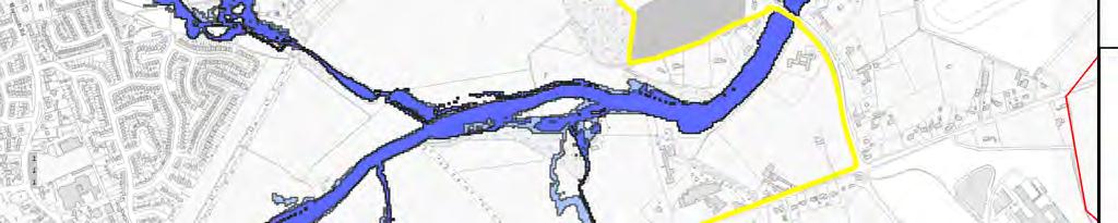


61
62
63 APPENDIX B Justification Test
64
.")


 Is essential to facilitate regenerationn and / or expansion of the centre of the urban settlement; The Maynooth Road is an important entry point to Celbridge from Maynooth and the M4 at the")
 Comprises significant previously developed and / or underutilized lands; The lands in this area comprise established settlements in the Forest Park estate.")
65 1 Celbridge Local Area Plan Forest Park Celbridge 1 The Regional Planning Guidelines for the Greater Dublin Area set out the planned direction for growth within the Greaterr Dublin Area up to 2022 by givingg regional effect to national planning policy under the National Spatial Strategy (NSS). Celbridge is designated as a moderatee Growth Town in the Kildare Development Plan and the Draft County Development Plan Detailed policy and zoning is provided under the Local Area Plan Arising from the RPGs and the Draft Kildare County Development Plan , a growth target of 3,250 units is prescribed for Celbridge between 2017 and The zoning or designation of the lands for the particular use or development type is required to achieve the proper planning and sustainable development of the urban settlement and in particular: Lands zoned B: Existing Residential & Infill are located in the Forest Park estate. This is an important land bank / entry point for the town located adjacent the Maynooth Road. (i) Is essential to facilitate regenerationn and / or expansion of the centre of the urban settlement; The Maynooth Road is an important entry point to Celbridge from Maynooth and the M4 at the northern edge of the town. The lands form an importantt expansion land bank for the town. (ii) Comprises significant previously developed and / or underutilized lands; The lands in this area comprise established settlements in the Forest Park estate. (iii) Is within or adjoining the core of an established or designated urban settlement; The site is located within the overall built envelope of the settlement, and the northern edge of the town. (iv) Will be essential in achieving compact and sustainable urban growth; and The development of lands in this area is considered to support strategic planning goals, and supports sustainable expansion of the town to meet the County Plan s Settlement Strategy (v) There are no suitable alternative lands for the particular use or development type, in areas at lower risk of flooding within or adjoining the core of the urban settlement. Having regard to the developed nature of the lands it is consideredd reasonable to retain the proposed use subject to the stipulation that the areas of the site inside the flood risk zone include measures to mitigate against flooding. Prior to any further development being permitted on this site a site specific flood risk assessment will have to be carried out to the satisfaction of Kildare County Council. 3 A flood risk assessment to an appropriate level of detail has been carried out as part of the Strategic Environmental Assessment as part of the development plan preparation process, which demonstrates that flood risk to the development can be adequately managed and the use or development of the lands will not cause unacceptable adverse impacts elsewhere. N.B. The acceptability or otherwise of levels of any residual risk should be made with considerationn for the proposed The Draft Final CFRAM flood mapping indicates that a small area of Forest Park falls within Flood Zone Flood Zone B. KCC carried out Justification Test and found that it is considered appropriate to retain the existing zonings. And any future development in this area of Forest Park should be subject to a site specific FRA. Site Specific FRAs should address the following: Apply sequential approach should be applied through site planning and should avoid encroachment onto, or loss of, the flood plain.


.")


66 development and the local context and should described in the relevant flood risk assessment be Highly Vulnerable Development shalll not be permitted in Flood Zone A or B. Should address climate change scenarios in relation to FFLs and potential mitigation measures. Finished floor levels should be above the 1% AEP level Bedrooms should be located in the upstairs of two story buildings. Flood resilient construction materials and fittings should be considered Proposals should not impede existing flow paths or cause flood risk impacts to the surrounding areas 2 Celbridge Local Area Plan Town Centre Mill Centre / Donaghcumper Celbridge 1 The Regional Planning Guidelines for the Greater Dublin Area set out the planned direction for growth within the Greater Dublin Area up to 2022 by giving regional effect to national planning policy under the National Spatial Strategy (NSS). Celbridgee is designated as a Moderatee Growth Town in the Kildare Development Plan and the Draft County Development Plan Detailed policy and zoning is provided under the Local Area Plan Arising from the RPGs and the Draft Kildare County Development Plan , a growth target of 3,250 units is prescribed for Celbridge between 2017 and The zoning or designation of the lands for the particular use or development type is required to achieve the proper planning and sustainable development of the urban settlement and in particular: The subject sites were zoned A: Town Centre and E: Community in the Celbridgee LAP The zoning objective policy is designed to support the function and vibrancy of the town centre and encourage town centre living with reduced need for vehicular trips. (i) Is essential to facilitate regenerationn and / or expansion of the centre of the urban settlement; The renewal and utilisation of A: Town Centre lands in Celbridge are essential to facilitate regeneration and urban expansion. Encouragingg renewal of the town centre as a preferred location is fundamental to the LAP s overall strategic objectives (ii) Comprises significant previously developed and / or underutilized lands; The lands generally comprise previously developed lands at the Mill Centree and underutilised lands in close proximity to the Main Street at Donaghcumper. (iii) Is within or adjoining the core of an established or designated urban settlement; The town centre sites are located within the historic urban core of the settlement.
67 (iv) Will be essential in achieving compact and sustainable urban growth; and The town centre sites are located at the core of the settlement. The development of lands in this area is considered to support strong strategic planning goals, support renewal of the town centre area, and the goal of achieving compact sustainable urban growth. Urban design guidance in the LAP emphasises the importance of compact urban from and sustainable growth in these locations. For the lands at Donaghcumper there is already a significant quantity of suitably zoned land that is not at risk of flooding adjacent to the town centre in Celbridge. These lands will facilitate the appropriate sustainable development in line with the proposed Settlement Strategy of the Kildare County Development Plan (v) There are no suitable alternative lands for the particular use or development type, in areas at lower risk of flooding within or adjoining the core of the urban settlement. The Mill Centre site is located at the core of the settlement and there are no other suitable lands. The development of lands in this area is considered to support strong strategic planning goals, support renewal of the town centre area, and the goal of achieving compact sustainable urban growth. Prior to any significant new development on the Mill Centre site being permitted a site specific flood risk assessment will have to be carried out to the satisfaction of Kildare County Council. The recommendations of this assessment will determine the location, type and quantum of development on this site. 3 A flood risk assessment to an appropriate level of detail has been carried out as part of the Strategic Environmental Assessment as part of the development plan preparation process, which demonstrates that flood risk to the development can be adequately managed and the use or development of the lands will not cause unacceptable adverse impacts elsewhere. N.B. The acceptability or otherwise of levels of any residual risk should be made with consideration for the proposed development and the local context and should be described in the relevant flood risk assessment The SFRA notes that the subject site at Donaghcumper has failed to pass the Justification Test and that the proposed land use has been reclassified to F: Open Space and Amenity in accordance with the Flood Risk Management Guidelines. The lands zoned A: Town Development have been maintained at the Mill Centre however any significant new development will be subject to a sitespecific FRA. Site Specific FRA should address the following: Apply sequential approach should be applied through site planning and should avoid encroachment onto, or loss of, the flood plain. Highly Vulnerable Development shall not be permitted in Flood Zone A or B. Should address climate change scenarios in relation to FFLs and potential mitigation measures. Finished floor levels should be above the 1% AEP level Flood resilient construction materials and fittings should be considered Proposals should not impede existing flow paths or cause flood risk impacts to the surrounding areas Celbridge was identified as an AFA in the Eastern CFAM study, the proposed flood risk management policies for shall be reviewed following publication of the Final Eastern CFRAM FRMP recommendations. The draft Eastern CFRAM FRMP has proposed flood defence works which would protect the areas adjacent to the Mill Centre against the 1% AEP event. Any FRA should be cognisant of the identified proposed flood defences on the school site.
.")


 Is essential to facilitate regenerationn and / or expansion of the centre of the urban settlement; Maintaining the existing zoning in this area is")
 Comprises significant previously developed and / or The lands in this area comprise established settlements in the Willow underutilized lands; Estate.")

 There are no suitable alternative lands for the particular use or development type, in areas at lower risk of flooding within or adjoining the core of the urban settlement.")
68 3 Celbridge Local Area Plan Primrose Gate, Celbridge 1 The Regional Planning Guidelines for the Greater Dublin Area set out the planned direction for growth within the Greater Dublin Area up to 2022 by giving regional effect to national planning policy under the National Spatial Strategy (NSS). Celbridgee is designated as a moderatee Growth Town in the Kildare Development Plan and the Draft County Development Plan Detailed policy and zoning is provided under the Local Area Plan Arising from the RPGs and the Draft Kildare County Development Plan , a growth target of 3,250 units is prescribed for Celbridge between 2017 and The zoning or designation of the lands for the particular use or development type is required to achieve the proper planning and sustainable development of the urban settlement and in particular: Lands zoned B: Existing Residential & Infill are located in the Willow Estate of Primrose Gate, Celbridge. This an important land bank for the town (i) Is essential to facilitate regenerationn and / or expansion of the centre of the urban settlement; Maintaining the existing zoning in this area is considered to support strategic planning goals, and sustainable growth through providing community and residential development in integrated manner in close proximity to neighbourhood and town centre facilities. (ii) Comprises significant previously developed and / or The lands in this area comprise established settlements in the Willow underutilized lands; Estate. (iii) Is within or adjoining the core of an established or designated urban settlement; The site is located on the edge of the existing built edge of the south eastern side of the town. The lands are situated besidee an existing local centre at Primrose Gate and St. Wolstons Shopping Centre, and bus routes along the R403 Dublin Road. (iv) Will be essential in achieving compact and sustainable urban growth; and The site is located on the edge of the settlement. The development of lands in this area is considered to support strategic planning goals, and sustainable growth through providing community and residential development in integrated manner in close proximity to neighbourhood and town centre facilities. (v) There are no suitable alternative lands for the particular use or development type, in areas at lower risk of flooding within or adjoining the core of the urban settlement. Having regard to the developed nature of the lands it is consideredd reasonable to retain the proposed use subject to the stipulation that the areas of the site inside the flood risk zone include measures to mitigate against flooding sizeable linear sections of the site are impacted upon by the flood zone and therefore unsuitable for certain sensitive uses. Prior to any further development being permitted on this site a site specific flood risk assessment will have to be carried out to the satisfaction of Kildare County


69 Council. 3 A flood risk assessment to an appropriate level of detail has been carried out as part of the Strategic Environmental Assessment as part of the development plan preparation process, which demonstrates that flood risk to the development can be adequately managed and the use or development of the lands will not cause unacceptable adverse impacts elsewhere. N.B. The acceptability or otherwise of levels of any residual risk should be made with considerationn for the proposed development and the local context and should be described in the relevant flood risk assessment The Draft Final CFRAM flood mapping indicates that a large area of the Willow Estate falls within Flood Zone Flood Zone B. KCC carried out Justification Test and found that it is considered appropriate to retain the existing zoning. And any future development in this area of Primrose Gate should be subject to a site specific FRA. Site Specific FRAs should address the following: Apply sequential approach should be applied through site planning and should avoid encroachment onto, or loss of, the flood plain. Highly Vulnerable Development shalll not be permitted in Flood Zone A or B. Should address climate change scenarios in relation to FFLs and potential mitigation measures. Finished floor levels should be above the 1% AEP level Bedrooms should be located in the upstairs of two story buildings. Flood resilient construction materials and fittings should be considered Proposals should not impede existing flow paths or cause flood risk impacts to the surrounding areas 4 Celbridge Local Area Plan Commons/Hazelhatch, Celbridgee 1 The Regional Planning Guidelines for the Greater Dublin Area set out the planned direction for growth within the Greater Dublin Area up to 2022 by giving regional effect to national planning policy under the National Spatial Strategy (NSS). Celbridgee is designated as a moderatee Growth Town in the Kildare Development Plan and the Draft County Development Plan Detailed policy and zoning is provided under the Local Area Plan Arising from the RPGs and the Draft Kildare County Development Plan , a growth target of 3,250 units is prescribed for Celbridge between 2017 and The zoning or designation of the lands for the particular use or development type is required to achieve the proper planning and sustainable development of the urban settlement and in particular: The subject lands were predominantly zoned B: Existing Residential & Infill, F: Open Space and Amenity and E: Community in the Celbridge LAP (i) Is essential to facilitate regenerationn and / or expansion The lands are located on the southern edge of the settlement and are not
70 of the centre of the urban settlement; essential to regeneration or expansion of the central area. (ii) Comprises significant previously developed and / or underutilized lands; The lands comprise previously developed individual dwellings and undeveloped greenfield lands/amenity lands. (iii) Is within or adjoining the core of an established or designated urban settlement; The site is located on the southern periphery of the settlement. (iv) Will be essential in achieving compact and sustainable urban growth; and The lands are located at the southern periphery of the settlement. The development of lands in this area does not support short term development objectives over the life of the LAP for compact growth or sustainable urban form. (v) There are no suitable alternative lands for the particular use or development type, in areas at lower risk of flooding within or adjoining the core of the urban settlement. There is already a significant quantity of suitably zoned land that is not at risk of flooding at various locations in Celbridge and in other areas of County Kildare. These lands will facilitate the appropriate sustainable development in line with the proposed Settlement Strategy of the Kildare County Development Plan A small number of existing properties at Commons on the R405 Road are impacted upon by Flood Zone B with flooding confined to green field areas within the sites.. The lands zoned B: Existing Residential & Infill have been maintained however any significant new development will be subject to a site specific FRA. The lands zoned E: Community & Educational will be maintained. However development will only be limited to community infrastructure e.g. playing pitches and associated infrastructure. Any development will be subject to a site specific FRA. 3 A flood risk assessment to an appropriate level of detail has been carried out as part of the Strategic Environmental Assessment as part of the development plan preparation process, which demonstrates that flood risk to the development can be adequately managed and the use or development of the lands will not cause unacceptable adverse impacts elsewhere. N.B. The acceptability or otherwise of levels of any residual risk should be made with consideration for the proposed development and the local context and should be described in the relevant flood risk assessment Site Specific FRA should address the following: Apply sequential approach should be applied through site planning and should avoid encroachment onto, or loss of, the flood plain. Highly Vulnerable Development shall not be permitted in Flood Zone A or B. Should address climate change scenarios in relation to FFLs and potential mitigation measures. Finished floor levels should be above the 1% AEP level Flood resilient construction materials and fittings should be considered Proposals should not impede existing flow paths or cause flood risk impacts to the surrounding areas Celbridge was identified as an AFA in the Eastern CFAM study, the proposed flood risk management policies for shall be reviewed following publication of the Final Eastern CFRAM FRMP recommendations. Due to the uncertainty encountered in the hydrological and hydraulic modelling of the Hazelhatch / Commons area the draft Eastern CFRAM FRMP has proposed that a detailed study be carried out to investigate non fluvial flooding sources in this region. Any FRAs should be cognisant of the potential for non fluvial flooding in this area and the proposed detailed study.
.")


 Is essential to facilitate regenerationn and / or expansion of the centre of the urban settlement; This land area is not considered essential to facilitate urban regenerationn and expansion where")
71 5 Celbridge Local Area Plan Newtown West, Celbridge 1 The Regional Planning Guidelines for the Greater Dublin Area set out the planned direction for growth within the Greater Dublin Area up to 2022 by giving regional effect to national planning policy under the National Spatial Strategy (NSS). Celbridgee is designated as a moderatee Growth Town in the Kildare Development Plan and the Draft County Development Plan Detailed policy and zoning is provided under the Local Area Plan. Arising from the RPGs and the Draft Kildare County Development Plan , a growth target of 3,250 units is prescribed for Celbridge between 2017 and The zoning or designation of the lands for the particular use or development type is required to achieve the proper planning and sustainable development of the urban settlement and in particular: This site was previously zoned C: New Residential in the Celbridge LAP (i) Is essential to facilitate regenerationn and / or expansion of the centre of the urban settlement; This land area is not considered essential to facilitate urban regenerationn and expansion where other alternatives are available. (ii) Comprises significant previously developed and / or underutilized lands; The lands generally comprise undevelopedd and underutilised lands. (iii) Is within or adjoining the core of an established or designated urban settlement; The site is located on the south western periphery of the town area. (iv) Will be essential in achieving compact and sustainable urban growth; and The development of lands in this areaa is not considered essential to achieving compact growth. (v) There are no suitable alternative lands for the particular use or development type, in areas at lower risk of flooding within or adjoining the core of the urban settlement. There is already a significant quantity of suitably zoned land that is not at risk of flooding at various locations in Celbridge lands will facilitate the appropriate sustainable development in line with the proposed Settlement Strategy of the Kildare County Development Plan A significant section of the site is impacted upon by the flood zone and thereforee is unsuitable for certain sensitivee uses. 3 A flood risk assessment to an appropriate level of detail has been carried out as part of the Strategic Environmental Assessment as part of the development plan preparation process, which demonstrates that flood risk to the development can be adequately managed and the use or development of the lands will not cause unacceptable adverse impacts elsewhere. N.B. The acceptability or otherwise of levels of any residual risk should be made with considerationn for the proposed The SFRA notes that the subject site at Newtown has failed to pass the Justification Test and thatt the proposed land use has been reclassified as I: Agriculture. Also the extent of the C: New Residential Zoning will be reducedd to outside the identified Flood Zones in accordance with the Flood Risk Management Guidelines. However the new residential development site should still be subject to a Site Specific FRA to confirm the flood zones adjacent to site.


.")


72 development and the local context and should described in the relevant flood risk assessment be Site Specific FRA should address the following: Confirm Flood Zones A and B adjacent to the site. Apply sequential approach should be applied through site planning and should avoid encroachment onto, or loss of, the flood plain. Highly Vulnerable Development shall not be permitted in Flood Zone A or B. Should address climate change scenarios in relation to FFLs and potential mitigation measures. Finished floor levels should be above the 1% AEP level Proposals should not impede existing flow paths or cause flood risk impacts to the surrounding areas 6 Celbridge Local Area Plan Simmonstown, Celbridge 1 The Regional Planning Guidelines for the Greater Dublin Area set out the planned direction for growth within the Greater Dublin Area up to 2022 by giving regional effect to national planning policy under the National Spatial Strategy (NSS). Celbridgee is designated as a moderatee Growth Town in the Kildare Development Plan and the Draft County Development Plan Detailed policy and zoning is provided under the Local Area Plan. Arising from the RPGs and the Draft Kildare County Development Plan , a growth target of 3,250 units is prescribed for Celbridge between 2017 and The zoning or designation of the lands for the particular use or development type is required to achieve the proper planning and sustainable development of the urban settlement and in particular: The subject lands were previously zoned B: Existing Residential & Infill and C: New Residential in the Celbridge LAP (i) Is essential to facilitate regenerationn and / or expansion of the centre of the urban settlement; Maintaining the existing zoning in this area is considered to support strategic planning goals, and sustainable growth through providing community and residential development in integrated manner in close proximity to neighbourhood and town centre facilities. (ii) Comprises significant previously developed and / or underutilized lands; The most southerly lands generally comprise undeveloped and underutilisedd lands. The existing residential lands in this area comprise established settlements on the Newtown Road and in Chelmsford Manor.
73 (iii) Is within or adjoining the core of an established or designated urban settlement; The site is located on the south western periphery of the town area. (iv) Will be essential in achieving compact and sustainable urban growth; and The site is located on the edge of the settlement. The development of lands in this area is considered to support strategic planning goals, and sustainable growth through providing community and residential development in integrated manner in close proximity to neighbourhood and town centre facilities. (v) There are no suitable alternative lands for the particular use or development type, in areas at lower risk of flooding within or adjoining the core of the urban settlement. Having regard to the developed nature of the lands it is considered reasonable to retain the proposed use subject to the stipulation that the areas of the site inside the flood risk zone include measures to mitigate against flooding sizeable linear sections of the site are impacted upon by the flood zone and therefore unsuitable for certain sensitive uses. Prior to any further development being permitted on this site a site specific flood risk assessment will have to be carried out to the satisfaction of Kildare County Council. 3 A flood risk assessment to an appropriate level of detail has been carried out as part of the Strategic Environmental Assessment as part of the development plan preparation process, which demonstrates that flood risk to the development can be adequately managed and the use or development of the lands will not cause unacceptable adverse impacts elsewhere. N.B. The acceptability or otherwise of levels of any residual risk should be made with consideration for the proposed development and the local context and should be described in the relevant flood risk assessment The lands zoned B: Existing Residential & Infill have been maintained however any significant new development will be subject to a site specific FRA. The flood risk to the lands zoned C: New Residential is confined to the north eastern corner of the site and any new development will be subject to a site specific FRA. Site Specific FRA should address the following: Apply sequential approach should be applied through site planning and should avoid encroachment onto, or loss of, the flood plain. Highly Vulnerable Development shall not be permitted in Flood Zone A or B. Should address climate change scenarios in relation to FFLs and potential mitigation measures. Finished floor levels should be above the 1% AEP level Flood resilient construction materials and fittings should be considered Proposals should not impede existing flow paths or cause flood risk impacts to the surrounding areas Celbridge was identified as an AFA in the Eastern CFAM study, the proposed flood risk management policies for shall be reviewed following publication of the Final Eastern CFRAM FRMP recommendations. The draft Eastern CFRAM FRMP has proposed channel conveyance improvement works in this area. Any FRA should be cognisant of the identified proposed works adjacent to the subject lands.
.")


74 7 Celbridge Local Area Plan Oldtown Celbridge Zoning 1 The Regional Planning Guidelines for the Greater Dublin Area set out the planned direction for growth within the Greater Dublin Area up to 2022 by giving regional effect to national planning policy under the National Spatial Strategy (NSS). Celbridgee is designated as a moderatee Growth Town in the Kildare Development Plan and the Draft County Development Plan Detailed policy and zoning is provided under the Local Area Plan Arising from the RPGs and the Draft Kildare County Development Plan , a growth target of 3,250 units is prescribed for Celbridge between 2017 and The zoning or designation of the lands for the particular use or development type is required to achieve the proper planning and sustainable development of the urban settlement and in particular: Development of the overall landholding is covered by KDA 3 Oldtown which seeks to ensure that new residential communities are delivered along with key and recreation and amenity infrastructure in this area. The subject site is predominantly zoned C: New Residential and F: Open Space and Amenity. The wider area is included as strategic reserve lands so as to ensure that any development with the KDA has regard to a long term vision for the northern edge of the town. This is an important land bank for the town, and seeks to locate new residential communities close to schools and infrastructure at the north west sector of the town. (i) Is essential to facilitate regenerationn and / or expansion of the centre of the urban settlement; The provision of new development and community facilities at Oldtown is an essential part of facilitating expansionn of Celbridge, serving a growingg residential community in the short term, and supporting the development close to school sites. (ii) Comprises significant previously developed and / or The lands are generally greenfield in nature on the edge of the town, and underutilized lands; may be considered underutilised. (iii) Is within or adjoining the core of an established or designated urban settlement; The site is located on the edge of the existing built edge of the north western side of the town. The nearby location of the school site will encourage walking and cycling access and the town core area is also accessiblee within cycling distance. (iv) Will be essential in achieving compact and sustainable urban growth; and The site is located on the edge of the settlement. The development of lands in this area is considered to support strategic planning goals, and sustainable growth through providing community and residential development in integrated manner in close proximity to community facilities. (v) There are no suitable alternative lands for the There is already a significant quantity of suitably zoned land that is not at


 and Circular PL02/2014 (August 2014).")


 1 The")

75 particular use or development type, in areas at lower risk of flooding within or adjoining the core of the urban settlement. risk of flooding at various locations in Celbridge and in other areas of County Kildare. These lands will facilitate the appropriate sustainable development in line with the proposed Settlement Strategy of the Kildare County Development Plan A flood risk assessment to an appropriate level of detail has been carried out as part of the Strategic Environmental Assessment as part of the development plan preparation process, which demonstrates that flood risk to the development can be adequately managed and the use or development of the lands will not cause unacceptable adverse impacts elsewhere. N.B. The acceptability or otherwise of levels of any residual risk should be made with considerationn for the proposed development and the local context and should be described in the relevant flood risk assessment A section of the site is impacted upon by a linear flood zone and therefore is unsuitable for certain sensitive uses. Along with residential an objective to provide Open Space and Amenity on the site has been proposed. Prior to any development being permitted on this site a site specific flood risk assessment will have to be carried out to the satisfaction of Kildare County Council. The recommendations of this assessment will determine the location, type and quantum of development on this site. The flood risk for these lands is confined to close proximity of the riverbank. A site specific FRA should be carried out for development on these lands in accordance with The Planning System and Flood Risk Assessment Guidelines for Planning Authorities (2009) and Circular PL02/2014 (August 2014). Site Specific FRA should address the following: Apply sequential approach should be applied through site planning and should avoid encroachment onto, or loss of, the flood plain. Highly Vulnerable Development shall not be permitted in Flood Zone A or B. Should address climate change scenarios in relation to FFLs and potential mitigation measures. Finished floor levels should be above the 1% AEP level Proposals should not impede existing flow paths or cause flood risk impacts to the surrounding areas 8 Celbridge Local Area Plan Simmonstown (Extension) 1 The Regional Planning Guidelines for the Greater Dublin Area set out the planned direction for growth within the Greater Dublin Area up to 2022 by giving regional effect to national planning policy under the National Spatial Strategy (NSS). Celbridgee is designated as a moderatee Growth Town in the Kildare Development Plan and the Draft County Development Plan Detailed policy and zoning is provided under the Local Area Plan. Arising from the RPGs and the Draft Kildare County Development Plan , a growth target of 3,250 units is prescribed for Celbridge between
76 2017 and The zoning or designation of the lands for the particular use or development type is required to achieve the proper planning and sustainable development of the urban settlement and in particular: The subject lands were previously zoned B: Existing Residential & Infill, C: New Residential and I: Agricultural in the Celbridge LAP Development of the overall landholding is covered by KDA 5 Simmonstown which seeks to ensure that new residential communities are delivered along with key and recreation and amenity infrastructure in this area. The subject site is predominantly zoned C: New Residential. The wider area is included as strategic reserve lands so as to ensure that any development with the KDA has regard to a long term vision for the eastern edge of the town. This is an important land bank for the town, and seeks to locate new residential communities close to infrastructure at the east sector of the town. (i) Is essential to facilitate regeneration and / or expansion of the centre of the urban settlement; Maintaining the existing zoning in this area is considered to support strategic planning goals, and sustainable growth through providing community and residential development in integrated manner in close proximity to neighbourhood and town centre facilities. (ii) Comprises significant previously developed and / or underutilized lands; The lands are generally greenfield in nature on the edge of the town, and may be considered underutilised. The existing residential lands in this area comprise established settlements on the Newtown Road and in Chelmsford Manor. (iii) Is within or adjoining the core of an established or designated urban settlement; The site is located on the south western periphery of the town area. (iv) Will be essential in achieving compact and sustainable urban growth; and The site is located on the edge of the settlement. The development of lands in this area is considered to support strategic planning goals, and sustainable growth through providing community and residential development in integrated manner in close proximity to neighbourhood and town centre facilities. 3 (v) There are no suitable alternative lands for the particular use or development type, in areas at lower risk of flooding within or adjoining the core of the urban settlement. A flood risk assessment to an appropriate level of detail has been carried out as part of the Strategic Environmental Assessment as part of the development plan preparation process, which demonstrates that flood risk to the development can be adequately managed and the use or development of the lands will not cause unacceptable adverse impacts elsewhere. N.B. The acceptability or otherwise of levels of any residual risk should be made with consideration for the proposed development and the local context and should be described in the relevant flood risk assessment Having regard to the developed nature of the lands it is considered reasonable to retain the proposed use subject to the stipulation that the areas of the site inside the flood risk zone include measures to mitigate against flooding sizeable linear sections of the site are impacted upon by the flood zone and therefore unsuitable for certain sensitive uses. Prior to any further development being permitted on this site a site specific flood risk assessment will have to be carried out to the satisfaction of Kildare County Council. The lands zoned B: Existing Residential & Infill have been maintained however any significant new development will be subject to a site specific FRA. The flood risk to the lands zoned C: New Residential is confined to the southern portion of the site and any new development will be subject to a site specific FRA. Site Specific FRA should address the following: Apply sequential approach should be applied through site planning and should avoid encroachment onto, or loss of, the flood plain. Highly Vulnerable Development shall not be permitted in Flood Zone A or B. Should address climate change scenarios in relation to FFLs and potential mitigation measures. Finished floor levels should be above the 1% AEP level Flood resilient construction materials and fittings should be considered Proposals should not impede existing flow paths or cause flood risk impacts to the surrounding areas Celbridge was identified as an AFA in the Eastern CFAM study, the proposed flood risk management policies for shall be reviewed following publication of the draft Final Eastern CFRAM FRMP recommendations. The draft Eastern CFRAM FRMP has proposed channel conveyance improvement works in this area. Any FRA should be cognisant of the identified proposed works adjacent to the subject lands.
.")


77 9 Celbridge Local Area Plan Newtown East 1 The Regional Planning Guidelines for the Greater Dublin Area set out the planned direction for growth within the Greater Dublin Area up to 2022 by giving regional effect to national planning policy under the National Spatial Strategy (NSS). Celbridgee is designated as a moderatee Growth Town in the Kildare Development Plan and the Draft County Development Plan Detailed policy and zoning is provided under the Local Area Plan. Arising from the RPGs and the Draft Kildare County Development Plan , a growth target of 3,250 units is prescribed for Celbridge between 2017 and The zoning or designation of the lands for the particular use or development type is required to achieve the proper planning and sustainable development of the urban settlement and in particular: The Newtown sites were previously zoned C: New Residential in the Celbridgee LAP (i) Is essential to facilitate regenerationn and / or expansion of the centre of the urban settlement; Maintaining the existing zoning in this area is considered to support strategic planning goals, and sustainable growth through providing community and residential development in integrated manner in close proximity to neighbourhood and town centre facilities. (ii) Comprises significant previously developed and / or underutilized lands; The lands generally comprise undeveloped and underutilised lands. The existing residential lands in this area comprise established settlements on the Newtown Road and in Chelmsford Manor. (iii) Is within or adjoining the core of an established or designated urban settlement; The site is located on the southwestern periphery of the town area. (iv) Will be essential in achieving compact and sustainable urban growth; and The Newtown sites are located on the edge of the settlement. The development of lands in this area is considered to support strategic planning goals, and sustainable growth through providing community and residential development in integrated manner in close proximity to neighbourhood and town centre facilities. (v) There are no suitable alternative lands for the particular use or development type, in areas at lower risk of flooding within or adjoining the core of the urban settlement. Having regard to the developed nature of the lands it is consideredd reasonable to retain the proposed use subject to the stipulation that the areas of the site inside the flood risk zone include measures to mitigate against flooding sizeable linear sections of the site are impacted upon by the flood zone and therefore unsuitable for certain sensitive uses. Prior to any further development being permitted on this site a site specific flood risk assessment will have to be carried out to the satisfaction of Kildare County Council.
Strategic Flood Risk Assessment for SDCC Development Plan
 Strategic Flood Risk Assessment for SDCC Development Plan Detailed Report on Flood Risk in the Baldonnell Area 8 th May 2015 rpsgroup.com/ireland Strategic Flood Risk Assessment for SDCC Development Plan
Strategic Flood Risk Assessment
 Strategic Flood Risk Assessment Draft Claremorris Local Area Plan 2012 2018 Prepared by Forward Planning Section Mayo County Council 1 Table of Contents Section 1: Overview of the Guidelines... 4 1.1 Introduction...
Strategic Flood Risk Assessment
 Strategic Flood Risk Assessment Ireland West Airport Knock Local Area Plan 2012 2018 Prepared by Forward Planning Section Mayo County Council 0 1 Table of Contents Section 1: Overview of the Guidelines...
STRATEGIC FLOOD RISK ASSESSMENT
 STRATEGIC FLOOD RISK ASSESSMENT FOR PROPOSED VARIATION NO. 1 (CORE STRATEGY) TO THE LONGFORD TOWN DEVELOPMENT PLAN 2009-2015 for: Longford Local Authorities Great Water Street, Longford, Co. Longford by:
Strategic Flood Risk Assessment
 PLANNING DEPARTMENT, KILKENNY COUNTY COUNCIL Strategic Flood Risk Assessment Proposed Amendment No. 2 of Callan Local Area Plan 2009-2020 Forward Planning January 2016 This Strategic Flood Risk Assessment
Document Control Sheet
 Strategic Flood Risk Assessment of the Maynooth Local Area Plan 2013-2019 Proposed Amendment No. 1 Document Control Sheet Client: Project Title: Document Title: Document No: Kildare County Council Strategic
Planning and Flood Risk
 Planning and Flood Risk Patricia Calleary BE MEngSc MSc CEng MIEI After the Beast from the East Patricia Calleary Flood Risk and Planning Flooding in Ireland» Floods are a natural and inevitable part of
BLESSINGTON LOCAL AREA PLAN FLOOD RISK ASSESSMENT
 BLESSINGTON LOCAL AREA PLAN 2013-2019 FLOOD RISK ASSESSMENT Table of Contents Page Number 1.0 INTRODUCTION 1 1.1 Definition of Flooding 2 1.2 Policy Framework 2 1.3 Flood Risk Identification 3 1.4 Mapping
Strategic Flood Risk Assessment. SFRA Report
 Strategic Flood Risk Assessment SFRA Report on Strandhill Mini-Plan Variation No.1 of the Sligo County Development Plan 2011-2017 Prepared by Contents 1. The context for the Flood Risk Assessment 1 2.
Sequential Flood Risk Test for Mid Sussex Neighbourhood Plans
 Sequential Flood Risk Test for Mid Sussex Neighbourhood Plans Introduction This Sequential Test has been prepared to assess the flood risk of sites within the parish that have been identified as suitable,
Strategic Flood Risk Assessment
 Gorey Town and Environs Local Area Plan 207-2023 Appendix 4 Strategic Flood Risk Assessment April 207 Table of Contents Introduction and Context.... Introduction....2 Legislative and Planning context....2.
Comhairle Baile Cheanntair~ Nás na Ríogh
 Comhairle Baile Cheanntair~ Nás na Ríogh DRAFT STRATEGIC FLOOD RISK ASSESSMENT NAAS TOWN DEVELOPMENT PLAN 2011 ~ 2017 Kildare County Council Water Services Department Aras Chill Dara Devoy Park Naas County
Flood Risk and Land Use Vulnerability Guidance
 Flood Risk and Land Use Vulnerability Guidance UPS-BP-GU2a v.2 UNCONTROLLED DOCUMENT WHEN PRINTED Pag SCOTTISH ENVIRONMENT PROTECTION AGENCY Identifier: LUPS-GU24 Land Use Planning System SEPA Guidance
Appendix 12.3 Flood Risk Assessment
 Appendix 12.3 Flood Risk Assessment Contents A12.3-1.1 Scope of Work 1 A12.3-1.2 Summary of Data Used 1 A12.3-1.3 Proposed Project 2 A12.3-2.1 The Planning System and Flood Risk Management Guidelines 2
FOR TO THE GAELTACHT LOCAL AREA PLAN MARCH 2013
 APPENDIX II TO THE SEA ENVIRONMENTAL REPORT STAGE 2 STRATEGIC FLOOD RISK ASSESSMENT FOR PROPOSED AMENDMENT TO THE GAELTACHT LOCAL AREA PLAN 2008-2014 for: Galway County Council County Buildings Prospect
Flood Risk Assessment Appendix 1 to Strategic Environmental Assessment Screening of Amendment No. 1 to Ferrybank/Belview Local Area Plan
 Flood Risk Assessment Appendix 1 to Strategic Environmental Assessment Screening of Amendment No. 1 to Ferrybank/Belview Local Area Plan Forward Planning Kilkenny County Council 18/8/2011 1 Introduction
The Planning System and Flood Risk Management Guidelines for Planning Authorities
 Technical Appendices November 2009 Contents PAGE A. Identification and Assessment of Flood Risk 1 B. Addressing Flood Risk Management in Design of Development 35 A Appendix A: Identification and Assessment
STAGE 2 STRATEGIC FLOOD RISK ASSESSMENT (AS AMENDED)
") STAGE 2 STRATEGIC FLOOD RISK ASSESSMENT (AS AMENDED) FOR PROPOSED AMENDMENTS TO THE CLIFDEN LOCAL AREA PLAN 2009-2015 for: Galway County Council County Buildings Prospect Hill Galway by: CAAS Ltd. 2 nd
STAGE 2 STRATEGIC FLOOD RISK ASSESSMENT (AS AMENDED) FOR PROPOSED AMENDMENTS TO THE CLIFDEN LOCAL AREA PLAN 2009-2015 for: Galway County Council County Buildings Prospect Hill Galway by: CAAS Ltd. 2 nd
Laois County Council Comhairle Chontae Laoise STRATEGIC FLOOD RISK ASSESSMENT PORTLAOISE DRAFT LOCAL AREA PLAN
 Laois County Council Comhairle Chontae Laoise STRATEGIC FLOOD RISK ASSESSMENT PORTLAOISE DRAFT LOCAL AREA PLAN 2018 2024 CONTENTS PORTLAOISE... 0 DRAFT LOCAL AREA PLAN... 0 2018 2024... 0 LIST OF FIGURES...
Flood Risk Assessment Cobh Town Plan Cobh Town Development Plan Volume 2: Strategic Flood Risk Assessment
 Flood Risk Assessment Cobh Town Plan 2013 Cobh Town Development Plan 2013 Volume 2: Strategic Flood Risk Assessment Cobh Town Plan 2013 Flood Risk Assessment Document Verification Page 1 of 1 Job Title:
Woodbrook - Shanganagh
 Strategic Flood Risk Assessment (SFRA) Woodbrook - Shanganagh Local Area Plan 2017-2023 Appendix 7 Strategic Flood Risk Assessment (SFRA) Woodbrook-Shanganagh Local Area Plan 2017-2023 August 2017 Appendix
Flood Risk Assessment Appendix 1 to Strategic Environmental Assessment of Ferrybank/Belview Local Area Plan 2017
 Flood Risk Assessment Appendix 1 to Strategic Environmental Assessment of Ferrybank/Belview Local Area Plan 2017 Forward Planning Kilkenny County Council June 2017 Contents 1 Introduction... 1 1.1 Disclaimer...
CHAPTER 10 FLOOD RISK
 CHAPTER 10 FLOOD RISK 10.1 Introduction and Key Issues 10.1.1 This chapter describes the likely effects that the construction and operation of the Upgrade will have on flood risk. The potential effects
STRATEGIC FLOOD RISK ASSESSMENT
 STRATEGIC FLOOD RISK ASSESSMENT UNDERTAKEN AS PART OF THE PREPARATION OF PROPOSED VARIATION NO. 2 (A) TO THE GALWAY COUNTY DEVELOPMENT PLAN 2015-2021 BEARNA PLAN for: Galway County Council Áras an Chontae
Engineers Ireland Annual Conference
 Engineers Ireland Annual Conference MANAGING FLOOD RISK AND BUILDING SUSTAINABLE COMMUNITIES Mark Adamson Office of Public Works 15 th May, 2015 FLOOD RISK IN IRELAND RECENT FLOODS November 2009: >1,600
Celbridge, Co Kildare
 Celbridge, Co Kildare Flood Risk Assessment December 2018 Oldtown, Celbridge, Co. Kildare. JBA Project Manager David Casey Unit 3, Block 660 Greenogue Business Plaza, Greenogue Rathcoole, Dublin Revision
Draft Regional Spatial & Economic Strategy
 Eastern & Midland Regional Assembly Draft Regional Spatial & Economic Strategy Regional Flood Risk Appraisal Report Tionól Reigiúnach Oirthir agus Lár-Tíre Eastern and Midland Regional Assembly TABLE OF
Strategic Flood Risk Assessment Report. Ireland 2040 Our Plan Draft National Planning Framework
 Strategic Flood Risk Assessment Report Ireland 2040 Our Plan Draft National Planning Framework TABLE OF CONTENTS 1 INTRODUCTION... 1 1.1 OBJECTIVE... 1 1.2 SFRA INTEGRATION WITH THE DRAFT NPF... 1 1.3
Broad-Scale Assessment of Urban Flood Risk Mark G. E. Adamson 1
 Broad-Scale Assessment of Urban Flood Risk Mark G. E. Adamson 1 1 Office of Public Works, Trim, Co. Meath, Ireland Abstract The Directive on the assessment and management of flood risks (2007/60/EC The
Volume. 10c. Clare County Development Plan Strategic Flood Risk Assessment
 Volume 10c Clare County Development Plan 2017 2023 Strategic Flood Risk Assessment Elizabeth Russell 24 Grove Island Corbally Limerick Ireland This report describes work commissioned by Brian McCarthy,
Guildford Borough Level 1 Strategic Flood Risk Assessment Summary Report. January 2016
 Guildford Borough Level 1 Strategic Flood Risk Assessment Summary Report January 2016 What is this document? This document provides a summary of Guildford Borough Strategic Flood Risk Assessment (SFRA,
Environment Agency pre-application advice incorporating Local Flood Risk Standing Advice from East Lindsey District Council
 Environment Agency pre-application advice incorporating Local Flood Risk Standing Advice from East Lindsey District Council Version 1 UNCLASSIFIED We are the Environment Agency. We protect and improve
STAGE 2 STRATEGIC FLOOD RISK ASSESSMENT
 STAGE 2 STRATEGIC FLOOD RISK ASSESSMENT FOR THE GORT LOCAL AREA PLAN2013-2019 for: Galway County Council County Buildings Prospect Hill Galway by: CAAS Ltd. 2 nd Floor, The Courtyard 25 Great Strand Street
Flood Risk Sequential Test
 Flood Risk Sequential Test Assessment of Proposed Development Sites Stroud District Council Evidence Base (December 2013) Development and Flood Risk Sequential Test 1.0 Introduction 1.1 This document considers
Chapter Flood Consequences
 Chapter 2.16. Flood Consequences 438 16. Flood Consequences 16.1. Introduction and Scope of Topic 16.1.1. This chapter identifies and describes the existing flood risk features along the route of the Scheme
Lowestoft. Summary 2016 FLOOD RISK MANAGEMENT. Mike Page
 Mike Page Lowestoft FLOOD RISK MANAGEMENT Strategy Summary 2016 Introduction This Strategy Summary Document is a brief overview of the Strategy for managing the risk of flooding to Lowestoft from the sea,
Unique ID: (from PFRA database) Location: Nenagh, Co. Tipperary. Stage 1: Desktop Review
 Location: Nenagh, Co. Tipperary. Stage 1: Desktop Review") Location: Nenagh, Co. Tipperary Unique ID: 250432 (from PFRA database) Initial OPW Designation APSR AFRR IRR Co-ordinates Easting: 186604 Northing: 178781 River / Catchment / Sub-catchment Nenagh River
Location: Nenagh, Co. Tipperary Unique ID: 250432 (from PFRA database) Initial OPW Designation APSR AFRR IRR Co-ordinates Easting: 186604 Northing: 178781 River / Catchment / Sub-catchment Nenagh River
Objectives of this Briefing
 Eastern CFRAM Study (Catchment Flood Risk Assessment & Management) Stakeholders Briefing Poddle & Camac Watercourses Overview Grace Glasgow July 2013 Burns Beach near Brighton, Western Australia RPS has
Unique ID: (from PFRA database) Location: Bridgetown, Co. Clare. Stage 1: Desktop Review
 Location: Bridgetown, Co. Clare. Stage 1: Desktop Review") Location:, Co. Clare Unique ID: 250412 (from PFRA database) Initial OPW Designation APSR AFRR IRR Co-ordinates Easting: 164500 Northing: 168500 River / Catchment / Sub-catchment Black River / Shannon Type
Location:, Co. Clare Unique ID: 250412 (from PFRA database) Initial OPW Designation APSR AFRR IRR Co-ordinates Easting: 164500 Northing: 168500 River / Catchment / Sub-catchment Black River / Shannon Type
East Meath Local Area Plan
 East Meath Local Area Plan 2014-2020 Bettystown / Laytown / Mornington East / Donacarney / Mornington Volume 3 Appendix C Strategic Flood Risk Assessment Copyright JBA Consulting Engineers and Scientists
Development and Flood Risk - the Environment Agency s approach to PPS25. scrutinised before planning decisions are made
 Development and Flood Risk - the Environment Agency s approach to PPS25 Steve Cook Flood Risk Policy Advisor Stephen.cook@environment-agency.gov.uk Our role in PPS25 h Providing advice and information
Flood Risk Management in Ireland. The National CFRAM Programme & overview of the Capital Works Programme. Click to add text
 Flood Risk Management in Ireland The National CFRAM Programme & overview of the Capital Works Programme Click to add text Dr. John Martin Office of Public Works Engineers Ireland's Local Government Seminar
THE EU FLOODS DIRECTIVE:
 Sixth Bulgarian Austrian Seminar THE EU FLOODS DIRECTIVE: EUROPEAN PRACTICE AND RESEARCH IN FLOOD RISK MANAGEMENT Mark Adamson Co-Chair, Working Group F Office of Public Works, IE 7 th November, 2013 PRESENTATION
DRAFT STRATEGIC ENVIRONMENTAL ASSESSMENT SCREENING REPORT. Climate Change Sectoral Adaptation Plan for Flood Risk Management ( )
") Office of Public Works DRAFT STRATEGIC ENVIRONMENTAL ASSESSMENT SCREENING REPORT Climate Change Sectoral Adaptation Plan for Flood Risk Management (2014-2019) Determination of the need for strategic environmental
Office of Public Works DRAFT STRATEGIC ENVIRONMENTAL ASSESSMENT SCREENING REPORT Climate Change Sectoral Adaptation Plan for Flood Risk Management (2014-2019) Determination of the need for strategic environmental
DRAFT APPROPRIATE ASSESSMENT SCREENING REPORT
 DRAFT APPROPRIATE ASSESSMENT SCREENING REPORT Climate Change Sectoral Adaptation Plan for Flood Risk Management (2014-2019) 2538_RP/003/C FRAM Section Office of Public Works 2538_RP/003/D CONTENTS 1.0
STRATEGIC FLOOD RISK ASSESSMENT
 STRATEGIC FLOOD RISK ASSESSMENT UNDERTAKEN AS PART OF THE PREPARATION OF PROPOSED VARIATION NO. 2 (B) TO THE GALWAY COUNTY DEVELOPMENT PLAN 2015-2021 GAELTACHT PLAN (INCLUDING SETTLEMENTS OF AN CHEATHRÚ
MONAGHAN COUNTY COUNCIL. Strategic Flood Risk Assessment for County Monaghan
 MONAGHAN COUNTY COUNCIL Strategic Flood Risk Assessment for County Monaghan November2017 Table of Contents 1.0: Introduction Page: 5 1.1: Objectives Page: 5 1.2: Study Area Page: 5 1.3: EU Floods Directive
Strategic Flood Risk Management
 Strategic Management Duncan McLuckie (NSW Department of Infrastructure and Natural Resources) Introduction This paper discusses what is meant by strategic flood risk management, who is responsible in New
STAGE 2 STRATEGIC FLOOD RISK ASSESSMENT LONGFORD COUNTY DEVELOPMENT PLAN FEBRUARY 2015 FOR THE. Longford County Council. CAAS Ltd.
 STAGE 2 STRATEGIC FLOOD RISK ASSESSMENT FOR THE LONGFORD COUNTY DEVELOPMENT PLAN 2015-2021 for: Longford County Council Great Water Street Longford County Longford by: CAAS Ltd. 2 nd Floor, The Courtyard
Flood Risk Assessment for Planning
 Flood Risk Assessment for Planning Report on: Sample Property, Sample Town, Sample Postcode Report prepared for: Report Reference: Report Date: Sample AEL-XXXX-FRA-XXXX 28 th October 2016 Client Reference:
FLOOD RISK MANAGEMENT IN IRELAND
 National Flood Management Conference 2018 FLOOD RISK MANAGEMENT IN IRELAND Mark Adamson Office of Public Works 15 th March, 2018 FLOOD RISK IN IRELAND NATIONAL RISK ASSESSMENT, OEP 2012 Flooding: Joint
LLDC Flood Risk Review Summary Report. Issue 2 13 January 2017
 Issue 2 13 January 2017 This report takes into account the particular instructions and requirements of our client. It is not intended for and should not be relied upon by any third party and no responsibility
A vibrant community offering a new way of living. Clonburris Strategic Development Zone (SDZ) Draft Planning Scheme. Strategic Flood Risk Assessment
 Draft Planning Scheme. Strategic Flood Risk Assessment") A vibrant community offering a new way of living Clonburris Strategic Development Zone (SDZ) Draft Planning Scheme Strategic Flood Risk Assessment September 2017 Contents 1 Introduction... 1 1.1 Terms
A vibrant community offering a new way of living Clonburris Strategic Development Zone (SDZ) Draft Planning Scheme Strategic Flood Risk Assessment September 2017 Contents 1 Introduction... 1 1.1 Terms
2018 PREPARING FOR A CHANGING CLIMATE AND MANAGING THE RISING FLOOD RISK
 Ireland Water 2018 PREPARING FOR A CHANGING CLIMATE AND MANAGING THE RISING FLOOD RISK Mark Adamson Office of Public Works 25 th April, 2018 FLOOD RISK IN IRELAND NATIONAL RISK ASSESSMENT, OEP 2012 & 2017
SFRA for Variation 6a of the Limerick City Development Plan
 SFRA for Variation 6a of the Limerick City Development Plan 2010-2016 Strategic Flood Risk Assessment February 2017 Economic Development & Strategic Planning Limerick City & County Council 7-8 Patrick
Strategic Flood Risk Assessment (SFRA)
") Draft Sligo County Development Plan 2017-2023 for public consultation September 2016 Strategic Flood Risk Assessment (SFRA) Strategic Flood Risk Assessment (SFRA) of the Draft Sligo County Development
Draft Sligo County Development Plan 2017-2023 for public consultation September 2016 Strategic Flood Risk Assessment (SFRA) Strategic Flood Risk Assessment (SFRA) of the Draft Sligo County Development
Flood Risk Management Strategy. Shetland
 Flood Risk Management Strategy Shetland Publication date: 14 December 2015 Terms and conditions Ownership: All intellectual property rights for Flood Risk Management Strategies are owned by SEPA or its
FLOOD SOLUTIONS Residence
 FLOOD SOLUTIONS Residence Report prepared on 22 Knighton Road, Liverpool, L4 9RD Report reference AEL028FLR022381 National grid reference 337815, 394462 Report prepared for Specimen Client Client reference
Chelmsford City Council. Level 1 and Level 2 Strategic Flood Risk Assessment. Final Report
 Chelmsford City Council Level 1 and Level 2 Strategic Flood Risk Assessment Final Report October 2017 This page has been left intentionally blank 2015s3715 Chelmsford SFRA L1 and L2 Final Report v1.0.docx
LOW. Overall Flood risk. Flood considerations. Specimen Address, Specimen Town. Rivers and the Sea Low page 4. Historic Flood.
 Specimen Address, Specimen Town Overall Flood risk LOW Crown copyright and database rights 2018. Ordnance Survey licence 100035207 Groundsure Floodview complies with relevant Law Society practice notes
Solway Local Plan District 1 Flood risk management in Scotland 1.1 What is a Flood Risk Management Strategy? Flood Risk Management Strategies have bee
 Flood Risk Management Strategy Solway Local Plan District Section 1: Flood Risk Management in Scotland 1.1 What is a Flood Risk Management Strategy?... 1 1.2 How to read this Strategy... 1 1.3 Managing
Good Practice Guide. GPG 101 Document Owner: Steve Cook. Page 1 of 7.
 Good Practice Guide Producing flood risk hydraulic models and flood consequence assessments for development planning purposes Date Published: September 2015 GPG 101 Document Owner: Steve Cook Page 1 of
Acknowledgements. Legal Disclaimer. Copyright
 SUMMARY REPORT 2018 Acknowledgements The Office of Public Works (OPW) gratefully acknowledges the assistance, input and provision of data by a large number of organisations towards the implementation
Strategic Flood Risk Assessment January 2018
 January 2018 As part of the preparation of the Proposed Variation No. 6, Limerick County Development Plan 2010-2016 (as extended) Proposed Variation No. 6 to the Limerick County Development Plan 2010-2016
Flood Risk Management Planning in Scotland: Arrangements for February 2012
 Flood Risk Management Planning in Scotland: Arrangements for 2012 2016 February 2012 Flood Risk Management (Scotland) Act 2009 1 Contents Forewords 1. Introduction to this document... 5 2. Sustainable
A GUIDE TO BEST PRACTICE IN FLOOD RISK MANAGEMENT IN AUSTRALIA
 A GUIDE TO BEST PRACTICE IN FLOOD RISK MANAGEMENT IN AUSTRALIA McLuckie D. For the National Flood Risk Advisory Group duncan.mcluckie@environment.nsw.gov.au Introduction Flooding is a natural phenomenon
Flood Risk Management
 Flood Risk Management COUNTY SUMMARY COUNTY: MONAGHAN (Information correct as of 31/12/2017) CONTENTS: 1. OPW Capital Investment to 31 December 2017 a. Major Flood Relief Schemes 1995 2017 b. Minor Flood
National Flood Risk Management Plan. CFRAM Programme
 National Flood Risk Management Plan AND THE CFRAM Programme Gerard O Connell, Engineer-in-Charge, Regional Projects & Flood Advisory Office Environmental SPC, 27 th June, 2018 HISTORIC & POLICY CONTEXT
Review of preliminary flood risk assessments (Flood Risk Regulations 2009): guidance for lead local flood authorities in England
: guidance for lead local flood authorities in England") Review of preliminary flood risk assessments (Flood Risk Regulations 2009): guidance for lead local flood authorities in England 25 January 2017 We are the Environment Agency. We protect and improve the
Review of preliminary flood risk assessments (Flood Risk Regulations 2009): guidance for lead local flood authorities in England 25 January 2017 We are the Environment Agency. We protect and improve the
STRATEGIC FLOOD RISK ASSESSMENT
 STRATEGIC FLOOD RISK ASSESSMENT FOR THE SLIGO COUNTY DEVELOPMENT PLAN 2011-2017 for: Sligo County Council County Hall Riverside Sligo County Sligo by: CAAS Ltd. 2 nd Floor, The Courtyard 25 Great Strand
Derry City & Strabane District Council 17th July 2015, 3pm.
 Derry City & Strabane District Council 17th July 2015, 3pm Malcolm Calvert, (Principal Engineer, Mapping & Modelling Unit) Sean O Neill, (Regional Engineer - Western) Flood Hazard & Risk Mapping www.riversagencyni.gov.uk
Local Flood Risk Management Strategy
 Local Flood Risk Management Strategy 2017 2019 Contents Section Pages Executive Summary 3 1.0 Introduction 4 2.0 Aims 5 3.0 Flood Risk in Poole 6 4.0 Drainage 10 5.0 Surface Water Management Plans 12 6.0
Strategic Flood Risk Assessment (SFRA)
") Strategic Flood Risk Assessment (SFRA) July 2007 (Final) London Borough of Hounslow The Civic Centre Lampton Road Hounslow TW3 4DN July 2007 (Final) EXECUTIVE SUMMARY Introduction 1. The London Borough
Strategic Flood Risk Assessment (SFRA) July 2007 (Final) London Borough of Hounslow The Civic Centre Lampton Road Hounslow TW3 4DN July 2007 (Final) EXECUTIVE SUMMARY Introduction 1. The London Borough
DO WE NEED TO CONSIDER FLOODS RARER THAN 1% AEP?
 DO WE NEED TO CONSIDER FLOODS RARER THAN 1% AEP? Drew Bewsher and John Maddocks Bewsher Consulting Pty Ltd Abstract Everyone is aware that floods rarer than the 1% AEP event occur. Australia-wide, over
TRANSPORT OF WORKS ACT ORDER 1992 THE PROPOSED NETWORK RAIL (EAST WEST RAIL BICESTER TO BEDFORD IMPROVEMENTS) ORDER
 ORDER") TRANSPORT OF WORKS ACT ORDER 1992 THE PROPOSED NETWORK RAIL (EAST WEST RAIL BICESTER TO BEDFORD Proof of Evidence in relation to Flood Risk Amy Hensler 156/3/1 BEng (Hons), MSc, C.WEM, MCIWEM, CEnv On
TRANSPORT OF WORKS ACT ORDER 1992 THE PROPOSED NETWORK RAIL (EAST WEST RAIL BICESTER TO BEDFORD Proof of Evidence in relation to Flood Risk Amy Hensler 156/3/1 BEng (Hons), MSc, C.WEM, MCIWEM, CEnv On
Flood Risk Management Plan for the BALLYTEIGUE BANNOW River Basin (UoM13)
") Appropriate Assessment Determination in accordance with Regulation 42(11) of the European Communities (Birds and Natural Habitats) Regulations 2011 2015 Flood Risk Management Plan for the BALLYTEIGUE BANNOW
Appropriate Assessment Determination in accordance with Regulation 42(11) of the European Communities (Birds and Natural Habitats) Regulations 2011 2015 Flood Risk Management Plan for the BALLYTEIGUE BANNOW
FLOODING INFORMATION SHEET YOUR QUESTIONS ANSWERED
 The information in this document has been written in partnership by the Association of British Insurers and the Environment Agency 1. Flood risk and insurance Q1. How can I find out the flood risk affecting
Flood Risk Management: Modelling blockage and breach scenarios February 2015
 Flood Risk Management: Modelling blockage and breach scenarios February 2015 OGN100 Document Owner: Mark Pugh Page 1 of 6 Version History: Document Date Summary of Changes Version Published 1.0 DEC-2014
FREQUENTLY ASKED QUESTION ABOUT FLOODPLAINS Michigan Department of Environmental Quality
 FREQUENTLY ASKED QUESTION ABOUT FLOODPLAINS Michigan Department of Environmental Quality WHAT IS A FLOOD? The National Flood Insurance Program defines a flood as a general and temporary condition of partial
LINCOLNSHIRE COUNTY COUNCIL A DRAINAGE AUTHORITY and what it will mean for Lincolnshire MARK WELSH & DAVID HICKMAN THE LEGISLATION:
 LINCOLNSHIRE COUNTY COUNCIL A DRAINAGE AUTHORITY and what it will mean for MARK WELSH & DAVID HICKMAN ADA Local Authority Seminar Thursday 17 March 2010 Great Northern Hotel, Peterborough THE LEGISLATION:
Flood Risk Management Plan for the NORTH WESTERN River Basin (UoM01)
") Appropriate Assessment Determination in accordance with Regulation 42(11) of the European Communities (Birds and Natural Habitats) Regulations 2011 2015 Flood Risk Management Plan for the NORTH WESTERN
Appropriate Assessment Determination in accordance with Regulation 42(11) of the European Communities (Birds and Natural Habitats) Regulations 2011 2015 Flood Risk Management Plan for the NORTH WESTERN
Kirkwall (Potentially Vulnerable Area 03/05) Local Plan District Local authority Main catchment Orkney Orkney Islands Council Orkney coastal Backgroun
 Local Plan District Local authority Main catchment Orkney Orkney Islands Council Orkney coastal Backgroun") Kirkwall (Potentially Vulnerable Area 03/05) Local Plan District Orkney Local authority Orkney Islands Council Main catchment Orkney coastal Summary of flooding impacts 490 residential properties 460 non-residential
Kirkwall (Potentially Vulnerable Area 03/05) Local Plan District Orkney Local authority Orkney Islands Council Main catchment Orkney coastal Summary of flooding impacts 490 residential properties 460 non-residential
Glasgow City centre (Potentially Vulnerable Area 11/16) Local Plan District Local authority Main catchment Clyde and Loch Lomond Glasgow City Council
 Local Plan District Local authority Main catchment Clyde and Loch Lomond Glasgow City Council") Glasgow City centre (Potentially Vulnerable Area 11/16) Local Plan District Clyde and Loch Lomond Local authority Glasgow City Council Main catchment River Clyde Summary of flooding impacts At risk of
Glasgow City centre (Potentially Vulnerable Area 11/16) Local Plan District Clyde and Loch Lomond Local authority Glasgow City Council Main catchment River Clyde Summary of flooding impacts At risk of
Lake District National Park Authority Strategic Flood Risk Assessment (SFRA)
") Strategic Flood Risk Assessment (SFRA) September 2007 (Final) The Lake District National Park Authority Murley Moss Oxenholme Road Kendal Cumbria LA9 7RL September 2007 i EXECUTIVE SUMMARY Introduction
Strategic Flood Risk Assessment (SFRA) September 2007 (Final) The Lake District National Park Authority Murley Moss Oxenholme Road Kendal Cumbria LA9 7RL September 2007 i EXECUTIVE SUMMARY Introduction
Vulnerability and Risk Assessment for the PFRA in Ireland
 Vulnerability and Risk Assessment for the PFRA in Ireland Mark Adamson 1, Anthony Badcock 2 1 Office of Public Works, Ireland 2 Mott MacDonald Group, U.K. Abstract The Preliminary Flood Risk Assessment
Navan Development Plan
 Navan Development Plan 2013-2019 Flood Risk Assessment and Management Plan Adopted Report June 2014 County Hall Navan Meath 2013s7163 Navan DP SFRA v1 4 tracked changes accepted.docx JBA Consulting 24
Callander Development and Flood Risk
 Callander Development and Flood Risk November 2012 1 CONTENTS 1. Purpose 3 2. Flooding in Callander 4 3. Management Responsibilities 6 4. Planning Application Procedure 6 5. Flood Risk Management and Mitigation
STATUTORY INSTRUMENTS. S.I. No. 122 of EUROPEAN COMMUNITIES (ASSESSMENT AND MANAGEMENT OF FLOOD RISKS) REGULATIONS 2010.
 REGULATIONS 2010.") STATUTORY INSTRUMENTS. S.I. No. 122 of 2010. EUROPEAN COMMUNITIES (ASSESSMENT AND MANAGEMENT OF FLOOD RISKS) REGULATIONS 2010. (Prn. A10/0432) 2 [122] S.I. No. 122 of 2010. EUROPEAN COMMUNITIES (ASSESSMENT
STATUTORY INSTRUMENTS. S.I. No. 122 of 2010. EUROPEAN COMMUNITIES (ASSESSMENT AND MANAGEMENT OF FLOOD RISKS) REGULATIONS 2010. (Prn. A10/0432) 2 [122] S.I. No. 122 of 2010. EUROPEAN COMMUNITIES (ASSESSMENT
State Planning Policy state interest guidance material. Natural hazards, risks and resilience Flood
 State Planning Policy state interest guidance material Natural hazards, risks and resilience Flood July 2017 The State of Queensland, July 2017. Published by the Department of Infrastructure, Local Government
Article 23-6 FLOODPLAIN DISTRICT
 AMENDING THE CODE OF THE CITY OF PITTSFIELD CHAPTER 23, ZONING ORDINANCE SECTION I That the Code of the City of Pittsfield, Chapter 23, Article 23-6 Floodplain District, shall be replaced with the following:
Joint Lincolnshire Flood Risk and Drainage Management Strategy: Draft v.6.0:consultation Draft, : Annexes A-F
 Lincolnshire Flood Risk and Drainage Management Partnership Framework Lincolnshire Joint Flood Risk and Drainage Management Strategy Draft v.6.0 Consultation Draft 23 rd May 2012 Annexes A-F Joint Lincolnshire
Alyth (Potentially Vulnerable Area 08/04) Local Plan District Local authority Main catchment Tay Perth and Kinross Council Alyth Burn (River Tay) Back
 Local Plan District Local authority Main catchment Tay Perth and Kinross Council Alyth Burn (River Tay) Back") Alyth (Potentially Vulnerable Area 08/04) Local Plan District Tay Local authority Perth and Kinross Council Main catchment Alyth Burn (River Tay) Summary of flooding impacts 50 residential properties 20
Alyth (Potentially Vulnerable Area 08/04) Local Plan District Tay Local authority Perth and Kinross Council Main catchment Alyth Burn (River Tay) Summary of flooding impacts 50 residential properties 20
CLIMATE CHANGE SECTORAL ADAPTATION PLAN FLOOD RISK MANAGEMENT
 CLIMATE CHANGE SECTORAL ADAPTATION PLAN FLOOD RISK MANAGEMENT (2015-2019) 2538_RP/002/E FRAM Section Office of Public Works PROJECT Climate Change Adaptation Plan PROJECT No. 2538 PROJECT ENGINEER: CLIENT:
Glossary. Annual Average Damages (AAD) Benefit cost ratio (BCR)
 Benefit cost ratio (BCR)") Glossary Term Accretion Actions Annual Average Damages (AAD) Appraisal Appraisal baseline Awareness raising Bathing waters Benefit cost ratio (BCR) Blue infrastructure Accumulation of sediment. Activities
Glossary Term Accretion Actions Annual Average Damages (AAD) Appraisal Appraisal baseline Awareness raising Bathing waters Benefit cost ratio (BCR) Blue infrastructure Accumulation of sediment. Activities
WG F 20 Workshop - Berlin
 WG F 20 Workshop - Berlin THE PLUVIAL PFRA IN IRELAND Mark Adamson Office of Public Works 4 th October, 2016 OVERALL APPROACH TO PFRA OVERALL APPROACH Risk Assessment Three-String Approach Historic FRA
Comptroller and Auditor General Special Report. Strategic Planning for Flood Risk Management
 Comptroller and Auditor General Special Report Strategic Planning for Flood Risk Management Report number 92 December 2015 2 Strategic Planning for Flood Risk Management Report of the Comptroller and Auditor
Flood Risk Management
 Flood Risk Management COUNTY SUMMARY COUNTY: CAVAN (Information correct as of 31/12/2017) CONTENTS: 1. OPW Capital Investment to 31 December 2017 a. Major Flood Relief Schemes 1995 2017 b. Minor Flood
Barry Island and Docks (2)
") Barry Island and Docks (2) Draft Recommendations: Long Term Plan It has been assumed that the structures associated with Barry Docks will be maintained and upgraded in the long term, but this is subject
Barry Island and Docks (2) Draft Recommendations: Long Term Plan It has been assumed that the structures associated with Barry Docks will be maintained and upgraded in the long term, but this is subject
Nairn Central (Potentially Vulnerable Area 01/18) Local authority Main catchment The Highland Council Moray coastal Background This Potentially Vulner
 Local authority Main catchment The Highland Council Moray coastal Background This Potentially Vulner") Nairn Central (Potentially Vulnerable Area 01/18) Local authority The Highland Council Main catchment Moray coastal Summary of flooding impacts At risk of flooding 350 residential 30 non-residential 340,000
Nairn Central (Potentially Vulnerable Area 01/18) Local authority The Highland Council Main catchment Moray coastal Summary of flooding impacts At risk of flooding 350 residential 30 non-residential 340,000
DOCUMENT CONTROL SHEET
 Final Report Unit of Management 08 DOCUMENT CONTROL SHEET Client Project Title Document Title Document No. This Document Comprises The OPW IBE0600Rp0079 F02 IBE0600Rp0079 DCS TOC Text List of Tables List